Dowsing a False Color Satellite Image Map for the LAD placer gold

aarthrj3811

Gold Member
Apr 1, 2004
9,256
1,169
Northern Nevada
Detector(s) used
Dowsing Rods and a Ranger Tell Examiner
~RBrown~
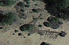
Another word of caution these satellites can't see anything smaller than 30' so you are looking for an outcropping of a thick vein lode gold deposit they will never see it however they will see the alteration zone where the deposit was formed, so in this case you would not look for gold at all but rather an alteration zone. For micron gold you use yet another different algorithm.
Seems to me it would be better to use an algorithm for micron gold...I doubt anyone has ever found a gold vein that was 30 inchs wide...

  1. Alteration Zones
Alteration ZonesCached - Similar
You +1'd this publicly. Undo
Alteration zones can be created around a number of the structural features (faults, shear zones, plugs, dykes and unconformities), and are defined as either ...

I was taught that these formation were what I was looking for...Art
 

OP
OP
RBrown

RBrown

Jr. Member
Oct 10, 2012
26
1
Phoenix Arizona
Detector(s) used
Minelab
Primary Interest:
All Treasure Hunting
aarthrj3811 - You are correct, finding alteration zones is the quickest way to find valuable mineral deposits. The Aster satellite series (up until 2008) provide a quick way to locate alteration zones without having to go into the field (the Landsat doesn't provide as much contrast in finding alteration zones as does the aster series of satellites). However, while these satellite maps will give you a detailed image of the alteration zone they will not tell you if a valuable mineral deposit exists there and if so where in the alteration zone. From my work on lode gold deposits I have found that they always form near the periphery of the alteration zone and never in it's cetral part.

This seems to be because when the alteration zone first forms the first venting is under very high pressure and there is little resistance to it escaping. If there is any gold in these initial ventings it will be thrown high up into the air where it solidified as very small micro particles and then settled down to the ground to be buried over (like the micron gold field of Carlin Nevada). As the venting continues the larger fissures seal which forces the alteration zone to grown but the resulting vents has less pressure because the fissures are smaller and the deposit is sealed in the rock (that makes up the alteration zone) instead of being vented high in the air.

There is another type of geology that you may be familiar with - the Gossan. I have read where all the Gossans in the SW US have already been found. However, this statement was made before the new satellite mineral technology arrived. The Landsat 7 series satellites provides the highest contrast for finding Gossans. Unlike finding an alteration zone where you don't know if there is a deposit or not, a gossan always has a mineral deposit.

Gossans are those brightly colored formations (including tuff and white earth) structures found around the world. As they are so colorful there were easily seen by the old timers. What we are now finding is that there are more Gossans under the ground (with no color showing) then those that have been found. Gossans form around drainage areas where water erodes away a mineral and the resulting minerals oxidize forming different bright colors (from bright yellows to oranges to bright reds and whites). However, when a Gossan is covered over by ground drainage (mud) it can't be seen and is missed.

Using satellites its possible to see Gossans that are buried a foot or more under ground (the mud covering). It can do this by seeing the IR reflections of the oxidized products that have leached into the water and mud above the Gossan. A case in point is a string of under ground Gossans in NE Arizona that no one has found or prospected. Gossans

Unlike an alteration zone the satellite gives you the exact location of a Gossan mineral deposit. Unfortunately, it won't tell you what the mineral deposit is. You will still have to go there and take samples to find that out - but using satellites will allow you to walk right up to a Gossan without having to spend years looking for one.

Roger
 

BoydBros

Jr. Member
Jul 28, 2019
47
39
Arizona
Detector(s) used
MineLab GoldMonster 1000
Garrett ATX
Primary Interest:
Prospecting
Is this still being researched? I'm interested in making the hikes into this area
 

Red_desert

Gold Member
Feb 21, 2008
6,850
3,500
Midwest USA
Detector(s) used
Garrett Ace 250/GTA 1,000; Fisher Gold Bug-2; Gemini-3; Unique Design L-Rods
Primary Interest:
All Treasure Hunting
A scientist can set up a mineral satellite, they used it to study Mars and to find underground water reserves in Africa.
 

dowsing_master

Full Member
Apr 17, 2017
121
16
Primary Interest:
All Treasure Hunting
I have a false color satellite image of a large alteration zone that I believe is where the Lost Adams Diggings is located. The image parameters were validated using the Ortiz and Vulture mine fields. The main alteration zone is 15 miles long and the erosion area is almost two miles wide so that's 30 square miles that need to be searched in a very remote and desolate area.

In the accompanying picture the alteration zone is the long white vertical streak just to the left of the center of the image. The erosion areas are shown in pink.

I would like help in determining if there are any gold deposits (lode or placer) in this map area. If so I have much more detailed maps and images available (down to 6" resolution) of the 15 mile by 20 mile area shown in the attached map which could be used to narrow down the search area considerably.

I would like to hire someone who is good at map dowsing to help me in this effort. I am retired (otherwise I wouldn't have all the time it takes to develop these false color mineral maps) so I don't have a lot of money to work with.

View attachment 738679

IMG_۲۰۱۹۰۷۳۰_۱۸۲۶۱.png
IMG_۲۰۱۹۰۷۳۰_۱۸۲۶۱.png gold
 

Red_desert

Gold Member
Feb 21, 2008
6,850
3,500
Midwest USA
Detector(s) used
Garrett Ace 250/GTA 1,000; Fisher Gold Bug-2; Gemini-3; Unique Design L-Rods
Primary Interest:
All Treasure Hunting
Looks like you posted the same image twice. It seems your circle is over where RBrown discovered the chimney from an old cabin he believed was the Adams cabin. The type of tree Adams is supposed to have used is still growing that part of the map. Above is a northwest flowing canyon. To the right of the old cabin chimney is where water flows from the canyon to a place. Between there and the old cabin site, I went back in GE to older satellite images, a year fires burned away the brush and grass, Quit visible still, was what appeared to be Spanish markings dug.
 

Red_desert

Gold Member
Feb 21, 2008
6,850
3,500
Midwest USA
Detector(s) used
Garrett Ace 250/GTA 1,000; Fisher Gold Bug-2; Gemini-3; Unique Design L-Rods
Primary Interest:
All Treasure Hunting
In the circle cut is trees I'd thought looked maybe something, RBrown found some stumps looked old were cut. The other almost seems as dug letters, you can decide.

LAD_02trees.jpg

LAD_03signs.jpg
 

Red_desert

Gold Member
Feb 21, 2008
6,850
3,500
Midwest USA
Detector(s) used
Garrett Ace 250/GTA 1,000; Fisher Gold Bug-2; Gemini-3; Unique Design L-Rods
Primary Interest:
All Treasure Hunting
At the place water flows to and stops.

LAD_02Bcrop.jpg

If these are signs (map below) they were up near the canyon. There is a Spanish silver treasure legend a short distance north.
 

Attachments

  • LAD_03new3C3crop.jpg
    LAD_03new3C3crop.jpg
    100 KB · Views: 68
Last edited:

Red_desert

Gold Member
Feb 21, 2008
6,850
3,500
Midwest USA
Detector(s) used
Garrett Ace 250/GTA 1,000; Fisher Gold Bug-2; Gemini-3; Unique Design L-Rods
Primary Interest:
All Treasure Hunting
Adams made the following remark a number of times (it appeared in a number of different versions of the stories) "No geologists will never find my gold". BLM contracted with three different geology firms between 1960 and 1985 to check the area for valuable mineralization and all three reports came back negative. Back then they didn't have satellite mineral imaging.

This is the NW flowing canyon with the short pine trees, 1000' wide canyon with nothing growing in it, the springs flowing on the SE side of it and the SE side of this canyon is darker than the other side of the canyon, and this canyon ends in a steep box canyon three miles
to the NW.

According to Adams the ridge above the gold was 15 miles long (this alteration zone is that length). This was the only Alteration zone within 30 miles of
the Aspen stand, so he thought this had to be the place.

The alteration zone is around 15 miles long and the pinkish-purple erosion areas range from 1/2 mile (near the bottom of the map) to a couple of miles wide near the canyon at the top.

At the top of these two areas is the canyon where the water flows in a NW direction. The springs are located at its right end (Edit-location deleted here).This is where he found two old home sites and the older one had been burnt down. The newer one dated to the early 1900s. The rock chimney is there as well.

This stone chimney should be within 1/4 from the placer site. The rock chimney was built near the side of the canyon up from the sandy area so they didn't have to worry about water.

There could be a cache (of these placers) under an old rock chimney, they did put about 100% of it there just before the Indians killed all of them. But It should be expected that possibly the cache under the chimney has already been taken by one of the three survivors (he went to Mexico and bought a big ranch there).

The placer gold should be very shallow. Most of the gold the Adams party dug was less than two feet deep. It was so rich they didn't dig any deeper. The area was several hundred feet across and was in a sand pit in a low canyon.

The Indian guide told them the second placer deposit was only a few miles away (1/2 a day's horse ride away) and it was a lot richer. A 1/2 day ride would be no more than maybe 8 miles. Placer deposits can't form on their own and require an thin vein gold deposit to erode which forms them. Then the drainage washes them down to an area where they settle.

There is a 82' gorge that could have held the log jam Adams mentioned that caused a 60' high water fall (maybe it eroded another 22' deeper in the last 150 years of weathering to make it 82' deep now).
 

Last edited:

Red_desert

Gold Member
Feb 21, 2008
6,850
3,500
Midwest USA
Detector(s) used
Garrett Ace 250/GTA 1,000; Fisher Gold Bug-2; Gemini-3; Unique Design L-Rods
Primary Interest:
All Treasure Hunting
Is this still being researched? I'm interested in making the hikes into this area
He wanted me to come use L-rods at this site, but I declined the invitation. I haven't heard from RBrown in a long time, just tried his email and nothing yet.
 

Top Member Reactions

Users who are viewing this thread

Top