Hi Veckov,
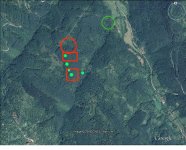
Dowsing revealed an attraction to:
Bronze, Orange circled areas
Gold, Green circled area
Archaeological items/location, White circled areas
Thank you for posting your picture,
Jon
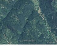
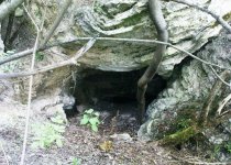
Where the creek flows out and opens onto the flats. Crops and water were close by and easy access in and out. I'm not saying it is 100% but that is where I would start. It's nearly impossible to grow crops up in the trees and even harder to carry water up there. It looks as if people are still there, in the best spot. I would move up the flats and metal detect up any creek the flows.
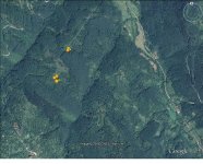
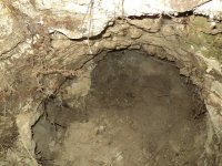
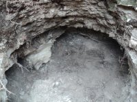
From my file of definitions for marked spots. Red rectangles usually indicate deeper layers of civilization or cave/tunnel sites and white for possible entrances or caves.
White in general is a color indicator, I use for natural caves or man made tunnel entrances and mine shafts, other similar type excavations (including old wells, tombs, etc.).
Red circle is to mark areas, of loose or surface coins/treasure and artifacts of value, down to 1-2 feet deep.
Red line box (or solid filled circles) for very deep coins/treasure or artifacts of value.
Green in general is a color indicator, I use for various other targets mostly archaeological (old ruins or foundations but especially those non-metallic objects such as Indian flints, glass, pottery, carved stone with treasure signs).
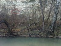
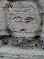
Yes, you will find old Roman sites along rivers. Somebody found this where map dowsing indicated, look how steep the bank is going up from the river. The Romans carved the stone face here, near the water.
The old Roman gold mines looked different, the entrances were sealed up. After the mining complex entrances got unplugged, treasure hunters only could be explored a short distance before reaching water flooded areas. Again, I think this location probably another location, not where the stone face was found.