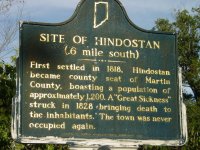
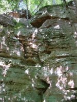
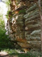
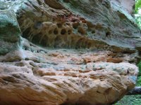
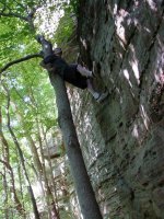
The finds werent so good but the sights & pix were

inspectorgadget

Hero Member
Jul 14, 2012
924
431
Indianapolis
Detector(s) used
Whites MXT with 10"DD coil, Sun Ray probe
Primary Interest:
All Treasure Hunting
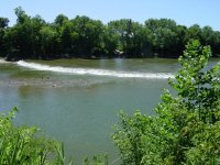
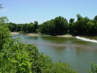
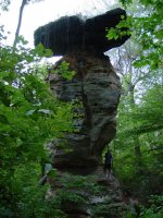
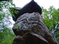
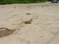
This is the general area we detected today! Not much luck hunting but had a blast playing in the water at the falls & at the rock table (the tallest freestanding rock table east of the Mississippi) known as the Jug Rock *note I'm about 15' or maybe even 20' above the base in the one pic*, The falls are about 4.5 feet tall & about 300 feet across, & the falls are in a bowed out shape that you cant fit in a single pic.
559296_10151054725132376_409523859_n.jpg 524418_10151054725352376_1728478352_n.jpg 487839_10151054725392376_1382271977_n.jpg 532426_10151054726072376_2112018852_n.jpg 318805_10151054726217376_1752785147_n.jpg 486503_10151054726002376_393937274_n.jpg
 

Last edited:

wingmaster

Bronze Member
Aug 10, 2009
2,344
934
Detector(s) used
White's MXT all pro, MXT300 D2, 950, 4X6 DD, detech ultimate 13" DD coils
Primary Interest:
All Treasure Hunting
Have you heard the story about that town? I've never detected there before but it is nice sites to see and I'm sure that if he buried the money in the woods its on private property I'm sure. HH
 

OP
OP
inspectorgadget

inspectorgadget

Hero Member
Jul 14, 2012
924
431
Indianapolis
Detector(s) used
Whites MXT with 10"DD coil, Sun Ray probe
Primary Interest:
All Treasure Hunting
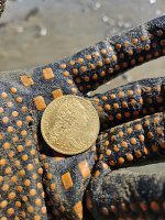
Yes I know all the stories of the town including the missing "kettle". The terrain in parts of that area is rugged as all hell, there are too many places to hide anything in that area! There is an overlook with picnic tables right above the falls, the area is laden with pull tabs 3"-4"-5" deep. We found 2 lincolns (mid 70's) & 1 still unidentified coin (cause it's so weathered) but seems quite old! These were found within about 5' of each other & we really didn't search much more because I was tired of digging pull tabs in rock hard ground. This area obviously has not been detected much or else someone did detect it but notched out pull tabs possibly? Either way there is plenty of stuff in the ground there. I also did detect some of the potholes in the huge rock you can drive out on just south of the falls but nothing other than trash there either.
 

wingmaster

Bronze Member
Aug 10, 2009
2,344
934
Detector(s) used
White's MXT all pro, MXT300 D2, 950, 4X6 DD, detech ultimate 13" DD coils
Primary Interest:
All Treasure Hunting
There's been lots of people detect the area where the town was and I think if someone buried that they would have put it by a natural landmark to make easy to find again. I think if they went even a little ways from the town there's a good chance its on private property somewhere though. HH
 

OP
OP
inspectorgadget

inspectorgadget

Hero Member
Jul 14, 2012
924
431
Indianapolis
Detector(s) used
Whites MXT with 10"DD coil, Sun Ray probe
Primary Interest:
All Treasure Hunting
We know for sure where 2 of the mills & the original church sat, we know approximately where the tavern & ferry were, they were located right next to each other as the tavern owner was also the original ferry operator. I don't have any info on where either of the 2 general stores were located nor where the town treasurer lived.

I believe this town was more spread out than most people think. It was 1200 people, many of the people bought a minimum of 1 acre plots just outside of "downtown" so that's possibly 1200 acres if not a whole lot more that was once part of Hindostan. Having 2 General stores also says it was most likely spread out & probably had one on the north west side (above the falls) & one on the south east (below the falls). The "downtown" area of the town had to be quite large, probably long & narrow mostly following along the river between the mills. NOTE Louisville had 1300 people at this same time which is just 100 people more than Hindostan had.

So yes I agree most of old Hindostan is on private property now but definitely not the downtown area along the river. The way I also understand the story of the "kettle" is it left town with the treasurer but didn't arrive in MT. Pleasant with him, he then died of the same sickness that swept the town. The real search area should be between MT. Pleasant & Hindostan, he probably crossed the river on the ferry as MT. Pleasant is on the other side of the river & it only gets alot deeper the further north you go away from the falls!

There are also many stories about McBrides Bluff which is a little north of Shoals on the west side of the river. A small cave was used by Indians then later outlaws, there are rock carvings at the high point of the bluffs that seem to be some sort of clues or directions (a map in a since) to where something is. Stories of Indians with hidden silver is popular but unlikely as these stories exist in many near by states, however later on outlaws hiding stolen property near this cave is very possible in my opinion. It was once said 1 man could hold off an entire army from this high up cave. There are so many holes, cracks, crevasses, cliffs, unusual sandstone formations, pot holes, natural rock houses, also known as "rock teepee's", valleys, peaks & what not that hiding something wouldn't be hard at all.
 

wingmaster

Bronze Member
Aug 10, 2009
2,344
934
Detector(s) used
White's MXT all pro, MXT300 D2, 950, 4X6 DD, detech ultimate 13" DD coils
Primary Interest:
All Treasure Hunting
I never had much luck detecting anywhere that can flood bad as some of the stuff gets washed away and some places silt from the river will bury stuff to deep to detect. I found an old picknic grove in a small town that had never been hunted but it set right by a creek that floods bad all that I found in one little spot where the creek washed away the silt was a mercury dime, a few wheats, and an IH penny, the rest of the area had silt from the creek built up that probably had the stuff buried more than a foot deep. This would have been a dream spot had it not been in a low area by the creek, you could even see where they had a fountain that at one time the land owner said his dad told him back in the day they piped water from a spring to the fountain, but when your digging cans that are not that old a foot deep or more its not a good sign. HH
 

OP
OP
inspectorgadget

inspectorgadget

Hero Member
Jul 14, 2012
924
431
Indianapolis
Detector(s) used
Whites MXT with 10"DD coil, Sun Ray probe
Primary Interest:
All Treasure Hunting
This area we detected does not flood, no way, it's 40 or 45ft above the river while the other side is only maybe 15 or 20ft high, the other side of the river is the flood plane in that general area. The coin I couldn't identify turns out to be an 1888 Indian Head penny in very bad shape, in pix it nothing shows up it is very weathered.
 

OP
OP
inspectorgadget

inspectorgadget

Hero Member
Jul 14, 2012
924
431
Indianapolis
Detector(s) used
Whites MXT with 10"DD coil, Sun Ray probe
Primary Interest:
All Treasure Hunting
but when your digging cans that are not that old a foot deep or more its not a good sign. HH

I would run fast from a spot where I found a not to old can 12" down! The now identified 1888 IH we found was about 5 inches down in the spot we were in Hindostan so I take that as a good sign! Now the strange thing is we found 2 Lincolns a 67 & 74 at about the same depth & same area, maybe 1 inch shallower. This spot we hit the hardest has probably been the main lookout for visitors over the falls for the past 150 years, it looks like a 30ft wide spot got clear cut at some point & now gets the new trees cut every 2 or 3 years to have a nice view of the river & falls. There is a heavily used path down to the falls right in the same area, the path is steep & someone at sometime carved/dugout steps in the dirt, you would almost need a rope to get up & down it without these carved out steps.

Not far from the path are 3 ceramic covered (like old farm irrigation tile material) squareish filled with old cement piers (with lots of roundish pebbles as the fill material). The base/foundation of 1 has bricks that looks to once have had the gritty cement covering them. The other 2 don't seem to have this brick base but instead all cement. The ceramic is 1/2 missing on each of them. In the rock the falls go over right below these piers there are at least 25-30 4" wide holes drilled out in the rock (in the water) they go out to about 1/2 way across the river a good 100 ft. & they are not all in a row, some are in rows & some are not in any apparent pattern. There are more closer to the shore than out far in the river, this is slightly above the falls not below the falls where the huge square holes have been cut in the rock.

This is believed to be the site of 1 of the mills. The other mill was down from the falls where the big square holes in the rock are. The piers could be newer than 1820-1828? But the holes right below them in the rock are not! Once the town was deserted it was never re inhabited but the ferry did run till like 1840. The piers somewhat resemble modern bridge piers (3 in a row) only much smaller. The trees between the piers & the river are not young trees they are 100 year old trees easily. With water levels low like they are now a horse & wagon could cross it in this general area on solid rock & just maybe 50ft more upstream there is a road & the boat launch ramp, it's only to be assumed this was one of the original roads that led down to the river & possibly the old ferry or maybe it was the take your chances cross for free spot. No matter what it was that was going on in this general area it was big & thus the shore along this area was heavily traveled/visited/used way back in the early 1800's & it is even still to this day.

It is said that many people lived on boats on the river maybe these holes in the rock were posts for the boats to tie to? Maybe it was the spot where goods were unloaded/loaded onto the flat boats running goods upstream above the falls to/from the boats running downstream below the falls? I love mysteries!
 

Last edited:
OP
OP
inspectorgadget

inspectorgadget

Hero Member
Jul 14, 2012
924
431
Indianapolis
Detector(s) used
Whites MXT with 10"DD coil, Sun Ray probe
Primary Interest:
All Treasure Hunting
Where in Indiana is this??

Hindostan Falls Indiana, Google maps brings it right up! It's in Martin County not far (about 8 miles from both Shoals & Loogootee). It's about 2 hours or so south west of Indy.

I tell you what Martin Co. is superior to Brown Co. it just doesn't get the attention! In Brown Co. the sites are more condensed together but in Martin Co. the sites are more spread out. I've never seen a 200+ foot cliff, real waterfalls, rock teepee's, a table rock, or even a 75'-80' tall x 2000' long cliff in Brown Co. but you sure can in Martin Co! McBrides Bluff's in the same area has some serious history from Indians to outlaws. The east fork of the White river over Thousands of years has eroded some very unique & neat geological features in the sandstone down there! Should be called Bluff Co. as there are more high Bluffs on sandstone cliffs than you can shake a stick at.
 

Kevin in IN

Sr. Member
Feb 21, 2011
478
369
N.Indiana
Detector(s) used
Minelab Sov.GT , Explorer SE Pro , Excalibur 1000
Primary Interest:
All Treasure Hunting
Beautiful place and pics. Keep hunting it, something good is sure to turn up.
 

Nanner

Jr. Member
Jun 25, 2012
21
0
A
Detector(s) used
Bounty Hunter 1100 discovery
Primary Interest:
All Treasure Hunting
I like that ole rock How much luck you have in Martin co.
 

revpo

Jr. Member
Dec 3, 2004
47
11
SOUTHERN INDIANA
expedition today AUGUST 23/2015
I went there today, and detected a small patch of the area, the river is way to high to get further down the hill or see much of the bottom land. T he find today was nails<wonderful>, and the property surrounded the area has NO TRESSPASSING signs every where.

I will be back late in the FALL and hopefully the river will be much lower.

REVPO
 

Top Member Reactions

Users who are viewing this thread

Top