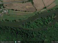
How can you tell when images on google earth were taken? I've wandered when they updated. I've seen pics there with boats on the road from hurricane Katrina. With all the storms the gulf coast has endured in the last 8 years, I need to zoom in on at least annual images.
HAve you ever looked at anything other than the picture itself? When you load a google earth image it has a lot of other info with it. You can scroll through past pictures of the same spot (with thier dates also)
How to do? I'm looking at a GE image right now, but don't see options to scroll to older images. Possibly I have to boot up the desktop computer. I'm on this little iPad right now.
Look in the lower left of the Google Earth image. It has an imagery date.
-Swartzie
I see it on your attached photo. Little iPad app for GE does not seem to have it. Will switch to a real computer because I want to work back in time a few years if that is possible. Is that accomplished by clicking on the date in the lower left?
Thanks .....
M
Last edited by Moonrover; Aug 18, 2012 at 08:41 AM.
Ray, I heard that Google has been updating at least some of the imagery here in town lately, I haven't looked into it much yet but I'm hoping for new images of a few areas I want to look into.
"That's me, on the beach side combing the sand, metal meter in my hand, sporting a pocket full of change"...... NOFX
Garrett Infinium & Gold Bug II, Bazooka Super Prospector Sluice
312
45 times
All Types Of Treasure Hunting
Having previewed prospecting areas from GE, and then actually went to those locations, GE has a LOT of shortcomings. Many areas of the national forest have very low resolution photos to view. Why is that exactly in the year 2012? That is why I am working on a way to create my own aerial maps that have much better resolution, and are simly not subject to the whims of Google...
... I am working on a way to create my own aerial maps that have much better resolution, and are simly not subject to the whims of Google...
Matt ... are you planning on doing a mosaic from low level aerial shots? Prior to satellite imagery the government contracted out for that work, but not much is going on now.
Which means the available aerial photos may not be current. Not that out of date is a downside since what you are seeking may be shown on older photos and not on current satellite passes.
M
Last edited by Moonrover; Aug 21, 2012 at 09:29 AM.