So no more old timers.

Kevin in IN

Sr. Member
Feb 21, 2011
478
369
N.Indiana
Detector(s) used
Minelab Sov.GT , Explorer SE Pro , Excalibur 1000
Primary Interest:
All Treasure Hunting
What are plat books?
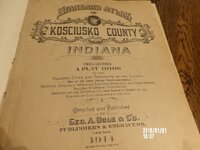
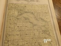
Here's some pics of a 1914 plat near my area. As others have said, there's a wealth of things you can learn from one of these books. I bought this one at an estate auction. In rural areas, our roads have changed very little in the past 100+ years. Go on google maps or bing, use earth view, and compare. Many houses have been added over the years, but many have also vanished, and you can spot these by useing the earth view. I water hunt alot, and this works well for finding old hotels and beaches. Hope this helps. Kevin 100_1108 (800x600).jpg 100_1110 (800x600).jpg 100_1111 (800x600).jpg
 

Sandflea

Greenie
Nov 27, 2012
14
14
Western Colorado
Detector(s) used
Garrett Ace 250 and pinpointer
Primary Interest:
All Treasure Hunting
Not all of us old timers are gone, LOL, we are just harder to find.
 

creskol

Gold Member
Jan 14, 2007
13,623
22,670
🥇 Banner finds
2
🏆 Honorable Mentions:
5
Primary Interest:
Other
Just about every treasure hunting book I've read is from around the 60s and 70s. The number one tip they gave was to talk to the old timers for leads. I'm pretty sure the old timers from then are pretty much gone now so where do we go for leads now?

I'm to the age where I find that I just talk to myself most of the time.
 

GA_Boy

Bronze Member
Jul 30, 2006
1,433
1,579
Jefferson, Ga
Detector(s) used
BH LRP
1265X,
GoldBug II
Primary Interest:
All Treasure Hunting
Ha, Ha, I finally got it all together-------------------------------Hhhhhhhhmmmmmmmm, now where did I put that.:dontknow:
Marv???
 

Clay Slayer

Sr. Member
Jan 4, 2011
300
338
Cajun Country
Detector(s) used
Equinox 800,
Garrett Pro Pointer
Primary Interest:
Metal Detecting
Here's a link to historical topo maps -

The USGS Store - One stop shop for all your maps, world, United States, state, wall decor, historic, planetary, topographic, trail, hiking, foreign, satellite, digital

These topo maps go back to the mid-nineteenth century for some locations around the country. In my area, Louisiana, they usually only go back to the 1920's or 1930's, but I still use them for finding old schools, farms, etc.

Zoom in the map to the area you're interested in, then on the right side click "MARK POINTS". Left click on the map to drop a red marker where you want it. Left-click on the red marker and a bubble appears with a list of all the available topo maps for that area. Right-click on the file size and select "Open"...a pdf file will be downloaded to your PC.
 

Top Member Reactions

Users who are viewing this thread

Top