Ragnor
Sr. Member
- Dec 7, 2015
- 445
- 422
- Primary Interest:
- All Treasure Hunting
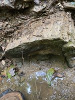
I have managed to find my way to the data files for several sattelites that are listed as having sensors usefull for mapping minerals. I understand the various spectrums and instruments. I have even downloaded some files that say they are complete data sets. However I have been completely unable to make any useful sense out of them.
Is there an open source program I can use to interpret them? A tutorial that will explain the steps required? I really wanna be able to map the gossans in certain area's. It would save me allot of time next spring narrowing down possible target locations on the ground.
(Windows OS)
Is there an open source program I can use to interpret them? A tutorial that will explain the steps required? I really wanna be able to map the gossans in certain area's. It would save me allot of time next spring narrowing down possible target locations on the ground.
(Windows OS)


Last edited: