US Govenment Removing Gold Areas from Topo Maps

Davidail

Jr. Member
Nov 3, 2012
53
12
North FL and North GA
Detector(s) used
Garrett AT Pro Metal Detector with 5" coil making it the AT gold
Primary Interest:
All Treasure Hunting
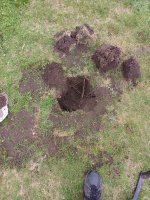
Over the Thanksgiving holidays I went prospecting in the North Ga mountains, I was in some known Good gold areas, and was taking sample from several creeks. On my last sample I had actually wondered off my map and came upon a creek crossing the National Forest Road I was on. I took the GPS Coordinates and saved them in the unit. When I got home I looked the coordinates up on a USGS 2011 Topo map, and the map didn't have the creek on it. So I thought my coordinates was off, and re-confirmed the location, which was right. I pulled out a 1961 USGS topo map same scale of the same area, and the creek was there. Not only was the creek missing, roads have been removed, Water falls and numerous tributaries to this creek. I did some research on this area and it was one of the biggest gold deposits in the North Ga area. It appears Uncle Sam doesn't want anyone finding this area with modern maps. This area is mention in the 1896 Gold Deposit of Ga. Guess my question is, has anyone else came across something like this in any areas? or states ?? I am reluctant to give out the area on a open form in that the Government may ban panning in this area. The state of Ga has already banned panning on the State Owned Wildlife areas. The area I am talking about is located in US National Forest.
 

Upvote 0
Aug 20, 2009
12,824
7,899
New Hampshire
Detector(s) used
Garret Master hunter Cx Plus
Primary Interest:
Other
Part of agenda 21,look it up and read all of it.Dont skim it read it you wont like it.
 

63bkpkr

Silver Member
Aug 9, 2007
4,069
4,618
Southern California
Detector(s) used
XLT, GMT, 6000D Coinmaster
Primary Interest:
All Treasure Hunting
Yup Agenda 21 is alive and perking unfortunately for anyone who loves freedom as it will end freedom as we know it....63bkpkr
 

bug

Full Member
Jun 5, 2008
236
392
Nor Cal
Primary Interest:
All Treasure Hunting
Agreed, They really dont want you out in the woods anymore.
Its just beginning.
 

johnnysau

Full Member
Apr 23, 2012
233
117
Reno NV
Primary Interest:
All Treasure Hunting
Its a shame, but low and behold i believe there are millions and millions in Gold in Georgia, wish i were around that area, i look at a certain kind of map it has the same
type of structure as the the CA mother lode and other golden areas ive researched, just dig a little deeper guys. Heres a blurb of what i was reading, it correlates with the
structure im seeing on the map. ( By 1830, historians estimate that there were 4,000 miners working on just the X Creek in X County and over 300 ounces (8.5 kg) of gold per day was being produced in an area from north of X to the southeast corner of X County. Other estimates were that there were 6,000 to 10,000 miners between the X River and the River in 1831. )

My take is they got all of the easy stuff. Theres a whole lot more.

johnnysau
 

trinityau

Full Member
Jan 20, 2010
239
797
Redding, Ca
Detector(s) used
Gold Bug Pro, GP 3000 modified
Primary Interest:
Prospecting
The government has been doing that to topo maps the last twenty years. They started with names that were derogatory to people and things. Some examples, You will not see n__gger creek any more, they have been changed to Black Creek on all topo's. The word digger or digger pine cannot be on a map because it refers to the Digger indians, which are all probably dead by now. Place names have been changed also. Here in Trinity County we have the town of Hayfork with the newly named Hayfork Creek running through it. Historically it was the Hayfork of the Trinity simply because hay was grown in Hayfork. Trinity Center was always written in old english, Trinity Centre. The town of Lewiston was Louistown. Weaver Bally in Weaverville was never called by that name, it was always Baldy historically. We have a plant called *****ears, or it use to be, I dont know what they did with that name. Get the idea ? Then they started getting rid of historical sites. Then it was any uninhabited cabin or building site. In the Trinity Alps we now have over fifteen peaks that have been renamed from historic names. There are a lot of mines that have been completely deleted on topo's lately. They want us dumb. It is pure :censored:. Sorry, TRINITYAU/RAYMILLS
 

Last edited by a moderator:

Tnmountains

Super Moderator
Staff member
Jan 27, 2009
18,714
11,703
South East Tennessee on Ga, Ala line
🥇 Banner finds
1
Detector(s) used
Tesoro Conquistador freq shift
Fisher F75
Garrett AT-Pro
Garet carrot
Neodymium magnets
5' Probe
Primary Interest:
All Treasure Hunting
Hahaha so it is like we do not already have these maps? Idiots.
 

Watchman

Greenie
Jun 24, 2012
17
5
Kings Mountain, NC
Detector(s) used
Garrett AT Pro, White's Coinmaster Classic III
Primary Interest:
All Treasure Hunting
Yes, Agenda 21 is alive and heavily active, I am well studied on the subject. I am also a former gold dredger, considering on getting back into it one last time. I was dredging for gold in North Georgia back in 2008-2010 and I remember being able to look up all the old gold mines on google earth and seemingly overnight they all disappeared one day back in late 2009... I suspected at that time the price of gold was ready to skyrocket soon afterwards and it came true. I really wish more people in this country would wake up to the truth and rise against this tyranny. However, it does my heart good to see several people on TreasureNet who know exactly what is going on. I tip my hat to you all in major respect for not being mindless drones.
 

Aug 20, 2009
12,824
7,899
New Hampshire
Detector(s) used
Garret Master hunter Cx Plus
Primary Interest:
Other
I really wish more people in this country would wake up to the truth and rise against this tyranny. However, it does my heart good to see several people on TreasureNet who know exactly what is going on. I tip my hat to you all in major respect for not being mindless drones.

No drones here Watchman.And all the respect back at you.I know exactly whats going on,you can count on it.:icon_thumright:
 

Sandflea

Greenie
Nov 27, 2012
14
14
Western Colorado
Detector(s) used
Garrett Ace 250 and pinpointer
Primary Interest:
All Treasure Hunting
BLM and Forest Service have been doing that for a few years now, but I thought it was just in the Rockies. They have been eliminating "unused" roads and trails to "benefit" the lands and keep the HOV and ATV off by logging the roads and trails they want traveled, and taking the others off as unused. Our local ATV clubs are re-maping the trails, and telling BLM the trail #, and the co-ords of each end so that they will put them back on the map as "used" trails, even if they don't like the info, lol. I use google earth to locate places and push pin/tag it, then I have the topo and color close ups.
 

NuggetN8

Hero Member
Mar 13, 2012
618
416
Northern California
Detector(s) used
SDC 2300
Primary Interest:
Prospecting
There are still ways to get the old topo maps. (Not for GPS that I know of.) I think they would be worth getting before they all disappear though.. I have some for my area on google earth that show old gold mines and diggins.
 

NeoTokyo

Bronze Member
Aug 27, 2012
1,803
1,580
Redding
🥇 Banner finds
1
Detector(s) used
Eyes - Nokta FORS Gold - Fisher Gold Bug II
Primary Interest:
Prospecting
Its getting hard to find good maps online, I cross-ref several and historic maps when I am looking in an area that I might want to detect, then I ask questions. :)
 

Top Member Reactions

Users who are viewing this thread

Top