Gold_Striker
Full Member
Seems like much of the mining industry is stuck in the 18th century. It is not clear to me as a citizen of my state where to obtain active mining claim info.
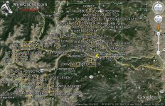
I'm looking at idaho springs which is jam packed with mines.
I'm looking at idaho springs which is jam packed with mines.


Upvote
0
")