I've been Claim Jumped!

Asmbandits

Bronze Member
Mar 4, 2014
1,039
2,290
NorCal
Detector(s) used
Fisher GB2, Bazooka Prospector 36", EZ sluice, Blue Bowl..
Primary Interest:
All Treasure Hunting
:BangHead:Where to begin.. So I filed my placer claim back in 2016, Its filled correctly both with the blm and county and has been kept current. Here are some photos of my signs I put up in 2016 and my discovery monument which I made a placard with the claim info on it. The capped pvc pipe contains the location documents.

20161004_092916.jpg new.jpg


It has been quite a while since Ive been up to the claim, I like to go after the first big storms to see if anything has changed. I made it up there today with a couple friends and when we first arrived and walked by the location monument I noticed the placard was gone, screws that held it still there... The pvc tube with the location document was there, I looked inside and saw paperwork... ( I wish I would have looked at it now but didn't at the time..)

We explored and detected around as usual, found some gold. I had just figured some A hole took the placard for god knows what..I didn't think much of it other than it sucked until on our way out I walked past one of my claim signs on the trail and saw that someone has blacked out all of my info and put new info!! I immediately recognized the claim name as one I had seen the night prior as I was checking into mylandmatters to see what has changed around my claim, I noticed that there seemed to be some new claims in an area that seemed too small for that acreage.. Now I know why, it was all coming together as I stared at my claim sign..

This genius not only top filled over my claim, which is filled correctly and marked correctly and always maintained and fees paid, he just decided to use my signs and monument while hes at it! I didn't even think to check the pvc tubes documents until riding home, I bet he removed my papers and put in his, and that's why he just removed the placard...

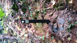
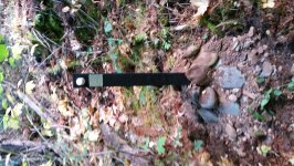
Here is what I found..

bear river locals only outting.00_00_00_00.Still006.jpg GOPR1297.MP4.09_00_26_29.Still001.jpg

Now this happened for two reasons, first is that the idiot did not do the proper research and did not check with the county. This would have made up for the second reason, which was the blm when entering the info on my filed paperwork into the computer database made a typo, which translates in the claim not showing up in some reports in lr2000. I had been in contact with the blm for over two years trying to get this resolved so something like this wouldn't happen. It took 2 years but they have since corrected this mistake and now my claim shows up as should, but the damage has been done.

I am 100% certain my claim has been filled and maintained and kept up with the blm and county properly. The fact remains that this person top filled "claim jumped", most likely committed mineral trespass, defaced my property and stole my property.

What is my proper recourse here? Wouldn't you know it the guy lives just 10 minutes away!! what are the odds!!....

I was thinking of bringing him a copy of my paperwork and asking for my placard back and compensation for the placard and signs and fuel to drive back up to replace everything, and that he stay away from my claim.
If he were to disagree then I would be forced to further action, could I then call the sheriff and file a report?

I feel my demands are more than fare in this situation. I would calmly state everything Ive said here and provide paperwork to back it. My only concern is if he does not comply I understand that the property dispute is a civil matter but that about the mineral trespass and claim jumping and theft/defacement?

Anyone have any thoughts or advise? I could sure use it!
 

Attachments

  • 20161004_095158.jpg
    20161004_095158.jpg
    2 MB · Views: 230
  • 20161004_095158.jpg
    20161004_095158.jpg
    2.3 MB · Views: 241
Last edited:
Upvote 0

winners58

Bronze Member
Apr 4, 2013
1,729
4,058
Oregon
Primary Interest:
All Treasure Hunting
Just to look at things objectively, from my memory of other threads/posts of Jerry's
the claim had changed hands from claim flippers (filed just to resell) Jerry wanted an honest claim,
(prudent man - prospect, find it worth investing time and labor) so he refiled as a new claim,
but for some time it showed both claims in the BLM registry, nether BLM or the county can give legal advice,
they can and do look things up for people, it's possible the original claim popped up and looked like nothing had been filed on it,
from the time of the original location, even before Jerry purchased it was not open ground,
so its a learning experience for Steve, due diligence is something that takes time to learn,
 

Last edited:

OreCart

Sr. Member
Jan 23, 2019
473
558
Maine
Primary Interest:
Prospecting
I learned a lot from this, so thanks everyone.

Maybe Ronald Regan said it best, "Trust, but verify!"
 

Bejay

Bronze Member
Mar 10, 2014
1,026
2,530
Central Oregon Coast
Detector(s) used
Whites GMT
Garret fully underwater
Primary Interest:
Prospecting
Hi again Klondi, We all have made mistakes. I have been doing this for 50 years now...and for the most part I thought that USFS lands were their lands and that their Code of Federal Regulations were law. Almost the same as those who think the BLM is the authority on claim ownership. It was not until I got on a forum many many years ago and met Clay that I began to really understand all the legal claim stuff and that CFRs and BLM rules are not law. One gets a big headache understanding the mining stuff/crud/policies/laws/intrusions/signage/locating/state/etc etc etc. It is often said by many that a miner needs to be a legal expert in order to mine/prospect and have a claim.


On top of all this you have Gov agencies willing to give you advice as though it were gospel. Unfortunately they won't/can't stand by their advice. Not a whole lot different than calling the IRS and asking a question...and each time getting a different answer. Understanding you made a reasonable attempt to locate a claim you thought was abandoned...you fell into the Gov "fake authoritative experience" ….kinda like the "fake news non-verify before reporting".


So Klondi I might suggest you join the My Landmatters crowd and get the "claims advantage reports". There are lots of open claims and I would bet Clay would even be kind enough to steer you along in locating a good claim...….he is the expert.


Bejay
 

Aug 20, 2009
12,824
7,899
New Hampshire
Detector(s) used
Garret Master hunter Cx Plus
Primary Interest:
Other
Put a copy of the movie "The Hanging Tree" in his mail box.Though it isnt exactly about claim jumping he'll get the idea:laughing9:
 

OP
OP
Asmbandits

Asmbandits

Bronze Member
Mar 4, 2014
1,039
2,290
NorCal
Detector(s) used
Fisher GB2, Bazooka Prospector 36", EZ sluice, Blue Bowl..
Primary Interest:
All Treasure Hunting
Just to look at things objectively, from my memory of other threads/posts of Jerry's
the claim had changed hands from claim flippers (filed just to resell) Jerry wanted an honest claim,
(prudent man - prospect, find it worth investing time and labor) so he refiled as a new claim,
but for some time it showed both claims in the BLM registry, nether BLM or the county can give legal advice,
they can and do look things up for people, it's possible the original claim popped up and looked like nothing had been filed on it,
from the time of the original location, even before Jerry purchased it was not open ground,
so its a learning experience for Steve, due diligence is something that takes time to learn,

This is all true, I purchased the claim and found issues with it over time of learning lots on here. I learned enough that I found holes in the paper trail so I re filled to ensure a solid starting point from there forward with the help of some very knowledgeable people in this matter. That was in 2016, Ive owned the claim since 10-9-14 when it was purchased under the name "Rock Creek 6". I let it lapse and re located to ensure validity under the name "Rock Creek Placer" back in 2016, and I made darn sure to stay current with my yearly filings..

What you would have seen a while back looking at it from a map view like on mylandmatters was that "rock creek 6" was there but invalid during this time.. In reality everything on the ground and in filing was done and correct, but blm takes their time and made a mistake when they did finally get around to entering my data it was incorrect and this made it to where nothing showed up at all for a short while. they have since corrected this, totally on there end and affects nothing in actual validity.

Being the case though, the info that Steven used or would have had according to his story is my location notice from discovery monument. This info should have been sufficient as my CAMC and county id doc numbers have always been there and are reference able regardless. The location notice for "Rock Creek Placer" was in there and what he had to go off of, not the old closed "rock creek 6" location notice... This was valid, proper information, how it lead someone to perceived open ground is beyond me..
 

OreCart

Sr. Member
Jan 23, 2019
473
558
Maine
Primary Interest:
Prospecting
This is all true, I purchased the claim and found issues with it over time of learning lots on here. I learned enough that I found holes in the paper trail so I re filled to ensure a solid starting point from there forward with the help of some very knowledgeable people in this matter. That was in 2016, Ive owned the claim since 10-9-14 when it was purchased under the name "Rock Creek 6". I let it lapse and re located to ensure validity under the name "Rock Creek Placer" back in 2016, and I made darn sure to stay current with my yearly filings..

What you would have seen a while back looking at it from a map view like on mylandmatters was that "rock creek 6" was there but invalid during this time.. In reality everything on the ground and in filing was done and correct, but blm takes their time and made a mistake when they did finally get around to entering my data it was incorrect and this made it to where nothing showed up at all for a short while. they have since corrected this, totally on there end and affects nothing in actual validity.

Being the case though, the info that Steven used or would have had according to his story is my location notice from discovery monument. This info should have been sufficient as my CAMC and county id doc numbers have always been there and are reference able regardless. The location notice for "Rock Creek Placer" was in there and what he had to go off of, not the old closed "rock creek 6" location notice... This was valid, proper information, how it lead someone to perceived open ground is beyond me..

You know...some young buck attorney is going to read this and realize he could make a killing doing "claim insurance" like they do on deeds (called Title Insurance). I am not really sure how it works, I opt out of it most of the time, but I deal with Warrantee Deeds only too.
 

Rail Dawg

Sr. Member
Oct 11, 2015
491
890
Northern Nevada
Detector(s) used
MineLab GPZ 7000
Garrett ATX Pro
Primary Interest:
Prospecting
Something important was mentioned earlier about someone coming in after you put your Notice of Location up.

Yes they could tear out your NOL and put theirs up before you file with the county and BLM.

For this reason I take photos of the NOL on-site with a date/time stamp. Yes a date/time stamp can be modified but I also have gas and other receipts showing I was in the area on that day.

Any reasonable judge would see the receipts and photos and know my NOL picture was valid.

What a great group of prospectors we have here. I swear without you guys I would have been one lost miner.

Chuck
 

Goldwasher

Gold Member
May 26, 2009
6,077
13,225
Sailor Flat, Ca.
🥇 Banner finds
1
Detector(s) used
SDC2300, Gold Bug 2 Burlap, fish oil, .35 gallons of water per minute.
Primary Interest:
All Treasure Hunting
Photos should be taken by someone "not party to" the claim

But, I say even if you hit a spot alone and are gonna claim it take pictures then too.

Even if you make discovery and come back to place your monument athe next day. Just document the actual discovery.

Pictures are pictures. It shows intent.
Heck make a video with you stating what you are doing.

It's not hard to find some one willing to go with you for a day and take a few pictures for you.
 

Clay Diggins

Silver Member
Nov 14, 2010
4,883
14,251
The Great Southwest
Primary Interest:
Prospecting
Pictures are useful but without an impartial witness there is no way to verify when the picture was taken. With an impartial witness you can prove you located on a certain day whether you took pictures or not.

I suggest that locators take someone along, when they stake, that is:
  1. Over the age of 18.
  2. Not a party to the claim.
  3. Willing to view the entire process of staking.
  4. Willing to sign a statement about the days staking activities when staking is completed.
  5. Willing and able to appear in court and attest to the facts about the staking activity, time, place etc. at a later date.

Claim boundaries have been defended, in court, on the basis of a photo for more than 100 years. Photos are pretty good evidence of where you placed your claims stakes if the photo shows permanent features in relation to the stake, that can be important evidence in a boundary dispute.

I don't know of any cases where the date of location has been established by a photograph alone. You really need a fellow human to provide evidence of the staking date if there is a dispute.

This situation that Asmbandits started this thread to discuss is far from unusual. In many popular areas more than 30% of the claims have been top filed. It's a fact of life that this happens. Anyone who has been in the mining business for any period of time can relate that from personal experience. Being prepared to defend against claim jumpers can only truly be done at the time of location.

In this particular instance Asmbandits doesn't need a witness to prove he is the senior locator. The time difference in the two locations is so great that no court could be confused as to who has the prior right to the minerals.

These type of overclaims are almost always due to ignorance about the proper way to locate a claim. Generally these type overclaims are more of a nuisance than a real threat to mineral ownership. That doesn't make the situation any less stressful but in a wider perspective they are generally easier to resolve than a dispute about who located first.

There is no recourse in criminal law to an overclaim. It is strictly a civil matter. It doesn't matter that someone took your signs or dug a hole on your claim. A person locating a claim on the mistaken belief that it was open to location would do all the things a new locator would do - like taking down old notices and sampling minerals for a discovery. The police/sheriff have no role in settling adverse mining claim locations. Only a court can give you relief and your property back, with damages, if proven.

This situation is one of the many ways the rubber meets the road when it comes to occupation of your claim. The overclaimer that knows they are challenging a senior claimant has 30 days after locating to serve and sue the senior claimant or their claim has no effect - it's null and void.

The problem comes when that overclaim is mined by the overclaimer or the junior claim is sold to another person. That creates a cloud on your mineral title. A major portion of your duty to occupy your claim is to clear any clouds on the title. This leads to a counter duty to remove those adverse claims from your minerals. That can be done with dialogue and communication but if that doesn't work your only real alternative is to sue in civil court to remove the top filer. That's a pretty easy win in this situation but if you don't do it you are complicit to the degree that you recognize the overclaim yet didn't fully occupy your claim.

The minerals are free for the discovery and staking but the cost of maintenance and occupation can be very high. I hope Asmbandits can settle this amicably. If not I suspect the top filer is going to get a quick hard lesson on the true nature of mineral rights.

Heavy Pans
 

Rail Dawg

Sr. Member
Oct 11, 2015
491
890
Northern Nevada
Detector(s) used
MineLab GPZ 7000
Garrett ATX Pro
Primary Interest:
Prospecting
Clay I swear you never stop teaching me new things.

Your time and efforts are appreciated.

Chuck
 

IMAUDIGGER

Silver Member
Mar 16, 2016
3,400
5,194
Primary Interest:
All Treasure Hunting
Clay what code are you referring to when you say the overclaimer has 30 days to sue the senior claim holder or their overclaim is invalid?
State? Federal?
 

Clay Diggins

Silver Member
Nov 14, 2010
4,883
14,251
The Great Southwest
Primary Interest:
Prospecting
Clay what code are you referring to when you say the overclaimer has 30 days to sue the senior claim holder or their overclaim is invalid?
State? Federal?

No Code - just the law. 1872 Mining Act:
It shall be the duty of the adverse claimant, within thirty days after filing his claim, to commence proceedings in a court of competent jurisdiction, to determine the question of the right of possession, and prosecute the same with reasonable diligence to final judgment; and a failure to do shall be a waiver of his adverse claim.

Heavy Pans
 

OP
OP
Asmbandits

Asmbandits

Bronze Member
Mar 4, 2014
1,039
2,290
NorCal
Detector(s) used
Fisher GB2, Bazooka Prospector 36", EZ sluice, Blue Bowl..
Primary Interest:
All Treasure Hunting
There is no recourse in criminal law to an overclaim. It is strictly a civil matter. It doesn't matter that someone took your signs or dug a hole on your claim. A person locating a claim on the mistaken belief that it was open to location would do all the things a new locator would do - like taking down old notices and sampling minerals for a discovery. The police/sheriff have no role in settling adverse mining claim locations. Only a court can give you relief and your property back, with damages, if proven.

Thanks Barry, I will say that this part of what you said has me thinking that there must be some protection for mineral trespass. While possibly not applicable in my situation for whatever reason that im not sure of, basically this statement makes it seem like anyone could commit mineral trespass while also just top filing and this would excuse it?
 

Rail Dawg

Sr. Member
Oct 11, 2015
491
890
Northern Nevada
Detector(s) used
MineLab GPZ 7000
Garrett ATX Pro
Primary Interest:
Prospecting
Back in the old days we as a district would hold "court" on a prospector who attempted to claim jump.

Of course leaving a shovel on a claim was enough to warn others to stay away...
 

Goldwasher

Gold Member
May 26, 2009
6,077
13,225
Sailor Flat, Ca.
🥇 Banner finds
1
Detector(s) used
SDC2300, Gold Bug 2 Burlap, fish oil, .35 gallons of water per minute.
Primary Interest:
All Treasure Hunting
Getting ready to head to town. Pulled up Steves file to double check spelling

I already see he missed an end of year deadline for His Notice of intent to hold. Since he paid the maintenance fee instead of filing a smw on his first full assesment year...and would have had to if he filed smw as well.

oopsies!!

Smogging the wifes car she works at the county. So I'll go to the recorder when take her vehicle back to her.
 

OP
OP
Asmbandits

Asmbandits

Bronze Member
Mar 4, 2014
1,039
2,290
NorCal
Detector(s) used
Fisher GB2, Bazooka Prospector 36", EZ sluice, Blue Bowl..
Primary Interest:
All Treasure Hunting
Thank a ton Jarrod!
 

Goldwasher

Gold Member
May 26, 2009
6,077
13,225
Sailor Flat, Ca.
🥇 Banner finds
1
Detector(s) used
SDC2300, Gold Bug 2 Burlap, fish oil, .35 gallons of water per minute.
Primary Interest:
All Treasure Hunting
No map on file. Plagerized location notice.

I doubt he located on the ground.

No intent to hold recorded.
 

OreCart

Sr. Member
Jan 23, 2019
473
558
Maine
Primary Interest:
Prospecting
No map on file. Plagerized location notice.

I doubt he located on the ground.

No intent to hold recorded.

Sounds like this is getting more shady by the day...

Kind of the same thing happened to me with the logger that timber trespassed on me. I was the first to report him to the Forest Service. The logger figured he could just give a sad story, but that day we had a stand in judge and he hammered the guy, it was a deferred sentence in that if he pays me in full by Feb 26th 2019, his fine is $200 but if he does not, his fine will be $2000. Either way he has to pay me full restitution, but at $1800.00 a MONTH!

But this is not civil, this is criminal, so it was State of Maine versus the Logger and not me, so the chances of recovering the money are better.

But the silly guy (I am being nice), after court, transferred his land over to his father for $0.00. That is fine, but it begs the question, why not sell his land at fair market value and pay his restitution? I was the first landowner, but now the Forest Service has found he had not paid dozens of landowners for their stolen wood.

But the worst thing was, his father has a separate business and brokers his wood, so now it has become Conspiracy to Commit Freud. Ultimately the land transfer will be redacted and it will be sold and landowners will be repaid.

What a mess!

Back in the old days we used to just burn them at the stake, but that used up too much good firewood, so we reverted to tar and feathering. Now it is lawyers. :-(
 

bug

Full Member
Jun 5, 2008
236
392
Nor Cal
Primary Interest:
All Treasure Hunting
No map on file. Plagerized location notice.

I doubt he located on the ground

No intent to hold recorded.

That reminds me, I have seen a good number of county recordings with no map on file, only the parcel description. I dont get that, as I always thought it was a requirement at the county level.
 

Top Member Reactions

Users who are viewing this thread

Latest Discussions

Top