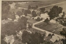
Monument City emerges

Moonrover

Sr. Member
Jul 17, 2012
476
182
Cambridge, MA
Primary Interest:
Other
Anyone live near Salamonie Lake? I saw a national news blurb about the dismantled town of Monument City which is showing up now that the lake waters are at record lows. Also heard the state has declared the area off limits to artifact collectors.

Although I'm not near there, I did a topo search just out of curiosity. One thing that strikes me as strange is the landform on the NW corner of Monument Island. Now that the water is down, the picture appears to look like there was an outdoor movie theater there. Look at coordinates 40.7761, -85.594
Sure looks like the parallel curved segments are what remains of the car parking humps. If it is an old outdoor movie theater, then coin hunting near the concession area should be heaven. Considering the fact that the Corps of Engineers took the land for lake construction in 1964 or 1965, coins found there will likely be non-clad.

Just a thought. Maybe some central Indiana metal detector enthusiasts will be able to shed some light on this. Might be a moot point since the state seems to have made their position clear concerning collection of artifacts from the drying lake bottom.

Merlin
 

inspectorgadget

Hero Member
Jul 14, 2012
924
431
Indianapolis
Detector(s) used
Whites MXT with 10"DD coil, Sun Ray probe
Primary Interest:
All Treasure Hunting
I'm in Indy & I have heard of people finding silver coins there just recently. I also read it is off limits to take anything from the area so I don't know what to believe! It is a man made reservoir not a lake & from what I've read there is more than one old town under this reservoir, have heard as many as 4 old towns are under it but only Monument City is exposed. If there are 4 towns under it I sure could see a drive in movie theater being in the area! Tho the humps you are seeing might be from water current erosion, as far as I remember that is spot is exposed stone not dirt, the areas east & south of that spot that have trees, grass & bushes growing on it has dirt but not where it looks barren like where the humps & mounds are. Google Maps Satellite images show the reservoir at a somewhat low level however not as low as it is right now. Water often is flowing over that spot which Google maps says the coordinates are 40.776983,-85.593594. At full capacity all the brownish grey areas around the reservoir & island are under water.
 

OP
OP
Moonrover

Moonrover

Sr. Member
Jul 17, 2012
476
182
Cambridge, MA
Primary Interest:
Other
I'm scratching around the Internet to see if I can locate a pre-1965 USGS topo map of the Monument City area. Just looking at the cut off roads going into the reservoir, I'm not able to pin-point the location of Monument City. The short TV story that I saw showed a photo of a tall brick school house that had been torn down during the reservoir site preparation.

The drought is probably taking down reservoir levels all over the Midwest. Looks like it is time for me to plan an RV trip.
 

inspectorgadget

Hero Member
Jul 14, 2012
924
431
Indianapolis
Detector(s) used
Whites MXT with 10"DD coil, Sun Ray probe
Primary Interest:
All Treasure Hunting
I'm scratching around the Internet to see if I can locate a pre-1965 USGS topo map of the Monument City area. Just looking at the cut off roads going into the reservoir, I'm not able to pin-point the location of Monument City. The short TV story that I saw showed a photo of a tall brick school house that had been torn down during the reservoir site preparation.

The drought is probably taking down reservoir levels all over the Midwest. Looks like it is time for me to plan an RV trip.

There is Morse reservoir in Cicero (Hamilton county) which is just north of Indianapolis, 40.100791,-86.038084. It is 6 1/2 feet low with most coves & shallower areas fully exposed, most of the people that live on it can't even think about getting their boats out of the hard dry mud or off their boat hoists. There may not be any towns under it but it has very expensive houses (some are $1,000,000+) on it with lot's of high dollar boats, The people I know up there are very wealthy, I'm quite sure some high dollar jewelery has been lost in this reservoir over the years.

Our other 2 local reservoirs (Fall Creek & Geist) are not that low like only 2.5 feet low, This makes getting boats out of some coves on Geist impossible but there's really not a lot of dry exposed area to check, Geist also has very high dollar houses on it to the point there are too many & so ya it's a very very high traffic lake! It would be great if cocktail cove dried out as this is the party spot! Fall Creek doesn't allow motorboats so it's a paddle & swimming lake only & nothing like the other 2 mentioned.
 

inspectorgadget

Hero Member
Jul 14, 2012
924
431
Indianapolis
Detector(s) used
Whites MXT with 10"DD coil, Sun Ray probe
Primary Interest:
All Treasure Hunting
I'm scratching around the Internet to see if I can locate a pre-1965 USGS topo map of the Monument City area. Just looking at the cut off roads going into the reservoir, I'm not able to pin-point the location of Monument City. The short TV story that I saw showed a photo of a tall brick school house that had been torn down during the reservoir site preparation.

The drought is probably taking down reservoir levels all over the Midwest. Looks like it is time for me to plan an RV trip.

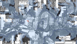
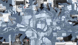
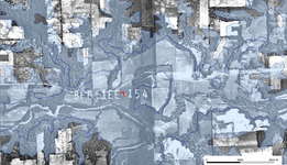
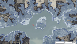
I think you might be right on in your initial thought about the drive-in movie. I have checked old aerial photo's from 1938, 1951, 1957 & 1964. In 1938 there was nothing there but in 1951 there was something there that resembles a drive-in (almost looks like a 2 screen drive-in or possibly just a larger drive-in) In 1957 it looks almost the same but slightly different as it looks like only 1 screen (or a smaller drive-in). The 1964 pic isn't much different from the 1957 pic, definitely has exactly what you see left now, spot on! A road ran from Monument City north east towards & past the "drive-in" just directly directly north of it (where the water is at now).

In the pix I added you can see the old town just southwest of the "drive-in" & the transition at the "drive-in site" from 1951 to 1957 to 1964 to 2008

So while taking stuff from this site is off limits I do now believe that was it most likely a drive-in back in the 50's just like you said! **NOTE** The drive-in looking thing is in about dead center of all 4 pix, it's easy to see!
Picture 25.png Picture 24.png Picture 23.png Picture 22.png
 

Last edited:
OP
OP
Moonrover

Moonrover

Sr. Member
Jul 17, 2012
476
182
Cambridge, MA
Primary Interest:
Other
Inspectorgadget,

Nice sleuthing on the collection of aerials. We now have that target to tempt us and there is nothing we can do. Unless the Indiana Parks Department (or whatever it is called) lifts the ban on metal detecting at the reservoir. Likelihood of that is slim to none.

However we did gain "dry fire target practice" on this outdoor movie theater identification thing. I'm an old military combat pilot; everything on the ground looks like a target to me.

Merlin
 

inspectorgadget

Hero Member
Jul 14, 2012
924
431
Indianapolis
Detector(s) used
Whites MXT with 10"DD coil, Sun Ray probe
Primary Interest:
All Treasure Hunting
Inspectorgadget,

Nice sleuthing on the collection of aerials. We now have that target to tempt us and there is nothing we can do. Unless the Indiana Parks Department (or whatever it is called) lifts the ban on metal detecting at the reservoir. Likelihood of that is slim to none.

However we did gain "dry fire target practice" on this outdoor movie theater identification thing. I'm an old military combat pilot; everything on the ground looks like a target to me.

Merlin

What did you fly in the military?

That DNR ban on the site will be lifted once the water level is higher & is once again fully covering Monument City. Google maps images show that the drive-in is NOT underwater unless the reservoir is very high, most aerial pics of the reservoir show the drive-in NOT underwater. The Monument City area is off limits but the drive-in is not really in Monument City so it might not be off limits? The only images I can find that show the drive-in spot submerged are in early pics of the reservoir in the late 60's & early 70's. I think at some point they decided to lower the normal "planned" level of the reservoir by several feet. It definitely doesn't appear to be as high in the 80's, 90's & 2000's as it was in the late 60's & early 70's. All that said I think that drive-in site could be done at some point in the future, a boat, a detector, 4-5 months from now & you might be good to go hunting that spot! Their protecting the actual town not the outlying areas that are usually accessible anyhow like that island is. Just gotta give it time.

Oh BTW there are at least 2 other towns under that reservoir that I can see from the old aerials (supposed to be 3 others but I can only find 2 of em so far) HH
 

Last edited:
OP
OP
Moonrover

Moonrover

Sr. Member
Jul 17, 2012
476
182
Cambridge, MA
Primary Interest:
Other
Jeremy S said:
<img src="http://www.treasurenet.com/forums/attachment.php?attachmentid=659874"/>

Here is an old picture of the town from this news story: Monument City rises from drought-hit Salamonie Lake bed - thestar.com

Another story here: Town submerged at Salamonie is closed to public

Very good! The school and general store show nicely. I guess that is the church near the cemetery and what looks like a mausoleum. According to the news articles, the cemetery was dug up and replanted on higher ground. Don't think I'd be comfortable in that line of work.

Merlin

Sent from my iPad using TreasureNet app
 

routerbit365

Newbie
Aug 5, 2012
1
0
Primary Interest:
All Treasure Hunting
I think you might be right on in your initial thought about the drive-in movie. I have checked old aerial photo's from 1938, 1951, 1957 & 1964. In 1938 there was nothing there but in 1951 there was something there that resembles a drive-in (almost looks like a 2 screen drive-in or possibly just a larger drive-in) In 1957 it looks almost the same but slightly different as it looks like only 1 screen (or a smaller drive-in). The 1964 pic isn't much different from the 1957 pic, definitely has exactly what you see left now, spot on! A road ran from Monument City north east towards & past the "drive-in" just directly directly north of it (where the water is at now).

In the pix I added you can see the old town just southwest of the "drive-in" & the transition at the "drive-in site" from 1951 to 1957 to 1964 to 2008

So while taking stuff from this site is off limits I do now believe that was it most likely a drive-in back in the 50's just like you said! **NOTE** The drive-in looking thing is in about dead center of all 4 pix, it's easy to see!

I found a map of Huntington County from 1960 here. Monument City is in Polk Township in about the center of the left side of the map. There is a symbol on the map in about the location of the "drive-in" that the legend says is a gravel pit. I've seen other old gravel pits that had similar patterns to what you see in the old areal photos.

We went to Monument City today and they are serious about not taking anything. I saw a lady pick something up and heard someone from the DNR tell her that if she tried to leave with it she would be arrested. There was also a lady there who used to live in Monument City. She had an album with several photos of the town. She talked about a lot of landmarks that were around the area, but never mentioned a drive-in.
 

OP
OP
Moonrover

Moonrover

Sr. Member
Jul 17, 2012
476
182
Cambridge, MA
Primary Interest:
Other
routerbit365 said:
I found a map of Huntington County from 1960 here. Monument City is in Polk Township in about the center of the left side of the map. There is a symbol on the map in about the location of the "drive-in" that the legend says is a gravel pit. I've seen other old gravel pits that had similar patterns to what you see in the old areal photos.

We went to Monument City today and they are serious about not taking anything. I saw a lady pick something up and heard someone from the DNR tell her that if she tried to leave with it she would be arrested. There was also a lady there who used to live in Monument City. She had an album with several photos of the town. She talked about a lot of landmarks that were around the area, but never mentioned a drive-in.

Thanks for the map URL. I see what you spotted, is the symbol sort of a bucket looking thing? Viewed on my iPad it is difficult to see. Will have to switch to my larger computer. Those symbols are elsewhere up and down the river valley. Logical place for gravel pits. My movie theater theory goes down in flames. <lol>

Artifact police are on this like the place is a sacred temple. They were not that concerned when they leveled the town with bulldozers back in '64.

Sent from my iPad using TreasureNet app
 

inspectorgadget

Hero Member
Jul 14, 2012
924
431
Indianapolis
Detector(s) used
Whites MXT with 10"DD coil, Sun Ray probe
Primary Interest:
All Treasure Hunting
The gravel pit makes since to me because as I remembered it that area on the island was indeed rock or very rocky, it was along time ago when I was there.
 

wingmaster

Bronze Member
Aug 10, 2009
2,344
934
Detector(s) used
White's MXT all pro, MXT300 D2, 950, 4X6 DD, detech ultimate 13" DD coils
Primary Interest:
All Treasure Hunting
It's really dumb they want to preserve a site that the state bulldozed down then built a lake over it, if they was going to preserve it you would think they wouldn't build a lake over the top of it. The state will say no metal detecting at a site but then a corporation will build a factory right on the site that was off limits to detect. HH
 

Jeremy S

Hero Member
Feb 27, 2012
515
343
God's Country
🏆 Honorable Mentions:
3
Detector(s) used
Garret Ace 250, AT Pro, Garret Pro Pointer
Primary Interest:
Metal Detecting
It's really dumb they want to preserve a site that the state bulldozed down then built a lake over it, if they was going to preserve it you would think they wouldn't build a lake over the top of it. The state will say no metal detecting at a site but then a corporation will build a factory right on the site that was off limits to detect. HH


Yup, GE did the same thing in Southern Indiana, right on top of an Indiana mound. Then the state pressed charges against a guy for collecting artifacts from the site, even though it was probably going to end up under a parking lot or building. It was a pretty big mess at the time and I believe the artifact collectors were essentially trespassing, which grabbed the archaeologist's attention!

http://www.unl.edu/rhames/courses/current/readings/munson.pdf

But that's another can of worms....

Will the ban be raised once the water levels go back up? If the lake is DNR property, then MDing wouldn't be allowed there no matter what. What is to keep a diver from going into the shallow water a picking up a brick or other "historical" object from the bottom of the lake? How were these ruins any different than any of the old house foundations out here int he country wasting away and buried in weeds?
 

inspectorgadget

Hero Member
Jul 14, 2012
924
431
Indianapolis
Detector(s) used
Whites MXT with 10"DD coil, Sun Ray probe
Primary Interest:
All Treasure Hunting
Yup, GE did the same thing in Southern Indiana, right on top of an Indiana mound. Then the state pressed charges against a guy for collecting artifacts from the site, even though it was probably going to end up under a parking lot or building. It was a pretty big mess at the time and I believe the artifact collectors were essentially trespassing, which grabbed the archaeologist's attention!

http://www.unl.edu/rhames/courses/current/readings/munson.pdf

But that's another can of worms....

Will the ban be raised once the water levels go back up? If the lake is DNR property, then MDing wouldn't be allowed there no matter what. What is to keep a diver from going into the shallow water a picking up a brick or other "historical" object from the bottom of the lake? How were these ruins any different than any of the old house foundations out here int he country wasting away and buried in weeds?

People were metal detecting the area before the DNR ban & no one got in "trouble", DNR just put a stop to it after the news stations got a hold of the story. There is nothing special about Monument City so I don't know why they are being so strict. Oh BTW I have detected on DNR property in the past right in front of DNR officers & they said nothing.
 

Last edited:

Jeremy S

Hero Member
Feb 27, 2012
515
343
God's Country
🏆 Honorable Mentions:
3
Detector(s) used
Garret Ace 250, AT Pro, Garret Pro Pointer
Primary Interest:
Metal Detecting
People were metal detecting the area before the DNR ban & no one got in "trouble", DNR just put a stop to it after the news stations got a hold of the story. There is nothing special about Monument City so I don't know why they are being so strict. Oh BTW I have detected on DNR property in the past right in front of DNR officers & they said nothing.

That's really good that you never have any trouble detecting there. I live close to a state forest that is controlled by the DNR. Lots of old shelter houses that date back to the 1930s, and many old homesites on the forest property. I may give it a try some weekend when it cools down and see what happens.
 

Top Member Reactions

Users who are viewing this thread

Top