Lost Adams Diggings Found!

Shake n Flake

Jr. Member
Jun 3, 2010
46
0
Midtown Sac
FWIW, I could find nothing by Ron Jensen after his "discovery" in 2001. So, either he is living in quiet luxury in a Latin American country, or he was wrong. And from reading his account I can't believe he'd ever admit to being wrong.

Or he is a true academic--the ones who don't need actual, physical evidence to prove their claims. ::) But I'd expect a true academic to publish, and I can find no evidence of that, either.

Fascinating stuff.
 

Twisted Fork

Hero Member
Sep 2, 2007
723
52
UTAH
Detector(s) used
tf900 & a good old fashioned willow forked limb
From what was passed down to me, the cache site was in a tributary with water present all of the time, but when it rained, the washout would turn the sandy bed over and expose the nuggets and they were rose quartz with Gold wire running through them. The oldest Peralta notes I found said that in the beginning, the lode stuck up through the surface and there were piles of naturally broken wire and rose quartz laid thick all around it. Adams accidentally walked up on the cache in an effort to escape a wicked storm that had recently stirred up and there it was. The miner's payroll in the code. There were short umbrella like trees all around the location before they built Roosevelt Dam. The spring and most of the trees are barley noticeable now. There is a monster cactus, not far from the place, "The Priest Who Stands By The River" An ancient cactus, in that it reminds one of crucification.
 

Oroblanco

Gold Member
Jan 21, 2005
7,838
9,830
DAKOTA TERRITORY
Detector(s) used
Tesoro Lobo Supertraq, (95%) Garrett Scorpion (5%)
Twisted Fork said:
From what was passed down to me, the cache site was in a tributary with water present all of the time, but when it rained, the washout would turn the sandy bed over and expose the nuggets and they were rose quartz with Gold wire running through them. The oldest Peralta notes I found said that in the beginning, the lode stuck up through the surface and there were piles of naturally broken wire and rose quartz laid thick all around it. Adams accidentally walked up on the cache in an effort to escape a wicked storm that had recently stirred up and there it was. The miner's payroll in the code. There were short umbrella like trees all around the location before they built Roosevelt Dam. The spring and most of the trees are barley noticeable now. There is a monster cactus, not far from the place, "The Priest Who Stands By The River" An ancient cactus, in that it reminds one of crucification.

Wow that sure is different; rose quartz with wire gold? (I thought Adams had placer gold) Peraltas? (I thought they were supposed to be linked intimately with the Lost Dutchman) A cache, a miners payroll? This doesn't sound at all like the story of the Lost Adams Diggings that I am familiar with. Can you provide any sources for this version? Thank you in advance;
Oroblanco

:coffee2: :coffee: :coffee2:
 

Twisted Fork

Hero Member
Sep 2, 2007
723
52
UTAH
Detector(s) used
tf900 & a good old fashioned willow forked limb
The find was in a moist, sandy and natural deposit the was arranged according to the same system the Bowman has been referring to; on the surface, a Masonic cartoon code if you will. Every site in the West including the KGC has used this method of preservation in order keep tabs on the goods.

With Adams, he found what appeared to be a sandy placer deposit, but it was man made in association to the mine nearby. Each site has a church cache of ingots and an ore cache set up as bait. There is also a simple stone map cache or mock up stone as an image resembling the mountain work-site in miniature. The cache the Adams walked up on was designed to appear that the lode was up further when in reality it is below. However, the party later realized a rich placer a ways off in the distance that was natural and well fed buy the rose outcrop when the river used to run higher, many a millennium ago. It is doubtful to me that they discovered all of the works at the site as the Apache didn't give them the opportunity.

The Spanish markers are still intact and the buried cave still has plants growing on it's seal that are not kin to the area. If you find the three red hill formations, you have found the location of where the Windrose once stood; A large square boulder of around 4 feet in span. The the words in large block letters once said "MINA RICA" upon the face of it. Next to it stood a cone shaped stone like a witches hat and another round, eight inch or so stone balanced atop it like a table top. This stone set represented a square entry with a tree marked near it; all buried still and not by the natives. This monument stood at the top of the 3rd red hill and is also recognized on the Peralta paper map, where one finds the word MINA ANNAYACCA; (please forgive any misspellings here) "RICH TREASURE AND MINE" ? Miners destroyed it years ago, but I held a Polaroid of it the first day I visited the site.

If you will notice on the tablets, there is a symbol of a safe with an II on it and a cross at it's side. This is the Kiva instruction attached to the mine; reference to the trail from the placer near the river to a point across the river and on to the sealed kiva. It sits between two markers and has unusual plants growing on it in rows that resemble a Christian Cross upon it.
All I can tell you now is that the site , the Peraltas and the Adams digs are all very real and dealing with one and the same place. It's where you wouldn't think to look so keep that in mind; The river can be seen from the hat mountain........ ( a second hat Mnt., not shaped like a sombrero, and other than the first witch hat Black Mnt.,; the first of these two different kinds of hats )
 

Oroblanco

Gold Member
Jan 21, 2005
7,838
9,830
DAKOTA TERRITORY
Detector(s) used
Tesoro Lobo Supertraq, (95%) Garrett Scorpion (5%)
Twisted Fork wrote
If you will notice on the tablets, there is a symbol of a safe with an II on it and a cross at it's side. This is the Kiva instruction attached to the mine; reference to the trail from the placer near the river to a point across the river and on to the sealed kiva. It sits between two markers and has unusual plants growing on it in rows that resemble a Christian Cross upon it.
All I can tell you now is that the site , the Peraltas and the Adams digs are all very real and dealing with one and the same place. It's where you wouldn't think to look so keep that in mind; The river can be seen from the hat mountain........ ( a second hat Mnt., not shaped like a sombrero, and other than the first witch hat Black Mnt.,; the first of these two different kinds of hats )

Well amigo you are the first I have ever run across, to have linked the Peralta stones with the Lost Adams Diggings, and your landmarks do not match with any I have ever run across for the Adams placer diggings either - a hat mountain, the boulder, "MINA RICA" etc none of these appear in any version of the Lost Adams that I am familiar with. That is why I had asked you earlier, for sources that tell this version. If it is strictly 100% from verbal sources, that is you heard it 'straight from the horse's mouth' so to speak, then you will find many of us to be VERY hesitant to accept it. You have been around enough to know, that the sort of stories that get passed around the saloons and campfires, are very often pure fiction or so mixed up and mis-remembered that they will only lead a treasure hunter on the proverbial wild goose chase. I am not saying this is what you are telling us, just that it would be better if there were some sources that we could check on. I have seen your opinion of the published sources, and in some cases it may well be justified; (I know of one particular treasure author, very well researched, well respected and a good writer, that has published deliberate misleading clues) however from what I could learn, in the majority of cases those published sources have tried to tell us the truth as best they understood it themselves.

So I take it there are no published sources for this alternate version of the Adams diggings, linked to the Peraltas and the stone tablets etc? I guess that I have to respectfully state that I remain quite skeptical. I hope that you are not offended by my skepticism, if so then my apologies for no offense is intended, and perhaps what you say is 100% factual - but I need more than just your word on it amigo, and am pretty sure that you would want more from me if the shoe were on the other foot.

Good luck and good hunting, I hope you find the treasures that you seek.
Oroblanco
 

Twisted Fork

Hero Member
Sep 2, 2007
723
52
UTAH
Detector(s) used
tf900 & a good old fashioned willow forked limb
Oroblanco,

No offense taken on anyone's part. All in good fun. What I am trying to get across is that Adams and the other Dutchies all walked on to the same Peralta site know as the Heart. There is only one place in every State, that one can call the richest one of them all and the markers present on site speak louder than words. All parties involved testified in one way or another that this place was ripe with gold like no other they had ever seen. That in itself should be more plausible wherein such a location is likely to be one of a kind. I would love to share more about the location, but then it would take the love of the hunt away from those of whom have taken me serious and are looking for it at this very moment. It just wouldn't be fair. Someone is just going to have to go out and earn it before it is going to pay off in any way. Everyone is entitled to anything the legend can dish out. One single little overlooked clue just might make all the difference.
 

Springfield

Silver Member
Apr 19, 2003
2,850
1,383
New Mexico
Detector(s) used
BS
Twisty,
You may well be correct about your Adams ancestor finding the rose quartz deposit in central Arizona. I for one place enormous value in closely held family secrets. Proprietory information will nearly always trump publicly held beliefs concerning these sorts of legends - the information available to the public is virtually always incorrect. Family secrets remain secret for a reason.

Having said that, it would seem to me that your Adams relative (George) was a different person than the Adams who is associated with the traditional 'Lost Adams Diggings'. There are too many fundamental differences in the stories for them to be describing the same thing. The year of discovery for George Adams (1883, which you've related elsewhere) is a deal breaker all by itself. By that date, there had already been a number of well publicized attempts to relocate the 'traditional LAD', the date of its discovery generally believed to be 1862-4. I personally do not rule out the Williams date of 1858 for the event, but that's immaterial here.

Your ancestors' traditions are very interesting to say the least and there's no reason to dismiss them out of hand. While it seems possible that the rose quartz deposit may turn out to be the same as the Peraltas, I would venture to say that the Lost Adams Diggings placer was a completely different animal located in a different place. Looks like two Adams here.
 

Twisted Fork

Hero Member
Sep 2, 2007
723
52
UTAH
Detector(s) used
tf900 & a good old fashioned willow forked limb
Wouldn't surprise me a bit Springfield. Your probably right there. I remember reading some of the earlier circulations also back in the eighties and seeing that something didn't jive. I remember being told that after Grandpa Joseph died, His map of which he kept in his bible disappeared; probably into the hands of his widow (daughter of Adams) and her new husband Dusty Roads (Rhoads and then Rhoades). Adams gave him a had drawn map, just of the exact area around the lode and how to get there was hear to hear. Joseph received it when he married his daughter. Later, Adams would almost die in Joseph's arms on the saloon floor. None of the time lines fit the other and due to the year in question, one might even presume that Waltz and he may have been an acquaintance in some way. Same backyard, and definitely Peralta even so. The place of the Don's Heart. All the luxuries and even a bath too.
 

cactusjumper

Gold Member
Dec 10, 2005
7,754
5,388
Arizona
Mr. Fork,

Just curious......Do you know who these folks are?

image0-16.jpg


Joe Ribaudo
 

cactusjumper

Gold Member
Dec 10, 2005
7,754
5,388
Arizona
forked,

I take it the picture is not something available by surfing the Net. George M. Adams and family are out there.......keep looking. Have you figured out how to explain your comment that George Adams moved back to Utah with his Daughter, instead of his second wife? Could it be that your saloon sources were spending too much time partaking of their wares?

The answer for your advancing your historical novel is..... :read2: :read2: :read2:

Joe Ribaudo.....Adams Family Historian. :D
 

lastleg

Silver Member
Feb 3, 2008
2,876
658
Well, I'm no closer to the LAD but at least my suspicions about the "finding"
of the Tayopa are now confirmed.
 

Nov 8, 2004
14,582
11,942
Alamos,Sonora,Mexico
Primary Interest:
All Treasure Hunting
HI last leg, my friend: You posted -->Well, I'm no closer to the LAD but at least my suspicions about the "finding"
of the Tayopa are now confirmed
***************

For some reason, I second that confirmed suspicion.

Don Jose de La Mancha
 

lastleg

Silver Member
Feb 3, 2008
2,876
658
Dear Don Jose:

Is it a logical assumption to conclude the precise location of the most
treasure laden of the Tayopas was aquired "from afar"? And I do not
include map dowsing as a possible means of discovery.
Whatever your response I expect readers to be entertained, amused
and bewildered.

Delightfully curious,
lastleg
 

iinvestigator

Tenderfoot
Sep 17, 2010
7
0
Detector(s) used
Minelab, Garrett, Tesoro, Fisher, SunRay, Apex,
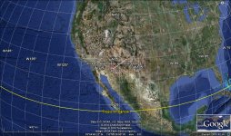
Mounted knights-- all on well-conditioned destriers or palfreys -- would move fairly fast and cover upwards of 50 or 60 miles per day. Four Days From Old Fort Wingate 200 to 240 miles
 

Attachments

  • AdamsDiggingsCasaGrandArizonaDivideetoSanRafaelold FortWingate.jpg
    AdamsDiggingsCasaGrandArizonaDivideetoSanRafaelold FortWingate.jpg
    172.8 KB · Views: 2,080

iinvestigator

Tenderfoot
Sep 17, 2010
7
0
Detector(s) used
Minelab, Garrett, Tesoro, Fisher, SunRay, Apex,
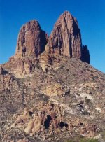
One days ride from the arizona divide which lines up with casa grande. Two haystacks weavers needle.
 

Attachments

  • two haystacked mountains.jpg
    two haystacked mountains.jpg
    54.1 KB · Views: 2,014

iinvestigator

Tenderfoot
Sep 17, 2010
7
0
Detector(s) used
Minelab, Garrett, Tesoro, Fisher, SunRay, Apex,
Lost Adams Diggings Found!
 

Attachments

  • Fish 001.jpg
    Fish 001.jpg
    152.7 KB · Views: 2,179

iinvestigator

Tenderfoot
Sep 17, 2010
7
0
Detector(s) used
Minelab, Garrett, Tesoro, Fisher, SunRay, Apex,
One days ride from arizona divide casa grande. Four days ride from san rafael old fort wingate.
 

iinvestigator

Tenderfoot
Sep 17, 2010
7
0
Detector(s) used
Minelab, Garrett, Tesoro, Fisher, SunRay, Apex,
During this period new mexico and arizona were one and the same place. The arizona divide was the divide.
 

iinvestigator

Tenderfoot
Sep 17, 2010
7
0
Detector(s) used
Minelab, Garrett, Tesoro, Fisher, SunRay, Apex,
The miners were warned by the apache not to go high up in the cliffs.
 

cactusjumper

Gold Member
Dec 10, 2005
7,754
5,388
Arizona
iinvestigator,

"The miners were warned by the Apache not to go high up in the cliffs."

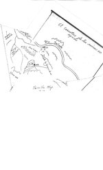
That map has always intrigued me. Did anyone ever notice the trail out of West Boulder over into Little Boulder on this map? Funny how it matches up with the Stone Maps.

The cliffs that the Apache were warning about, assuming that story is true, are likely the cliffs off the ridge between West and East Boulder Canyons. Anyone here ever do any serious climbing up there.....other than me? :dontknow:

Joe Ribaudo
 

Top Member Reactions

Users who are viewing this thread

Top