Return to the Lost Adams Diggings. The Paul Hale Story. By Richard U. French

whiskeyrat

Hero Member
May 7, 2012
539
1,246
mid Michigan
Primary Interest:
Prospecting
just finished reading the book

I purchased the book "return to the lost adams diggins". Awesome read, could not put it down finished it in 2 days. HOWEVER, could not help but be very disappointed by the finish.
Seems to me, they never really found the "big one", kept needing more prospecting, then just as they had the machine to do it, the Rocky Mountain Elk Foundation inherited the property and ended the search.
Cant help it, but it was a huge let down at the end of the book. Like no real ending.
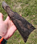
I have searched many sites myself, and found bones, artifacts, cans, knifes. gold in various concentrations, blah blah they are everywhere. You cant metal detect anywhere in NM without finding stuff like that.
Its like the entire book you are waiting for the real positive proof, then looks like they have the machine to deliver and RMEF pulls the plug. Book over. Really?????
Extremely disappointing ending, but yet, it might just keep the hunt alive.
Guess im not sure if they found the LAD or not???
If they did, it was sure a disappointment.
12 years for old tin cans and bone fragments????? and various assays???? That stuff is everywhere.
Fallen down chimneys, burnt cabins, they are all over the place in NM, you cant explore any canyon without finding one.
hmmmm, not sure what to think. Loved the read, but the ending sucked.
Im left really hangin on this one?????

whiskeyrat
 

rufrench

Newbie
Mar 30, 2015
3
3
Primary Interest:
All Treasure Hunting
Excellent book again by Richard French and kudos to Paul Hale and his partners for their arduous efforts and success.

I bought the ebook; quite a "page turner" for the LAD enthusiasts. Had I not dozed off, I would have finished it in one setting. Using a topomap website and GoogleEarth, I was able to locate and blow up the cabin site as described in the book for a very close view. The chimney stones are obvious on the surface. I was hoping that one of Richard French's illustrations would also include the actual route Adams used once he arrived just southwest of the mountains. I am interested in which drainages on the topo map the Adams party took to access the "Bench" and finally the Old Canyon site where they built the cabin. It would be interesting to compare the Allen map to the actual route. French does include some of the map references on a GoogleEarth illustration in his book, but it would be interesting to see where the rest of the "check points" are located once Adams crossed north of the Plains of San Agustin: the little door, the pumpkin patch, the big square rock, and the zig zag trail/canyon.

In his book, Richard French indicates that the zig zag canyon/trail is Rock House Canyon; I found two - one in Catron County and the other in Socorro County but not sure which is the significant one. I would imagine it would be the one in Socorro County which is south of Old Canyon.

I assume the Adams Party skirted the mountains just north of present day Route 12 and entered the mountain drainages north of Route 60 northeast of Datil.

Mr. French, could you add the locations of those points to your illustration and post them here?

Thanks in advance for any clarifications.

Bill
Hi Bill,
I apologize for being so long in getting back to you. Thank you for your interest and your kind review of my book.
There are two maps at the end of chapter 3, pages 77 & 78 in the book. They display the Adams route from the crossing of the
"Big Much Traveled Trail" (over the bench) to the cabin site. Before they got to the big trail, I believe they traveled an Indian
trail that brought them in from what is now the Springerville, AZ area along a course near what is now US Highway 60. That is
my determination from information in the Charles Allen account.
I hope this helps you out, and thanks again for your interest.
Dick French
 

UncleMatt

Bronze Member
Jul 14, 2012
2,389
2,530
Albuqerque, NM / Durango, CO
Detector(s) used
Garrett Infinium & Gold Bug II, Bazooka Super Prospector Sluice
Primary Interest:
All Treasure Hunting
Richard, can you please give us a GPS location for the location of the rock house mentioned in the book?
 

rufrench

Newbie
Mar 30, 2015
3
3
Primary Interest:
All Treasure Hunting
Richard, can you please give us a GPS location for the location of the rock house mentioned in the book?

The Rock House location is identified on the map on page 77 of the book.
Richard French
 

rufrench

Newbie
Mar 30, 2015
3
3
Primary Interest:
All Treasure Hunting
UncleMatt,

I think this pix is a blow up of the chimney site . If you can blow up the image, you will notice a couple of piles of rocks in the center near the bushes... do you agree?

Bill

View attachment 1110763

Bill,
The site marked for the chimney is about 100 yards north of the actual chimney site. Use cords: 34-368021North 107642208 West. The black spot in the center is the hearth. I think what you saw were the rocks in the Circle of Rocks; they are very large. Cords for the Big Square Rock are: 34-370825North 107652557West. The Rock House site is identified on page 77.
Again, sorry for the delay in getting back to you.
Dick French
 

UncleMatt

Bronze Member
Jul 14, 2012
2,389
2,530
Albuqerque, NM / Durango, CO
Detector(s) used
Garrett Infinium & Gold Bug II, Bazooka Super Prospector Sluice
Primary Interest:
All Treasure Hunting
I purchased my copy as a kindle book, and it does not have page numbers that match the printed book. Instead it has locations. With the font set to the smallest setting, what location number is the rock house location shown DF? Or at least what chapter it is in to help narrow things down a bit.
 

Last edited:

Curious_George

Jr. Member
Jul 15, 2013
37
45
MN
Primary Interest:
Other
I purchased my copy as a kindle book, and it does not have page numbers that match the printed book. Instead it has locations. With the font set to the smallest setting, what location number is the rock house location shown DF? Or at least what chapter it is in to help narrow things down a bit.

Am anxiously waiting for my hard copy of Richard's book to arrive. Have been intensely interested in the LAD since reading his 1st book for at least three reasons--

he is an *excellent* story teller and

he did his field work, allowing the real geography "on the ground" literally to guide him in determining the next step to take, rather than taking the next step due to some sacred theory he was allowing to drive him and

he loved doing the fieldwork. As a former Grand Canyon backpacker, and lover of the South West, I can think of very few things more fulfilling than exploring and simply enjoying the beauty of NM & Arizona.

While I understand they did find some gold at the site they id'd as the LAD, apparently the mother lode had been cleaned out-- how about moving on to the original site Gotch Ear was aiming to take them, which was, according to the stories, 1 or 2 days closer to the two mountains visible from the area just before (or is it the Mesa above) the Zig ZAg Canyon's "Little Door."

Looking forward to a great read (and reread, and reread again, etc, etc.,..)

George
 

concho

Newbie
Dec 5, 2014
4
0
PA
Detector(s) used
Bounty Hunter , Looking at ATX Garrett
Primary Interest:
All Treasure Hunting
That Gold is still there , I can show the people that own that property where it is but they have never contacted me from my first contact .
 

Curious_George

Jr. Member
Jul 15, 2013
37
45
MN
Primary Interest:
Other
Why say.....?

That Gold is still there , I can show the people that own that property where it is but they have never contacted me from my first contact .

Concho,

Would you please share with us why, specifically, you say "That gold is still there"?
 

Curious_George

Jr. Member
Jul 15, 2013
37
45
MN
Primary Interest:
Other
Interesting article at:

THE LOST ADAMS DIGGINGS by ps94506

Check out especially the 3rd page of the article, paragraphs 2-4. I'm looking forward to seeing if Dick French's book LAD location relates to the discovery of these skeletons, (back in the 30's?, if not earlier?) by Bob Lewis of Magdelana.
 

whiskeyrat

Hero Member
May 7, 2012
539
1,246
mid Michigan
Primary Interest:
Prospecting
The above gps coordinates given for the cabin site (cabin hearth) are in Old Canyon. A relatively easily accessible canyon that can be entered from the top, bottom and many places from the side all along its length.
In the LAD legends, the cabin site (the gold canyon site) is in a double box end canyon with no access from above or below.
The double box canyon of the legand is only accessible thru the "secret door" which gains entrance to the zig zag canyon and then into the side of the "gold canyon where the cabin was. The secret door is so narrow as a rider can almost touch both sides of the canyon (like a crack in a vertical limestone cliff).
There is no access above the cabin, there is no access or exit out of the gold canyon below the cabin (the stream goes into the ground to find its way out, as in it flows under the lower box end (vertical cliffs)).

Above the cabin is a waterfall that marks the sacred burial ground of the apaches. Above the waterfall, is a box end, no access, no exit (as in vertical cliffs)
Chief Nana warned the Adams party not to prospect above the waterfall as it was sacred. They did, so he killed them.

I dont find any waterfall above this "cabin" location give by RUF in the post above. Old canyon is far from a "double box end canyon", it is relatively easily accessible from the top, the bottom and many locations along its length.

Sorry, I just dont see the above given location as anything close to the the Adams cabin site.

wr
 

alaskabill

Jr. Member
Jan 5, 2009
81
13
Alaska
Detector(s) used
White's GMT
Bill,
The site marked for the chimney is about 100 yards north of the actual chimney site. Use cords: 34-368021North 107642208 West. The black spot in the center is the hearth. I think what you saw were the rocks in the Circle of Rocks; they are very large. Cords for the Big Square Rock are: 34-370825North 107652557West. The Rock House site is identified on page 77.
Again, sorry for the delay in getting back to you.
Dick French

Thanks, Dick,

Now it is my turn to apologize for being so late to reply. I have been having problems with access to my email server and finally got it resolved. I'm way behind with email, but finally back to normal ops.

I found the correct cabin location with the dark spot still on the surface that located the hearth. Thanks for clearing that up. I also was having trouble locating your references in my Kindle version - no page numbers - but located the two route maps in Chapter 3. I was able to trace the same path on Google Earth and see how the clues from most earlier accounts fit nicely. But I was hoping like others to be able to identify the Rock House site in Rock House Canyon. I would think that Google Earth should give some indication of a remaining rectangular pattern on the surface in the vicinity where you have indicated on the topo map in your book. But so far, I haven't been able to do so. If and when I do, I'll post what I think are the coordinates for the Rock House. If you have already done this, could you post the coords, please?

Again, Dick, thanks for publishing this excellent account of evidence to support the finding of the legendary "Lost Adams Diggings".

Bill
 

Last edited:

alaskabill

Jr. Member
Jan 5, 2009
81
13
Alaska
Detector(s) used
White's GMT
I purchased my copy as a kindle book, and it does not have page numbers that match the printed book. Instead it has locations. With the font set to the smallest setting, what location number is the rock house location shown DF? Or at least what chapter it is in to help narrow things down a bit.

UncleMatt,
I'm not positive, but here is an image on google earth that might be the foundation of the Rock House in Rock House Canyon. The side lengths are about 9 feet on each side. It is in the vicinity of where Dick French locates the Rock House structure on the map in Chapter 3. The green line in the image is my approximation of Adams route based on Dick French's map in Chapter 3.

34°18’26.86"N
107°38'25.23"W

Dick, do you agree?


RockHouse.jpg
 

Last edited:
Mar 2, 2013
729
1,825
Primary Interest:
All Treasure Hunting
If the legend is true about the "pumpkin patch" and the venerable old Mangas Coloradas' Rancheria being located in close proximity to the LAD site, then it isn't that much of a mystery as the Mimbreno chief was visited many times by the US cavalry and it was relatively well known where Mangas would be when he was in New Mexico.

What brings some complexity to the matter is the fact that the old mighty chief and lost his beloved home at Pinos Altos to gold miners and prospectors and had enlisted the help of his son-in-law (a certain Chiricahua chief called Cochise) to 'eliminate' the trespassers. If the LAD is real, and Adams described it accurately, then it would be fairly straightforward to locate it based on where old Mangas resided in his mountain Rancheria in New Mexico where there was old rock-houses and cultivation patches.
 

UncleMatt

Bronze Member
Jul 14, 2012
2,389
2,530
Albuqerque, NM / Durango, CO
Detector(s) used
Garrett Infinium & Gold Bug II, Bazooka Super Prospector Sluice
Primary Interest:
All Treasure Hunting
Chapter 3 map. Got it.

Something I absolutely hate about kindle books is the lack of a zoom feature for maps and photos, and that you can't cut and paste maps, or save the maps to a file. Very irritating indeed!
 

UncleMatt

Bronze Member
Jul 14, 2012
2,389
2,530
Albuqerque, NM / Durango, CO
Detector(s) used
Garrett Infinium & Gold Bug II, Bazooka Super Prospector Sluice
Primary Interest:
All Treasure Hunting
UncleMatt,
I'm not positive, but here is an image on google earth that might be the foundation of the Rock House in Rock House Canyon. The side lengths are about 9 feet on each side. It is in the vicinity of where Dick French locates the Rock House structure on the map in Chapter 3. The green line in the image is my approximation of Adams route based on Dick French's map in Chapter 3.

34°18’26.86"N
107°38'25.23"W

Dick, do you agree?


That GPS points to what looks like a large rock. I think this GPS points to it: 34.311517, -107.640801 . Tell me what you think.

RockHouse.jpg
 

Last edited:

alaskabill

Jr. Member
Jan 5, 2009
81
13
Alaska
Detector(s) used
White's GMT
Yep, I think you are correct. This location appears more like a foundation for a rock house than the one I found.
 

Loke

Hero Member
Mar 24, 2010
589
1,383
Republic of Texas
Primary Interest:
All Treasure Hunting
Maybe I am not remembering right, but was it not from Silver City that Adams in later years tried to find his 'place'? If so, one would think he would be able to recognize some of the features ...
 

sdcfia

Silver Member
Sep 28, 2014
3,648
8,861
Primary Interest:
Other
Maybe I am not remembering right, but was it not from Silver City that Adams in later years tried to find his 'place'? If so, one would think he would be able to recognize some of the features ...

[Note: in order not to disturb the Hale/French thread, I have deleted my two recent posts here and will re-post later today into a new thread]
 

Last edited:

Top Member Reactions

Users who are viewing this thread

Top