WANTED: Hikers to help document the conclusion of the Peralta Stone Maps

PotBelly Jim

Hero Member
Dec 8, 2017
900
2,990
Primary Interest:
Other
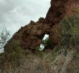
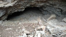
jim....going by his claim papers a couple of them say the north side of the river....and it seems like they border each other....which in mining is common practice..when you hit a good strike most miners try to claim the ground adjacent to their strike...the reason for that is there could be more goodies close by...and as soon as word gets out about your good fortune..other miners will flock to your area and claim around you...by claiming ground adjacent to your claim you prevent this.....i've tried researching old mining claims before and its hard due to the miners description in their papers..they didn't have a very accurate way of measuring mileage like we do today so they just guessed....the few cases where i was able to actually locate an old mine on the ground...it wasn't where the claim papers indicated it was.....the area around alder creek is pretty vertical...on both sides of the river...if i were going to prospect the river i would be looking a bit further east..away from the cliffs....the only places you would be able to mine in those cliffs would be where a wash or creek empties into the river...try emailing greg davis or tom kollenborn and see if they have ever investigated these claims

Thanks for the help, Dave, I appreciate you looking over all those claims...I know it sucks they're hard to read. I don't know Greg D. or Tom K. so I'm reluctant to bother them, they probably get inundated with this sort of thing from people they don't know. I'm inclined to give a lot of weight to Joe and Garry, as they both have looked at this in depth, and same to you as you've been kicking around over on that side of the lake. So that brings me to exactly the same place Garry arrived at years ago (I think):

Defender is most likely on the south bank;
Curiosity is over on the north side at the mouth of Alder Creek;
Puritan may be on either side;
and the rest are over on the north side, possibly some distance up river

It may be a few days before I can get the maps joined together...they may not be of much use in the end, but may help someone out if they're just starting out like me. Thanks to all you guys for giving me all the feedback, I think I'm a lot better off now than I was a few days ago in regards to these mines. Best regards, Jim
 

azdave35

Silver Member
Dec 19, 2008
3,606
8,104
Thanks for the help, Dave, I appreciate you looking over all those claims...I know it sucks they're hard to read. I don't know Greg D. or Tom K. so I'm reluctant to bother them, they probably get inundated with this sort of thing from people they don't know. I'm inclined to give a lot of weight to Joe and Garry, as they both have looked at this in depth, and same to you as you've been kicking around over on that side of the lake. So that brings me to exactly the same place Garry arrived at years ago (I think):

Defender is most likely on the south bank;
Curiosity is over on the north side at the mouth of Alder Creek;
Puritan may be on either side;
and the rest are over on the north side, possibly some distance up river

It may be a few days before I can get the maps joined together...they may not be of much use in the end, but may help someone out if they're just starting out like me. Thanks to all you guys for giving me all the feedback, I think I'm a lot better off now than I was a few days ago in regards to these mines. Best regards, Jim

greg usually checks in on this forum ..if he has any info he will usually chime in....i can email tom and see what he knows
 

Cubfan64

Silver Member
Feb 13, 2006
2,986
2,789
New Hampshire - USA
Detector(s) used
Fisher CZ21, Teknetics T2 & Minelab Sovereign GT
Primary Interest:
All Treasure Hunting
Jim and Dave - great job following up on Garry's work from some years ago. It would be really nice to see a "best guess" mapped image of where all of Bark's claims were. I'd love to spend some time wandering around on the N side of the river there but not sure I'll ever get the chance. The only ways there are either long 4x4 high clearance driving or kayaking and I can't bring either of them out to AZ by airplane.
 

azdave35

Silver Member
Dec 19, 2008
3,606
8,104
Jim and Dave - great job following up on Garry's work from some years ago. It would be really nice to see a "best guess" mapped image of where all of Bark's claims were. I'd love to spend some time wandering around on the N side of the river there but not sure I'll ever get the chance. The only ways there are either long 4x4 high clearance driving or kayaking and I can't bring either of them out to AZ by airplane.
paul...to my knowledge you cant drive on the north side of the river...i dont even think there are any roads east of alder creek...there used to be a road from cottonwood camp to adams camp but the forest service closed the eastern half of it years ago...the west end is so rough they didnt bother closing it...lol...i'm pretty sure the only way to get to alder creek is by horse or boat
 

Cubfan64

Silver Member
Feb 13, 2006
2,986
2,789
New Hampshire - USA
Detector(s) used
Fisher CZ21, Teknetics T2 & Minelab Sovereign GT
Primary Interest:
All Treasure Hunting
paul...to my knowledge you cant drive on the north side of the river...i dont even think there are any roads east of alder creek...there used to be a road from cottonwood camp to adams camp but the forest service closed the eastern half of it years ago...the west end is so rough they didnt bother closing it...lol...i'm pretty sure the only way to get to alder creek is by horse or boat

Dang - can't take a horse on the plane either - hehe.

Since it's that hard to get N of the river it just makes me want to get over there and explore even more!!!! Maybe I can rent a kayak at Apache Lake?
 

Cubfan64

Silver Member
Feb 13, 2006
2,986
2,789
New Hampshire - USA
Detector(s) used
Fisher CZ21, Teknetics T2 & Minelab Sovereign GT
Primary Interest:
All Treasure Hunting
Thanks for the help, Dave, I appreciate you looking over all those claims...I know it sucks they're hard to read. I don't know Greg D. or Tom K. so I'm reluctant to bother them, they probably get inundated with this sort of thing from people they don't know. I'm inclined to give a lot of weight to Joe and Garry, as they both have looked at this in depth, and same to you as you've been kicking around over on that side of the lake. So that brings me to exactly the same place Garry arrived at years ago (I think):

Defender is most likely on the south bank;
Curiosity is over on the north side at the mouth of Alder Creek;
Puritan may be on either side;
and the rest are over on the north side, possibly some distance up river

It may be a few days before I can get the maps joined together...they may not be of much use in the end, but may help someone out if they're just starting out like me. Thanks to all you guys for giving me all the feedback, I think I'm a lot better off now than I was a few days ago in regards to these mines. Best regards, Jim

Jim - forgot to mention that Greg doesn't mind being contacted with questions - he may not always respond back right away but he loves talking dutchman :)
 

PotBelly Jim

Hero Member
Dec 8, 2017
900
2,990
Primary Interest:
Other
Jim - forgot to mention that Greg doesn't mind being contacted with questions - he may not always respond back right away but he loves talking dutchman :)

I did see him once, but he looked busy so I just nodded hello and left him alone...Paul, if you need a kayak while you're in town, I know where you can rent one...strangely enough, the person that now lives in the house my Grandfather built in North Phoenix (and I grew up in) runs a kayak rental business out of his garage...from what I hear, fair prices and really good service...not sure what the rules are, if I can post the name and address, so I'll just PM you. And if I'm in town when you come out, heck with the kayak, I'll just get my uncle or step-brother to take us out there in their boat. I want to go look up there too!
 

azdave35

Silver Member
Dec 19, 2008
3,606
8,104
Dang - can't take a horse on the plane either - hehe.

Since it's that hard to get N of the river it just makes me want to get over there and explore even more!!!! Maybe I can rent a kayak at Apache Lake?

i'm not sure about now but a few years back all the lakes had small motor boat rentals
 

jhobbs1824

Greenie
Apr 21, 2006
11
6
Texas
Detector(s) used
Garrett
Primary Interest:
Cache Hunting
Hi Gary. I went out there two years ago this March. Climbed that Damn Mtn. Found a bunch of things. Boot's on the ground is the only way to get it done. I discovered at least 5 worthwhile areas of research. Good Luck!
 

cactusjumper

Gold Member
Dec 10, 2005
7,754
5,388
Arizona
Jim,

Here is an old post of mine from another site:

[h=3]How Close?[/h]
Postby Joe Ribaudo » Wed May 10, 2006 9:22 am
Garry,

I believe, without actually going to the location of the Salt River mine, you are close enough. I figured out that location a number of years ago.
Not sure how important it is, unless you believe that Chuning believed that was actually the area of Deering find.

Most people have overlooked the "at least 12 mile clue". I have no doubt that just about everyone will deny that, but believe it is true. I have mentioned it to a number of Dutch Hunters, and they all draw a blank. You will find that happening quite often as you continue your research.

The trail to the mine would be around the 2400' level. There is only one place where the cliffs match the description and that is around 1/2 mile from the dam. Not sure about the "box canyon" reference. There are a number of ravines or washes in the area that might end up in a box.

Couple of interesting points here: You are back, very close, to Barranca Grande and if you climb the back side (south) of Horse Mesa, you will be right on top of one of Late 49ers GPS clues.

Wonder how Horse Mesa got its name?
icon_eek.gif
icon_smile.gif
Also wonder if we have been led away from where our conversation was begining to be focused, by another "newcomer"? Not saying that's what happened, just wondering.
icon_smile.gif


The "at least" portion of that passage may be important. Sounds like you are being pulled out of the mystery of the mystery and into the specifics of location. Be careful here, as the mountains have a draw of their own.

Good Hunting,

Joe
________________________________________________

Might shed some light on the subject.

Take care,

Joe
 

Cubfan64

Silver Member
Feb 13, 2006
2,986
2,789
New Hampshire - USA
Detector(s) used
Fisher CZ21, Teknetics T2 & Minelab Sovereign GT
Primary Interest:
All Treasure Hunting
I did see him once, but he looked busy so I just nodded hello and left him alone...Paul, if you need a kayak while you're in town, I know where you can rent one...strangely enough, the person that now lives in the house my Grandfather built in North Phoenix (and I grew up in) runs a kayak rental business out of his garage...from what I hear, fair prices and really good service...not sure what the rules are, if I can post the name and address, so I'll just PM you. And if I'm in town when you come out, heck with the kayak, I'll just get my uncle or step-brother to take us out there in their boat. I want to go look up there too!

Got the PM - thanks, but I probably wouldn't be able to get a kayak on a rental car :(. I may take you up on getting a boat ride there with you to spend a few days exploring. I'll give you a shout when I make plans to come out for a week or so. Worst case scenario if I could rent one from the Apache Lake Marina or borrow one from someone local who wouldn't mind dropping me off and picking me up that would work too.

My list of places to explore just keeps getting larger and larger :(.
 

Oroblanco

Gold Member
Jan 21, 2005
7,837
9,826
DAKOTA TERRITORY
Detector(s) used
Tesoro Lobo Supertraq, (95%) Garrett Scorpion (5%)
Dang - can't take a horse on the plane either - hehe.

Since it's that hard to get N of the river it just makes me want to get over there and explore even more!!!! Maybe I can rent a kayak at Apache Lake?

Anything is possible for the right fee, just need to find the gold first then costs are no object


:coffee2: :coffee: :coffee2:
 

Matthew Roberts

Bronze Member
Apr 27, 2013
1,131
4,955
Paradise Valley, Arizona
Primary Interest:
All Treasure Hunting
Got the PM - thanks, but I probably wouldn't be able to get a kayak on a rental car :(. I may take you up on getting a boat ride there with you to spend a few days exploring. I'll give you a shout when I make plans to come out for a week or so. Worst case scenario if I could rent one from the Apache Lake Marina or borrow one from someone local who wouldn't mind dropping me off and picking me up that would work too.

My list of places to explore just keeps getting larger and larger :(.


Cubfan64,

Some 20 years ago Al Reser asked me to go with him to some old mine sites he knew of on the north side of the Salt River (Apache Lake). Al had a map he got from either Roy Bradford or Abe Reid and on that map were several mines marked, some of them down closer to Horse Mesa Dam and others up river almost to Roosevelt Dam. All of them were on the north side of the river.

At that time you could rent boats and motors from the marina at Apache Lake so one day Al and I went up there and rented a boat and went to the mines marked nearer to Horse Mesa Dam. Al got us in at the wrong landing spot the first try but found the right cove on the next landing which turned out to be Alder Creek/canyon.

We tied up the boat at the mouth of Alder Creek and hiked up creek for about 3/4 mile and came to a nice waterfall. Just above that waterfall about 1/4 mile farther we came to a couple diggings not more than 5-6 feet deep. We searched around in the dumps and didn't find anything worthwhile. Just up creek a little ways from that we came on an area that looked like a corral on the East side of the creek. It was fenced with barbed wire and back in the brush we started finding mining equipment and parts of an old ore car that someone had taken apart. Right there we saw a mine tunnel dug into the bluff under a large overhang. The entrance was wide but had partially collapsed but had enough room to get inside. It went pretty far back and the track for the ore car was still in there. Al and I followed it back until water covered the floor. At that point Al thought it best not to go back any farther because we couldn't see what we were walking on or into.

We ate a lunch there and while Al dug around in the dump I went farther up canyon and came on a good pack trail right away. I couldn't locate any mines farther up Alder canyon.

It was a good day and we found some nice samples and got back to the marina just as it was getting dark.

Al always wanted to go up river to the mines closer to Roosevelt Dam but we never got the chance to make that trip. Al died in 2000 and I think it was a couple years later Clay Worst asked me to go with him up to try and find those mines Al talked about.

I don't remember now if we rented a boat at the Apache marina or if we used Clay's boat on that trip. Clay piloted the boat so I think it might have been his. Greg Davis went along on that trip and I remember we were pretty far up river on the Lake, past Burnt Corral a ways. Clay put in and hit the right cove. We hiked up that creek/canyon and right away we could see a trail had been built up in several places. Twenty feet or more it was built up in some spots. We found a huge mine about a mile up that creek. Ore cars, tracks, pumps and an old stone arrastra so old a large tree had grown up in it's center. It was a major operation, much larger than the mine Al and I had been to in Alder Canyon.

I don't remember now what the name of the creek/canyon was we went up that day. Clay and Greg know I'm sure. I could find the creek again I just don't know the right name of it. Greg took a lot of pictures that day and has photos of that old arrastra. The mine itself was at the top of a steep slope under a bluff and was filled in at the entrance. We didn't open it up and go inside that day but Greg and some others went back and got inside. That mine was a huge operation and a lot of work went on at that site.

I don't know the names of any of these mines, the ones Al and I were at or the ones I was at with Clay and Greg. I don't know if any of them were Bark's or Chunning's but can tell you there are definitely mines at these two places north of the Salt River (Apache Lake).

Matthew
 

Cubfan64

Silver Member
Feb 13, 2006
2,986
2,789
New Hampshire - USA
Detector(s) used
Fisher CZ21, Teknetics T2 & Minelab Sovereign GT
Primary Interest:
All Treasure Hunting
Cubfan64,

Some 20 years ago Al Reser asked me to go with him to some old mine sites he knew of on the north side of the Salt River (Apache Lake). Al had a map he got from either Roy Bradford or Abe Reid and on that map were several mines marked, some of them down closer to Horse Mesa Dam and others up river almost to Roosevelt Dam. All of them were on the north side of the river.

At that time you could rent boats and motors from the marina at Apache Lake so one day Al and I went up there and rented a boat and went to the mines marked nearer to Horse Mesa Dam. Al got us in at the wrong landing spot the first try but found the right cove on the next landing which turned out to be Alder Creek/canyon.

We tied up the boat at the mouth of Alder Creek and hiked up creek for about 3/4 mile and came to a nice waterfall. Just above that waterfall about 1/4 mile farther we came to a couple diggings not more than 5-6 feet deep. We searched around in the dumps and didn't find anything worthwhile. Just up creek a little ways from that we came on an area that looked like a corral on the East side of the creek. It was fenced with barbed wire and back in the brush we started finding mining equipment and parts of an old ore car that someone had taken apart. Right there we saw a mine tunnel dug into the bluff under a large overhang. The entrance was wide but had partially collapsed but had enough room to get inside. It went pretty far back and the track for the ore car was still in there. Al and I followed it back until water covered the floor. At that point Al thought it best not to go back any farther because we couldn't see what we were walking on or into.

We ate a lunch there and while Al dug around in the dump I went farther up canyon and came on a good pack trail right away. I couldn't locate any mines farther up Alder canyon.

It was a good day and we found some nice samples and got back to the marina just as it was getting dark.

Al always wanted to go up river to the mines closer to Roosevelt Dam but we never got the chance to make that trip. Al died in 2000 and I think it was a couple years later Clay Worst asked me to go with him up to try and find those mines Al talked about.

I don't remember now if we rented a boat at the Apache marina or if we used Clay's boat on that trip. Clay piloted the boat so I think it might have been his. Greg Davis went along on that trip and I remember we were pretty far up river on the Lake, past Burnt Corral a ways. Clay put in and hit the right cove. We hiked up that creek/canyon and right away we could see a trail had been built up in several places. Twenty feet or more it was built up in some spots. We found a huge mine about a mile up that creek. Ore cars, tracks, pumps and an old stone arrastra so old a large tree had grown up in it's center. It was a major operation, much larger than the mine Al and I had been to in Alder Canyon.

I don't remember now what the name of the creek/canyon was we went up that day. Clay and Greg know I'm sure. I could find the creek again I just don't know the right name of it. Greg took a lot of pictures that day and has photos of that old arrastra. The mine itself was at the top of a steep slope under a bluff and was filled in at the entrance. We didn't open it up and go inside that day but Greg and some others went back and got inside. That mine was a huge operation and a lot of work went on at that site.

I don't know the names of any of these mines, the ones Al and I were at or the ones I was at with Clay and Greg. I don't know if any of them were Bark's or Chunning's but can tell you there are definitely mines at these two places north of the Salt River (Apache Lake).

Matthew

Thanks Matthew - next time I'm at Greg's I'll have to look for those pics! I gotta believe there's a whole lot of interesting stuff on the N side of the river since not many people have been back that way (relatively speaking of course).

Hope all's well.

Paul
 

wrmickel1

Bronze Member
Nov 7, 2011
1,854
1,392
Jamestown ND
Detector(s) used
Garrett 2500
Primary Interest:
Other
Jim that describes the area to a T. The Salt is now Apache Lake in that spot. The granite starts on the other side of the lake. I have a friend that does very well in areas with decomposed granite. She uses a detector.

Sarg

Here's a place in your Area you like right at the fish creek bridge. Show up about noon or so and you'll see the cross and the Heart in the back ground, Could be a nice trail to follow.

IMG_1787.JPG

Babymick1
 

Top Member Reactions

Users who are viewing this thread

Top