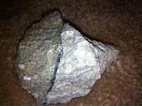
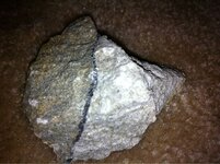
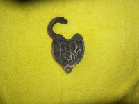
CLUES TO THE LOST DUTCMAN MINE

roadrunner

Bronze Member
Jan 28, 2012
1,230
520
Pinal Mountains,Arizona
Detector(s) used
Garrett Groundhog-2012-1st MD.
White's Goldmaster V/Sat-2nd-MD-2013
Tesoro Lobo-2015-3rd
Primary Interest:
Prospecting
On the Watlz carpenter map,it shows the Pinto Creek by Iron Mountain.
Do you really think Waltz could have been that far into the Pinals?
Was the Pinals part of the Supes back then.I will look at some topos.
No wonder no one found the mine if it is that far off.
I go over that bridge twice a month,that is a steep icline no matter where I look.
As your heading to Miami,and on the last right hand turn before the bridge,a person can see the pull off to their left. A person comitted suicide by driving off that area some years ago.
 

Last edited:

Oroblanco

Gold Member
Jan 21, 2005
7,838
9,830
DAKOTA TERRITORY
Detector(s) used
Tesoro Lobo Supertraq, (95%) Garrett Scorpion (5%)
Roadrunner wrote
And like I said,most of it is fiction I believe. There have been 2 posts that I read that could give a set of directions from the board house in 3 sentences.
Why did not waltz just say that. Unless he did and no one heard him right.

The fact that we have two basic versions, which are both complicated with several "clues", and the third version which gives very little information, hints that it is not easy to find the mine at all. There are many canyons that run the right general way (as with the clue, "north trending canyon") and they do all tend to look rather alike. I think Waltz did try to tell them how to get to the mine, but they simply did not understand what he was trying to get across to them.

Loke wrote
Oro - I think those are the best directions I have ever seen!! (I don't mean just the li'l excerpt, but your whole post).

And hey - you wouldn't even tell ME where you think it is? Shame on you!! (just kiddin' of course - if anyone ever found it, I'd be the first in the queue of congratulants!!)

Thank you for the very kind words, hope it came out the way it was intended. Too often a lot of us treasure hunters get SO caught up in trying to work out the various clues, maps (stone or otherwise) and forget that the mine had to be discovered in the first place. Even if Waltz did not discover the mine (as the popular version has it) then the Peraltas had to discover it, or if they found it due to Apaches working it, then the Apaches had to discover it any way you slice it, the mine was not always a mine, someone had to discover it the old fashioned way, by tracing the float, or tracing panned out specks of gold back to the vein. The story I believe is the true one, is the story we get from the Pioneer interviews, which has no Peraltas, no massacre, no huge funnel shaped pit etc but does have Waltz getting a drywasher to use, which he then uses to trace back to the vein and thus finds his mine. This same approach should work today. The need for the drywasher was not so much for actual gold mining (remember it is a lode mine after all, not a placer) but to get enough concentrates to be able to get a color or two, which I take to indicate that the mine is not in a place where you can pan a lot of gold easily. Hence that clue about "No miner will find my mine" which also suggests that the place does not look right for a vein of gold. It could mean that it is a vein in a lot of solid volcanic rock, well known to be poor for finding gold, or in a sedimentary type of rock, also known to be very poor places to hunt for gold but as that saying goes, gold is where you find it, and a vein can be found intruding into the worst kind of rock, where it "shouldn't" be. Sorry for getting carried away on it, hope that others do not let the confusion and far too many clues and maps to let that discourage them, when the mine cannot hide the "trail" of quartz float that may be hundreds of yards or even miles down from the vein, nor can it conceal the tiny specks of gold that likewise will travel over the years.

For our readers - just keep that in mind, that all mines had to be discovered, and the person who found it in the first place had no clues or maps to lead to it, and in almost all cases they used regular, old-fashioned prospecting methods to find the mine. So no matter how confusing or how many lies or false maps there are about the Lost Dutchman mine, you could throw them all out and hunt for the mine the same way it was found and stand a good chance of finding it.

Also, just because I have not told you that location pard Loke, does not mean that I won't tell you! :tongue3: Obviously I do not know where the mine is, only know some places where it is not. If you are curious about where I do think it is, I will tell you when we meet next month, for our little joint venture. I will tell you this, the spot I suspect is not within the popularly-believed area at all.

I think that the idea Cactusjumper was suggesting was not to hunt right ON Pinto Creek, but on the side canyons, and there are many of them. The lower end of Pinto creek has some patented (private) land, just upstream from the bridge, and there are (or were last winter) several active claims on the Forest Service land as well, right on the creek. However it is pretty much a certainty that Waltz's mine is not right on the creek, it is on a side canyon, that is what the old timers told the interviewers in the Pinto Creek version and most of the side canyons are not under active claims. Some are within the Wilderness Area and could not be claimed anyway. If the mine were right on Pinto creek, which got a lot of attention from propectors and still does, it seems more than likely that the mine would have been found long ago and would not be lost today.

Good luck and good hunting amigos, I hope you find the treasures that you seek.

Oroblanco
 

Last edited:

Oroblanco

Gold Member
Jan 21, 2005
7,838
9,830
DAKOTA TERRITORY
Detector(s) used
Tesoro Lobo Supertraq, (95%) Garrett Scorpion (5%)
On the Watlz carpenter map,it shows the Pinto Creek by Iron Mountain.
Do you really think Waltz could have been that far into the Pinals?
Was the Pinals part of the Supes back then.I will look at some topos.
No wonder no one found the mine if it is that far off.
I go over that bridge twice a month,that is a steep icline no matter where I look.
As your heading to Miami,and on the last right hand turn before the bridge,a person can see the pull off to their left. A person comitted suicide by driving off that area some years ago.

If you look at some of the old maps, which date to Waltz's time, pretty much the entire region was called the Superstition mountains, including the Pinals and Mazatzals, also called the Salt River mountains, and older maps call them Montana del Espuma (mountains of foam). Waltz had a mule to travel, was not hiking in and out, and could cover quite a lot of ground in a day. In the story from Weiser as told to Dr Walker, it was over a day's travel by mule to get to Adams Mill (near Florence) which could easily have meant 35 miles, based on actual records of cavalry travel in that time period using pack mules to carry supplies or even more than that. A lot of us today forget that Waltz was not walking, he was riding, and you can cover more ground that way than we can hiking on foot.

Good luck and good hunting Roadrunner, I hope you find the Lost Dutchman Mine!
Oroblanco
 

roadrunner

Bronze Member
Jan 28, 2012
1,230
520
Pinal Mountains,Arizona
Detector(s) used
Garrett Groundhog-2012-1st MD.
White's Goldmaster V/Sat-2nd-MD-2013
Tesoro Lobo-2015-3rd
Primary Interest:
Prospecting
Oroblanco, I am confused gain as usual.
In your statement below,you said these 2 things.

QUOTE::I think that the idea Cactusjumper was suggesting was not to hunt right ON Pinto Creek, but on the side canyons, and there are many of them. The lower end of Pinto creek has some patented (private) land, just upstream from the bridge, and there are (or were last winter) several active claims on the Forest Service land as well, right on the creek. However it is pretty much a certainty that Waltz's mine is not right on the creek, it is on a side canyon, that is what the old timers told the interviewers in the Pinto Creek version and most of the side canyons are not under active claims. Some are within the Wilderness Area and could not be claimed anyway. If the mine were right on Pinto creek, which got a lot of attention from propectors and still does, it seems more than likely that the mine would have been found long ago and would not be lost today.UNQUOTE.

The Pinto Creek by the bridge is not where Waltz carpenter searched.
And,the Pinto Creek by Iron Mountain,is not in the wilderness area I think,I will have to look. It is under NFS though.
I am waiting for Joes response.

I will check the area around the bridge for a way down,and what claims are around.
There was that mine right at top of the world on the left side,not far off the road also.
I have hiked around the part on the right side of the road where the turn off is.Road side rest area thingy.
There is a paved road that goes way back in there also. Have hiked around Oak Flats and the cave there.

Just looked at Us Gold maps and there are no claims around the PV bridge. There is a spot on the south side that looks like a way down.On the east side of the bridge.
 

Last edited:

Oroblanco

Gold Member
Jan 21, 2005
7,838
9,830
DAKOTA TERRITORY
Detector(s) used
Tesoro Lobo Supertraq, (95%) Garrett Scorpion (5%)
Roadrunner wrote
The Pinto Creek by the bridge is not where Waltz carpenter searched.
And,the Pinto Creek by Iron Mountain,is not in the wilderness area I think,I will have to look. It is under NFS though.
I am waiting for Joes response.

I will check the area around the bridge for a way down,and what claims are around.
There was that mine right at top of the world on the left side,not far off the road also.
I have hiked around the part on the right side of the road where the turn off is.Road side rest area thingy.
There is a paved road that goes way back in there also. Have hiked around Oak Flats and the cave there.

Just looked at Us Gold maps and there are no claims around the PV bridge. There is a spot on the south side that looks like a way down.On the east side of the bridge.

The best place to find out if there are active mining claims is at the BLM office in Phoenix. They are the official place where the federal mining claims are kept. They are also supposed to be recorded in the county courthouse, but fairly often this is not true, when they forget to file the claim at the county but do file it with the BLM. The BLM handles all mining claims on all Federal lands. Here is the BLM address and phone number

21605 N. 7th Avenue
Phoenix, AZ 85027-2929
Phone: (623) 580-5500
Fax: (623) 580-5580
E-mail: [email protected]
District Manager: Mary D'Aversa

You will have to go in to the office to check on where the active mining claims are, and will need to know the legal bounds, that is Section, Township and Range, as that is how mining claims are filed.

A good US Forest Service map of the area will show the private lands as white areas, national forest lands as green, BLM as yellow-orange etc. They are a big help, but do not show unpatented mining claims so you would want to check at the BLM office for them. There is a Forest Service office in Globe which sells the USFS maps. The Forest Service maps also show you the boundaries for the Sections, Township and Range which is helpful for checking on the mining claims at the BLM.

The story about Waltz having his mine on Pinto creek, does not say it is on the creek but on a side canyon, which there are many of them, including some within the wilderness area. You can drive up Pinto creek quite a ways, which will save a lot of hiking but still this only gets you close to those side canyons. The area shown on the Waltz "carpenter" map as where the carpenter searched, does not mean that the carpenter was in the right area, just that he thought it was. Other maps from the time period do not show that area as Pinto creek, so it is possible he had it wrong. However in that same area is the mining district known as the Randall or Rogers district, where several dozen silver mines were found in the 1870s, and is the same area where the "Pit mine" is located so could be promising.

After all, if you find a rich gold mine (or a rich silver mine for that matter) will it really matter what the name of it is? :thumbsup:

Good luck and good hunting amigo, sorry if I confused you, hope this helps.
Oroblanco
 

roadrunner

Bronze Member
Jan 28, 2012
1,230
520
Pinal Mountains,Arizona
Detector(s) used
Garrett Groundhog-2012-1st MD.
White's Goldmaster V/Sat-2nd-MD-2013
Tesoro Lobo-2015-3rd
Primary Interest:
Prospecting
Thanks for the information and the blm info.
I will have to look and see where there is a entrance, or way to drive up Pinto Creek.
I will have to buy me a couple maps I can see.
I am just trying to put some pices of the puzzle together,not really confusing me,you,but all the different stories or clues.
Now no one knows what Pinto Creek. Of course,could be the old one by the bridge.
 

sgtfda

Bronze Member
Feb 5, 2004
2,351
3,887
Mesa Arizona
From what I understand Pinto Creek did not pay well. At least not enough to make it. Hobby is one thing eating something else.
 

cactusjumper

Gold Member
Dec 10, 2005
7,754
5,388
Arizona
Oroblanco, I am confused gain as usual.
In your statement below,you said these 2 things.

QUOTE::I think that the idea Cactusjumper was suggesting was not to hunt right ON Pinto Creek, but on the side canyons, and there are many of them. The lower end of Pinto creek has some patented (private) land, just upstream from the bridge, and there are (or were last winter) several active claims on the Forest Service land as well, right on the creek. However it is pretty much a certainty that Waltz's mine is not right on the creek, it is on a side canyon, that is what the old timers told the interviewers in the Pinto Creek version and most of the side canyons are not under active claims. Some are within the Wilderness Area and could not be claimed anyway. If the mine were right on Pinto creek, which got a lot of attention from propectors and still does, it seems more than likely that the mine would have been found long ago and would not be lost today.UNQUOTE.

The Pinto Creek by the bridge is not where Waltz carpenter searched.
And,the Pinto Creek by Iron Mountain,is not in the wilderness area I think,I will have to look. It is under NFS though.
I am waiting for Joes response.


I will check the area around the bridge for a way down,and what claims are around.
There was that mine right at top of the world on the left side,not far off the road also.
I have hiked around the part on the right side of the road where the turn off is.Road side rest area thingy.
There is a paved road that goes way back in there also. Have hiked around Oak Flats and the cave there.

Just looked at Us Gold maps and there are no claims around the PV bridge. There is a spot on the south side that looks like a way down.On the east side of the bridge.

RR,

I was, of course, referring to the Pinto Creek by Iron Mountain. There are, historically, many reasons for taking another look at that region.

I would be more inclined to check small ravines and minor waterways droping down into Pinto Creek. I think canyons will be a dead end.

Just one man's unqualifiied opinion.:dontknow:

Good luck,

Joe
 

Last edited:

roadrunner

Bronze Member
Jan 28, 2012
1,230
520
Pinal Mountains,Arizona
Detector(s) used
Garrett Groundhog-2012-1st MD.
White's Goldmaster V/Sat-2nd-MD-2013
Tesoro Lobo-2015-3rd
Primary Interest:
Prospecting
Thanks Joe,that was what I was waiting for.
The Pinto Creek by the bridge has never had anything that I can find for gold.
I do know of one incident by Iron Mountain though.
I did look at a hill (a person took me there) by Queen Valley. This hill was nothing but white quartz all over it.Some in veins in the ground still,and float all over.
I brought some home and will have to post a pic.No rust color or anything,but we only walked around the hill,up to the top,and then panned some in the creek below it,across the road.
If I remember right it is a tributary creek that feeds into Queen Creek.
Will have to pan and MD queen Creek next. Especially by the bridge I think the stone maps where found.The article I have does not show the bridge by 60.But the bridge on Camino Del Vejo.
 

sgtfda

Bronze Member
Feb 5, 2004
2,351
3,887
Mesa Arizona
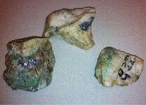
Today at the invitation of Jack San Felice I attended his class at the Central AZ Community College in AJ. Subject the Pitt Mine and Dutch clues in the area. I'm sold! A very interesting class. Examples of all the clues and the mine history. The mine contained both silver and gold. The high grade silver was dumped and gold removed by the last group. Attached is a photo of some of the silver ore from the dump.

image-3759869876.jpg
 

sgtfda

Bronze Member
Feb 5, 2004
2,351
3,887
Mesa Arizona
Donald wish it was that easy to get to. Waltz was not the first in that hole or the last. That and cave with the 2 room house. A interesting name engraved in both. No not Waltz. Attached is a photo of high grade ore from the Silver King that Jack gave me.

image-2246229207.jpg
 

Jan 2, 2013
4,541
1,971
somewhere between flagstaff, preskit
Detector(s) used
Whites prism III
Primary Interest:
Relic Hunting
jack wasn't real nice to me down there...I had the nerve to ask him a question, he told me to buy his book...

anyway...hope you gained some knowledge ...

as a foot note, I found a mine up in walker area...the people were so inflamed for gold...they threw out the silver ore...entire tailing pile is galena...I used to fetch some to the swap meet in Prescott...had people drooling for more...
 

cactusjumper

Gold Member
Dec 10, 2005
7,754
5,388
Arizona
Today at the invitation of Jack San Felice I attended his class at the Central AZ Community College in AJ. Subject the Pitt Mine and Dutch clues in the area. I'm sold! A very interesting class. Examples of all the clues and the mine history. The mine contained both silver and gold. The high grade silver was dumped and gold removed by the last group. Attached is a photo of some of the silver ore from the dump.

View attachment 905316

Frank,

Not saying Jack was involved in the Pit Mine, since I don't really know that, but if anyone would know what came out of there, it would be Jack.......IMHO.

As you know, I have been saying I BELIEVED that the Pit Mine was the LDM, since day one.:dontknow:

I will have to post a picture of the rock that Jack gave me.

Take care,

Joe
 

roadrunner

Bronze Member
Jan 28, 2012
1,230
520
Pinal Mountains,Arizona
Detector(s) used
Garrett Groundhog-2012-1st MD.
White's Goldmaster V/Sat-2nd-MD-2013
Tesoro Lobo-2015-3rd
Primary Interest:
Prospecting
Went down to the Superstition mountain museum Sunday.
Saw Al Morrows diary in the case.He was maybe,possibly,who know at the side of Watlz on his deathbed,or was friends with waltz, ect.
But,are the directions to the mine in this diary.
I am going to ask the lady that works there if I can read the diary.
Unless there is a book out already. But I wouild rather read the actual diary.
 

Cubfan64

Silver Member
Feb 13, 2006
2,986
2,789
New Hampshire - USA
Detector(s) used
Fisher CZ21, Teknetics T2 & Minelab Sovereign GT
Primary Interest:
All Treasure Hunting
jack wasn't real nice to me down there...I had the nerve to ask him a question, he told me to buy his book...

anyway...hope you gained some knowledge ...

as a foot note, I found a mine up in walker area...the people were so inflamed for gold...they threw out the silver ore...entire tailing pile is galena...I used to fetch some to the swap meet in Prescott...had people drooling for more...

I like Jack, but I was there when you asked a simple question about the hotel and it was a rather rude "brushoff" imho. Jack's a people person, so his response was unexpected - maybe he was busy or had someplace to go quickly or something, but that wasn't exactly the way to make a book sale.
 

sgtfda

Bronze Member
Feb 5, 2004
2,351
3,887
Mesa Arizona
Donald it's easier for one retired cop to talk to to another. I must say it was a very interesting presentation. Jack did say he was going to do a program at Dons camp next year on the Pitt mine He presented each clue and they all match the area. He was kind enough to give me a high grade ore sample from the Silver King.

image-2428250987.jpg
 

somehiker

Silver Member
May 1, 2007
4,365
6,426
Primary Interest:
All Treasure Hunting
Anybody else here, heard anything about a large cache of gold ore being found recently in the area of the pit mine?
Apparently very close to where Chuck found the cargo panniers last year. All bagged and ready to go.

Regards:SH.
 

sgtfda

Bronze Member
Feb 5, 2004
2,351
3,887
Mesa Arizona
Makes sense Wayne the whole area was claimed up in the past. Bound to be more deposits and caches in the area. Jack had a photo of one that was emptied and recovered with rocks.
 

Last edited:

roadrunner

Bronze Member
Jan 28, 2012
1,230
520
Pinal Mountains,Arizona
Detector(s) used
Garrett Groundhog-2012-1st MD.
White's Goldmaster V/Sat-2nd-MD-2013
Tesoro Lobo-2015-3rd
Primary Interest:
Prospecting
How close to a road was this cache found?
Anyone hear anything. Also, Shiker,where did you hear or read about it so I can see it.
 

Top Member Reactions

Users who are viewing this thread

Top