Azquester
Bronze Member
- Dec 15, 2006
- 1,736
- 2,596
- Primary Interest:
- All Treasure Hunting
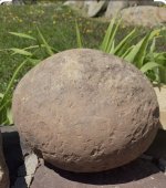
Here's a few photo's of where I was a few weeks ago. I saw a sign about a Massacre of Peralta's while going through the town of Reserve. Reserve was a Spanish town that was attacked by Indian's with only one family surviving the slaughter. The San Francisco River I believe. In a few of the photo's you can see a white rock spire or needle sticking up in the vast wilderness. This was east of Reserve where the forest is located a bit south. I have some unknown history of the area in a not so published book left in the cabin I bought near there. I'm going there again for new years I'll see If I can scan or snap a photo of a few pages of that fantastic book.


Last edited:


 ? The fact that the Wilderness prohibits grazing and we have a virtual "bloom" of tangled brush in the cannons and the ridge line, to me, is instructive. To me, that speaks to soil type and naturally occurring vegetation. Is the spot right to support the occurrence of heavy vegetation in protected areas? Yeap; I think it is. Nothing more than that. But it does seem to rule out other areas where such is not the case. To each his own.......nothing wrong with that. Your guess is as good as mine. Just giving you some of my thoughts to ponder.