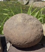
Clue 4 Peaks Lined up as 1

somehiker

Silver Member
May 1, 2007
4,365
6,426
Primary Interest:
All Treasure Hunting
wayne,,the area north of cave creek and carefree is dotted with mines,,,,they had a few big producers just a mile or two north of town....most have been developed and houses built on them now...alot of private property up there..many celebrities live there....the guy i knew up there used the stone maps to locate the ldm...actually he had the mine and made the maps fit the area (like everybody else with the stone maps does)

Maybe that's all they are.
A universal excuse for anyone who finds something valuable. Treasure, gold mine, or even that box of Wells Fargo loot like "Blake" the GPR guy did.
But the stones have also been a fine excuse for not finding gold, for the hundreds who have otherwise "found it". Not to mention many more who have used them as a reason not to look in the first place.
 

Last edited:

wrmickel1

Bronze Member
Nov 7, 2011
1,854
1,392
Jamestown ND
Detector(s) used
Garrett 2500
Primary Interest:
Other
For me, the thing is those directions she followed may have been misinterpreted, in that I suspect Waltz was talking about more than just Superstition Mtn. itself. To him, everything between the Salt R. and the south end of the main mountain, as viewed from the west and her house in Phoenix, was what he called "those Salt River Mountains", as they were known in those times. The way I see it, his directions gave the most direct route into the interior, this via approximately the same path that #88 follows towards First and Second Water and to a long north trending canyon from there.

Somehiker

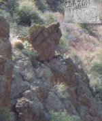
I don’t believe first and Second water was even in the equation. More like take the Military Trail to a certain point, by her leaving the trail and heading right to the face of the Superstition Mountain tells a lot. Must have wanted her to see something. I think I know now what they were looking for. To bad I didn’t piece it together when I stayed there in February. The rock shaped like a man standing is there. I’d sure like to have the rest of Clays Clues. I think he should give them to me, Pass the Torch Kindda thing.

Settle that dutchman’s ore thing once and for all.

I took a pic of the rock man standing, But I’ll keep that for now.

wrmickel1
 

somehiker

Silver Member
May 1, 2007
4,365
6,426
Primary Interest:
All Treasure Hunting
Seems ironic though, that every discussion about Jacob Waltz and his gold mine eventually hits the same pothole.
That heart shaped one in the stone maps I mean. Where even those who might believe in the LDM, but not the stones, can't seem to be able to just drive around it.
 

Attachments

  • pothole fixers.jpg
    pothole fixers.jpg
    50.7 KB · Views: 185
Last edited:

somehiker

Silver Member
May 1, 2007
4,365
6,426
Primary Interest:
All Treasure Hunting
Looks like a gorilla alright.
Definitely not one of the "little people", mentioned on maps and in stories about the mountain.
Nice shot.
 

deducer

Bronze Member
Jan 7, 2014
2,281
4,360
Primary Interest:
Other
Blake! I wonder how our long-lost friend is doing these days?
 

somehiker

Silver Member
May 1, 2007
4,365
6,426
Primary Interest:
All Treasure Hunting
Blake! I wonder how our long-lost friend is doing these days?

Living it up.....way down in Kokomo.

While RG is probably still hiding from the T family and it's process servers.....IMO.
 

Last edited:

Al D

Bronze Member
Jul 23, 2011
2,066
3,524
Gold canyon AZ
Detector(s) used
DJI Air 2S
Primary Interest:
Cache Hunting
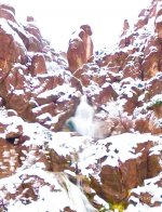
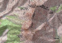
Here is an image of Four peaks running in line almost North South, as can be seen on any topo map, there is no place within the Superstition mountain range where these peaks appear as one 6144E81B-9BEB-4D51-9768-B1B814ACEBA4.jpeg
 

Al D

Bronze Member
Jul 23, 2011
2,066
3,524
Gold canyon AZ
Detector(s) used
DJI Air 2S
Primary Interest:
Cache Hunting
Alan

They do from here

View attachment 1725466

Notice The Heart

Babymick1
Then your location is not within the Superstition Mountains and is not the LDM
but you did state that the Stone Tablets had nothing to do with the LDM, so you must have discovered something else which may be Jesuit, but not the LDM
 

Last edited:

wrmickel1

Bronze Member
Nov 7, 2011
1,854
1,392
Jamestown ND
Detector(s) used
Garrett 2500
Primary Interest:
Other
Very possible I guess, But perhaps it’s so close that it was mistaken to be in the range or there was no range but the Salt River Mountains,

babymick1
 

somehiker

Silver Member
May 1, 2007
4,365
6,426
Primary Interest:
All Treasure Hunting
Alan

The do from here

View attachment 1725466

Notice The Heart

Babymick1

And they're lined up so good, you can't even see them in your photo.
Besides that, the outline of that rock ain't much like a heart, when it's enlarged for a closer look.

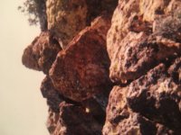
Not like this one.....made from a single slab....about 4 1/2 ft. high and 5-6" thick...set upright so it can be seen from a distance...if you have the stone and are doing the "BUSCA" thing, like it says.
Upper right lobe has the notch, with a pointer...important, because of the "MEX" on the HP stone with the same style of "M".....and down there, where the map shows there should be a "M"on that heart....it certainly looks like there is one of the same shape.
Best trail marker I've ever seen out there....bar none.
 

Attachments

  • Mik rock.jpg
    Mik rock.jpg
    23 KB · Views: 423
  • 100_1106 heart scratch.jpg
    100_1106 heart scratch.jpg
    88.5 KB · Views: 214
Last edited:

Al D

Bronze Member
Jul 23, 2011
2,066
3,524
Gold canyon AZ
Detector(s) used
DJI Air 2S
Primary Interest:
Cache Hunting
Of the hundreds of clues to the location of the LDM, two are most agreed upon to be authentic, if not necessarily interpreted correctly.
1. The mine is in the Superstitions
2. Weavers Needle is an important and prominent landmark.
not many of the claimed LDM discoveries meet that criteria, which bring as evidence obscure information, the Carefree mine and the pit mine, come to mind as examples.
others are weighted heavily on the perceived significance of one clue, a heart shaped rock or spire that resembles a man....somewhat.
my point for your consideration is this; the Superstitions are almost devoid of gold producing strata, so... the gold that has been found there should all be the same, i.e gold in rose quartz, however it is not, there for it must have been brought there, which brings up one more point to consider, perhaps, the LDM, the squaw or old woman mine, the gold ledge, etc may all be basically the same source and by scrutinizing the clues and eliminating the ones that do not measure up there may be a chance of figuring this thing out, or we can all just defend our theories as if the world really cared and feed the ledgend forever.
 

Last edited:

azdave35

Silver Member
Dec 19, 2008
3,606
8,104
Of the hundreds of clues to the location of the LDM, two are most agreed upon to be authentic, if not necessarily interpreted correctly.
1. The mine is in the Superstitions
2. Weavers Needle is an important and prominent landmark.
not many of the claimed LDM discoveries meet that criteria, which bring as evidence obscure information, the Carefree mine and the pit mine, come to mind as examples.
actually alan...i dont think waltz ever called it weavers needle...if anything it was a sharp peak
 

Al D

Bronze Member
Jul 23, 2011
2,066
3,524
Gold canyon AZ
Detector(s) used
DJI Air 2S
Primary Interest:
Cache Hunting
actually alan...i dont think waltz ever called it weavers needle...if anything it was a sharp peak
Excellent point, so...how many sharp peaks are there in the Sups?, I know of only two
 

azdave35

Silver Member
Dec 19, 2008
3,606
8,104
Excellent point, so...how many sharp peaks are there in the Sups?, I know of only two
alan....there are a bunch...many have no names....byous butte comes to mind..there is also a sharp right behind byous butte...this has been brought up a few times over the years...nobody has ever been able to pin down the time frame that the needle was officially named weavers needle
 

wrmickel1

Bronze Member
Nov 7, 2011
1,854
1,392
Jamestown ND
Detector(s) used
Garrett 2500
Primary Interest:
Other
And they're lined up so good, you can't even see them in your photo.
Besides that, the outline of that rock ain't much like a heart, when it's enlarged for a closer look.

Not like this one.....made from a single slab....about 4 1/2 ft. high and 5-6" thick...set upright so it can be seen from a distance...if you have the stone and are doing the "BUSCA" thing, like it says.
Upper right lobe has the notch, with a pointer...important, because of the "MEX" on the HP stone with the same style of "M".....and down there, where the map shows there should be a "M"on that heart....it certainly looks like there is one of the same shape.
Best trail marker I've ever seen out there....bar none.

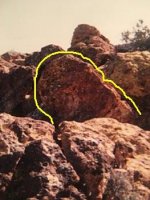
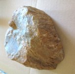
My Heart is in the same position as the Maps and there is a Mine right there straight down,

8769D512-D9CD-4597-8E2A-0C11FE38F99D.jpeg

8E465125-2D88-4B85-BE30-48528A09A705.png 8E465125-2D88-4B85-BE30-48528A09A705.png

Times two, not far away from each other but can’t be seen from each other.

Babymick1
 

Top Member Reactions

Users who are viewing this thread

Latest Discussions

Top