azblackbird
Sr. Member
WTF dude... you forgot Rudolph! 

Daaayyyummmm... that's exactly what I was thinking!If you look at the Royal Reindeer you'll notice it's looking
at a sun seven with a dot or door symbol above. Many other
stacked symbols are in the area once you line up the main large
symbols other come into play like a rabbit, bell.
That's the Infinity of the Stone Maps they cover all seen.

Here's some old knowledge from Chuck Kenworthy on the Stone Maps.
View attachment 1141087 View attachment 1141088 View attachment 1141089 View attachment 1141090
Peralta Stone Map Priest Map decoded using Gematria, Anagrams, a compass, and two languages.
Using a compass and Gemtaria I uncovered a riddle about the wheel symbol which finally yielded the answer "It is a Bowl" the sacred bowl of Free Masons called the 'Golden Bowl" which simply means a Human Skull. The Human Skull was used in all free mason rituals as a cup for drinking wine.
From the Peralta Stones using a compass, bible gematria, and anagrams of two langauges.


Thanks Hal for reminding me of my own extensive Archives!
I had forgotten all about that Magazine!
View attachment 1144164 View attachment 1144165 View attachment 1144166 View attachment 1144167
I just thought I would Start a new thread where I can consolidate the Solar Lunar signs found with the help of the Stone Maps coded system.
Superstition Peralta Road
View attachment 1137369
Horse, Arrows, and Goose or Duck upper right zoom in for symbol
A Water and Directional Symbol same as in the range below only smaller
View attachment 1137370 View attachment 1137371
Catalina Mountains, Tucson, Goose or Duck Symbol
View attachment 1137372 View attachment 1137382
Catalina Mountain Range Tucson Bird in Flight
Change Direction into this canyon and go up, Elevate
View attachment 1137384 View attachment 1137385
Mid Afternoon Shadow Symbols
and Directional Arrows.
All Shadow Symbols Appear at early morning,
Mid Morning, Solar Noon,
Early Afternoon, and
Late Afternoon
Most Sun Symbols happen at day break,
noon, not solar noon,
and again
at Dusk
Sun Reflection Symbols are the
Hardest Ones to see
View attachment 1137386 View attachment 1137387
Symbols in Metamorphosis
Mid Morning Shadow Glyph
"Only Lone Fish"
Contains a Face looking at an
Arrow, some sort of blessing Priest or Witch,
and a in flight laying down bird at the top.
"This direction to blessed safe water, Campsite,
Protection and abundant Food"
I'll stick more up as I get them ready.
Enjoy, Thanks for looking.
heres another giant bird shadow. View attachment 1148418
Very Nice you see what I do that is refreshing! I see a sombrero or Hat symbol and eye catchers
with many pointers this must be near a superior campsite! You can even see the eyes and feathers of the Bird!
Not Google Earth I hope?
Tell me this is a photo taken from a mountain top please.
But this is how the they did it.
Do you mind me asking the time of day and year that was taken?
Bill,
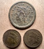
Do you have the Life Magazine article that, I think, first introduced the stones to the general public?
Hal,
The riddle I solved with these gematria numeral's has three phrases.
'I tie Him'
'The Beating'
'It is a Bowl'
The first two are spells to ward off any would be solvers of the riddle.
"I tie or bind him that who ever finds this phrase will be cursed with the ropes times three."
" The Beating will be severe for those that dare defy those who solve this riddle so be it may your heart will surely stop beating".
The last is the answer to the riddle: "What does the compass represent"?
It is a Bowl.
"The Golden Skull is the key to all gold mines hidden."
But the Ritual of the Skull is sacred a symbol of the death bestowed on anyone that dares to find it.
You must us the compass to find the entrance.
The keys lie with the Master pointing to the Warlocks Skull.
Kind a cool there hey?
Yes, very.
Bill, IF there was a mining operation in the Superstitions prior to 1847,48, who, in your opinion, would have done the physical work?
Mexico first banned slavery with the Sentimentos de La Nacion (1813) then formally in 1820 with the Plan of Iguala. So, who do you believe would have provided the labor?
This is the exciting part of Superstition history. Once proof of a mining operation is established, Spanish or Mexican, the next question will be... who did the digging?
Bob are you saying there is no physical evidence these are man made. That nature just happened to place all these sites in exactly the right location. Or perhaps there are those who see things in these areas and then fit then into their theories. Now I can picture someone in the past locating a deposit. Then there happens to be a natural feature nearby that stands out using that on a map. Of course there are a lot of formations that look like something. Just like floating in the pool looking at clouds. That is when there are some to look at.

Bob are you saying there is no physical evidence these are man made. That nature just happened to place all these sites in exactly the right location. Or perhaps there are those who see things in these areas and then fit then into their theories. Now I can picture someone in the past locating a deposit. Then there happens to be a natural feature nearby that stands out using that on a map. Of course there are a lot of formations that look like something. Just like floating in the pool looking at clouds. That is when there are some to look at.
Another way of drawing graffiti...............by craving mountains to look like animals?
And I thought Borglum had the edge on this form of art. Who knew?
I was curious.
I often thought some of the things I see when I gaze at a mountain looked familiar and were not the result of heat exhaustion. Wow was I wrong!
And I always suspected the Knights Templers and the Jesuits might have been a bunch of chiseler's.....but they took the meaning of moving a mountain to a whole new level.
Speaking of chisel's where are the chisel marks?? There must be chisel marks left on some of these so called "machines" and on the clefts of the cravings.
As well there must be piles of tailings or alluvial fans near these anomalies from all the carving, I mean look the debris pile at Mount Rushmore that is still there.
As far as certain rocks being machines that share their secrets at certain times of day, week or year. They would be useless unless they could self adjust themselves to account for cloud cover, falling leaves, creatures building nest in alcoves, growing vegetation, dust storms, the wobble of the earth on it's axis in relationship as to where the sun is. As an example of dust accumulation, estimates vary, but the USGS says at least 1,000 million grams, or roughly 1,000 tons of material enters the atmosphere every year and makes its way to Earths surface. Plus any information to tell someone when and where to look would have to be recorded some where, other wise all that work would before naught.
BTW
De re metallica (Latin for On the Nature of Metals (Minerals)) is not Roman. It is a book cataloguing the state of the art of mining, refining, and smelting metals, published a year posthumously in 1556 due to a delay in preparing woodcuts for the text. The Author Georg Baue 24 March 1494 – 21 November 1555 was a German Catholic, scholar and scientist. Known as "the father of mineralogy", he was born at Glauchau in Saxony, whose pen name was the Latinized Georgius Agricola. The book remained the authoritative text on mining for 180 years after its publication. It was also an important chemistry text for the period and is significant in the history of chemistry.