A Heap of Proof.

Status
Not open for further replies.
OP
OP
Hal Croves

Hal Croves

Silver Member
Sep 25, 2010
2,659
2,695
Hello Hal:

You stated:

"If the Heart & Trails Stones are old, or based on some old map, then I would have to read them entirely differently than I do now. It would still be an aerial view, like most maps are, however the view would be way less exact than I initially believed. Instead of corresponding to specific topographic lines, (like Joe and I have suggested), the actual topography (mountain ranges) are depicted in almost childlike waves or "saw-teeth" (green). Blue dashed lines would be temporary water or canyon bottom. Blue circles a spring (H2o). Grey instructions, directions, camping locations".

What is missed is the possibility that the heart and trail maps were carved not from an old map that is similar but was carved from an old map that was of a far wider scope than the heart and trail map. A map that showed the entire range and other places. A master map that was carved on a wall hidden in the range that we simply refer to as the map room. A location the heart and trail maps were taking you to. If this is true then then the heart and trail stones are the most basic maps. With later maps simply being copies.

Proof? Simply take the trail map from its starting point north of the Salt River down Fish Creek Canyon. The Heart and Trail map will take you there. But you will need to recognize the trick in the trail and understand the trail and heart maps refer to the same location, just a different perspective. Who knows this trail here might also take you back to Tucson and the Confederates.

Good luck in your journey.


Starman
Honestly, at this point, I am open to most ideas. The Heart & Trail stone appear to be old. The Horse & Trail stones (I think) date to the second half of the 1800's or early 1900's. One of the coincidences that I find fascinating is that there were a few familiar names in the Confederacy who wore SOMBREROS into battle. That same hat was also made famous by at least one well know Texas Ranger.


"The 1887 Ranger photo is one with the subject not wearing a vest. He appears to have a sombrero. This isn't surprising. Sergeant Gillett said every ranger who got assigned to south Texas would show up at his next assignment wearing a sombrero and vaquero pants and coat."


View attachment 1186884

View attachment 1186888

View attachment 1186890

Photo was taken in 1894 at Ysleta, Texas. Company D Rangers with Captain John Huges (seated at the far right)


View attachment 1186931

"Camp Roberts, 1878. Most of the hats were well worn and shapeless, but the ranger on the left in the foreground stands out with a sombrero dented and curled to predate the Col. McCoy by 32 years. If you've got to wear a wide-brimmed, tall crowned hat and want to be authentic, this is an authentic 19th century hat.

His hat probably started life as a sombrero and developed some use dents and creases.

I looked at Charlie Russell and Frederic Remington's paintings. For "A Dash for the Timbers" Remington had a friend buy up a lot of gear from working cowboys and send it to his studio. Thus his gear was right on. The hats were windblown Boss of the Plains, Montana Peaks, and Mexican Sombreros."
In Search of The Real Cowboy Hat, Page 2


View attachment 1186968


"Either at Houston or en route to New Orleans, members of the command began calling themselves Texas Rangers. To their surprise, on reaching New Orleans, they found themselves regarded as the Texas Rangers and lionized accordingly. Especially picturesque members of the command, like Captain John G. Walker, attired in buckskin and Mexican sombrero, were singled out for special attention by the Crescent City populace who, it was noted, still used the old-fashioned word Texican in referring to their Trans-Sabine neighbors."


Texas Tejanos in the Confedercy


1st (Buchel's) Cavalry Regiment: Organized in early spring 1862 at Carreicetas Lake on the Rio Grande. The regiment served in Louisiana including the battles of Mansfield and Pleasant Hill. Company C was composed entirely of Mexicans and Tejanos.

Hoods Texas Brigade: (1st, 2nd and 5th Texas) fought at Antietam, suffering heavy casualties in the morning phase. Although most the men were Anglos, a few Mexican-Americans served in its ranks. The most unique name in the brigade was undoubtedly Captain Decimus Et Ultimus Barziza of the Company C. 4th Texas. His name in Latin means "Tenth and Last". As it turned out he was the tenth and last child in his family.


2nd Texas Mounted Rifles: Organized in May 1861 in south Texas, company B from Bexar County contained 31 Mexican, Americans or "Tejanos." The unit saw service in Sibley's invasion of New Mexico and various other military operations in Texas and Louisiana. Thirty Tejanos also served with an artillery battery attached to this unit during the New Mexico Campaign.

6th Texas Infantry: Tejanos from the San Antonio area served with this unit at battles such as Chickamauga, Atlanta, Franklin and Nashville.

8th Texas Infantry: Served in the Trans__Mississippi in Texas and Louisiana. Several hundred Tejanos were in this regiment.


8th Texas Cavalry (Terry's Texas Rangers): This regiment was known as one of the hardest fighting cavalry regiments in the western theater. It saw action at Shiloh, Murfreesboro, Chickamauga, Knoxville and Atlanta. Most of the men in Company C were natives of Mexico.

Benevides Cavalry: The largest and most effective Confederate Tejano unit was commanded by Colonel Santos Benevides of Laredo. His Command saw active service along the Rio Grande against Union regulars and guerrillas. His brothers, Cristobal and Refugio, were company commanders in this unit. One of the major duties they had was to keep the Confederate cotton trade into Mexico free from Union interference. On March 19, 1864 the unit repulsed a Union attempt to capture Laredo and 5,000 bales of cotton that were stored there. A few days later the unit assisted in driving back a Federal force at Brownsville. Benevide's cavalry was one of the last Confederate commands to surrender at the end of the war.

Waul's Legion Infantry: Served in Mississippi and Louisiana. It served at Vicksburg where it was captured. Later the regiment was stationed in Galveston. One company was composed of Mexicans and Tejanos
.


Last edited:

cactusjumper

Gold Member
Dec 10, 2005
7,754
5,388
Arizona
Boys,

If you start that trail map anywhere but the bottom of Hieroglyphic Canyon, you're just kidding yourselves.

Good luck,

Joe
 

starman 1

Full Member
Jun 3, 2010
157
305
The Maps

Hello Hal,

Good catch on the topographical observation. The Heart Map you reference shows the trail from a higher elevation than the Trail Map. The knife point points to the drainage point of Fish Creek Canyon into the Salt River. As you enter the range you pass Coronado Mesa to the west and well other locations to the east. The Trail map basically starts at the same place and takes you pass Black Cross Butte, Coronado Mesa and other points. Simply take a topographical map and details will start appearing.

Once the maps are connected in the correct fashion the final location can be seen as horse mesa. Remember the ancient trail Jim Bark and Sims Ely took there?

One final point. Many have puzzled why the Trail Map and Heart Map were made of stone. The answer is really quite simple. They were carved in the map room with tools and stones that were already there. Stones were a logical way to create a map home. A map that would stand the rigors of time. A map that coupled with others would be a testament to its creators.

Perhaps the horse and priest map were created by the same folks to send folks to the eastern part of the range. Who knows maybe they threw in a little gold in appropriate locations. A mine here a mine there to make them think they were on the road to eldorado.

Two other mysteries now appear. Your original observations on how the maps were created were not that far off the mark. The only difference is that the master map was created from a high point that I won`t go into. The other is how Mr. Ribaudo`s solution is a solution but not the solution. If he had ever gotten into those monuments in boulder canyon he would have made it to horse mesa.

Again, apologize for hijacking this thread. I really liked your color image.


starman
 

OP
OP
Hal Croves

Hal Croves

Silver Member
Sep 25, 2010
2,659
2,695
Bark (a republican) lost several elections for Sheriff,
Democrats outnumbered Republicans 5 to 1 in early Phoenix.

Bark, Ely, & even Waltz (German immigrants were typically anti slavery) were Republican.
A number of leading Democrats in early Phoenix were ex-Confederated Soldiers.

LIKE


"COLUMBUS H. GRAY, PRIVATE, COMPANY B, 34TH ARKANSAS INFANTRY REGIMENT, C.S.A. ARRIVED IN PHOENIX SOON AFTER THE FOUNDING OF THE CITY IN 1868. SERVED ON THE FIRST MARICOPA COUNTY BOARD OF SUPERVISORS IN 1871. HE LATER SERVED IN THE ARIZONA TERRITORIAL LEGISLATURE, WHERE HE HAD A STRONG INFLUENCE IN PROMOTING THE CONSTRUCTION OF THE FIRST RAILROAD INTO PHOENIX. BURIED AT PIONEERS CEMETERY, PHOENIX, ARIZONA."

PIONEER CONFEDERATES--Colonel Sherod Hunter Camp 1525, Sons of Confederate Veterans, Phoenix, Arizona


"Mr. Gray was in the Confederate Army. He got back home from California the year before the war broke out. He had been in California for ten years. He went there when he was sixteen years old with his brother, and then got back just in time to go into the war. He served in the war and was nine months in the prison at Alton, Illinois. He was captured at Helena, Arkansas, and then he escaped by jumping out of the cars as he was being transferred from Alton to Fort Delaware. There were three of them got away by jumping through the windows of the car. He got back home and stayed for three or four weeks, and then went back into the army."

CHAPTER XII. SALT RIVER VALLEY PROGRESS (Continued).


----------------------------------------- ----------------------------------------- ---------------------- ----------------------------------------- ---------------------- -----------------------------------------


"Sims Ely’s description of James E. Bark is one of the best available. Ely for the most part eulogized Bark and his life, but there is much more about Bark’s life than Sims Ely’s writings. Periodicals of the period support Ely’s description of Bark’s personality in most cases. But, according to Ely, Barks spent most of his life searching for the Lost Dutchman Mine. This could be true, but documents and periodicals do not support this."


"The public life of James E. Bark is quite well documented. He was known to dabble in mining and prospecting. He also was known to search for the Lost Dutchman Mine. He was certainly a contemporary of Jacob Waltz. He apparently ran cattle in the Superstitions during the time Jacob Waltz was alive and living with Julia Thomas. Did he know Jacob Waltz? John Spangler said, “Why yes, Jim Bark knew Jacob Waltz quite well. He often stopped at his ranch in Pinal County south of Superstition Mountain.” Some called it the old “Board Ranch.” The next logical question would be, did Jim Bark ever see Waltz with any high-grade gold ore?

Spangler never really answered this question. Historians favor the thesis that Bark was just a great storyteller and people loved to listen to him. He certainly embellished on the story of the Lost Dutchman Mine and his audience loved the way he
told the story."

http://www.ajpl.org/aj/superstition/stories/James Bark.pdf


Barks Claims:
http://recorder.maricopa.gov/recdoc...47&edt=12/31/1946&cde=ALL+TYPES&set=20#tabs=1


BACK FROM HUNT FOR LOST MINE

Editor and Cattleman Will Not Tell Where They Got Ore Supply

PHOENIX, May 9 -Sims Ely, editor of the Arizona Republican, and James Bark, a cattleman, have just returned from a hunt for the Lost Duachman mine north-east of Mesa in the vicinity of the Superstition mountains. They came bck with their pockets filled with ore, but refuse to state where they got it. Bark has long had an idea that he knows where the old Teuton who expired so many years ago in Mesa got his gold.

9, May 1911
Tucson Citizen


Last edited:

cactusjumper

Gold Member
Dec 10, 2005
7,754
5,388
Arizona
What has always astounded me is that people can have my map, which is a topographic map with the Stone Maps drawn on them, and the tracing of the Stone Maps right next to them, and not see that they are the best answer ever shown.......by anyone. Not only do they fit the terrain, but they work with many of the LDM stories. The two that really stand out are Adolph Ruth and Harry Lafrance tales.:icon_scratch: Anyone out there paying any attention, at all? It's pretty plain. No secret codes, handshakes or symbols, just a simple map. Too simple???

Joe Ribaudo
 

Not Peralta

Bronze Member
Mar 23, 2013
2,167
3,061
Primary Interest:
All Treasure Hunting
Joe :coffee2:, just one question, what has simple produced for you.:dontknow:NP:cat:
 

OP
OP
Hal Croves

Hal Croves

Silver Member
Sep 25, 2010
2,659
2,695
What has always astounded me is that people can have my map, which is a topographic map with the Stone Maps drawn on them, and the tracing of the Stone Maps right next to them, and not see that they are the best answer ever shown.......by anyone. Not only do they fit the terrain, but they work with many of the LDM stories. The two that really stand out are Adolph Ruth and Harry Lafrance tales.:icon_scratch: Anyone out there paying any attention, at all? It's pretty plain. No secret codes, handshakes or symbols, just a simple map. Too simple???

Joe Ribaudo


I felt the same way Joe. This solution only works if the Priest stone was carved after 1909ish. If they (Pries & Horse) are older, then I don't have a clue where they will lead someone who is able to follow them.
 

Last edited:

Azquester

Bronze Member
Dec 15, 2006
1,736
2,596
Primary Interest:
All Treasure Hunting
So let me get this straight,

The Witch flew over the Superstitions and took memory photographs of the terrain and made a leather or parchment maps with their photographic memory, then carved the stone to match after flying back down from 2-3 miles up? Must have been a powerful broom!

I suppose the maps could have been drawn by a Witch in a hot air balloon or from traveling along the high peaks riding a flying horse along ridges while making notes of the valleys and peaks. I guess the Horse map depicts a flying Horse better known as a Unicorn standing not on ridges but on clouds. Similacra's all Similar's of nature. You could probably find the same matching features in almost any mountain range.

If its true they made these maps from Hieroglyphic canyon it they would almost certainly be modern fakes from areal photo's.

I wonder if Travis had access to some of these before 1949?

He probably did. Or whomever made those depictions in stone.


What has always astounded me is that people can have my map, which is a topographic map with the Stone Maps drawn on them, and the tracing of the Stone Maps right next to them, and not see that they are the best answer ever shown.......by anyone. Not only do they fit the terrain, but they work with many of the LDM stories. The two that really stand out are Adolph Ruth and Harry Lafrance tales.:icon_scratch: Anyone out there paying any attention, at all? It's pretty plain. No secret codes, handshakes or symbols, just a simple map. Too simple???

Joe Ribaudo
 

cactusjumper

Gold Member
Dec 10, 2005
7,754
5,388
Arizona
Joe :coffee2:, just one question, what has simple produced for you.:dontknow:NP:cat:

NP,

Well......."Simple" has provided me with thousands of dollars to comfortably put the Dutch Hunter's Rendezvous on the map. It's provided thousands of dollars for pack trips into the mountains. It's provided me with three houses, a duplex and three lots on an Arnold Palmer golf resort. I could go on about the new cars and trucks/toys we have purchased over the years, but I'm sure you get the idea.

Now the real question here is.........What has complex produced for you.

Good luck,

Joe Ribaudo
 

Last edited:

Not Peralta

Bronze Member
Mar 23, 2013
2,167
3,061
Primary Interest:
All Treasure Hunting
Joe,:coffee2::director: No the"Simple Question" was just that, a "Simple Question" ,So since the trail ,and the map are so simple,:dontknow:
I personally have never used your simple map to try and find or follow anything ,so I can not answer your simple question about your simple
map,maybe we should ask all the other people who got rich like you by using it.???NP:cat:
 

cactusjumper

Gold Member
Dec 10, 2005
7,754
5,388
Arizona
Joe,:coffee2::director: No the"Simple Question" was just that, a "Simple Question" ,So since the trail ,and the map are so simple,:dontknow:
I personally have never used your simple map to try and find or follow anything ,so I can not answer your simple question about your simple
map,maybe we should ask all the other people who got rich like you by using it.???NP:cat:

NP,

If you aren't going to like the answer, you should just avoid asking the question. You asked, "just one question, what has simple produced for you."

Good luck,

Joe
 

Last edited:

Oroblanco

Gold Member
Jan 21, 2005
7,838
9,830
DAKOTA TERRITORY
Detector(s) used
Tesoro Lobo Supertraq, (95%) Garrett Scorpion (5%)
Not Peralta wrote
Hal Croves, Oroblanco,
coffee2.gif
director.gif
Very interesting about the southern family connections,Please do continue. Great Job. Its time a lot of this should be out. NP
cat.gif

Thank you but really all of that research was entirely the effort of Hal Croves 100%, not me at all.

I like your "simple" answer Joe, that clears up one question I had asked you a few years ago! :thumbsup: :notworthy: :notworthy: :notworthy:

:coffee2: :coffee: :coffee2:
 

cactusjumper

Gold Member
Dec 10, 2005
7,754
5,388
Arizona
So let me get this straight,

The Witch flew over the Superstitions and took memory photographs of the terrain and made a leather or parchment maps with their photographic memory, then carved the stone to match after flying back down from 2-3 miles up? Must have been a powerful broom!

I suppose the maps could have been drawn by a Witch in a hot air balloon or from traveling along the high peaks riding a flying horse along ridges while making notes of the valleys and peaks. I guess the Horse map depicts a flying Horse better known as a Unicorn standing not on ridges but on clouds. Similacra's all Similar's of nature. You could probably find the same matching features in almost any mountain range.

If its true they made these maps from Hieroglyphic canyon it they would almost certainly be modern fakes from areal photo's.

I wonder if Travis had access to some of these before 1949?

He probably did. Or whomever made those depictions in stone.

Bill,

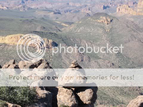
If one gets off the trails in the canyons, and climbs to the highest elevations, such a map is not difficult to make.
Kinda simple really.
EasyClimb.jpg


Good luck,

Joe Ribaudo
 

Azquester

Bronze Member
Dec 15, 2006
1,736
2,596
Primary Interest:
All Treasure Hunting
Gregory,

I looked but couldn't find it. I did however find these:


View attachment 1187252 View attachment 1187253 View attachment 1187254 View attachment 1187255 View attachment 1187256 View attachment 1187257 View attachment 1187258 View attachment 1187259 View attachment 1187260 View attachment 1187261 View attachment 1187262 View attachment 1187263 View attachment 1187264 View attachment 1187265 View attachment 1187266 View attachment 1187267 View attachment 1187268 View attachment 1187269 View attachment 1187270 View attachment 1187271


Bill: Look up the following: L.A. Examiner, Sunday, September 10, 1933, (American Weekly, Inc.), Page 10. "Seek again Superstition Mountain Blood Stained Lost Gold." Although he did not sign this article, It was written by Oren Arnold. It was in this article that Oren mentioned that the Dons Club was putting together an expedition to look for the mine. This is the paragraph that started the Dons Club to putting on the "Dons Trek" because they were deluged by request from across the country from people wanting to go along on the hunt. Cordially, Greg Davis
 

Azquester

Bronze Member
Dec 15, 2006
1,736
2,596
Primary Interest:
All Treasure Hunting
You know Joe, your right.

I never looked at the maps as being that complex. Simple writing, simple symbols, that's the way I always looked at it from the simple way they're carved actually.

When I first discovered the carved Horse's head at the site I found it was a simple carving.

Finding the Witches heads embedded in the rock outcrops was simple.

Finding a ground laid cross at an old mine site on a hillside was simple.

The only complex thing that has taken me quite a while to solve was how to use that ground laid cross to find the true entrance into the gold mine complex.

That is not on the maps, or at least on these maps, and took me a few years of searching to finally find the answer. It was where I found the map carved on a rock outcrop that was made from angled sun induced shadows illuminating the numeral 75 at the right time of day for about fifteen minutes. The Janus Witch.

But even that was simple once I found it.

I spent years thinking it had to be more complex and that one numeral 75 could not be both the direction and distance. In the end I was correct.

Under the sun induced 75 was more information sun blocked from between two outcrops by a small boulder suspended in the air and wedged in there. I was afraid to move the boulder for fear of losing a small sun symbol it thought it may produce, but, I now know it was always meant to be removed so the sun could show the rest of the shadow symbol map below next to a recessed carved in solid stone heart shape the heart stone from the trail maps would fit perfectly in.

Simple.

Also simple has afforded me a good life with 6 classic cars a huge new metal garage to work in, a large modern style home on a 1.5 acre lot in the foot hills, a Industrial building with a thriving business and a six figure income, a large double deck pontoon boat, three 4x4 vehicles, all the gold processing equipment you could want, a large Gym for working out, and a hefty retirement income for when I decide to hunt treasure full time, and of course a Beautiful wife and three Beautiful Daughters with many grandchildren to share it all with.

Simple


Bill,

If one gets off the trails in the canyons, and climbs to the highest elevations, such a map is not difficult to make.
Kinda simple really.
EasyClimb.jpg


Good luck,

Joe Ribaudo
 

Not Peralta

Bronze Member
Mar 23, 2013
2,167
3,061
Primary Interest:
All Treasure Hunting
:coffee2::coffee2:The complex with out the aid of a simple map,using the shadows produced by the light from the moon and the alignment of certain stars pointing to the entrance of the mine,helped me plan my life long dream of putting a tramway from peralta trail head across the mountains to a fine dining restaurant and night club,that way you can get a really good view of the mnts,and for people that don't like being in the air they can travel by my train on the same route with open air cars and a lounge,also there will be camel tours,:director: sorry to say I will never be there because the warning labels on my meds say that I have to stay near the pool and bar at my resort that I own,:dontknow: have a nice day.NP:cat:
 

Last edited:
OP
OP
Hal Croves

Hal Croves

Silver Member
Sep 25, 2010
2,659
2,695
Views of the Trail & Heart stones.
The first is 3d to simulate the bumper photo perspective.
2/3 are quick 3d renderings based off of the lines in the two Trail stones. Not "scientific" but still cool to see a simulated topography.

View attachment 1187317 View attachment 1187314 View attachment 1187313

View attachment 1187318 View attachment 1187319 View attachment 1187321

The arrow is pointing to the large DOT on the Trail Stone. That false peak should be removed.
_____________________________________


With everything removed except terrain.
The needle in triangle replace with a circle which causes a spike or peak.
Still missing the topography on the Heart stone.


View attachment 1187348
 

Last edited:

Not Peralta

Bronze Member
Mar 23, 2013
2,167
3,061
Primary Interest:
All Treasure Hunting
NP,

Are you related to Wyatt Westwood......maybe brothers????

Good luck,

Joe Ribaudo
Joe,no relation,why. also people need to know that there actually was plans for a tramway and train both through the supe's.NP:cat:
 

Status
Not open for further replies.

Top Member Reactions

Users who are viewing this thread

Top