Is my mine the LDM?

Azquester

Bronze Member
Dec 15, 2006
1,736
2,596
Primary Interest:
All Treasure Hunting
Could be because you are trying to line up a physical picture with a hand drawn map.:BangHead:

Joe Ribaudo

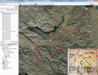
You're right Joe, It's not perfect but I think it's close. I did it all in Google Earth Pro which I had to download and install after uninstalling the one I on my computer because the old version I had was outdated and wouldn't let me log in. Then the fun began.

Once all those pix were out of my snap shot it became clear the map had some problems but some portions were fine and lined up nicely.

Bill
 

OP
OP
BlackLine

BlackLine

Full Member
Feb 7, 2016
184
401
NRW, Germany
Detector(s) used
Fisher Gold Bug 2
Primary Interest:
Other
I get headache from the mountain range on the map. i have set as reference points the mountain range, salt river and lime mountain as the picacho. the upper right no. 1 is then the arizona trail and the no. 2 could be the trail from wiesners map (between the 2 peaks).

military-map.gif

once again back to the minas del oro map. if there is a mesa ruin, then it is 1.5 miles away from the vein and it faces north. like waltz said... the north wind blows in the cave ??? :icon_scratch:
 

markmar

Silver Member
Oct 17, 2012
4,117
6,259
Primary Interest:
All Treasure Hunting
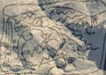
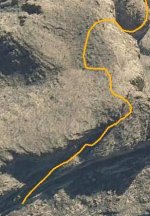
And the lower part without overlay

lower stone trail.jpg
 

Ponteach

Full Member
Feb 1, 2016
106
90
Primary Interest:
All Treasure Hunting
Blackline
For your safety and longivity pls dont waiste your time in that map looking for waltz mine, maybe the sombrero.... looks good,
Bill you are making progres in GE, but the Waltz mine is not in there, i like the more transparent map you have summit,
dont forget the new dam, the new river that was created and the ones that vannish over time since 1905 = your maps are no goods
to overlay in today googles, try again, take care,
frenchy
 

Azquester

Bronze Member
Dec 15, 2006
1,736
2,596
Primary Interest:
All Treasure Hunting
If you zoom in on the number 3 military trail you can see old parts of the trail on GE. With the #1 and #2 trails it seems they both line up with a modern road to first water and if it's true Jacob said: "where the trails turns south he left it for his final journey too the mine", then we have the mine somewhere between first & second waters respectively. In other words, it's not that far back in the range and fairly accessible from first water. My impression of the area only shows a few spots of prospecting activity. If the mine is in that area, it looks as though Jacob did a good job of hiding it as so many people have driven their mule teams right over it and never even knew it was there!

There is a cow barn right there. Fits some of the clues, if, they are real clues of course, and not fabrications of other Dutchman Hunters. Nice feature on GE though.
 

Azquester

Bronze Member
Dec 15, 2006
1,736
2,596
Primary Interest:
All Treasure Hunting
That trail is going off a cliff

That's the Dutchman's sunset trail. You ride off it into the sunset for the last time there. You'll fall Smack Dab face first in that hidden valley called:
"Panty Tree Canyon".

It's a dead end canyon with a trick in the trail. You get lost going in and out, in and out, until you come upon a crevice lined with creamy white Arizona Prickly Poppies and Milk Weed. Once there, you'll experience the joy the old Dutchman himself once experienced as a younger man chasing his mules and sewing his oats!

Many will come there, and many will stay, just to see the glory of the prickly, milky, trail. Don't fall for it, that trail leads to the devil himself! Just pay your money and leave. Periodic Flash floods have been known to take out many a man!


View attachment 1344561
(Curtesy of Sarg)
 

azdave35

Silver Member
Dec 19, 2008
3,606
8,104
basically if you have to ask if your mine is the ldm ..then you dont have the ldm
 

azdave35

Silver Member
Dec 19, 2008
3,606
8,104

there are many reasons but a few come to mind...anyone that found a fortune would not get on a public forum and give the coords for it
...also the ore from the ldm would be so rich there would be more gold than rock..not just a speck or two...if you want anyone to believe you found the ldm you will have to show the ore
 

OP
OP
BlackLine

BlackLine

Full Member
Feb 7, 2016
184
401
NRW, Germany
Detector(s) used
Fisher Gold Bug 2
Primary Interest:
Other
there are many reasons but a few come to mind...anyone that found a fortune would not get on a public forum and give the coords for it
...also the ore from the ldm would be so rich there would be more gold than rock..not just a speck or two...if you want anyone to believe you found the ldm you will have to show the ore

im sure... anyone will check it in the future and then we will see if it is right. for me it isnt a reason that nobody would give the coords. its only one mile away from the forrest road. not very hard to check. plz let me know what inside the cactus is. i cant show you the ore cause i had not enough time in az and no thermal camera. i wrote many messages with someone and at the end i was frustrated. my girl said i have to quit this story. belive me or not.

in most photographs i colored the skyline now i have upload all the photos from the 2 days (the last is the first). will also upload 4 small clips on youtube.

https://youtu.be/oOMBF-dBA-s
https://youtu.be/CR9SE_TLKe4
https://youtu.be/qQSDdSpe_9Q
https://youtu.be/bOxcuTrC9tw

has someone ever been able to reconstruct 2 maps in the same place?
 

Last edited:

Top Member Reactions

Users who are viewing this thread

Top