Superstition Toponymy with Prof. Aubrey Drury

Hal Croves

Silver Member
Sep 25, 2010
2,659
2,695
Aubrey Drury.jpg

Profosor Aubrey Drury [1891-1959]
http://digitalassets.lib.berkeley.edu/bancroftiana/ucb/text/bancroftiana_024.pdf

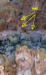
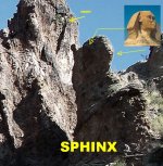
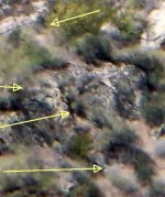
This thread is a look at the many geographical features in the Superstitions that were recorded in 1917 by Prof. Drury for the Southern Pacific Railroad, Co.
For Superstition history lovers, Drury's work is essential.

For local treasure hunters, Drury's work will help to contextualize the tales you've been reading.
 

Last edited:

dredgernaut

Hero Member
Dec 27, 2012
560
1,444
wisconsin
Detector(s) used
whites mxt, tesoro lobo super trac., monster1000
Primary Interest:
All Treasure Hunting
hello. please tell us more. I know he is responsible for naming some features such as victorio peak and horse mesa , I think he worked on mapping and naming features , tried naming fish creek canyon barronco. it seems he liked to use Spanish names. Or I am totally wrong. lol. but I would like to hear more . thanks
 

OP
OP
Hal Croves

Hal Croves

Silver Member
Sep 25, 2010
2,659
2,695
hello. please tell us more. I know he is responsible for naming some features such as victorio peak and horse mesa , I think he worked on mapping and naming features , tried naming fish creek canyon barronco. it seems he liked to use Spanish names. Or I am totally wrong. lol. but I would like to hear more . thanks

Prof. Drury was a details man, focused on the preservation of history but his work for the Southern Pacific R.R. isn't perfect. He sometimes assigned arbitrary titles to geographical features with no identifiable name.

Victoria Peak (your Victorio Peak?) I think may be one example. Unless there are two Peaks Victoria/Victorio(?)

"Several geographic names, including Victorio Peak, were submitted by Professor Aubrey Drury on behalf of the Southern Pacific Railroad for unnamed features along the Apache Trail. Many of these names were approved by the USBGN on 07 November 1917, and on 01 February 1933, most of the names were vacated by the Board at the request of the U.S. Forest Service. The name Victorio Peak was one of these names, and the decision was vacated based on the Forest Service recommendation that the feature name should not be shown on maps because it was difficult to locate and Chief Victorio had no direct association to the specific feature. The spelling variation of Victoria Peak has likely evolved over the years due to local use and map editor's interpretation. The name was recommended in 1917 by Professor Drury for Victorio, a noted chief of the Warm Springs Tribe of the Apache Indians. Victorio did not travel this far west but is closely identified with the Apache Indian Wars."

Geranimo Head, the mountain, is also interesting because Prof. Drury never actually recorded that name. He used "Geronimo Head" to describe the "Mountain Profile" (USGS), the stone-head formation found"On the mountain to the south of Tortilla Flat station is the remarkable profile of an indian chief, quite appropriately called "Geronimo Head".

"Quite appropriately" means that the name, at least locally, was in use before Prof. Drury's work in 1917. Geronimo passed in 1909, which is eight potential years of use, in memorial. Miners, ranchers, cowboys, Natives Americans, locals named the stone-head formation, not Prof. Drury. The site was already culturally important.

Just how important is the question.

The USGS ultimately redefined Geronimo Head to mean "Summit", Geronimo Head Mountain, and Prof. Drury's Geronimo Head the Mountain Profile was all but forgotten.
 

Last edited:
OP
OP
Hal Croves

Hal Croves

Silver Member
Sep 25, 2010
2,659
2,695
Last edited:
OP
OP
Hal Croves

Hal Croves

Silver Member
Sep 25, 2010
2,659
2,695
View attachment 1722884
Geronimo
E. A. Burbank. 1897


Its unclear who named this particular Mountain Profile, but Prof. Drury agreed with their decision to use Geronimo Head.

Read about Wells Drury (father) here:
https://nevadapress.com/about-us/hall-of-fame/wells-drury/
https://ch.ucpress.edu/content/11/2/190


Read about Prof. Drury's brother Newton here:
https://www.nytimes.com/1978/12/16/archives/newton-drury-conservationist-who-led-redwood-drive-dies-park-named.html


I am unable to share a photograph of Prof. Drury's Geronimo Head (the Mountain Profile), but enclosed is an exact tracing of it in profile. This I believe is the same Mountain Profile that Ron describes seeing with Tom K. Here, side-by-side are the images for comparison.

Anyone been to the site and can point-point the location? Anyone have photos to share?

Geronimo Heads.jpg
 

dredgernaut

Hero Member
Dec 27, 2012
560
1,444
wisconsin
Detector(s) used
whites mxt, tesoro lobo super trac., monster1000
Primary Interest:
All Treasure Hunting
sorry, not sure where rons is, but there is lots of head shaped structures out there. 20190211_122429.jpg 20190212_121959.jpg . sorry if I am going off topic.
 

OP
OP
Hal Croves

Hal Croves

Silver Member
Sep 25, 2010
2,659
2,695
sorry, not sure where rons is, but there is lots of head shaped structures out there. View attachment 1723044 View attachment 1723045 . sorry if I am going off topic.

I agree that there are "lots" of head shaped structures in the range.
Naturally occurring structures.
Structures that, based on lighting and viewer position, resemble a human face or head.

"Pareidolia is a phenomenon in which the mind responds to a stimulus (for example an image) and perceives a pattern (for example a face) where none exists."

I asked if anyone could identify a face/head-like structures with a known name, issued by the USGS.
Only one was offered in the Superstitions.

The Geronimo Head Mountain Profile (USGS), named by locals before 1916.
"on the mountain to the south of Tortilla Flat Station..."
The same one (I believe) that impressed Ron & Tom.

There are "lots" of examples as you noted but only one with a USGS assigned name.
 

Last edited:
OP
OP
Hal Croves

Hal Croves

Silver Member
Sep 25, 2010
2,659
2,695
Taken from somehiker's list.

13) Theres a spirit that sleeps near the mine 4 hours a day. (Apache Jack)
43) All the old landmarks are still there. You can almost peek into the mine where the entrance has settled. The cave of hidden gold. (San Carlos Apaches 1965)
55) Near the mine is a face that looks right at the mine. (Storm)
56) A Sphinx overhangs and dominates the mine area. (John Reed)
57) Waltz told of a natural stone face sitting upon the end of a canyon below his mine. (Storm)


OP
OP
Hal Croves

Hal Croves

Silver Member
Sep 25, 2010
2,659
2,695
Prof. Drury's work for the Southern Pacific R.R., along the Apache Trail, is explained in this article written by Tom Kollenborn.
Sunset Route and Apache Trail
1915 Auto Tours - Sunset Route LTD


"The Apache Trail Auto Line served as an extra added adventure for those who wanted to take a motorcar trip from the Bowie/Globe station to Chandler or Phoenix via the Apache Trail."

Tom's article is sobering for anyone overly mystified by the geography of the Superstitions.
The Apache Trail is more accurately described as the "Roosevelt to Mesa Road".
Most sites and their names along the Apache Trail were assigned names by Prof. Drury...
an advertising man.
Apache Trail.jpg
Cover.jpg
 

Last edited:
OP
OP
Hal Croves

Hal Croves

Silver Member
Sep 25, 2010
2,659
2,695
Superstitions.jpg

1916 Apache Trail view of the Superstition Mountains.
A favorite photograph.

What year was the tale of Jacob Waltz's Gold first made public?
 

somehiker

Silver Member
May 1, 2007
4,365
6,426
Primary Interest:
All Treasure Hunting
Arizona Weekly Gazette
September 1/1892
“A Queer Quest, Another Lost Mine Being Hunted by a Woman.”
 

somehiker

Silver Member
May 1, 2007
4,365
6,426
Primary Interest:
All Treasure Hunting
Taken from somehiker's list.

13) Theres a spirit that sleeps near the mine 4 hours a day. (Apache Jack)
43) All the old landmarks are still there. You can almost peek into the mine where the entrance has settled. The cave of hidden gold. (San Carlos Apaches 1965)
55) Near the mine is a face that looks right at the mine. (Storm)
56) A Sphinx overhangs and dominates the mine area. (John Reed)
57) Waltz told of a natural stone face sitting upon the end of a canyon below his mine. (Storm)


The Apache believed there were spirits in the world they roamed. The were collectively known as Ga'an(s), who lived in mountains, caves, rivers and lakes and so forth.
It was they who were responsible for all of the everyday occurrences which were outside of man's control....what we would call nature or natural....especially things of a spiritual nature. They had the power that controlled both the people and the animals, good luck and bad luck, as well as those forces of nature like thunder and lightning, hail and rain etc. Usen was the only God they believed in, as both the creator and guarantor of continued life.

13) So it sounds like Apache Jack was referring to one of the Ga'ans. Question is which one ? And why would such a spirit sleep for four hours each day.
Was there something close to the mine which resembled a likeness of a Ga'an dancer that they recognized ?

43) All or most of the old landmarks should remain to this day as well then, since there has been no significant change to the terrain out there since the Great Bavispe Earthquake of May 3,1887. Other Than Celeste Jones blasting off the top of Weavers Needle,that is. But is it a mine or a cave ? Who knows....maybe both ? A mine somewhere down in a cave ?

55) A "face" that looks at the mine.
Which is something this shot brought to mind.....for me anyway......
I had wondered why my Priest didn't have the hat. Thought maybe it had broken up and fallen down below, since there was a big pile of broken rock at the base. But I also wondered what he might be pointing to with that big cross.....turned out....this....
That looks like a face at the bottom of the shot.... is it that face he was talking about ?
 

Attachments

  • Priest hat and face.jpg
    Priest hat and face.jpg
    27.3 KB · Views: 197
Last edited:

somehiker

Silver Member
May 1, 2007
4,365
6,426
Primary Interest:
All Treasure Hunting
56) A "sphinx" ?
Got one of those as well. About as close to one as anyone is gonna get IMHO.
 

Attachments

  • 100_0536 sphinx  face up.jpg
    100_0536 sphinx face up.jpg
    176 KB · Views: 163

Super Dog

Jr. Member
Jun 18, 2019
24
8
Primary Interest:
All Treasure Hunting
If you did see something then walk in the line you see it best in and you may see another sign. I've seen them carve hard rock into sandstone archways as a sign. Anything that catches your eye. Even a feeling can lead you to it.
 

Last edited:

somehiker

Silver Member
May 1, 2007
4,365
6,426
Primary Interest:
All Treasure Hunting
And for 57).....It's at the end of a canyon alright....a box canyon
 

Attachments

  • 100_0883perfil_zpsa265a8c8.jpg
    100_0883perfil_zpsa265a8c8.jpg
    33.9 KB · Views: 157

Super Dog

Jr. Member
Jun 18, 2019
24
8
Primary Interest:
All Treasure Hunting
The indians stole back many mines and stuffed the Spaniards in it, so more than one. Probably a hundred across the nation.
 

Super Dog

Jr. Member
Jun 18, 2019
24
8
Primary Interest:
All Treasure Hunting
It's why Spain wanted Georgia. They had a buncha gold mines in it.
 

somehiker

Silver Member
May 1, 2007
4,365
6,426
Primary Interest:
All Treasure Hunting
And a couple of bonus shots just for you Hal....seeing as how you yourself have put some effort into this.
It's all there....all of it !
 

Attachments

  • 063 cropped.jpg
    063 cropped.jpg
    78.7 KB · Views: 179
  • 063 b cropped.jpg
    063 b cropped.jpg
    57.9 KB · Views: 502
Last edited:
OP
OP
Hal Croves

Hal Croves

Silver Member
Sep 25, 2010
2,659
2,695
The indians stole back many mines and stuffed the Spaniards in it, so more than one. Probably a hundred across the nation.

Can you name one documented example?
If not, how were you able to estimate one hundred?
 

Top Member Reactions

Users who are viewing this thread

Top