Continuum

markmar

Silver Member
Oct 17, 2012
4,117
6,259
Primary Interest:
All Treasure Hunting
This version of the Peralta Fish Treasure Map dates to 1845 and a different one (The Treasurer of the Indians) to 1844. Which is the original, the Manuel Peralta Superstition Map of 1845 or the undated version? A massacre in the Superstitions would have gone unreported in 1845, less likely so in 1870 - 80.

The cross to the right of Masca El Sombrero and above Miners Needle, could that be Wagoners find?

https://www.desertusa.com/lost-dutchman/peralta-stones2/peralta-gold2.html

Why to write the year on a map? Is a map not a letter. Nothing would change in the fields over the years.
IMO the original maps have not years written on them.

The mine which is depicted near WN is not Wagoner's outcrop but what Jacobs and Ludi worked or were willing to work.
 

Hal Croves

Silver Member
Sep 25, 2010
2,659
2,695
Why to write the year on a map? Is a map not a letter. Nothing would change in the fields over the years.
IMO the original maps have not years written on them.

The mine which is depicted near WN is not Wagoner's outcrop but what Jacobs and Ludi worked or were willing to work.

I agree about the dates not being found on the original map.
I was not describing the mine next to the bottom of WN, but the one to the right of that landmark, above what I wrote is Miners Needle (the mine furthest to the right). It fits the location of Wagoner's rose quartz ledge.
 

OP
OP
somehiker

somehiker

Silver Member
May 1, 2007
4,365
6,426
Primary Interest:
All Treasure Hunting
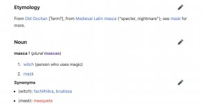
Consider the orientation of Masca El Sombrero on the map. Flip my profile picture and it matches the profile of MSE which means that it was drawn looking north. MN should be oriented the same way on the map and it is, if that line represents MN.

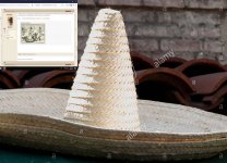
Anyway, for the map to be authentic, Masca El Sombrero must have already become a tradition in Mexico. I thought that the witch-brimmed, conical hat connection began in the late 1800's which would be a problem.

View attachment 1747435

Tall conical sombreros have been around as long as "Mexicans".
It's just a variation in style. Possibly original to a certain region and Mestizo group within Mexico.
Nothing to do with witches or witchcraft.
"Masca El Sombrero" ???
Spanish to English translation....."Chew the Sombrero" ;)
 

Hal Croves

Silver Member
Sep 25, 2010
2,659
2,695
Tall conical sombreros have been around as long as "Mexicans".
It's just a variation in style. Possibly original to a certain region and Mestizo group within Mexico.
Nothing to do with witches or witchcraft.
"Masca El Sombrero" ???
Spanish to English translation....."Chew the Sombrero" ;)

Not the best site to quote but it works.
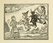
Conical hats have been around forever but the brimmed conical hat - Masca connection is more recent. I have found one early woodblock print but the publisher hasn’t shared the source or more importantly, the date.

A5CF06F5-96F7-400C-A698-0355DB7D5131.jpeg
 

Last edited:

Hal Croves

Silver Member
Sep 25, 2010
2,659
2,695
Not the best site to quote but it works.
Conical hats have been around forever but the brimmed conical hat - Masca connection is more recent. I have found one early woodblock print but the publisher hasn’t shared the source or more importantly, the date.

View attachment 1747510

I can’t say that it’s not a reproduction or something made to look old.
When the tradition began in Mexico would be the earliest possible date of that map.

I read that the current Halloween tradition, in the US began with Irish immigrants in 1846, but something similar was celebrated earlier.

No date or source.
View attachment 1747518
 

Hal Croves

Silver Member
Sep 25, 2010
2,659
2,695
OP
OP
somehiker

somehiker

Silver Member
May 1, 2007
4,365
6,426
Primary Interest:
All Treasure Hunting
Familiar illustrations Hal.

So, do you think Oct. 31 would be a good night to be out there waiting for the moon to shine through the hole in the rocks ?

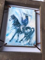
Ted DeGrazia had been round a bit. I really doubt he would have seen a "witch" on the stone, or even amongst his many Mexican or native acquaintances.
Personally, I don't believe the Mexicans were into European/North American "Haloween" type witches or festivities back when these maps were made. Their " DĂ­a de Muertos " was and is quite a bit different.
 

Attachments

  • Witch hat sombrero.jpg
    Witch hat sombrero.jpg
    140.2 KB · Views: 51
  • 3_indians_waiting_.jpg
    3_indians_waiting_.jpg
    24.4 KB · Views: 50
  • DG  Many times North.jpg
    DG Many times North.jpg
    75.4 KB · Views: 47
  • Mexican Sombrero DG.JPG
    Mexican Sombrero DG.JPG
    75.3 KB · Views: 67
Last edited:

Hal Croves

Silver Member
Sep 25, 2010
2,659
2,695
Familiar illustrations Hal.

So, do you think Oct. 31 would be a good night to be out there waiting for the moon to shine through the hole in the rocks ?

Ted DeGrazia had been round a bit. I really doubt he would have seen a "witch" on the stone, or even amongst his many Mexican or native acquaintances.
Personally, I don't believe the Mexicans were into European/North American "Haloween" type witches or festivities back when these maps were made. Their " DĂ­a de Muertos " was and is quite a bit different.

Any night in the Superstitions is a good night. I don't think that the person who made the map had to be "into" Halloween or witches. They only had to know of it through literature or art, enough to make a comparison that others would understand. While those prints date to the 1600's, Ashton didn't publish his book until 1882. Which means that the mapmaker didn't learn about Masca El Sombrero from Ashton's book or that he/she did and the map was made after 1882.

Discovering and working nine or more sites in Apache held wilderness just seems unlikely without their consent and perhaps help.
 

Hal Croves

Silver Member
Sep 25, 2010
2,659
2,695
1790 - 1831 would have been a relatively safe time for Mexicans in the Superstitions. Not so between 1832 and 1886.

“By 1790, most of the Apache bands, which had no central leadership, were at peace with the Spanish. By 1793, almost 2,000 Apache were settled at a dozen presidios, including 400 at Janos and 800 at El Norte.
The number of Apache still living in the mountains and deserts is unknown. Relative peace between the Apache and the Spaniards and Mexicans would endure until 1831.”

“From 1832 to 1849, there were 1,707 recorded encounters, 80 percent of which resulted in hostilities, between Indians (Apache and Comanche) and Mexicans. Of these 1,040 were reported to be Apache. The remaining 667 were by Comanche or Indians unidentified by tribe. Data was sufficient to total up casualty figures for nine of the years between 1835 and 1846. A total of 1,394 Mexicans were killed, including 774 killed by Apache and 620 killed by Comanche or unidentified Indians. A total of 559 Indians were reported killed, including 373 Apache and 186 Comanche and unidentified Indians.”


Matthew Roberts

Bronze Member
Apr 27, 2013
1,131
4,955
Paradise Valley, Arizona
Primary Interest:
All Treasure Hunting
Before I moved to Huntington Beach I lived near Orange, California and the historic Rancho Santiago de Santa Ana. The rancho was owned by Juan Pablo Peralta in the 1820's and by his descendants thru the late 1800's. It was either Juan Pablo or one of his sons who is mentioned in the article. There are many Peralta's still living in Orange and Santa Ana, California.
 

Hal Croves

Silver Member
Sep 25, 2010
2,659
2,695
Before I moved to Huntington Beach I lived near Orange, California and the historic Rancho Santiago de Santa Ana. The rancho was owned by Juan Pablo Peralta in the 1820's and by his descendants thru the late 1800's. It was either Juan Pablo or one of his sons who is mentioned in the article. There are many Peralta's still living in Orange and Santa Ana, California.

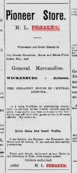
The article says that the coal mine was discovered twenty years earlier, which would be around the time that Pablo and Miguel left California for Arizona. 1863-66ish. Wickenburg then Phoenix.

68120402-FD58-4A65-9A38-2C88957780B6.jpeg
 

markmar

Silver Member
Oct 17, 2012
4,117
6,259
Primary Interest:
All Treasure Hunting
I agree about the dates not being found on the original map.
I was not describing the mine next to the bottom of WN, but the one to the right of that landmark, above what I wrote is Miners Needle (the mine furthest to the right). It fits the location of Wagoner's rose quartz ledge.

Hal, that mine isn't Wagoner's gold ledge. IMO, in the Fish/Peralta map is not depicted MN.
 

Hal Croves

Silver Member
Sep 25, 2010
2,659
2,695
It’s a matter of interpretation but the location on the map, the silhouette, other details from the map and logic leave me convinced that it is Miners Needle. Its not some random line I hope you agree, so what does it represent?

Some work has been done on the Peralta Fish Map. Whatever the cost to obtain a recent copy would be well worth it IMO, if indeed there is one.
 

Matthew Roberts

Bronze Member
Apr 27, 2013
1,131
4,955
Paradise Valley, Arizona
Primary Interest:
All Treasure Hunting
The article says that the coal mine was discovered twenty years earlier, which would be around the time that Pablo and Miguel left California for Arizona. 1863-66ish. Wickenburg then Phoenix.

View attachment 1747728

If you study the history of Southern California you see the Peraltas were involved in land, farming, ranching and mining from the earliest days. All the Peraltas came from Mexico via Arizona (Tubac) and entered California in 1776. Prior to 1776 they were involved in mines in southern Arizona and Sonora. Pablo and Miguel Peralta did not leave California in the 1860's for Arizona to prospect. They left to reopen mines they already knew about. Read carefully the history of California and the Peraltas and you will see their connection to mining in all three places, Sonora, Arizona and California.
 

Hal Croves

Silver Member
Sep 25, 2010
2,659
2,695
If you study the history of Southern California you see the Peraltas were involved in land, farming, ranching and mining from the earliest days. All the Peraltas came from Mexico via Arizona (Tubac) and entered California in 1776. Prior to 1776 they were involved in mines in southern Arizona and Sonora. Pablo and Miguel Peralta did not leave California in the 1860's for Arizona to prospect. They left to reopen mines they already knew about. Read carefully the history of California and the Peraltas and you will see their connection to mining in all three places, Sonora, Arizona and California.

The Valenciana which was sold prior to becoming merchants? They must have had a map of the location if they were returning to it. Matthew, it would be much appreciated if you could share your thoughts on dating the Peralta Fish Map.
 

OP
OP
somehiker

somehiker

Silver Member
May 1, 2007
4,365
6,426
Primary Interest:
All Treasure Hunting
Hal:

All this would be much easier to understand if a Peralta Family Tree was available for reference.
Possibly beginning with this gentleman ?
Might be a worthy project for you and Matt to collaborate on, given both of your respective talents in that area IMO.

The earliest reference to a Peralta in Mexico I have to date......Juan Suarez de Peralta 1537-1590

A merchant and historian apparently.

http://www.historicas.unam.mx/publicaciones/publicadigital/libros/lecturas/T1/LHMT1_036.pdf

http://libreriasdeocasion.com.mx/hi...ias-noticias-historicas-de-nueva-espa-a.html#

Interesting individual.....with connections

JUAN SUAREZ DE PERALTA
Creole born in Mexico the year of 1537. He died in Spain
after 1590.
Family of Cortes devoted to mercantile life and
description of the history of the Conquest, as well as of the cos ·
galanas and chivalrous lights of his contemporaries.
Federico GĂłmez de Orozco, in his Preliminary Note to the Tra-
tado of the discovery of the Indies, (Historical news of
New Spain), composed in 1589 by Don Juan Suárez
from Peralta, neighbor and native of Mexico. Mexico

A partial (Google) translation of one of his own historical accounts, as given to writer Don Juan Suárez .....

"THE SEVEN CITIES OF CIBOLA. THE HUNTING
That is about how Viceroy Don Antonio de Mendoza did
the army for the Seven Cities, and how he went out with the people
and how far he got with her, and what happened most.
The greed was so great that he put the new of the Seven to all.
Cities, which not only the viceroy and marquis raised the
feet to go to it, but to the whole earth, and so much, that by
please negotiated to go the soldiers, and take leave; and was
so that they were sold, and the one who had it was not thinking, but
which was already a title at least, because it was more expensive
I had come from there, luckily, who claimed to be the best
thing that was in the world: the people of that land very
prosperous, and all the dressed Indians, gentlemen of much ga-
I swim; the mountains like those of Spain, and tempera, the firewood that
it burned were very large walnuts, which gave a lot
walnut, better than those in Spain; many mountain grapes of
Very nice to eat, chestnuts and hazelnuts. As he painted it,
it must be the earthly paradise, and in what is partridge hunting,
aresres, cranes and all other poultry, it was wonderful what
that there was. In all this I told the truth, because there is in that
land the mountains he said and cattle, especially cows;
but they are not like those here, because I saw leathers of those who
they brought these soldiers, and they are very different; they have the pes-
I bake and forehead full of wool, which look like only choir lions
swims, the horns like a span, very sharp, that can
serve as alesnas; little bulls and cows, brave in
Big end, and many in quantity. Grapes and hunting without
doubt, and temperament, like that of Spain.
In what is hunting, in New Spain there are many
of poultry, and ares and cranes that there is no number, the four
they come to winter, and then, as spring begins
They leave, that not one remains. I have heard that they are going to breed
to Florida, and that's where they come from, and it's certainly, for everything
that of CĂ­bola, where they say of these cities; and even the
hawks, as they are NeblĂ­es, and sacres and fins and baharĂ­es, and
other birds of prey must come from there, because when
They come, they are wintering when the sands. Then it was
man, and it is in a lot and there are so many that are taken,
that I have seen in the Mixteca la Alta, in Tamazulapa, a
My brother's people, which belonged to my father, and in Y anhui-
tlán, town of Gonzalo de las Casas, and in other towns by
there near, market days, which call tianguez, com "

Now that I think of it, an outline of Mexico,California,Arizona, and New Mexico would make a great tree-like background for it.
 

Last edited:

Matthew Roberts

Bronze Member
Apr 27, 2013
1,131
4,955
Paradise Valley, Arizona
Primary Interest:
All Treasure Hunting
In 2011 I was in downtown Los Angeles at the main city library talking with Curt Gentry who authored The Killer Mountains. Gentry lived in San Francisco but also kept an apartment in LA. We were talking about his research of the Peraltas when he took me over to the historic California section and showed me a book written by Zoeth Eldredge, part of a multi volume of California history. In that book Zoeth wrote of mining the Peraltas did starting in Sonora, moving on to Arizona and later to California. Mining in Arizona was done as far north as today's Jerome, Arizona. The mines at Jerome were happened upon by the first white men to explore the region. In Abraham Peeples notes he tells of himself and a group of men in 1863 prospecting down Turkey Creek (today Black Canyon) and happening upon Miguel Peralta and several Mexicans mining at the Valencia just north of today's Black Canyon City. He described an extensive mine working and a large arastra about a mile to the west on Turkey Creek. Peeples wrote the mine had been there for "some" time.
 

Top Member Reactions

Users who are viewing this thread

Top