Objects of Interest -- Boulder Canyon

OP
OP
skyhawk1251

skyhawk1251

Sr. Member
Nov 9, 2018
311
669
Kingman, AZ
Detector(s) used
Fisher Gold Bug Pro
Primary Interest:
Prospecting
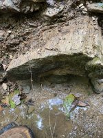
Excuse my bumping up this thread, but as I wrote when I started it, I'll be adding to it as I find objects of interest in, or very near, Boulder Canyon. As far as the ravine site is concerned, the most significant objects at that site are not the possible stacked-stone structures. The object of prime importance, in my opinion, is the circle of stones. The circle is now incomplete, because some perimeter stones have been removed, but its circular shape is still evident. Most importantly, it looks like the central, pinnacle stone is still there, but has been toppled from its original, upright position, either by human intervention, or from natural causes, i.e. earthquake. Some stabilizing stones, originally at the pinnacle stone's base, are still there. If this was intended as a monument/marker, it took a good amount of effort to put it there, thus indicating that it marked something of great importance. At this time, I suspect that some perimeter stones were removed to be used elsewhere, or they were removed to allow the central, pinnacle stone to lay low on the ground, making the monument less prominent on the ridge above the ravine; this assumption favors human intervention, rather than natural causes.

023.jpg

024.jpg
 

OP
OP
skyhawk1251

skyhawk1251

Sr. Member
Nov 9, 2018
311
669
Kingman, AZ
Detector(s) used
Fisher Gold Bug Pro
Primary Interest:
Prospecting
Looks like this will be my last addition to this thread. GE images below show areas of "disturbed" ground on the slope of the ravine across from the stone structure. GPS coordinates are at the bottom of the frames for the features within the larger red boxes. I see a "pit" depression inside the larger red boxes. In the third image, I see what could be evidence of a switchback trail that can be traced partway from the top of the ridge to just above the "pit" depression.

032.jpg

031.jpg

033.jpg
 

OP
OP
skyhawk1251

skyhawk1251

Sr. Member
Nov 9, 2018
311
669
Kingman, AZ
Detector(s) used
Fisher Gold Bug Pro
Primary Interest:
Prospecting
Maybe this is proof that just about any place can be matched to crude, hand-drawn maps. The Peralta Tesora Mappa compared to the ravine of interest, off Boulder Canyon (image below). When looking at any "treasure" map, it's important to keep in mind that those maps only include clues as to the route to the treasure/mine. They are not comprehensive maps, and do not show vast distances that are not related to the treasure route. Get one clue wrong, and you're off-route, lost.

032.jpg
 

Last edited:
OP
OP
skyhawk1251

skyhawk1251

Sr. Member
Nov 9, 2018
311
669
Kingman, AZ
Detector(s) used
Fisher Gold Bug Pro
Primary Interest:
Prospecting
Two more features in Boulder Canyon. The first two GE images show something with straight "walls," and two 90-degree angles. It seems to be enclosed in a circle of stones. GPS 33.472794, -111.390926. The third GE image shows what I see to be the location of a spring, and what could be a favored campsite of hikers when the weather is dry. I have no idea what the white dots at the "campsite" location could be. What looks like a breached dam is inside the red ellipse. GPS of the "campsite" is 33.468805, -111.391168.

034.jpg

036.jpg

037.jpg
 

EarnieP

Hero Member
Jul 20, 2015
526
1,062
Primary Interest:
All Treasure Hunting
Good eye Skyhawk, Indian Paint mine does have some interesting history.
I tried to fit it into the clues myself before listening closer to the more knowledgeable guys on this site. No one (living) has more expertise on this subject than some of the old timers posting here. Other than the guys who actually found the mine and they're not talking! ;)
I still like Indian Paint, but probably because I just want it to be that easy.
Tourists stop there on their day hikes.
 

Last edited:
OP
OP
skyhawk1251

skyhawk1251

Sr. Member
Nov 9, 2018
311
669
Kingman, AZ
Detector(s) used
Fisher Gold Bug Pro
Primary Interest:
Prospecting
Here is a GE image that summarizes the anomalies seen in the ravine of interest. The view is from directly overhead.

1. Possible stone walls surrounded by circle of stones.
2. Possible stone structure.
3. Possible mine site. Line-of-sight distance between 2 and 3, 300 feet.
4. Circle of stones, possibly a monument.
5. Possible stone walls, not clearly visible here, NE up ridge from 4.

GPS of the possible mine site is 33.472697, -111.388791, elevation 2,422 feet.

Back when Jacob Waltz was alive, getting to the possible mine site would have been a challenging and dangerous journey. Today, it is a different story. A young, fit backpacker can easily get there in one day with no major problems, starting from Canyon Lake Trailhead. The route to the possible mine site would probably be south on Boulder Trail, past the mouth of the ravine, then northeast up the ridge at the junction of Boulder/Needle canyons. Once at the top of the ridge, the route would be east along the ridge, past the possible stone structure (2), then a long switchback to the north side of the ravine, and down to the possible mine site.

I'd like to see some on-the-ground photos of the anomalies shown in this GE image, but I don't want to see this ravine become a money-making project of yet another TV production crew. If the possible mine site really is a mine, I'd ultimately like to see an ore sample from it. I'd hazard the guess that people have thoroughly explored this location, because getting to it is not overly difficult, but if they've found anything there they've kept silent. You can make your own conclusions as to why they've remained silent.

0100.jpg
 

OP
OP
skyhawk1251

skyhawk1251

Sr. Member
Nov 9, 2018
311
669
Kingman, AZ
Detector(s) used
Fisher Gold Bug Pro
Primary Interest:
Prospecting
Here's a 3D GE view of the ravine of interest. This view is an anaglyph. You'll need 3D glasses (red/blue lenses) to see the stereo effect. Increase your screen brightness if the image seems dim.

ravine.png
 

markmar

Silver Member
Oct 17, 2012
4,117
6,259
Primary Interest:
All Treasure Hunting
skyhawk

IMO, what you see as a circle building along the Boulder Canyon, was a lookout spot used by the Mexicans while the Peraltas parties were mining in that region. Like you can see in the Peralta-Fish map, south of your circle there were some mines.
There should be more than one Peraltas lookout in the west Superstitions, which are at a shot hearing afar from the mines.
 

OP
OP
skyhawk1251

skyhawk1251

Sr. Member
Nov 9, 2018
311
669
Kingman, AZ
Detector(s) used
Fisher Gold Bug Pro
Primary Interest:
Prospecting
skyhawk

IMO, what you see as a circle building along the Boulder Canyon, was a lookout spot used by the Mexicans while the Peraltas parties were mining in that region. Like you can see in the Peralta-Fish map, south of your circle there were some mines.
There should be more than one Peraltas lookout in the west Superstitions, which are at a shot hearing afar from the mines.

I agree. That was my conclusion when I first spotted the possible structure. A walled lookout to monitor those passing near that vantage point. Definitely not a good defensive position, however, as those inside the lookout could easily be outflanked and shot at from higher ground.
 

Top Member Reactions

Users who are viewing this thread

Top