skyhawk1251
Sr. Member
It lies within an imaginary circle whose diameter is not more than five miles and whose center is marked by the Weaver's Needle, a prominent and fantastic pinnacle of volcanic tufa that rises to a height of 2500 feet among a confusion of lesser peaks and mountainous masses of basaltic rock, ...
the first gorge on the south side, from the west end of the range they found, as he had told them, a monumented trail which led them northward over a lofty ridge; thence downward past Sombrero Butte into a long canyon running north, and finally to a tributary canyon very deep and rocky, and densely wooded with a continuous thicket of scrub oak.
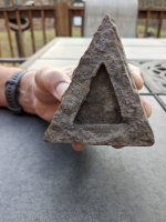
The great clew for which all the search is now being made is a rock cabin in a cave, which, according to Old Yoccup's story, is directly across the canyon from the mine, and not more than 200 feet from it. It was here that the two Germans lived while they worked the mine. P.C. Bicknell
This GE image shows a "rock cabin" and a mine on opposite slopes of a ravine located east of Boulder Canyon, and north of the canyon's junction with Needle Canyon. The viewpoint of the GE image is looking up the ravine to the east from directly overhead. The "rock cabin" is on the south ridge of the ravine. The mine is on the northern slope of the ravine. The mine is marked by a narrow terrace/ledge of level ground that is retained by a stacked-stone wall. A few rocks have fallen down the slope and now rest on the terrace/ledge. No dump of waste material from the mine is clearly visible, which indicates that very little waste was taken out of the mine, or that the waste material was widely scattered down the slope. There could be some disturbed ground directly below the mine, but that fact is far from certain. There are no clearly defined foot trails visible in the GE image. This indicates to me, based on mining trails I've seen in Mohave County, AZ, that the mine is very old -- much older than 100 years.
I've measured the line-of-sight distance from the "rock cabin" to the mine, as shown by the white line. That distance is 183 feet. The easiest route to the mine from Boulder Canyon would be by passing the mouth of the ravine, going south, then by turning about and ascending to the ravine's south ridge. Once on the south ridge, the "rock cabin" is passed, heading east to the high end of the ravine. A long traverse/switchback is then made to the north slope of the ravine and down slightly to the mine. The bottom of the ravine is too choked with boulders and vegetation for a more direct route to its high end.
The green box encloses what looks like a terraced depression. There are other possible indications of human activity at this location, but they are not of primary importance, so I won't discuss them in this post.


 ...
...