Peglegs Black Gold Nuggets

bobinsd

Sr. Member
Oct 20, 2005
491
250
San Diego California
Detector(s) used
Bounty Hunter
Primary Interest:
All Treasure Hunting
Re: Pegleg's Black Gold Nuggets

Gollum...hope you are still watching this thread. Didn't you post years ago a picture of what you thought was a "natural" cross on the side of a mountain/hill. In Bailey's book the is a reference to a "natural" cross in relation to Pegleg's mine. Have you read it?
 

gollum

Gold Member
Jan 2, 2006
6,729
7,596
Arizona Vagrant
Detector(s) used
Minelab SD2200D (Modded)/ Whites GMT 24k / Fisher FX-3 / Fisher Gold Bug II / Fisher Gemini / Schiebel MIMID / Falcon MD-20
Primary Interest:
All Treasure Hunting
Re: Pegleg's Black Gold Nuggets

It's a heart not a cross.

Mike
 

MrLee

Sr. Member
Mar 25, 2012
492
273
Tokyo & OC
Detector(s) used
Google Earth, BS Detector, $$
Primary Interest:
All Treasure Hunting
I just spent the past 6 hours (have the flu) reading this fascinating conversation. So much history down here in So. Cal and much of it not know to the public for one reason or another. I'm very interested now in the Spanish and their doings in the Colorado Desert. How is it that they could have passed these nugget up?

Also, I'm starting to do research into the Big Blue Lead as someone else had mentioned earlier in this thread. Klondike Ike had mentioned blue clay out in Barstow on another thread. I'm wondering if the Big Blue Lead may have drained into the Gulf of California, or the sea that occupied that area? Could these placers have come from the BBL?

Pegleg, have you started a book on this subject?

The history of the area would make a great mini-series starting with the Spanish and the San Felipe massacre. Very cool.
 

pegleglooker

Bronze Member
Jun 9, 2006
1,857
237
Banning, California
Detector(s) used
ace 250
Primary Interest:
All Treasure Hunting
Thx Mr. Lee, but my magazine does keeps be VERY busy ( however I have discussed a book with a publisher though ).... You should check out my site if you like ( HOME )...
 

jimmyquick1

Newbie
May 3, 2012
2
0
Primary Interest:
All Treasure Hunting
Hey Guys,
I regestered here after a friend of mine showed me this thread. I will be the first to admit that I'm no "expert" about Pegleg's lost gold but I know the story. I grew up in the Imperial Valley. The north end. We know all about the black gold nuggets. My Dad's uncle was what we call a range rat. He used to go out on the artillery range to collect scrap metal to sell. Occasionally he would come back with a black rock. He also knows where there is an abandoned opal mine up in the Chocolates. It used to be privatley owned but the military absorbed it. I spent many days riding dirtbike and quad around the Cargo Muchacho and Chocolate mountains. Why do you think they put that big gold mine on the 78? Because there is gold out there. Also, if you are looking for sandstorms, check out the north end of Glamis, I've survived a few out there and I''l never risk it again. There is a reason that some of the moutans have a greenish hue (copper). To me it just makes sense that, if Pegleg were travelling from Yuma to LA that he would traval diagonally, rather than straight across the Valley then up. Hope this helps you guys. Happy hunting.
 

MrLee

Sr. Member
Mar 25, 2012
492
273
Tokyo & OC
Detector(s) used
Google Earth, BS Detector, $$
Primary Interest:
All Treasure Hunting
Jimmy, never been out to Glamis, but everyone I know has. Is the gold mine you refer to just above Glamis on the 78?

The Navy is working on an LEIS for a 25 year renewal of the CHocolate Mountain Gunnery Range. Any possibility they could be turned down by Congress or the public?
 

jimmyquick1

Newbie
May 3, 2012
2
0
Primary Interest:
All Treasure Hunting
Mr. Lee,
Yes, there is a big open pit mine North of Glamis on the 78 (Ben Hulse HWY). The Native Mexican's mined the Chocolates and then the Spanish after them. There's even a legend about a lost gold ledge in the Chocolates.

Lost Gold Ledge of the Chocolate Mountains

I can't really see them not renewing the lease for the Gunnery Range, partially because there is so much unexploded ordinance out there it would cost a small fortune to clear it all. Trespassers beware!
 

MrLee

Sr. Member
Mar 25, 2012
492
273
Tokyo & OC
Detector(s) used
Google Earth, BS Detector, $$
Primary Interest:
All Treasure Hunting
Oh, I won't go near that range. Had a friend in high school that was out on his atc, picked up a flare, probably signal flare. He brought it back to his trailer to show his dad and it went off. Severely burned him.

I was out at the geode beds last week. Talk about middle of nowhere. Seems very difficult to find them now as we spent a few hours digging as did the other people around us, but nothing good. Still a nice day to be out and see the area.
 

mastahmynd

Newbie
Aug 19, 2011
3
0
staten island ny
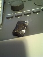
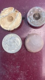
i found the black gold missing and i got pictures to prove it !! pure platinum nugget.jpg
 

Scout

Jr. Member
Jul 18, 2012
32
44
So Cal
Detector(s) used
Whites MX SPORT, Tesoro Eldorado 1989 model, Tesoro Compadre, Fisher Gold Bug
Primary Interest:
All Treasure Hunting
Hey PLL, I have read your story in old issues of Desert Mag.... thanks! Have you read the book by Frank L. Fish "Buried Treasure and Lost Mines" his story was from the personal papers taken from a man who spent 40 years looking for the Gold from 1865 to 1905. He was injured in an accident in the Badlands and taken to his home in Santa Monica where he died from a crushed chest. Before he died he said he finally found the Lost Pegleg location. His wife could not make no sense of his directions to the find. However, later when his maps and notes were studied closley his search area and findings centered around the south end of the Santa Rosas in the Badlands, a hard to reach spot.
It does not give a name of this person in the book of this man who spent 40 years looking.... you might have this info already so I am sorry if I missed a post regarding this person. Thats a long way to travel with a chest injury even these days, I know because I broke seven ribs riding my dirt bike down there in those Badlands. I rode back in a truck and that hurt like hell.
The book says that two of these Black Nuggets the size of Hazle Nuts with a reddish-black coating rest in the iron safe at one of the California Ranches! ... well that really narrows it down:BangHead:
I am up for a trip down again when the weather allows, lets go guys!
 

Jack Hamilton

Full Member
Apr 13, 2009
186
22
Murrieta Ca
Detector(s) used
Tesoro Silver Sabre, Tesoro Lobo Super Traq
Hey PLL...been a few years. Hope things are well. I've read through this entire thread. While I may not have the knowledge of the treasure tales, I have been prospecting quite a bit. If there were nuggets being found on hilltops, there will be fine gold and pickers and smaller nuggets in the tributaries and washes, even hillsides below the places these blackend nuggets were and have continued to be found.

An interesting note to point out. I have been prospecting east into the high desert. Just south of 29 palms. I have found chrysicolla mines and many gold mines. Chrysicolla is a copper ore. Geologically speaking, the low desert is really not far. Considering these nuggets were found on a hill top or butte, it may place the geologic time frame some where in the vicinity of the high desert. Just a guess there, Need a topo for minerals...sooo

I took a look over at the USGS website which is simply a maze of directions to go and no search engine. I tried to use google also to pull up a geologic map of the southern mohave. It will take me more time. I do think it would be benifcial to locate the mineralized hill tops and possibly cross referance those with your own research.

If you ever want to go down and do some spot checking for color in areas, or washes that may lie below your suspect targets let me know. I've learned quite a bit since we chatted last. I've found spots in the high desert where people were finding nuggets in the past with metal detectors but never dry washed and done well. Also, small gold runs further than big gold. If we find small gold and follow it to pickers it will point a direction to either the original placer deposit as mentioned in the ancient river theory spoken of earlier in this thread, or a vein. Take care and best of luck.
 

pegleglooker

Bronze Member
Jun 9, 2006
1,857
237
Banning, California
Detector(s) used
ace 250
Primary Interest:
All Treasure Hunting
Hello Gang,
Wow it's been awhile hasn't it??? lol Things are good and everything is fine, our magazine ( Dezert magazine ) is doing very well!!! In fact I'm here to let everyone know that I wrote an article about Pegleg in the recent issue. If you would like to read it , please follow the link ( Dezert Magazine Archives | Dezert Magazine/ ) and there is no cost for the online version. But if you like, you can also order a printed copy as well ( $15.00 ). It will be a 2 part article and this one debunks some of the old theories and follows, what I believe, is the true path... In the next issue we will lay out where we feel the gold is and why it hasn't been found in so long... I hope everyone is healthy and doing well, if you would like to stay in touch you can reach us at Facebook/Dezert Magazine....
Pegleg.jpg


Adios Amigos!!!!!
 

Last edited:

sailaway

Hero Member
Mar 2, 2014
623
815
Primary Interest:
All Treasure Hunting
While researching the Ruth/Gonzolas Maps I came across this:
Thought’s about the Ruth search for the California Mine
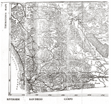
A few years ago (sometime in the 1990's), Greg Davis gave me a copy of a page from a Thurston’s Road Map which was apparently used by Adolph Ruth on the California adventure. The original map was given to Fred Guiry of the Dons Club in 1949 by Erwin Ruth. The page copied from the road map was a map of a portion of Southern California which will be shown shortly; however, later I obtained a complete copy of the Thurston Road Map and found some interesting details. First, the Thurston map had two copyrighted dates of 1915 and 1916 And second, I had assumed that the original map was a map of California which Adolph and Erwin had probably purchased when they rented the car after they arrived in Los Angeles by train; however, as shown below, the front side of the title page on the cover said:
THURSTON’S TRAVEL AND MILAGE MAP OF HIGHWAYS,
CITIES, TOWN, RAILWAYS [of] SOUTHERN CALIFORNIA and
ARIZONA (The Desert Map) and East to WASHINGTON D.C. Via Southern all year Round Route
and the back side of the title page contained a Transcontinental Map which showed the “Southern all year Round Route” that extended from Washington D.C. on the east to San Diego, California on the west.
Albert G. Thurston
Cali Ruth Map.PNG Ruths Marker.PNG
http://www.lost-dutchman.com/dutchman/robtwo/ruth.pdf

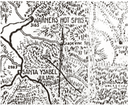
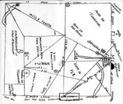
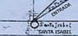
The reason I bring this up is that the Molina Map I have has the town of Santa yIsabella on the side of the map. Does this mean that what we are calling the Molina Map was one of the 5 Maps that were given to Erwin Ruth in Mexico by Senor Gonzolas before his death? And when Adolph broke his hip and pronounced he had found the mine that he was talking about the Peg Leg Mine? Notice the search area is exactly the center of the area posted by Gollum at the start of this thread.
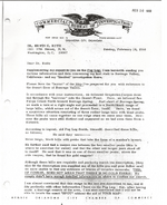
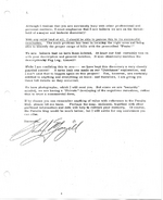
Ruth report.PNG Ruth report 2.PNG
 

Last edited:

gollum

Gold Member
Jan 2, 2006
6,729
7,596
Arizona Vagrant
Detector(s) used
Minelab SD2200D (Modded)/ Whites GMT 24k / Fisher FX-3 / Fisher Gold Bug II / Fisher Gemini / Schiebel MIMID / Falcon MD-20
Primary Interest:
All Treasure Hunting
Sail,

The Molina Map only shows the area in and around the Tumacacori Mission. Would not show all the way to California. Even the map that Glen Macgill had only showed from Warner Hot Springs down to just East of Borrego Mountain.

Mike
 

OP
OP
Oroblanco

Oroblanco

Gold Member
Jan 21, 2005
7,838
9,830
DAKOTA TERRITORY
Detector(s) used
Tesoro Lobo Supertraq, (95%) Garrett Scorpion (5%)
While researching the Ruth/Gonzolas Maps I came across this:


The reason I bring this up is that the Molina Map I have has the town of Santa yIsabella on the side of the map. Does this mean that what we are calling the Molina Map was one of the 5 Maps that were given to Erwin Ruth in Mexico by Senor Gonzolas before his death? And when Adolph broke his hip and pronounced he had found the mine that he was talking about the Peg Leg Mine? Notice the search area is exactly the center of the area posted by Gollum at the start of this thread.

I posted that map at the start of the thread, it is not an actual "treasure map" but is taken from a book, about the famous lost mine. I can assure you that the person who drew that map, did not know the location of Pegleg's gold, and was attempting only to depict the general region where it is believed to be.

There is reason to doubt that the mine sought by Adolph Ruth in California was not the black nuggets of Pegleg, for Ruth claimed he found this mine, and fell into the "shaft" injuring himself rather severely. There was no mine "shaft" involved with Pegleg's black nuggets, they were a placer scattered directly on the surface. But it is an interesting parallel.

Good luck and good hunting amigos I hope you find the treasure that you seek.
Oroblanco

:coffee2::coffee2:
 

sailaway

Hero Member
Mar 2, 2014
623
815
Primary Interest:
All Treasure Hunting
The person was Adolph Ruth that marked the X on the Map shown in the above post.
molina map marked.jpg molinamap1 Santa ysabel.jpg
here I have outlined with a square what I found so that you can see. Sorry that this copy is not clear but mine clearly states in the same spot santa yisabela (I have my own personal marks on my version that I do not care to share).

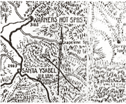
then the map that Adolph Ruth had marked with an X
Ruths Marker.PNG This is an enlargement of the area taken directly from the Ruth Map

The author claims it is the Map that Adolph Ruth had with him when he broke his hip searching for the Peg Leg Mine in 1919.
Is it not a fact that Adolph Ruth lost his life in the Superstitions some years after his accident that broke his hip in California?
Did both of you read the whole Document in the link I posted?
Could it also be a possibility that Adolph Ruth was the author of the side notes on the molina map?
Is the X a depiction of where Adolph thought the Molina map would overlay and line up with natural features? look closely and you may spot features that appear to be in the right locations. I do know that Father Kino wrote about gold he had shipped from California back to the King of Spain in 1710. With that information it could be that the Peg Leg Mine was worked by the Peraltas before Peg Leg Smith stumbled on it. The maps Erwin Ruth received from Senor Gonzolas in Mexico were claimed to be the maps to the Peralta mines that were handed down for Generations.
Could Auga de San Ramon be Warners Springs?
Did Adolph Ruth find something in California that lead him to the Superstitions?
This was the route that was known by Spanish/Mexicans used to go to California.
The Topographic map was produced immediately after the War with Mexico by the War Dept.
Adolph Ruth did not Fall into a shaft but a 20 foot drop off in a small ravine where he was found after 3 days of laying there.
Please read the whole Document or I will post the whole thing.
Did you not see the document of Erwin Ruth about the Peg Leg mine with the description of the area coming from Peg leg Smith Himself?
 

Last edited:

gollum

Gold Member
Jan 2, 2006
6,729
7,596
Arizona Vagrant
Detector(s) used
Minelab SD2200D (Modded)/ Whites GMT 24k / Fisher FX-3 / Fisher Gold Bug II / Fisher Gemini / Schiebel MIMID / Falcon MD-20
Primary Interest:
All Treasure Hunting
I posted that map at the start of the thread, it is not an actual "treasure map" but is taken from a book, about the famous lost mine. I can assure you that the person who drew that map, did not know the location of Pegleg's gold, and was attempting only to depict the general region where it is believed to be.

There is reason to doubt that the mine sought by Adolph Ruth in California was not the black nuggets of Pegleg, for Ruth claimed he found this mine, and fell into the "shaft" injuring himself rather severely. There was no mine "shaft" involved with Pegleg's black nuggets, they were a placer scattered directly on the surface. But it is an interesting parallel.

Good luck and good hunting amigos I hope you find the treasure that you seek.
Oroblanco

:coffee2::coffee2:

To follow up on Oro's Post,

Ruth was not looking for PegLeg's Black Gold Nuggets. He was looking for a lost mine owned by the Gonzales Family that had been lost since about the 1860s or so. Ruth's injuries came from falling off a steep embankment into an arroyo. He could not climb back out and was stuck in the arroyo for a long time.

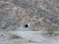
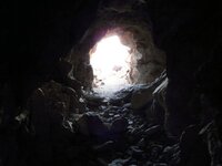
PegLeg's Black Gold Nuggets were laying around on the surface of the middle of three hills/buttes/bluffs. The one place that kind of matches both sites is Borrego Mountain in California's Anza-Borrego Desert. It very closely resembles the place on the map Erwin Ruth described to Glen Macgill as the Lost Gonzales Mine. Adolph Ruth fell into an arroyo on the NorthEastern end of Borrego Mountain. I can tell you that the mine Ruth saw was not the Gonzales. Gene Reynolds saw that same mine in the seventies and claimed it was the Lost Gonzales Mine. I have been in it and posted tons of pictures. It is a 25 foot deep prospect cave. It is highly mineralized, and may contain some very low grade gold, but the description of the ore from the Gonzales Mine was chunky solid gold with a little bit of quartz stuck in it. Nothing close to what is here.

p1010505b.jpg mineinsideoutsm1.jpg

So, The Pegleg Nugget Hill and the Lost Gonzales Mine are still lost!


Mike
 

sailaway

Hero Member
Mar 2, 2014
623
815
Primary Interest:
All Treasure Hunting
Erwin Ruth himself hired an investigative team to search out all known materials about the PEG LEG Mine look above and you will see it clearly states the PEG LEG and no other mine is mentioned. The Ruths were no where near where they claimed to be, they were miles west of NorthEastern end of Borrego Mountain.

http://www.lost-dutchman.com/dutchman/robtwo/ruth.pdf
 

Last edited:

Top Member Reactions

Users who are viewing this thread

Top