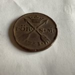
Swifts Square/Compass/Trowel and associated carvings

vamelungeon

Jr. Member
Jul 13, 2009
61
25
Wise, VA
Re: Swift's Square/Compass/Trowel

The object in the upper left looks like an ancient level. Instead of a bubble like we use now, at the top of the "hump" in the middle there would have been a string attached and a weight on the end. There would have been a line inscribed down the center. If the string and the line were aligned you were level.
 

-Ki-

Hero Member
Feb 12, 2009
642
574
EASTERN KENTUCKY
Detector(s) used
MD & Handwand "CaveHunter"Hiker" SonyDigital SLR
Re: Swift's Square/Compass/Trowel

Great research Swizz... I see where the skull and cross bone play in together with the other carvings.
 

Curtis

Hero Member
Sep 3, 2008
899
1,009
Cincinnati
Primary Interest:
All Treasure Hunting
Re: Swift's Square/Compass/Trowel

That is great, just curious Swiz, where did this come from(if you can share).
 

OP
OP
Swifty

Swifty

Full Member
Aug 13, 2007
125
68
Kentucky
Detector(s) used
Whites XLT (E- Series)
Primary Interest:
All Treasure Hunting
Re: Swift's Square/Compass/Trowel Survey

Hello all 07/04/2011 @ 3:30 A.M.

Johnathan Swifts,..."Square, Compass and Trowel Survey " actually consists of two carvings put together, "but left separate", both of these carvings are found on Lower Devils Creek near the Red River Gorge area. The late Ralph Volker, an author/friend and avid explorer who searched for the "Swift Mines" for many many years wrote a book and did a video on these two carvings. I have met and talked with him personally before his death. He revealed to me much about the Shawnee Cave, contents, etc. and the mines. I have worked extensively with these carvings and many others carvings in the Red River Gorge area.
The Compass Rock Carving" and the Partial Star or Trowel Carving or S.J.M carving are obviously Masonic symbolism. These carvings are found on Lower Devils Creek and are found separate from each other... but are found very, "very close" to eachother. When these two carvings are conjoined together they reveal a "Survey" (The Square, Compass and Trowel Survey). I believe this was the astronomical survey that was utilized by Swift to point to the direction of the 'Upper Mines" and is also "used" in the area of the "Upper Mines" to pinpoint the entrances of the mines, as well as, to find caches associated with the mines. This survey also astronomically calculated and revealed the latitude and possibly, (the longitude), of the "Upper Mines. Swift had the skills necessary to survey and plot courses...as he was a navigator/owner of ships on the High seas, not to mention a Free Mason with extensive education. Another piece of evidence that a survey existed, comes from Swift's journal... Swift states in his journal...quote," After leaving the mines we were attacked by Indians, he says,... the Indians had taken some papers and horses, "these papers were of great value to us"". I believe these were the survey papers of the Square, Compass and Trowel Survey that included the area of the Upper mines, furnace and Great Cave.
Other evidence of the mines and Great Cavern or something of great importance being in the area is that there are numerous "very "peculiar"/strange carvings" and petroglyphs... located in and around the entire area of the Red River Gorge, so many so, that it is hard to make any sense of them. These carvings, I believe were left behind and are evidence of Swifts party and Native Americans on their travels to and from the mines and Shawnee Cave, to mark their trails.
When Swift came back the second time to relocate his mines approx. 1785 A.D., after emprisonment in an England he was blind. I believe that if Swift would of had his "survey papers", he could have found the mines back but he didn't and the markers/carvings left behind to mark "his" trail were of no use to him...since he was blind. But he continued searching in his blindness in the Red River Gorge area... and it is documented and is stated...as the legend goes...that, (Old Mr. Townsend, also associated with the Swift Mines) found him wondering around the Red River Gorge area looking for his mines and tried to help him. I believe the Indians still have these papers and know where the Shawnee Cave and mines are presently, but can do nothing with the information, but only come to visit the cave secretly and retrieve things.
The carvings of the Square, Compass and Trowel and S.J.M carvings left on Lower Devils Creek as well as, other Free Mason symbolic/allegoric carvings, and Native American petroglyphs located through out the area, as well as, quotes from Swifts Journal and the documented Native Americans (Shawnee) scant visits to into the area, looking for a "War Woman or Princesses' burial cave bears these facts out.
Another fact is...that Becky Timmons who was related to Swift by blood was searching the area as well, but was unsuccessful. Blackburn lived in the Red River Gorge area as well and he left sevaral carvings too. Other evidence is the Rock Bridge (Swift Creek), and the Indian Trace (just west of Chimney Top Creek), which Swift talks about in his journal,. These monuments and trails are present in the area and tie in to the legend too. There are many monument rocks Swift mentions in his journal that are present as well, The Lighthouse, The Haystack Rock, etc., etc., etc..
Other evidence in the immediate area are the many historic initials of Boone, Stewart, Gist, and others, etc.,
There are still even many other very unusual/strange European and Native American motiffs, carvings and petrogltphs, some are documented others are not, there are, bugs, hands, guns, feet, creatures, animals, reptiles, circles, anchors, turtles, bow and arrows, numbers, etc., just to mention a few. I know of many others as well, and over the years I have studied, researched, documented and taken pictures of them. I have researched the topography diligently utilizing thee carvings and other inforrmation, etc.
I believe some of the carvings were left by members of Swifts party, and possibly later relatives who had maps that were given to them by members of the original Swift party. The Native American carvings I believe pertain to the location of the "Shawnee Cave" or Great Shawnee Cave. The Kelly Dunn map even shows a Lookout Rock, which is also a monument rock that Swift mentions in his journal. The Kelly Dunn map depicts/shows a cave and Lookout Rock too, which I believe is the Shawnee Cave, where Swift and the immediate members of his party stored and hid their wealth.
After following the Swift Legend for 37 years and having read all the books, historic newspaper clippings, stories, journals, folklore, and numerous other facts, etc., not mentioned here, as well as, the presence and abundant evidence of historical European Pioneer and Native American people culture and presense in the area; along with the carvings, petroglyphs, initials,. etc., associated with the legend, give strong evidence. And the weight of the evidence for the location of the "Lost? "Upper" Silver Mines of Johnathan Swifts and The Shawnee Cave tends to point to the the Red River Gorge area.
But this is just my opinion from the extensive research I have done on the "Lost? "Upper" Silver Mines of Johnathan Swift" and the "Great Shawnee Cave". Others have their own opinion and are entitled to it. But as for me I will stay steadfast in my intuition.

Sincerely,

W. Neff -aka- The Swizard (Treasurenet Forum: The Lost Silver Mines of Johnathan Swift)
 

Last edited:

Curtis

Hero Member
Sep 3, 2008
899
1,009
Cincinnati
Primary Interest:
All Treasure Hunting
Re: Swift's Square/Compass/Trowel

Cool stuff Swiz! I like it. I hope those are the lower mines and we find the upper mines near Sandy Hook! Haha...With my luck though they are the upper ones and the ones I found are just Indian dirt scrapes. Looking forward to the meeting! Going to CA to dig some more placer I found last October. Hoping to file a claim.

Keep looking up and don't forget to take the trash out Nov. 2ND!
 

OP
OP
Swifty

Swifty

Full Member
Aug 13, 2007
125
68
Kentucky
Detector(s) used
Whites XLT (E- Series)
Primary Interest:
All Treasure Hunting
Re: Swift's Square/Compass/Trowel Survey

The Swizard said:
Hello Glenn, Mike, Ki, Curtis, and all 07/04/2011 @ 3:30 A.M.

Johnathan Swifts,..."Square, Compass and Trowel Survey " actually consists of two carvings put together, "but left separate", both of these carvings are found on Lower Devils Creek near the Red River Gorge area. The late Ralph Volker, an author/friend and avid explorer who searched for the "Swift Mines" for many many years wrote a book and did a video on these two carvings. I have met and talked with him personally before his death. He revealed to me much about the Shawnee Cave, contents, etc. and the mines. I have worked extensively with these carvings and many others carvings in the Red River Gorge area.
The Compass Rock Carving" and the Partial Star or Trowel Carving or S.J.M carving are obviously Masonic symbolism. These carvings are found on Lower Devils Creek and are found separate from each other... but are found very, "very close" to eachother. When these two carvings are conjoined together they reveal a "Survey" (The Square, Compass and Trowel Survey). I believe this was the astronomical survey that was utilized by Swift to point to the direction of the 'Upper Mines" and is also "used" in the area of the "Upper Mines" to pinpoint the entrances of the mines, as well as, to find caches associated with the mines. This survey also astronomically calculated and revealed the latitude and possibly, (the longitude), of the "Upper Mines. Longitude was harder to estimate back in those days because of the lack of technical instruments used to calculate longitude. But it was possible... and Swift had the skills necessary to survey and plot courses...as he was a navigator/owner of ships on the High seas, not to mention a Free Mason with extensive education.
Swift I believe...had done a survey of the mine area, because he states in his journal...quote," After leaving the mines we were attacked by Indians, he says,... the Indians had taken some papers and horses, "these papers were of great value to us"". I believe these were the survey papers of the Square, Compass and Trowel Survey that Swift had astonomically mapped of the area of the "Upper mines, which as I said above revealed the latitude and (possibly longitute) of the exact location of their mines, caches, etc.).
Other evidence is the "very "peculiar"/strange carvings" and petroglyphs... located in and around the area of the Red River Gorge, so many so, that, it is hard to make any sense of them. These carvings, I believe were left behind and are evidence of Swifts party and Native Americans on their travels to and from the mines and Shawnee Cave, to mark their trails.
When Swift came back the second time to relocate his mines approx. 1785 A.D., after emprisonment in an England he was blind. I believe that if Swift would of had his "survey papers", he could have found the mines back but he didn't and the markers/carvings left behind to mark "his" trail were of no use to him...since he was blind. But he continued searching in his blindness in the Red River Gorge area... and it is documented and is stated...as the legend goes...that, (Old Mr. Townsend, also associated with the Swift Mines) found him wondering around the Red River Gorge area looking for his mines and tried to help him. I believe the Indians still have these papers and know where the Shawnee Cave and mines are presently, but can do nothing with the information, but only come to visit the cave secretly and retrieve things.
The carvings of the Square, Compass and Trowel and S.J.M carvings left on Lower Devils Creek as well as, other Free Mason symbolic/allegoric carvings, and Native American petroglyphs located through out the area, as well as, quotes from Swifts Journal and the documented Native Americans (Shawnee) scant visits to into the area, looking for a "War Woman or Princesses' burial cave bears these facts out.
Another fact is...that Becky Timmons who was related to Swift by blood was searching the area as well, but was unsuccessful. Blackburn lived in the Red River Gorge area as well and he left sevaral carvings too. Other evidence is the Rock Bridge (Swift Creek), and the Indian Trace (just west of Chimney Top Creek), which Swift talks about in his journal,. These monuments and trails are present in the area and tie in to the legend too. There are many monument rocks Swift mentions in his journal that are present as well, The Lighthouse, The Haystack Rock, etc., etc., etc..
Other evidence in the immediate area are the many historic initials of Boone, Stewart, Gist, and others, etc.,
There are still even many other very unusual/strange European and Native American motiffs, carvings and petrogltphs, some are documented others are not, there are, bugs, hands, guns, feet, creatures, animals, reptiles, circles, anchors, turtles, bow and arrows, numbers, etc., just to mention a few. I know of many others as well, and over the years I have studied, researched, documented and taken pictures of them. I have researched the topography diligently utilizing thee carvings and other inforrmation, etc.
I believe some of the carvings were left by members of Swifts party, and possibly later relatives who had maps that were given to them by members of the original Swift party. The Native American carvings I believe pertain to the location of the "Shawnee Cave" or Great Shawnee Cave. The Kelly Dunn map even shows a Lookout Rock, which is also a monument rock that Swift mentions in his journal. The Kelly Dunn map depicts/shows a cave and Lookout Rock too, which I believe is the Shawnee Cave, where Swift and the immediate members of his party stored and hid their wealth.
After following the Swift Legend for 37 years and having read all the books, historic newspaper clippings, stories, journals, folklore, and numerous other facts, etc., not mentioned here, as well as, the presence and abundant evidence of historical European Pioneer and Native American people culture and presense in the area; along with the carvings, petroglyphs, initials,. etc., associated with the legend, give strong evidence. And the weight of the evidence for the location of the "Lost? "Upper" Silver Mines of Johnathan Swifts and The Shawnee Cave tends to point to the the Red River Gorge area.
But this is just my opinion from the extensive research I have done on the "Lost? "Upper" Silver Mines of Johnathan Swift" and the "Great Shawnee Cave". Others have their own opinion and are entitled to it. But as for me I will stay steadfast in my intuition.

Sincerely,

W. Neff -aka- The Swizard (Treasurenet Forum: The Lost Silver Mines of Johnathan Swift)
 

Rebel - KGC

Gold Member
Jun 15, 2007
21,680
14,739
Re: Swift's Square/Compass/Trowel and associated carvings

:icon_thumleft: :coffee2: WASSAIL? :wink: Swiz, your research is congruent with mine; I "see" the FreeMasonic "connection", also. Here is what I think... The OLD FreeMasonic "symbol" was simply the square & compass, w/o the "G"... in the "olden days". THAT is ONE "carving". The Trowel is used to "cement" the buildings of stone, etc by OPERATIVE FreeMasons (FORMERLY, Knights Templar of the "lost" fleet). :o SPECULATIVE FreeMasons used the "Trowel"
to indicate the BOND of Brotherly Love. ;D From the "lost" fleet of the KT... gives you PIRATES, then later... BUCCANEERS; for the MANY American colonies... raiding SPANISH ships & bringing their "spoils" in-land for LEGAL enterprises; after the Americans & Brits "cracked down" on the buccaneers. Look at the OLD "square & compass"; doesn't it look like the OLD "sighting instrument" (Sextant?) used on the "high seas"... http://en.wikipedia.org/wiki/Sextant :o :wink: :read2: MORE later! ;D
 

Rebel - KGC

Gold Member
Jun 15, 2007
21,680
14,739

Rebel - KGC

Gold Member
Jun 15, 2007
21,680
14,739

swiftfan

Sr. Member
Feb 24, 2008
353
491
Pikeville, Ky
Detector(s) used
Garrett Ace 250
Primary Interest:
Other
Re: Swift's Square/Compass/Trowel and associated carvings

Sorry I haven't been on here in a while, but reading Swiz's comments made alot of sense. Something I have been looking for is the trail TO the Gorge, as some of the treasures were left by Swift along the way. Athough probably long gone. would make for an intersting road trip though.. :icon_thumright: Need to get back to the gorge!
 

Rebel - KGC

Gold Member
Jun 15, 2007
21,680
14,739
Re: Swift's Square/Compass/Trowel and associated carvings

:icon_thumleft: ;D Yo, sf! TRAIL? From where? It is a HUGE place! :dontknow: ??? I think I would "follow" the Daniel Boone "trail"... the "survey trail" left by young George Washington; :wink: DYK, that George Washington was a BRO? (FreeMason). Was even Worshipful Master of HIS Lodge in Fredericksburg, VA; even Daniel Boone's son said "daddy" (Daniel Boone) was a FreeMason. There are some reports that DB even joined & attended the Fredericksburg, VA Lodge.
Hmmm... Daniel Boone, a "man of the WILD Frontier", and "way shower"; YOUNG George Washington, a SURVEYOR! :wink: BOTH, FreeMasons & contemporaries; PROBABLY, left MANY FreeMasonic "clues" behind, based on the stories of Bro. J. Swift! ;D :wink: :coffee2: :read2:
 

swiftfan

Sr. Member
Feb 24, 2008
353
491
Pikeville, Ky
Detector(s) used
Garrett Ace 250
Primary Interest:
Other
Re: Swift's Square/Compass/Trowel and associated carvings

Hey whats up Rebel! OK, easily put, the trail I am after is the main path Swift and co. used. Now, I know they came in different ways, BUT, trail from Tenn, Va, into KY is the one I am right now. Using the "50 miles as the crow flies" theory, and inputing various gaps in the mountains, gives me a starting point. From there, take the areas and put them in the journal descriptions. Now, I agree about Swift using trails the Indians used, and the Washington Survey. Best I can remember that was With Gist in 1750 for the Loyal Land Co.? Or was it earlier? Seems there was a Fry/Jefferson map predating Gist...either way once the search areas are established, see which ones have been associated with the legend. But don't forget the others... :icon_thumright: From there, don't forget to narrow it down..
 

Rebel - KGC

Gold Member
Jun 15, 2007
21,680
14,739
Re: Swift's Square/Compass/Trowel and associated carvings

:D BACK! IF... J. Swift left OLD TOWN Alexandria, Va... HE probably sailed up the James River to the "Falls" in Richmond, Va. OR... Chesapeake Bay to Potomac River to Alexandria, Va.; thence "rode" the GREAT WAGON ROAD down the Shenandoah Valley into Tenn. (Cumberland Gap, etc), ALL of which IS the Wilderness Road of Daniel Boone. ALL the way into Kentucky, etc. The maps I saw, last night of the Wilderness Trail/Road on the internet were AWESOME! :hello2:
 

Rebel - KGC

Gold Member
Jun 15, 2007
21,680
14,739
Re: Swift's Square/Compass/Trowel and associated carvings

:coffee2: :icon_thumleft: :wink: SO! I would look for FreeMasonic and/or PIRATE signs/carvings like an anchor, which USUALLY means to "hunker down... look around". THIS was INTERESTING, tho... "google" Legend of Jonathan Swift and Fabulous Silver Mine :wink:
Anyone considered or "know" S.W.I.F.T. as a "cover" for "pirate/privateer/buccaneer enterprises" in several states along the WILDERNESS ROAD?? :dontknow:
 

Curtis

Hero Member
Sep 3, 2008
899
1,009
Cincinnati
Primary Interest:
All Treasure Hunting
Re: Swift's Square/Compass/Trowel and associated carvings

Lets not forget the "Indian Old Fields" Boone went past, they were no doubt the abandoned Indian camp grounds Swift mentions...to the trail leading to and from there is worth looking at you might find yourself near Carter Caves KY and some interesting stuff there that the park service won't talk about.
 

OP
OP
Swifty

Swifty

Full Member
Aug 13, 2007
125
68
Kentucky
Detector(s) used
Whites XLT (E- Series)
Primary Interest:
All Treasure Hunting
Re: Swift's Square/Compass/Trowel and associated carvings

Curtis said:
Lets not forget the "Indian Old Fields" Boone went past, they were no doubt the abandoned Indian camp grounds Swift mentions...to the trail leading to and from there is worth looking at you might find yourself near Carter Caves KY and some interesting stuff there that the park service won't talk about.
 

Top Member Reactions

Users who are viewing this thread

Top