Indian waybill... Caney Creek.. Elliott County Kentucky..

KY Hiker

Bronze Member
Oct 28, 2014
1,537
3,220
North Central Kentucky
Detector(s) used
Whites
Primary Interest:
All Treasure Hunting
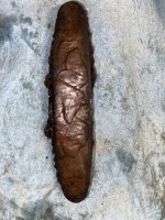
just got back from texas and new mexico, some treasure hunters toke me to the supposed jim bowie mine. learned the turtle head and upside down cross was the most used sign for finding opening to mines at least in southwest. saw several old mines and smelters. seems the Spanish carvings are the same as here. where the old barn was on caney creek, just across creek,that long cliff that runs from boat dock down creek to the bend. I have a photo of a carving that shows the 101 and the bend. past this bend and the 101, it shows a long line and a V pointing against the line. some where along that cliff. it means an opening covered up or something hidden there. I never got to inspect that cliff. there should be a vary small carving or line cut where to dig. the barn across creek seems to be close to the center of where the V line is shown on carving. as for the upside down cross. that was funny,I new that something was close by. but I almost fell in the hole. inside the hole I guess 10 feet, there are two openings that have a lot of rock in them. do not know what's in them. the cross match's the hole. there was a furnace at the barn. samples came back iron and lead. keep this in mind, the civil war went in this area, so some carvings may be from that time.

Turtle head ? ... I will check the Frog Head rock in the RRG this Fall with a compass and see what it faces.
 

boomer

Sr. Member
Jul 8, 2003
487
523
kentucky
Detector(s) used
army all terrain
Curtis, you mean the rainbow rocks near the end of the cliff as your facing the small rock house with the 3 trees in side, where the old tree is at the end. if its still there. you could shimmy up to get on top. odd thing about this is why? I searched around there, did find a small flat rock with a small bit mark and a small line pointing to it. the waybill says to go to the rockhouse with the 3 trees and look inside, than go on line of rocks. as I have said before, what is it about that rockhouse. I always felt that something vary important is underground? has for the cranes body and being next to the lid gap. in about 1980 I used an old bfo two box detector on the crane. I did pick up something in four places about 100 yards back from the tail of the crane, where sandy and caney meet. the signals were so faint, I could have picked up rust. the guys at the indian mound were rick and haskel from Ashland.
 

boomer

Sr. Member
Jul 8, 2003
487
523
kentucky
Detector(s) used
army all terrain
before putting this in here I had to do some checking. the people I was with, T.H. is their living. they looked at some of the stuff I had and said that the mines are indian and Spanish. the name that e c mason found on caney creek and map with hand was to do with the hands carved at line of rock. the hand on caney creek shows an oblong cut in palm of the hand. went on google earth and looked at the 5 fingers of little sandy that start at line of rock and run up river about a mile. the section of land just to the west of the fingers is the palm and just north is caney creek. they said that was a hill or a low dip. I found a hill near the center of the palm that may be what's shown on the hand carving. it runs north and south and has a lot of trees on it. if some of you could take a look at google earth and check that area out, more eyes the better. one thing I learned that the name elipe is a form of claiming this land for the king of spain. and that hicraa is some type of Spanish code word. this part flipped me out, the JS found carved around could be saying that Jesuit monks where with the miners, and the order was Jesuit spain or js they had a large order stationed in north Carolina. now a new mess to dial with. it goes on and on?
 

boomer

Sr. Member
Jul 8, 2003
487
523
kentucky
Detector(s) used
army all terrain
caney creek

had trouble with photo upload. notice palm of hand hill or dip? look to right of hand notice that it seem to be part of fingers. look down and there seems to be a small oblong cut that kind of matches the palm of hand and kind of a straight line pointing to it. it never ends. mine or hiding place?
 

Attachments

  • hand on caney (2).jpg
    hand on caney (2).jpg
    248.5 KB · Views: 548

KY Hiker

Bronze Member
Oct 28, 2014
1,537
3,220
North Central Kentucky
Detector(s) used
Whites
Primary Interest:
All Treasure Hunting
The Spanish always took clergy with them since their main goal was to convert all that they encountered to Christ. Monks and or priests were part of their non military decision making process. Think of them as emissary to God. Don't know why JS would be carved and not JC or a cross, doesn't sound right to me. The catholic church always used symbolism, it was the universal language, especially to the illiterate and native peoples.

The picture is confusing, it looks like a JP and a date at the bottom. That hand reminds me of something I have seen before, possibly masonic? At first glance the hand appears to have a mouth in it... actions speak louder than words? or hand speak? It looks to me that you have several layers or additions to whichever was the original drawing. The ' HI CRAFT ' looks like it was altered F and T. The oldest parts look to be to the left and right of the hand. Might have been a map. Directly under the hand might have been a stick horse or deer? I do not have a trained eye for such things, but that is what I see subjectively. Interesting that the hand pattern matches the local topography and streams though.
 

franklin

Gold Member
Jun 1, 2012
5,036
7,168
Detector(s) used
Garrett ADS-7X, Fisher Two Box M-Scope, Mother Lode Locator, Dowsing Model 20 Electroscope, White's TM808, White's TM900, Inground Scanners
Primary Interest:
All Treasure Hunting
had trouble with photo upload. notice palm of hand hill or dip? look to right of hand notice that it seem to be part of fingers. look down and there seems to be a small oblong cut that kind of matches the palm of hand and kind of a straight line pointing to it. it never ends. mine or hiding place?

When you place chalk or any tracing on rock markers or trees you destroy the true saying and make it into something you are looking for. Sign or symbols like this are useless. When you find a sign or carving take a photo of it and leave it untouched. Works much much better.
 

P.ALLEN

Hero Member
Jun 8, 2017
642
811
A2 Michigan
Detector(s) used
AT Pro, Tesoro Compadre, Ace 250, CMS magnetics, Garrett pinpointer, Fiskars trenching spade.
Primary Interest:
All Treasure Hunting
Chances are it would be on the upper reaches of the Red, and probably off of the Geologic area boundaries, maybe Clifty Wilderness. My hypothesis is that it was more likely a cache placed by the Shawnee or Cherokee, and mislabeled as a mine. Thoughts?
 

KY Hiker

Bronze Member
Oct 28, 2014
1,537
3,220
North Central Kentucky
Detector(s) used
Whites
Primary Interest:
All Treasure Hunting
The Red River Gorge and Clifty Wilderness have literally thousands of visitors annually with nothing found. The Red River Gorge is more associated with John Swift Silver mines than an Indian stash as you speak of. I guess that is possible, but unlikely after all these years unless it is on private land.
The waybill topic on this thread has been focused on Caney Creek a branch off of Sandy. Some say that you can follow the waybill step for step and see old mine entrances that are collapsed. There are various signs and carvings in the area that are of Indian origin.
 

Brushy Bandit

Full Member
Jan 11, 2017
195
560
Carter County, KY
Primary Interest:
All Treasure Hunting
The Red River Gorge and Clifty Wilderness have literally thousands of visitors annually with nothing found. The Red River Gorge is more associated with John Swift Silver mines than an Indian stash as you speak of. I guess that is possible, but unlikely after all these years unless it is on private land.
The waybill topic on this thread has been focused on Caney Creek a branch off of Sandy. Some say that you can follow the waybill step for step and see old mine entrances that are collapsed. There are various signs and carvings in the area that are of Indian origin.

There are for sure mines at Caney Creek, and silver has been found there in smelted and ore form with lead. I have two pieces I'm workin on gettin tested, that I found in the area. Hope to learn the percentage of silver in the pieces, with hopes that they aren't sterling which will rule out melted silverware and other suggestions that have been made. Myself I'm certain the results will be favorable, it's taken me longer get than I've wanted to get these pieces tested but I am working on it.
It seems unlikely to me that these mines can be silver mines and not be linked to Swift or be the basis for the Swift legends.
 

Last edited:

KY Hiker

Bronze Member
Oct 28, 2014
1,537
3,220
North Central Kentucky
Detector(s) used
Whites
Primary Interest:
All Treasure Hunting
Brushy Bandit, Your silver samples will tip the balance for me on the Caney Creek mines. I hope you got some GPS coordinates where you were detecting your find. A follow up look-see for relics or furnace evidence will seal the deal. I agree, they almost have to be the same set of mines as Swift legend. Next question will be, was the Swift legend a white man's tactic to blur the location of the Indian mines? OR did a man named Mundy who worked those same mines while a captive of the Indians actually lead Swift to them and they worked them as claimed and became the basis of the legend?
If so, the journals I have read are all read in past tense. That is, 'we went here, thence there, and left for the settlements on such 'n such date..' A real journal would read more as a diary... ' today _____ date we were startled by a band of savages and narrowly escaped...' So my theory is the journal was composed after the events, probably from memory, either before or during his quest to re-find the mines sometime in the 1780s or 90s. Makes sense because of the vast array of versions of the journal and the claimed possible locations. Imagine a small group of men searching the mountains looking for a lost Silver mine and passing through small settlements of pioneer families. Seems only natural a legend would develop and different versions of the story (journal) would be jotted down by those listening to the men on the search or helping them with the search in their area. Might explain why Campton got its name, maybe it wasn't Swift's camp while mining, but the search party's camp while conducting a search of that area.
 

Last edited:

KY Hiker

Bronze Member
Oct 28, 2014
1,537
3,220
North Central Kentucky
Detector(s) used
Whites
Primary Interest:
All Treasure Hunting
Great Cave of the Shawnee...?

If it ends up the Caney area is the Swift mines then the Shawnee cave is/was part of either the Carter cave system or Pigeon water ? Those two would be on the way back from Elliott Co. depending on their route, wouldn't they? Maybe the hollow ground around Pound Gap is where the Shawnee cave is located.
 

Last edited:

Brushy Bandit

Full Member
Jan 11, 2017
195
560
Carter County, KY
Primary Interest:
All Treasure Hunting
Brushy Bandit, Your silver samples will tip the balance for me on the Caney Creek mines. I hope you got some GPS coordinates where you were detecting your find. A follow up look-see for relics or furnace evidence will seal the deal. I agree, they almost have to be the same set of mines as Swift legend. Next question will be, was the Swift legend a white man's tactic to blur the location of the Indian mines? OR did a man named Mundy who worked those same mines while a captive of the Indians actually lead Swift to them and they worked them as claimed and became the basis of the legend?
If so, the journals I have read are all read in past tense. That is, 'we went here, thence there, and left for the settlements on such 'n such date..' A real journal would read more as a diary... ' today _____ date we were startled by a band of savages and narrowly escaped...' So my theory is the journal was composed after the events, probably from memory, either before or during his quest to re-find the mines sometime in the 1780s or 90s. Makes sense because of the vast array of versions of the journal and the claimed possible locations. Imagine a small group of men searching the mountains looking for a lost Silver mine and passing through small settlements of pioneer families. Seems only natural a legend would develop and different versions of the story (journal) would be jotted down by those listening to the men on the search or helping them with the search in their area. Might explain why Campton got its name, maybe it wasn't Swift's camp while mining, but the search party's camp while conducting a search of that area.

I don't have GPS coordinates but I'm not gonna easily forgot the 2 spots I found these.
You talk bout the journals bein in past tense Hiker. I read once that Swift wrote many versions of the journal in his later years, he sold the journals and also different versions of the maps. The piece I read gave numbers in the 20s, for different versions of the journal, it was less for map versions.
 

KY Hiker

Bronze Member
Oct 28, 2014
1,537
3,220
North Central Kentucky
Detector(s) used
Whites
Primary Interest:
All Treasure Hunting
I don't have GPS coordinates but I'm not gonna easily forgot the 2 spots I found these.
You talk bout the journals bein in past tense Hiker. I read once that Swift wrote many versions of the journal in his later years, he sold the journals and also different versions of the maps. The piece I read gave numbers in the 20s, for different versions of the journal, it was less for map versions.

You can use your phone to get coordinates with an app installed. Don't want to end up like Swift and not find your way back sometime! :)
I have read something similar, that he sold the journals and maps to finance his search. Doesn't make sense though, he should have had wealth from the mining unless it was seized during the revolutionary war. Since what I had read didn't site the source of the info about selling the journals, I have to assume that is speculation or an explanation of why there are so many versions. Also read that his journal was left with a Mrs. Renfro...journal is singular not plural in that claim. I am betting that the legend was told verbally for many years before 'versions' of the journal were written down.
 

KY Hiker

Bronze Member
Oct 28, 2014
1,537
3,220
North Central Kentucky
Detector(s) used
Whites
Primary Interest:
All Treasure Hunting
How could he...? Thought he "went BLIND"!

Was he blind or, because of age, his sight was severely impaired with cataracts or nearsighted. He could read and write but not focus at distance? Who knows, that part of the legend could be false as well?
 

Brushy Bandit

Full Member
Jan 11, 2017
195
560
Carter County, KY
Primary Interest:
All Treasure Hunting
I thought the same thing Hiker, was he blind or was his eyesight just horrible. I think it's the best explanation I've heard for there bein so many so many versions. If he was blind I don't think it'd be hard to find someone to write and draw them for him, in lieu of a quick buck.
 

Top Member Reactions

Users who are viewing this thread

Top