Long time listener first time caller

Zeek51

Newbie
Feb 12, 2017
4
14
Every where
Detector(s) used
only the best
Primary Interest:
All Treasure Hunting

KY Hiker

Bronze Member
Oct 28, 2014
1,537
3,220
North Central Kentucky
Detector(s) used
Whites
Primary Interest:
All Treasure Hunting
Over the last couple of years I have read through all the posts here. There are mentions of the 101 in some of the oldest threads. Are you referring to the 101 on a version of the map or the actual carving in rock? Seems I remember both being discussed. Check back into the oldest threads and read them through.
As far as knowledge of things you have never seen mentioned, that seems to be pretty common theme. I guess folks are too secretive to share too much. Call it greed, vice, or ego. I would just like to see this legend proved beyond a doubt as being real or fiction. No one is going to get rich off of silver unless they get a lot of manpower and/or equipment. They may find enough to make them better off though, just not rich.
I think there is as much distractive information out there that leads one in the wrong direction as there is actual information. Whether is be stone 'Swift Mundy Jefferson' carvings someone did as a prank in the early 1800's, destruction of actual evidence like carvings of maps ect. to posts here on this forum in regards to 'No need to look any more, I found it! Case closed!'. And then there are all the variations of the legend and the Journals. Some 50 or more versions, all a little different. That means, of course, that 49 of the 50 are wrong or have been 'improved' upon to tell a better story, or again to lead people in the wrong direction.
 

Last edited:

KY Hiker

Bronze Member
Oct 28, 2014
1,537
3,220
North Central Kentucky
Detector(s) used
Whites
Primary Interest:
All Treasure Hunting
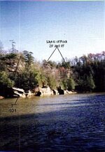
I am amazed by all the stories on the Swift mines, but I like to keep it simple. I have been looking since my teens and I am quite old now. I know many things about this and have things know one here has ever mentioned. My only thing is why has know one ever said anything about 101?

Oh and please, share what you know! I think if all of us on here did more of that we would all benefit in our search and/or research. Maybe even finally get this mystery solved as fact or fiction. Fame and fortune is not for me, all I am seeking is the truth and history behind this story.
 

franklin

Gold Member
Jun 1, 2012
5,036
7,168
Detector(s) used
Garrett ADS-7X, Fisher Two Box M-Scope, Mother Lode Locator, Dowsing Model 20 Electroscope, White's TM808, White's TM900, Inground Scanners
Primary Interest:
All Treasure Hunting
Have you did any research or thinking about the Bluestone River. Swift I believe mentioned it a couple of times. Then on the Guest and Jefferson Map there is a "Remarkable Rock" shown. I believe this to be Pinnacle Rock near Bluewell, WVa. Daniel Boone lived not too far down this road near Pounding Mill and I believe he followed the Swift Party around trying to find the location of the Silver Mines. There is also a vein of silver in the Tazewell, Va. area as a man named Lefew counterfeited silver dollars in the area. That silver vein runs under the Blue Ridge Parkway just West of Lover's Leap on Rt. 58 and then runs through Ingles' Ferry where George Clark owned the lead and silver mines for a while and then on into eastern Kentucky. I am sure this is the vein that runs through the corners of Virginia, West Virginia and Kentucky. You asked others to share so there you go. Also Swift did own the land from Williamson West Virginia to the Levisa River including Pikeville, Ky. at the centered on 100000 acres or about 12 miles lone and 10 miles wide.
 

KY Hiker

Bronze Member
Oct 28, 2014
1,537
3,220
North Central Kentucky
Detector(s) used
Whites
Primary Interest:
All Treasure Hunting
Have you did any research or thinking about the Bluestone River. Swift I believe mentioned it a couple of times. Then on the Guest and Jefferson Map there is a "Remarkable Rock" shown. I believe this to be Pinnacle Rock near Bluewell, WVa. Daniel Boone lived not too far down this road near Pounding Mill and I believe he followed the Swift Party around trying to find the location of the Silver Mines. There is also a vein of silver in the Tazewell, Va. area as a man named Lefew counterfeited silver dollars in the area. That silver vein runs under the Blue Ridge Parkway just West of Lover's Leap on Rt. 58 and then runs through Ingles' Ferry where George Clark owned the lead and silver mines for a while and then on into eastern Kentucky. I am sure this is the vein that runs through the corners of Virginia, West Virginia and Kentucky. You asked others to share so there you go. Also Swift did own the land from Williamson West Virginia to the Levisa River including Pikeville, Ky. at the centered on 100000 acres or about 12 miles lone and 10 miles wide.

I don't recall a mention of that river, but of the 'remarkable rock'. Those that mention the 'remarkable rock' also speak of heading West and South West of the forks of the Sandy. So I think that would not track with the area you mention. Too far South, and East of Pine Mountain. That's not to say Silver isn't there! Just not the Silver Mine(s) of the legend.
 

boomer

Sr. Member
Jul 8, 2003
487
523
kentucky
Detector(s) used
army all terrain
101

there are 3 101's Jackson county on war fork, Elliott county on caney creek and Beattyville ky. on silver creek.
 

Attachments

  • 101 caney creek.jpg
    101 caney creek.jpg
    67.2 KB · Views: 192

Rebel - KGC

Gold Member
Jun 15, 2007
21,680
14,739
OK, "101"... COULD be phases of the MOON; 1st Quarter is "1" on the left, FULL MOON is the "0" & 3rd Quarter is "1" on the right. First "1" is WAXING Moon; FULL MOON indicates the "Treasure"; final "1" is WANING Moon. WAXING Moon indicates getting close to the "Treasure"; FULL MOON is where it ("Treasure") is at. WANING Moon is when you have gone TOO far & passed the "Treasure". NOW! FOURTH Quarter is the NEW MOON; start all over, again... heh!
 

boomer

Sr. Member
Jul 8, 2003
487
523
kentucky
Detector(s) used
army all terrain
there are 8 101's from Cumberland gap north. first has map of trail to follow, next 3 are land guides to sand gap, where the 101 is cut on its side _ 0_ .. with a crown over the side ways zero and 2 dots. had a problem with this one. good to have topo maps and aerial maps. we guessed that the people were Spanish because of the crown. we went up indian creek to McKee ky. that's where we lost the trail. we back tracked to sand gap and we spent almost a year removing moss and leaves from rocks. it took some time but a small crown and map were found. showing the creeks in Jackson county. I put the info on the stuff the map had on it, in post I did about 6 months ago. wind cave, turkey foot and silver mine hollow are shown on topo maps in the post. has for the 101 on caney creek in Elliott county. the photo was taken from the boat. notice the land goes up behind the rock. their is a cliff and at this spot there looks to be 2 monument rocks, they look to be lime stone with maybe a 10 to 15 foot spacing between the 2 arch's. has for the chalk under the 101, the cuts were vary faint. there are chisel dots, lines seem to show tunnel with a larger dot at the opening. at least I think it could be. anyway I never got to go back there because of messing up my leg. notice the deep cut line under the 101. also on other side of creek up next to cliff under leaves is a flat rock with 3 chop marks on it. now you see why, not being able to get out, i talk so much.
 

boomer

Sr. Member
Jul 8, 2003
487
523
kentucky
Detector(s) used
army all terrain
101 rock

go up caney to red sandstone cliff where indian mine is. go around sharp bend to your left the rock is about 75 yards on your left. this was shot at low pool. park boat here and go up behind rock. the hill is not to steep. you should see the 2 pillar like rocks at cliff line. there seems to be a small cycle impression in the back side next to the cliff. not sure if this is a bedding for a deer or loose soil sinking had to remove a lot leaves. look at photo showing 101 rock and the 2 uprights behind the 101 rock on next post, for some reason keeps telling me to refresh page and lose everything..
 

boomer

Sr. Member
Jul 8, 2003
487
523
kentucky
Detector(s) used
army all terrain
101 rock part 2

look at photo, notice I took this photo on north side of creek at shore edge. the indian mine is to my left about 100 yards on the 3rd level. behind me the cliff is about 25 yards its an easy rise to walk up. there is a path that runs along the cliff to the indian mine and on past to a small opening going straight down about 10 feet. just past is the lid gap with I cross on it, then heads to line of rocks. the path goes on west up caney past the boat landing. where i'm standing on my right about 60 feet is a massive rock fall that looks natural but I could see 2 trigger rocks. the rocks go up against the cliff and block the path. up next to the cliff you can small a faint odder of gun powder. just to the right of the rock fall on the edge of the shore is a small mine opening that goes down at an angle, the opening is half filled with water. you must use tanks at the mine. diving down in front of the mine is a lot of rock or slag. but where is the furnace at? I found a some small pieces of burnt rock in front of the indian mine unless the rest is in water. their is a lot of rock below, but nothing that was used for a furnace.
 

Attachments

  • 101 pillers or rock behind.jpg
    101 pillers or rock behind.jpg
    18.8 KB · Views: 172

KY Hiker

Bronze Member
Oct 28, 2014
1,537
3,220
North Central Kentucky
Detector(s) used
Whites
Primary Interest:
All Treasure Hunting
Boomer what is your interpretation or opinion of the 101 markings. Other than the obvious masonic symbolism. Do you think they flag mine entrances from the waters edge, and if so who do you think made them?
If there are 8 of these markings within the state I tend to doubt that they were done by Swift simply because the legend mentions 2 or sometimes 3 mine locations. I think we can rule the Indians out as well! That leaves Spanish or French in the modern era, what about the Welsh are they too 'new' to be of their making them?
 

franklin

Gold Member
Jun 1, 2012
5,036
7,168
Detector(s) used
Garrett ADS-7X, Fisher Two Box M-Scope, Mother Lode Locator, Dowsing Model 20 Electroscope, White's TM808, White's TM900, Inground Scanners
Primary Interest:
All Treasure Hunting
Boomer what is your interpretation or opinion of the 101 markings. Other than the obvious masonic symbolism. Do you think they flag mine entrances from the waters edge, and if so who do you think made them?
If there are 8 of these markings within the state I tend to doubt that they were done by Swift simply because the legend mentions 2 or sometimes 3 mine locations. I think we can rule the Indians out as well! That leaves Spanish or French in the modern era, what about the Welsh are they too 'new' to be of their making them?

Spanish and French were not of the modern era. The French and Spanish had been mining gold and silver in what is now Kentucky for a hundred years or more before Jonathan Swift's mining in 1760's.
 

KY Hiker

Bronze Member
Oct 28, 2014
1,537
3,220
North Central Kentucky
Detector(s) used
Whites
Primary Interest:
All Treasure Hunting
Spanish and French were not of the modern era. The French and Spanish had been mining gold and silver in what is now Kentucky for a hundred years or more before Jonathan Swift's mining in 1760's.

In comparison to the Welch getting here in either the mid 7th century (Alan Wilson's estimation) or the 12th century (Prince Madoc tradition) the French and Spanish are of the more modern (firearms development) era.
 

Top Member Reactions

Users who are viewing this thread

Top