Curtis
Hero Member
Hi All,
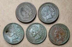
Been doing a preliminary comparison of the Swift description's as we know them(Henson and others) and the Chief Joseph Waybill. I had always kind of scoffed at the idea. Now I am learning more and more that they maybe related. As I mentioned in previous posts the waybill mines could be the "lesser" mines or lower mines Swift talks about. Here are a few pics of the area. above the line of rocks on the way bill.
 In the mine under the big rock house.
 standing on the line of rocks.
 in the mine.
 monument rocks ?
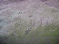
 turkey tracks.
Been doing a preliminary comparison of the Swift description's as we know them(Henson and others) and the Chief Joseph Waybill. I had always kind of scoffed at the idea. Now I am learning more and more that they maybe related. As I mentioned in previous posts the waybill mines could be the "lesser" mines or lower mines Swift talks about. Here are a few pics of the area.
above the line of rocks on the way bill.
In the mine under the big rock house.
standing on the line of rocks.
in the mine.
monument rocks ?
turkey tracks.