did swift have 3 groups of mines

rgb1

Sr. Member
Nov 24, 2013
295
769
s.w. Ohio
Detector(s) used
2 whites 1 garett
Primary Interest:
All Treasure Hunting
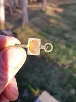
i believe swift had 3 groups of mines it seems he did not give many discriptions for his upper minesthe only thing i have found is basicly for the lower or west mines he did make reference to the head waters of sandy going up the levisa fork yet no discriptionsof area he went to i found mines near one of the forks within 4or 5 miles i also found a table top he discribes this is my avatar it is several miles south of the mines also 5od 10 miles below this i found a french mine on a creek that runs in an easterly direction and flowes into a larger stream going westerly i was told that at one time there was 2 smelters in a bottom a quarter mile away which was removed for farming it seems to me mabey these could be the upper mines or maybe not the surounding area does not fit his discriptions so either these are not his or ???. give me an idea . rgb1
 

KY Hiker

Bronze Member
Oct 28, 2014
1,537
3,220
North Central Kentucky
Detector(s) used
Whites
Primary Interest:
All Treasure Hunting
Thanks for the mail rgb1!
Perhaps nothing will absolutely fit the descriptions because the original version of the journal is either lost or tucked away in someone's library? I say this because of all the various versions of the journal that are out there. If you look at any of the versions from a literary standpoint, they all seem to be written in the past tense. A true journal would be written more like a diary.
For example,' June 12 in the year of our lord 1763 we left Cassles' woods for the mines. June 29 we arrived at the mines with no troubles by way of the Big Sandy.' This reads more like a diary or journal than what you typically find in Swift Journals.

Many of the existing journals have bits of information that are from the original in my opinion. Maybe its the landmarks, maybe its the timeline...but I am thinking they have been altered and added to mislead others. Greed could cause one to do very selfish things. Consider someone who has searched for a long time with nothing to show for it, So they alter the journal (West become North for example) they have and make copies and sell them for cash...? When I sit and reflect about the timeline of this legend and those that have searched for it. I can't help but wonder how many hundreds of people have searched since the late 1700s. How many hands the journals have passed through.
I think if you find a landmark that you should compare it to the journal, but not dismiss it if it doesn't match. See if that landmark takes you to another one. Another thing is to compare the journals to each other. Maybe by looking at them side by side and seeing what is in common among them, one could tell what is original and what was added later. By doing this and by using the travel time in days of the journey one could deduce where the mines should be, or at least where its too far or too close.
 

Last edited:

KY Hiker

Bronze Member
Oct 28, 2014
1,537
3,220
North Central Kentucky
Detector(s) used
Whites
Primary Interest:
All Treasure Hunting
Some journals say upper and lower mines, some make mention of middle mines. I defer back to Rebecca Timmins and the version she was going by. Probably the oldest version to my knowledge and most of which she had published in the Hazel Green newspaper. Her thoughts were two mines or that there was 2 openings, one on the ridge top the other along the cliff line and that they may be connected. Its split into two articles a week apart 'Written by one who knows'.

Links to articles in original post...
http://www.treasurenet.com/forums/l.../529060-written-one-who-knows-oct-1894-a.html
 

Last edited:

franklin

Gold Member
Jun 1, 2012
5,036
7,168
Detector(s) used
Garrett ADS-7X, Fisher Two Box M-Scope, Mother Lode Locator, Dowsing Model 20 Electroscope, White's TM808, White's TM900, Inground Scanners
Primary Interest:
All Treasure Hunting
The lower mines are the mines that Swift's men went along Pine Mountain to get to, which most likely are the mines on Elkhorn Creek. The richer or Upper Mines most likely is NE of Lexington on the headwaters of the Little Sandy River or branches of the western side of the Big Sandy since the maps say the creeks flowed to the NE.
 

KY Hiker

Bronze Member
Oct 28, 2014
1,537
3,220
North Central Kentucky
Detector(s) used
Whites
Primary Interest:
All Treasure Hunting
Thanks for the mail rgb1!
Perhaps nothing will absolutely fit the descriptions because the original version of the journal is either lost or tucked away in someone's library? I say this because of all the various versions of the journal that are out there. If you look at any of the versions from a literary standpoint, they all seem to be written in the past tense. A true journal would be written more like a diary.
For example,' June 12 in the year of our lord 1763 we left Cassles' woods for the mines. June 29 we arrived at the mines with no troubles by way of the Big Sandy.' This reads more like a diary or journal than what you typically find in Swift Journals.

Many of the existing journals have bits of information that are from the original in my opinion. Maybe its the landmarks, maybe its the timeline...but I am thinking they have been altered and added to mislead others. Greed could cause one to do very selfish things. Consider someone who has searched for a long time with nothing to show for it, So they alter the journal (West become North for example) they have and make copies and sell them for cash...? When I sit and reflect about the timeline of this legend and those that have searched for it. I can't help but wonder how many hundreds of people have searched since the late 1700s. How many hands the journals have passed through.
I think if you find a landmark that you should compare it to the journal, but not dismiss it if it doesn't match. See if that landmark takes you to another one. Another thing is to compare the journals to each other. Maybe by looking at them side by side and seeing what is in common among them, one could tell what is original and what was added later. By doing this and by using the travel time in days of the journey one could deduce where the mines should be, or at least where its too far or too close.

Take into consideration the Filson land title stating 60-70 miles NE of Martin's cabin along with Swift said a group went SW along the great ridge (Pine Mt). Pigeon Water Cave is in that area.... you could almost shade in an area by using these along with the days traveled and referencing roughly the longitude and latitude.
Walking with mules or horses a group could do 15-20 miles a day maybe a little more on level ground and longer days. If those animals are loaded maybe only 10-12 miles a day. So do the math and look at a map as the crow flys from Alexandria VA (Washington DC) towards Castlewood, VA and draw an arc...
 

Last edited:

franklin

Gold Member
Jun 1, 2012
5,036
7,168
Detector(s) used
Garrett ADS-7X, Fisher Two Box M-Scope, Mother Lode Locator, Dowsing Model 20 Electroscope, White's TM808, White's TM900, Inground Scanners
Primary Interest:
All Treasure Hunting
Yes, but would not Pigeon Water Cave be considered the Lower Mines. If so where are the Upper Mines were Swift says they went a considerable distance West of the Forks of the Big Sandy. How many forks of the Big Sandy are there? At least five I think? Most likely the Fork at Louisa, Ky.
 

KY Hiker

Bronze Member
Oct 28, 2014
1,537
3,220
North Central Kentucky
Detector(s) used
Whites
Primary Interest:
All Treasure Hunting
I think after what was brought out of pigeon water cave by Mr. Gibson that it is actually part of the Shawnee Cave. It was a stash cave and not a mine itself. Although a mine could be near it on either side of the ridge. Swift probably used a different entrance than the Pigeon Water entrance, and Gibson happened upon part of the stash in kegs.
 

KY Hiker

Bronze Member
Oct 28, 2014
1,537
3,220
North Central Kentucky
Detector(s) used
Whites
Primary Interest:
All Treasure Hunting
Yes, but would not Pigeon Water Cave be considered the Lower Mines. If so where are the Upper Mines were Swift says they went a considerable distance West of the Forks of the Big Sandy. How many forks of the Big Sandy are there? At least five I think? Most likely the Fork at Louisa, Ky.

Yep, they would be lower if around Pigeon Water Cave. The terminology has always struck me wrong. 'Upper' could mean Northern or it could mean higher in elevation or it could mean upstream. Same with 'lower' ... but opposite of course. So what would 'middle' mean if there are middle mines???

I have even wondered if upper, middle and lower could be a reference to the KY. River's three forks? or the Red River's 3 forks?
 

Last edited:
OP
OP
rgb1

rgb1

Sr. Member
Nov 24, 2013
295
769
s.w. Ohio
Detector(s) used
2 whites 1 garett
Primary Interest:
All Treasure Hunting
thanks guys this kind of discussions is what helps everybody no idea is wrong each is a new avenue to pursue rgb1
 

KY Hiker

Bronze Member
Oct 28, 2014
1,537
3,220
North Central Kentucky
Detector(s) used
Whites
Primary Interest:
All Treasure Hunting
There is an entry in the journal that infers multiple mines... its goes something like '...we returned to the same place'. If there were only one mine that line would not be needed! Now was this saying the same mine, or the same group of mines? who knows? Later on in many versions it states '...we walled up the entrance with locust posts...' which makes one assume there is only one mine. Or was this just the mine Swift worked? And most state that '...we removed all evidence of our workings...' . That suggests the furnace was destroyed and any equipment buried or hauled out. Most versions I have read say that the furnace was in a rock house. If this were so, heavy soot would still be on the rock overhang. Using a rock house makes sense, you can keep the rain off the charcoal before burning and the inside/back wall would hold heat well and support the stones needed to build the furnace.
 

Rebel - KGC

Gold Member
Jun 15, 2007
21,680
14,739
"Pics" from Red River Gorge are AWESOME! Archways like bridges over Creeks, MANY trails... INTERESTING "Rock Formations"... WHEW!
 

KY Hiker

Bronze Member
Oct 28, 2014
1,537
3,220
North Central Kentucky
Detector(s) used
Whites
Primary Interest:
All Treasure Hunting
"Pics" from Red River Gorge are AWESOME! Archways like bridges over Creeks, MANY trails... INTERESTING "Rock Formations"... WHEW!

Its why I almost exclusively hike and camp in the gorge, its truely a gorgeous place to see and be. I can see why this was sacred country to the indians. When you want some eye candy search Red River Gorge pictures. Then search Kentucky arches. There are over 100 arches in and around the gorge.

here is a link to some wonderful arch pictures: http://redrivergorgearches.com/
 

Last edited:

Curtis

Hero Member
Sep 3, 2008
899
1,009
Cincinnati
Primary Interest:
All Treasure Hunting
I am thinking Swift had at least two main, but maybe more workings or mines, remember he said they left one mine because it wasn't as rich as the other, newer mine. I think the best mine is the one he describes putting the locust posts and large rock and burying. Once again the French are documented as being on Kinniconick Creek about the time of Swifts venture. There is also some reports of his being near the trace that went to Maysville(limestone?) before Boone. That is west of the Forks !
 

KY Hiker

Bronze Member
Oct 28, 2014
1,537
3,220
North Central Kentucky
Detector(s) used
Whites
Primary Interest:
All Treasure Hunting
I am thinking Swift had at least two main, but maybe more workings or mines, remember he said they left one mine because it wasn't as rich as the other, newer mine. I think the best mine is the one he describes putting the locust posts and large rock and burying. Once again the French are documented as being on Kinniconick Creek about the time of Swifts venture. There is also some reports of his being near the trace that went to Maysville(limestone?) before Boone. That is west of the Forks !

Didn't it also mention that the French were jealous of his production being better than theirs? I think one journals mentions where the French were in relation to Swift's ? Might be a way to deduce where he was if the French were on Kinni-creek. I know its a long winding creek...
 

KY Hiker

Bronze Member
Oct 28, 2014
1,537
3,220
North Central Kentucky
Detector(s) used
Whites
Primary Interest:
All Treasure Hunting
Its too bad we don't have more information from the late 1700s about the buffalo traces, eastern elk traces and Indian traces. I think it is almost certain that Swift and his party would have to use these traces beyond the 'gaps' except for the lessor creek beds that were shallow enough to walk. Think about the 'signs' they would have left for hostile Indians to use to track them. Rocky creek beds leave little to no hoof marks or broken ends of branches. Once in an area where they were working one or multiple mines, they would 'make' their own paths from mine to furnace and from furnace to char-pit where they would make their charcoal. Game trails would be important for them while doing their work as they would still have to feed themselves, also local salt licks would become important places to find game. These licks would still be present today and probably have to be less than a days walk from where they camped do to logistics. Their pack animals would need feed, the brush in a woodland would not support them for long, so field grasses would need to be nearby as well.
 

Last edited:

jim bridger

Tenderfoot
Feb 13, 2017
9
40
Primary Interest:
All Treasure Hunting
I can tell you from personal research that the mouth of Beaver Creek at present-day Allen, KY was the intersection of two major warpaths. The left trace up Levisa and probably up Russell Fork went to the Clinch through the Breaks (see Tony Scales' "History of the Breaks"), the same route Boone took down Levisa in late fall 1767. The right warpath went "To the Cherokee Territory," but not the way you'd think. Hint: Remember that Verhoeff said the buffalo traveled the ridge and mountaintops. She was correct to an extent! The Clinch trace had numerous salt licks and cane brakes to sustain the herds along the bottom lands, but when they migrated they took to the mountaintops. The Bowles Addition in modern Pikeville was once a large cane brake and would have supported hundreds of buffalo. We have found that the left trace took a more indirect route to "The Cherokee Territory." Strip mine excavations from the mid 1970s onward prove the existence of scores of Native American encampments on the mountaintops of Left Beaver Creek. Only one reason would put them there: The migration of the herds along the mountaintops. Verhoeff also documents a trace up Tug Fork and other lesser trails. The whole point of this rambling is that we shouldn't get hung up thinking that someone like Swift would have stayed with the rocky, muddy, overgrown creek bottoms and cane-thick river bottoms. In the words of my research partner, the buffalo traces along the eastern KY ridgelines were the superhighways of the day and provided enough space for men and pack animals to travel. Scalf in his "Kentucky's Last Frontier" documents Boone carvings on Floyd County mountaintops, but errs in how the woodsman would have reached that point from Pound, or more appropriately, Payne Gap. Boone didn't go down Elkhorn, down Shelby, up Long Fork or Indian Creek and through the gap into modern Floyd, but would have stayed with the buffalo traces and walked it in practically no time in comparison to the route through the valleys.
 

Last edited:

Top Member Reactions

Users who are viewing this thread

Latest Discussions

Top