is there a link somewhere in this thread, or did it get removed over time?
You are using an out of date browser. It may not display this or other websites correctly.
You should upgrade or use an alternative browser.
You should upgrade or use an alternative browser.
FREE MAPS 1867-1970 All states
- Thread starter Lookn4Seated
- Start date


Itsmy6
Jr. Member
Any update with the latest username and password?
B1u3Dr4g0n1
Banned
- Mar 14, 2010
- 693
- 143
- Detector(s) used
- Garrett ace 250 with Sniper & DD coil with a Sun Ray Probe ,BountyHunter 101/BountyHunter pinpointer Dredge/highbanker combo, Mini Trommel, Blue Bowl and other stuff I dont use very often..lol
- Primary Interest:
- All Treasure Hunting
*&^$%^@#(6789)*&^#$%@&pl*&#$@
Forgive me if this sounds stupid but I cant see a map at all just a bunch of symbols, or am I missing something... Im looking for a map for Northern Indiana.....Lake and Newton counties....any help at all would be great....THANKS
McKinney_5900
Bronze Member
- Jul 30, 2010
- 1,139
- 929
Ditto. No Link.
mical66
Hero Member
same,,, no link
menotomymaps
Sr. Member
I don't have anywhere near the number of Sanborn's maps, but I do have some on my site and there is no login or password.
See my signature.
See my signature.
travelafar
Tenderfoot
I'm not seeing the link!!! I want in!!
coinmaster
Jr. Member
- Feb 9, 2012
- 23
- 2
- Primary Interest:
- All Treasure Hunting
were is the site?
menotomymaps
Sr. Member
Sometimes your local library will have a free subscription to the Sanborn Maps through ProQuest (Digital Sanborn Maps -- Splash Page)
EagleDown
Bronze Member
- May 13, 2010
- 1,857
- 629
- Detector(s) used
- Whites MXT, Whites TDI
- Primary Interest:
- All Treasure Hunting
This figures!!
I've been trying to find 1964 street maps online for L.A.County, CA, off and on for years now. I got excited when I spotted this thread. What a disappointment!! The link is unusable.
*&^$%^@#(6789)*&^#$%@&pl*&#$@
I've been trying to find 1964 street maps online for L.A.County, CA, off and on for years now. I got excited when I spotted this thread. What a disappointment!! The link is unusable.
auferret
Sr. Member
- Sep 25, 2007
- 420
- 73
- Detector(s) used
-
White's MXT
Sunray DX-1
Falcon MD20
Garrett Seahunter Mark II
- Primary Interest:
- All Treasure Hunting
I've been trying to find 1964 street maps online for L.A.County, CA, off and on for years now. I got excited when I spotted this thread. What a disappointment!! The link is unusable.
Here is one from 1965. It might help to know what features you are looking for. 1965 Los Angeles | Los Angeles Rocks and Roads
EagleDown
Bronze Member
- May 13, 2010
- 1,857
- 629
- Detector(s) used
- Whites MXT, Whites TDI
- Primary Interest:
- All Treasure Hunting
Halito Brother, thanks for the reply!!Here is one from 1965. It might help to know what features you are looking for. 1965 Los Angeles | Los Angeles Rocks and Roads
I have been looking for a street/highway map for the area between San Fernando and Palmdale. (Both are North of Los Angeles City). I guess I still don't know enough internet biz to find one. (lol)
auferret
Sr. Member
- Sep 25, 2007
- 420
- 73
- Detector(s) used
-
White's MXT
Sunray DX-1
Falcon MD20
Garrett Seahunter Mark II
- Primary Interest:
- All Treasure Hunting
Maybe there is one in google images https://www.google.com/search?q=196...v&sa=X&ei=JbG1Uv-zAYrXkQfnlIHwCA&ved=0CC0QsAQ
auferret
Sr. Member
- Sep 25, 2007
- 420
- 73
- Detector(s) used
-
White's MXT
Sunray DX-1
Falcon MD20
Garrett Seahunter Mark II
- Primary Interest:
- All Treasure Hunting
Here are some Thomas Bros map pages from 1964 that show the area you are looking for I think.
Historic Thomas Brothers Maps (56k warning)
Historic Thomas Brothers Maps (56k warning)
Kevenater
Jr. Member
I want these maps of alabma....
KGCnewbieseeker
Sr. Member
if the link was to sanborn maps look for other thread here for links of good sites with recent PW's they are out there
EagleDown
Bronze Member
- May 13, 2010
- 1,857
- 629
- Detector(s) used
- Whites MXT, Whites TDI
- Primary Interest:
- All Treasure Hunting
Halito My Brother,Here are some Thomas Bros map pages from 1964 that show the area you are looking for I think.
Historic Thomas Brothers Maps (56k warning)
Thanks for the link!! Unfortunately, I still can't find what I'm looking for. The map below gives me my starting point out of LA, but I need one showing the San Fernando Rd. from this point, up to Palmdale. Actually, just before Palmdale.
One of the maps might include it, but at age 77, my eyes are not what they use to be. (Come to think of it, I'm not the man I use to wuz). (lol)
Crazy, because last year, out of frustration, I got a new 36" flat-screen T.V. and hooked it up as my monitor. Works great usually. Unfortunately, the maps he presents are a little blurry, so they are hard to read. (At least for me).
Anyway, thanks again!!
Eagle
Last edited:

auferret
Sr. Member
- Sep 25, 2007
- 420
- 73
- Detector(s) used
-
White's MXT
Sunray DX-1
Falcon MD20
Garrett Seahunter Mark II
- Primary Interest:
- All Treasure Hunting
Here's a 1932 topo map near there. http://www.lib.utexas.edu/maps/topo/california/txu-pclmaps-topo-ca-palmdale-1932.jpg
EagleDown
Bronze Member
- May 13, 2010
- 1,857
- 629
- Detector(s) used
- Whites MXT, Whites TDI
- Primary Interest:
- All Treasure Hunting
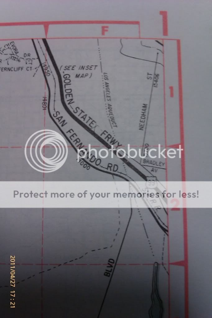
If the map showed a little more of the East, say about the amount of one of the grid squares, I believe it would be ideal. It has the area where I would turn off, but it stops before it gets to the area I would need for positive identification.Halito My Brother,
Thanks for the link!! Unfortunately, I still can't find what I'm looking for. The map below gives me my starting point out of LA, but I need one showing the San Fernando Rd. from this point, up to Palmdale. Actually, just before Palmdale.
One of the maps might include it, but at age 77, my eyes are not what they use to be. (Come to think of it, I'm not the man I use to wuz). (lol)
Crazy, because last year, out of frustration, I got a new 36" flat-screen T.V. and hooked it up as my monitor. Works great usually. Unfortunately, the maps he presents are a little blurry, so they are hard to read. (At least for me).
Anyway, thanks again!!
Eagle
But it does give me something to work for.
Thank you!!
Top Member Reactions
-
 2393
2393 -
 1139
1139 -
 1101
1101 -
 896
896 -
 826
826 -
 803
803 -
 765
765 -
 738
738 -
 619
619 -
 506
506 -
 487
487 -
 473
473 -
 467
467 -
 426
426 -
 400
400 -
 394
394 -
O
368
-
 365
365 -
 362
362 -
 361
361
Users who are viewing this thread
Total: 2 (members: 0, guests: 2)

