BosnMate
Gold Member
- Sep 10, 2010
- 6,916
- 8,441
- Detector(s) used
- Whites MXT, Whites DFX, Whites 6000 Di Pro
- Primary Interest:
- Other
Yesterday, Duke and I took a drive up the North Umpqua river. The river is named for the local Indian tribe that inhabited the area. One of the early fur trappers spelled the name phonetically, Oomp Qawk, which is neither here nor there. I drove up to Copeland Creek, which is also neither here nor there, but it's probably 60 miles east of where I live. The hiway follows the river, so there is little gain in elevation until you get to Copeland Creek, and if you drive on from where I turned around, the road starts climbing, and in the next thirty miles or so, it gains over 3000 feet at Diamond Lake, which is around 5100 feet, and which got 61 inches of snow the last storm, which was a couple of weeks ago. Copeland creek must be between 1600 and 2000 feet, and there was no snow to be seen. The river and streams are running full of snow melt. I live in the foothills of the Cascade Mountain range, which is also called the coast range, and these mountains aren't near as high as the Rockies or even the Sierra Nevada, which if you look at a map, we are kind of an extension of the Sierra.
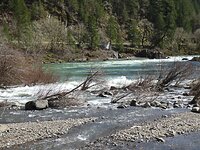
Rock creek is the white water flowing in from the left. The fly fishing deadline on the river can be seen where the river is flowing between the rocks, the white water at the right edge. The river passes by on the right, out of the picture.
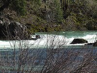
A close up of the deadline. Where I'm standing you can bait fish, east of the deadline for the rest of the river, it is fly fishing only, barbless hook, catch and release.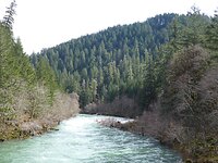
Looking up stream off of Mott Bridge. There is gold in the North Umpqua, and I think most of it came down Steamboat Creek, which is a sizeable tributary, that is a wild and scenic, native steel head and salmon spawning area, so there is no fishing or gold panning in Steamboat Creek. Steamboat creek flows in a few hundred yards behind where I'm taking this picture.
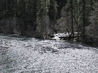
This is apple creek flowing into the river. Apple creek is east of Steamboat probably 20 miles. If you look close at the mouth of the creek, you can see the bridge that crosses. That's the north Umpqua trail, which is for hiking and horse riding only. I don't know about mountain bikes or motorized vehicles.
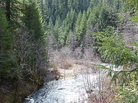
This is Copeland creek. The road up this creek is paved up to the bridge, so I drove up that far, and took this picture from the bridge. I've never tried to pan on Copeland, but there is a gold mine of sorts further up the road. I've been there years ago, there was a log cabin at the mine, but it has rotted away. I detected there back then and only found modern bullets. The mine was in the 30's, and I don't think much gold was there. I think they followed a quartz vein, but I don't think it amounted to much.
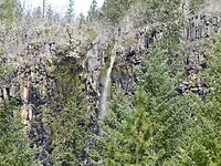
Heading back down Copeland creek, across the river you could see a snow melt water fall. That will dry up as soon as the snow upstream is gone. This country is full of high cliffs. Years ago, a fellow with my exact first and last name was deer hunting, fell off one of those cliffs and was killed. I sure did get a lot of hugs when everyone found out it wasn't me. There was a period of time I was reading a lot about my obituary.
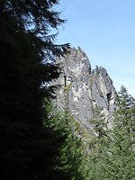
This is a view of Eagle Rock from the Copeland Creek road, heading back to the river.
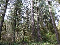
This is a view of the woods near one of the picnic areas. I let Duke out to run, but didn't get any pictures of him, he didn't do any running around up close. He didn't go into the river, but he did find a mud puddle to stand in and drink out of.
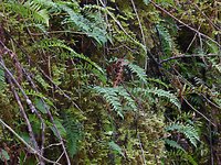
These ferns are growing out of the moss on a solid rock. And the last picture is moss on a limb. I'm showing this just in case anyone thinks it doesn't rain much in this area.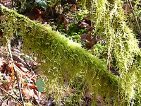

Rock creek is the white water flowing in from the left. The fly fishing deadline on the river can be seen where the river is flowing between the rocks, the white water at the right edge. The river passes by on the right, out of the picture.

A close up of the deadline. Where I'm standing you can bait fish, east of the deadline for the rest of the river, it is fly fishing only, barbless hook, catch and release.

Looking up stream off of Mott Bridge. There is gold in the North Umpqua, and I think most of it came down Steamboat Creek, which is a sizeable tributary, that is a wild and scenic, native steel head and salmon spawning area, so there is no fishing or gold panning in Steamboat Creek. Steamboat creek flows in a few hundred yards behind where I'm taking this picture.

This is apple creek flowing into the river. Apple creek is east of Steamboat probably 20 miles. If you look close at the mouth of the creek, you can see the bridge that crosses. That's the north Umpqua trail, which is for hiking and horse riding only. I don't know about mountain bikes or motorized vehicles.

This is Copeland creek. The road up this creek is paved up to the bridge, so I drove up that far, and took this picture from the bridge. I've never tried to pan on Copeland, but there is a gold mine of sorts further up the road. I've been there years ago, there was a log cabin at the mine, but it has rotted away. I detected there back then and only found modern bullets. The mine was in the 30's, and I don't think much gold was there. I think they followed a quartz vein, but I don't think it amounted to much.

Heading back down Copeland creek, across the river you could see a snow melt water fall. That will dry up as soon as the snow upstream is gone. This country is full of high cliffs. Years ago, a fellow with my exact first and last name was deer hunting, fell off one of those cliffs and was killed. I sure did get a lot of hugs when everyone found out it wasn't me. There was a period of time I was reading a lot about my obituary.

This is a view of Eagle Rock from the Copeland Creek road, heading back to the river.

This is a view of the woods near one of the picnic areas. I let Duke out to run, but didn't get any pictures of him, he didn't do any running around up close. He didn't go into the river, but he did find a mud puddle to stand in and drink out of.

These ferns are growing out of the moss on a solid rock. And the last picture is moss on a limb. I'm showing this just in case anyone thinks it doesn't rain much in this area.

Amazon Forum Fav 👍
Last edited:


