Flint from Black Mesa region of Oklahoma

docmann

Sr. Member
Jan 2, 2009
277
69
OKLAHOMA!
Detector(s) used
Rarely!
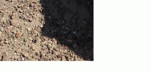
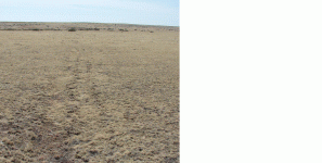
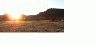
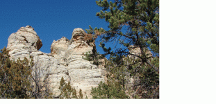
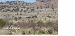
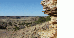
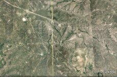
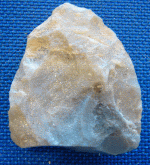
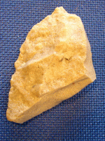
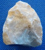
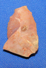
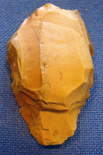
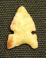
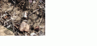
Spent a couple of days in the Black Mesa area of Oklahoma. I've never seen so much flint in two days as I saw there. Because we were mixing in some sightseeing with flint hunting, we didn't spend a lot of time at any one place. Consequently, I didn't make a big haul, but did come up with a few interesting pieces. This area is incredible, and if one can gain access, I highly recommend it.
docmann
 

Attachments

  • BlkMesaPt1.GIF
    BlkMesaPt1.GIF
    283.5 KB · Views: 707
  • DSC09931(1).GIF
    DSC09931(1).GIF
    173.4 KB · Views: 463
  • DSC09957(1).GIF
    DSC09957(1).GIF
    214.3 KB · Views: 506
  • DSC09907(1).GIF
    DSC09907(1).GIF
    252.7 KB · Views: 507
  • DSC09931(1).GIF
    DSC09931(1).GIF
    173.4 KB · Views: 446
  • DSC09957(1).GIF
    DSC09957(1).GIF
    214.3 KB · Views: 455
  • DSC09913(1).GIF
    DSC09913(1).GIF
    164.9 KB · Views: 398
  • DSC09907(1).GIF
    DSC09907(1).GIF
    252.7 KB · Views: 395
  • DSC09898(2).JPG
    DSC09898(2).JPG
    74.1 KB · Views: 421
  • BlkMesaPt1.GIF
    BlkMesaPt1.GIF
    283.5 KB · Views: 394
Upvote 0
OP
OP
docmann

docmann

Sr. Member
Jan 2, 2009
277
69
OKLAHOMA!
Detector(s) used
Rarely!
By-the-way, notice in the first photo the amount of scatter (surrounding flint). This was as I found it. This particular area was believed to be a lookout for sentinels. Theoretically, the sentinels, while spending hours watching for approaching trouble, would produce weapons and tools. As you can see, there is an incredible amount of diversity in the flint as demonstrated in the color, texture, and no-doubt origin. While it may be difficult to see, notice the photo below (especially in the shaded region). There are at least a hundred flint flakes in this 3' square area. This was taken below what appeared to be a natural stone seat on the top of one of the mesas there. Flint seemed to range from Alibates to Kay County (chert), to colors and forms I'd never seen before.
 

Attachments

  • Lithic scatter.GIF
    Lithic scatter.GIF
    330.4 KB · Views: 916
  • Lithic scatter.GIF
    Lithic scatter.GIF
    330.4 KB · Views: 430
  • Lithic scatter.GIF
    Lithic scatter.GIF
    330.4 KB · Views: 421
OP
OP
docmann

docmann

Sr. Member
Jan 2, 2009
277
69
OKLAHOMA!
Detector(s) used
Rarely!
Central MO,
Thanks for the comment. That is, I believe, what is known as Kay County chert. It's one of my favorite chunks of rock, and I brought back a couple of raw pieces just for its natural beauty. This piece is an unfinished point known as a blank or core.
docmann
 

jamey

Silver Member
Feb 3, 2007
3,069
1,924
Primary Interest:
All Treasure Hunting
yes.thank you docmann.i come across areas like that often,and love that point,ishi looks like he could of made that point.thanks jamey
 

Charmin

Bronze Member
Sep 3, 2007
2,284
281
Oklahoma
Detector(s) used
White's Prizm III and Ace 250
Primary Interest:
All Treasure Hunting
docmann said:
By-the-way, notice in the first photo the amount of scatter (surrounding flint). This was as I found it. This particular area was believed to be a lookout for sentinels. Theoretically, the sentinels, while spending hours watching for approaching trouble, would produce weapons and tools. As you can see, there is an incredible amount of diversity in the flint as demonstrated in the color, texture, and no-doubt origin. While it may be difficult to see, notice the photo below (especially in the shaded region). There are at least a hundred flint flakes in this 3' square area. This was taken below what appeared to be a natural stone seat on the top of one of the mesas there. Flint seemed to range from Alibates to Kay County (chert), to colors and forms I'd never seen before.
So, you have to look for "shape" instead of "color" with so much flint, huh? That looks like a great place and I had never heard of the "Black Mesa" region--thank you for posting this, docmann--very interesting!! regards, sandcreek4
 

Monty

Gold Member
Jan 26, 2005
10,746
166
Sand Springs, OK
Detector(s) used
ACE 250, Garrett
Primary Interest:
All Treasure Hunting
Black Messa is the highest point in the state above sea level. It use to be a trail marker for many of those heading west toward Oregon territory. There should be old wagon trails easily identified in the area. Monty
 

Tnmountains

Super Moderator
Staff member
Jan 27, 2009
18,716
11,709
South East Tennessee on Ga, Ala line
🥇 Banner finds
1
Detector(s) used
Tesoro Conquistador freq shift
Fisher F75
Garrett AT-Pro
Garet carrot
Neodymium magnets
5' Probe
Primary Interest:
All Treasure Hunting
Looks like you had a nice trip with added bonuses. The flint is beautiful. Thank you for sharing your finds.
TnMountains
 

OP
OP
docmann

docmann

Sr. Member
Jan 2, 2009
277
69
OKLAHOMA!
Detector(s) used
Rarely!
Monty,
You, sir, are a scholar as well as a gentleman. Indeed, the Santa Fe trail ran through that area. No doubt a lot of starry-eyed gold seekers traveled that route. Also no doubt a lot of scalps lifted by the Cheyenne, Kiowa, Comanche and occasional Sioux. Also, Monty, believe it or not, the track ruts are still visible. Just in case there are a few nonbelievers out there, I've added a photo of the ruts of the Santa Fe tracks taken just three days ago. These are looking southwest, away from the marker. If there is one thing I love more than huntin' flint, it's Oklahoma history, particularly Plains Indian history. Of course, I live right square in the middle of the Southern Cheyenne (and Arapaho) nation. Thanks for the comments, Monty. You seem to know your way around this old state.
Also, Tnmountains, Muddy Feet, Sand Creek, Jamey, RT Fact, Pinellas, and Cent MO, I appreciate your comments. Glad you enjoyed the photos.
docmann
 

Attachments

  • Santa Fe Trail.GIF
    Santa Fe Trail.GIF
    325 KB · Views: 487

sidmind

Full Member
Nov 10, 2008
198
8
As a fellow Okie, I too am very intersted in Oklahoma History, I loved the photos.

Very good post, I would love to make it that way sometime, I have a friend who lives in Beaver.

Post more photos if you have them!
 

OP
OP
docmann

docmann

Sr. Member
Jan 2, 2009
277
69
OKLAHOMA!
Detector(s) used
Rarely!
Sidmind,
I'd be happy to post a few more pictures if the rest of you don't mind. Funny thing, I hadn't been that far northwest in our state before. Driving out,I thought that when I got close to Beaver I'd be close. Not a chance. Heck, when I hit Boise City I was still 30 minutes away. However, that area does have its appeal. The problem is that the appealing parts are just a loooong way apart.
Thanks for the comment Sid,
docmann
 

OP
OP
docmann

docmann

Sr. Member
Jan 2, 2009
277
69
OKLAHOMA!
Detector(s) used
Rarely!
Sid,
If the moderator doesn't mind, I submit the following of the Black Mesa country, Oklahoma.
The first image is from the opening of what is known as "Mummy Cave", the second is of a herd of antelope that happened to stop by. The next is at the base of one of the many mesas. Next is myself and son at a local pictoglyph, and lastly is the sun setting over and ancient Indian campsite. OK, there is my slideshow, I'll keep my future postings related closely to artifacts.
Thanks for your indulgence.
docmann
 

Attachments

  • Mntn View.GIF
    Mntn View.GIF
    482.3 KB · Views: 571
  • Sundown.GIF
    Sundown.GIF
    161.8 KB · Views: 298
  • Pictoglyph6.GIF
    Pictoglyph6.GIF
    243.3 KB · Views: 346
  • MesaView.GIF
    MesaView.GIF
    508.5 KB · Views: 351
  • Antelope.GIF
    Antelope.GIF
    400 KB · Views: 356
  • Mntn View.GIF
    Mntn View.GIF
    482.3 KB · Views: 371

RGINN

Gold Member
Oct 16, 2007
8,612
10,763
Summit County, CO
🏆 Honorable Mentions:
1
Detector(s) used
White's DFX, White's Classic 1 Coinmaster, Nokta Pointer
Primary Interest:
All Treasure Hunting
Spectacular Doc. The Cimarron cutoff of the Sante Fe Trail ran through there. It saved a few miles off the main trail but at times was too dangerous to use. The dry climate has been conducive to retaining organic artifacts in the caves around there. We pass through the panhandle when we come back to Oklahoma, and I believe the speed limit should be raised to 125, as it's a long, long way between places.
 

OP
OP
docmann

docmann

Sr. Member
Jan 2, 2009
277
69
OKLAHOMA!
Detector(s) used
Rarely!
RGINN,
At 125 mph, it still takes too long!, but I'm with you on that one. Hey, one thing I noticed last night, the Santa Fe crossing is still very visible from satellite. Look below, this photo was probably taken within the last year or so. Look just below the "325" mark in the middle of the page. This is where the marker stands indicating the crossing point of the Santa Fe trail. Wow. Anybody can log onto Google Earth and bring this image up. I didn't realize that it would be that apparent from the air. You're right RGINN, the Kiowa, Comanche, and later the Cheyenne's came down heavy on the travelers when the war pipe was passed. As you know, this was usually a result of some knuckle head like Chivington or Evans who thought they would get "tough" with the Indians. It seems that our "leaders" of that day did more to cause our own people harm as the Cheyennes, especially Black Kettle, usually wanted peace and to be left alone. Oh well, I digress.
As always, I appreciate your comments, RGINN,
doc
 

Attachments

  • Santa Fe Crossing 325 in OK Panhandle.jpg
    Santa Fe Crossing 325 in OK Panhandle.jpg
    360.5 KB · Views: 323

Monty

Gold Member
Jan 26, 2005
10,746
166
Sand Springs, OK
Detector(s) used
ACE 250, Garrett
Primary Interest:
All Treasure Hunting
I've lived here all my life and have visited many historical sites and read about many more. The state has a lot of history, not all of it good, but a lot of historical events took place here. Many of them are not so well documented because it was a territory so long and much of the inhabitants were illiterate. Much of the earlyiest history was passed down by word of mouth. My grandfather was a small child in Indian territory, being born in the mid 1880s and he told me bits and pieces of what his grandparents and parents told him. Every now and then I remember a bit of history that I had long forgotten because it was told to me when I was a small child. In viewing your pictures, I had to laugh because you would be shocked by the number of people back east and up deep north who think the whole state looks like those pictures! Anyone from those areas that drives completely across the state are shocked to see the mountians and streams, lakes and trees that are found in the south and eastern part of the state. That use to be the aura of old Route 66 that came in from Joplin, Mo and ran completely across the state east to west. Western Oklahoma and parts of Kansas are called the High Plains and it is beautiful in its own right. Out in that same area you were in are huge cliffs with gypsum deposits that gleam white in the sun and can be seen for a hundred miles. And just when you think the land is perfectly flat you will find deep canyons and arroyos that have hidden streams and giant cottonwoods and Oaks all along and they teem with deer and other wildlife. Truly amazing. Monty
 

Top Member Reactions

Users who are viewing this thread

Latest Discussions

Top