need help determining who and age?

DigIron2

Silver Member
Jan 22, 2014
4,031
2,967
Virginia
Detector(s) used
Fisher f75/1270/1266x/Radio Shack Treasure tracker/
Primary Interest:
All Treasure Hunting
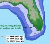
I was doing a little homework trying to figure out how old these artifacts might be and who might have made them.So far I think they might have been Siouan or Iroquoian because the location I live in is inland Va.Not sure if that is even correct,but aging them I am completely lost. I did see some woodland points that looked similar?I was reading something that was saying that age can be determined by the notching "corner notched","side notched"but I really cant tell what is what?Here is what I have found from the site so far. 005.JPG
 

Last edited:
Upvote 0

GatorBoy

Gold Member
May 28, 2012
14,716
6,149
Primary Interest:
All Treasure Hunting
Looks like I see a couple forms of Big Sandy bases there.. That's well before the time of tribes.. As old as early archaic.
 

redbeardrelics

Hero Member
Jan 3, 2014
891
1,019
Maryland's Eastern Shore
Detector(s) used
Garrett GTI 2500, (Ace 250 spare)
Primary Interest:
Other
Nice assemblage so far DigIron2 ! To me on the top row left you have a Lecroy and then St. Albans type B bifurcates, roughly 8000-8500 years old. The others look mostly like side notched or expanding stem forms which are generally considered a little older, to a couple thousand years newer than the bifurcates. The broken one on the bottom left looks like the earliest point to me, being a serrated and corner notched example, maybe a Kirk. The difficulty in knapping quartz material makes the notched point types difficult to type. I agree with GatorBoy that they are probably all early to mid/ mid-late archaic, and well before the time frame when the peoples were identified by tribal names, which is roughly only within the last 1000 years. Nice site you found, and I am anxious to see what else you end up finding there. HH
 

theviking

Bronze Member
Aug 29, 2009
1,395
919
Blue ridge mts, Virginia
Primary Interest:
Other
I agree, some early archaic, and middle archaic. The piece in the top left is a LeCroy, early archaic 8500-7700 BP. BP means before present, as in years old.. The two in the middle, and a few others look like Halifax points, middle archaic 6000- 3000 BP, or years old. These dates are approximate and different from site to site, but not much different. I believe these predate any known tribes. Someone please correct me if I am mistaken.
 

theviking

Bronze Member
Aug 29, 2009
1,395
919
Blue ridge mts, Virginia
Primary Interest:
Other
I couldn't tell if the piece in the lower left was a Kirk, or a Jacks Reef. If its its a Kirk Corner notch it's the oldest of the bunch. Projectilepoints.net puts it at 9000 years old.
 

Last edited:

JOHUNT

Sr. Member
Sep 24, 2009
462
106
Southern tier of New York
Detector(s) used
bounty hunter
Primary Interest:
All Treasure Hunting
You have a few that resemble Vestal points. They're named for the next town over from me(Vestal, NY). I'm on the NY / PA border which was Iroquois territory. You could also look into the Susquehannocks , the Delawares and the Tuscaroras. The Tuscaroras were originally located in NC , but eventually migrated to NY/PA and became the 6th nation of the Iroquois. Ironically enough, those Vestal points I mentioned are in Oneida territory and the Oneidas were the ones who sponsored the Tuscaroras's acceptance into the Iroquois Confederacy.

Sent from my SCH-S720C using Tapatalk 2
 

OP
OP
DigIron2

DigIron2

Silver Member
Jan 22, 2014
4,031
2,967
Virginia
Detector(s) used
Fisher f75/1270/1266x/Radio Shack Treasure tracker/
Primary Interest:
All Treasure Hunting
That is just amazing information!I am tickled to death,i had no idea they were that old.I was thinking maybe 2-3 thousand years old woodland period.I have allot to learn!Thank you guys and thanks for the hunting tips Viking.I am excited now.
 

SCrocks

Hero Member
May 11, 2013
953
1,551
Primary Interest:
All Treasure Hunting
Nice bunch of finds! Looks like ya have a bunch of quartz around your area to.
 

Apr 11, 2013
251
329
Wyoming Valley. PA
Detector(s) used
Whites V3i and Coinmaster GT
Primary Interest:
All Treasure Hunting
You have a few that resemble Vestal points. They're named for the next town over from me(Vestal, NY). I'm on the NY / PA border which was Iroquois territory. You could also look into the Susquehannocks , the Delawares and the Tuscaroras. The Tuscaroras were originally located in NC , but eventually migrated to NY/PA and became the 6th nation of the Iroquois. Ironically enough, those Vestal points I mentioned are in Oneida territory and the Oneidas were the ones who sponsored the Tuscaroras's acceptance into the Iroquois Confederacy.

These were the tribes that were here when the white man first showed up(history = his story) before that(pre-history = no his to write the story) there's no knowing who the actual tribes that inhabited this area were . The Iroquois and Susquehannocks migrated to our area around 800-1300 AD .
 

GatorBoy

Gold Member
May 28, 2012
14,716
6,149
Primary Interest:
All Treasure Hunting
Geological...(correction....thanks for pointing out my mistype Charl) ....Environmental conditions going further back into time didn't lend itself to a sedentary lifestyle where large numbers that would be considered tribes had a real opportunity to congregate and stay in one area either.... And least that's the belief based on the evidence
 

Last edited:

GatorBoy

Gold Member
May 28, 2012
14,716
6,149
Primary Interest:
All Treasure Hunting
??Geological conditions?? I wonder what the heck that means?

Mostly water level Charl that had a huge effect on climate and forestation patterns.. That in turn had an effect on hunting patterns and therefore settlement patterns..
 

Last edited:

Charl

Silver Member
Jan 19, 2012
3,054
4,682
Rhode Island
Primary Interest:
Relic Hunting
Enviornmental conditions, perhaps. Geological conditions, not......

Year round villages present in southern New England by 2500 BP. Tribal affiliation predates that point by quite a bit.......
 

GatorBoy

Gold Member
May 28, 2012
14,716
6,149
Primary Interest:
All Treasure Hunting
Good job pointing out my typ-o thanks
 

Charl

Silver Member
Jan 19, 2012
3,054
4,682
Rhode Island
Primary Interest:
Relic Hunting
Well, just a confusing typo, since geological conditions would imply things like volcanism and earthquakes, but not climate, like degree of rainfall over time. Groups in the SW did move around due to volcanoes because the ash improved the fertility of the soil, so, in that respect, geological conditions did play a role in the movement of people in that region of NA.

On the north shore of one of our salt water estuaries, only about 5 miles of shore, an estimated 20,000 natives lived during the Transitional Archaic some 3500 years ago, and earlier. These were seasonal village, summer on the coast, winter inland. The 2500 year old year round settlement discovered on Block Island is among the earliest known in southern New England. But anytime you have that many people living together or in proximity, you have political organization. Since clans and tribes were the basic form of social organization in native America, it's pretty likely tribes and clans go back a very long way. What a tribe living in an area at the time of contact might have called themselves in earlier ages, we really can never know. But we shouldn't think of tribal and clan structures as something that only appeared with the advent of agriculture, IMHO. Such organization probably has very deep roots in NA.
 

Charl

Silver Member
Jan 19, 2012
3,054
4,682
Rhode Island
Primary Interest:
Relic Hunting
One notable example of geological events playing a major role in the movement of people was the massive eruption of Sunset Crater in northern Arizona. Think it was the 11th century and thousands of Sinagua people moved away from the volcano to Walnut Canyon and Wupatki, both in Az., where the thinner layers of ash proved to actually improve agricultural yield for about 100 years before they had to move on once more.
 

Charl

Silver Member
Jan 19, 2012
3,054
4,682
Rhode Island
Primary Interest:
Relic Hunting
Mostly water level Charl that had a huge effect on climate and forestation patterns.. That in turn had an effect on hunting patterns and therefore settlement patterns..

The rising sea level accompanied the end of the Pleistocene and transition to the Holocene and Early Archaic times, took hundreds and thousand of years before Florida achieved it's present recognized shoreline. That said, sedentary settlements and political/social organization based on the tribal/clan model were easily possible since the rise of the sea was so very slow. Here in the Northeast, the shore at the height of the Wisconsin glacial advance was such that the shoreline extended 50 miles south of the offshore islands. Must be Paleo sites underwater from that time period. However, the bottom line is settlement patterns are developing in the Early Archaic onwards, and no reason, give the enormous time, in human terms, not geological time, for social/ political organization to develop in permanent or temporary settlements. Looks like Florida assumed it's present outline closer to 4000 years ago. Here in Rhode Island it took a similar period of thousand of years for the Narragansett River to become Narragansett Bay and tributary bays. But that did not effect the development of tribal/clan arrangements, because these processes, melting ice and rising sea level took part over a great stretch of time in human terms.


Florida Historical Contexts: The Paleoindian Period - Historical Reports - Florida Facts - Florida Division of Historical Resources

in the map from southern New England we see the terminal and recessional moraines, where the glacial conveyor belt of ice 1-2 miles high, reached a stasis where melting matched ice advance, creating moraine ridges of glacial debris, sand, gravel, boulders.
Once the Pleistocene transmitted to the Holocene, and thereby year round occupation rather then nomadic Paleo caribou hunters, larger bands and settlements conducive to tribal/clan development would exist, even in the midst of sea level rise taking thousands of years to accomplish. The sea leve changes in Florida would not have required movement quickly; the water was not advancing at a visible to the eye rate, and so settlements did not need to be abandoned almost as quickly as they were set up. Plenty of opportunity for tribal/clan development during the Holocene and right up to when a Florida assumed it's present shape. JMO......
 

Attachments

  • image.jpg
    image.jpg
    17.6 KB · Views: 105
  • image.jpg
    image.jpg
    47.8 KB · Views: 85
Last edited:

GatorBoy

Gold Member
May 28, 2012
14,716
6,149
Primary Interest:
All Treasure Hunting
All great. And just speaking about Florida it wasn't until water levels reached today's levels that the lagoons and estuaries that formed Great Salt Marsh environments for things like oysters and fishing plentiful enough to base your diet and therefore your lifestyle around it.
Before that time Florida was covered with vast grasslands and roaming herds of animals... My point was the way they filled their bellies determined how they lived their lives... I never thought they were trying to get out of the way of the water level or anything..sheesh..
Great information there.. I'm exiting this thread now
 

NC field hunter

Silver Member
Jul 29, 2012
4,227
1,623
I see a LeCroy in the upper left hand side. Nice find. I see quite a few bifurcated stems, for that matter. I also see a couple of Halifax style points. You have archaic and early woodland, perhaps. Nice group of finds.
 

Top Member Reactions

Users who are viewing this thread

Top