I think this is a pretty good sized shard...

Clay Slayer

Sr. Member
Jan 4, 2011
300
338
Cajun Country
Detector(s) used
Equinox 800,
Garrett Pro Pointer
Primary Interest:
Metal Detecting
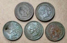
Most pottery shards I find are about an inch or so in size. I found this one this morning about 10ft out beyond the surf zone during a slack tide in about a foot of water...the water was calm and pretty clear. This is the largest pottery piece I have ever found and I really like the indented pattern. This is about the same area where I found my first point in my previous post. I think I'm going to really like searching this area.

Sorry, my photos seem to be uploading with the wrong orientation for some reason. When you select one, it displays correctly, go figure.

IMG_0760.JPG

IMG_0761.JPG
 

Upvote 0

WaterScoop

Bronze Member
Sep 12, 2017
2,181
3,710
SW Washington
Detector(s) used
Nox 800,
CTX 3030,
XP DEUS,
Excalibur II
Garrett AT Max,
Whites DFX,
Vanquish 540
Primary Interest:
All Treasure Hunting
Very nice find!
 

tomclark

Bronze Member
Dec 18, 2006
1,177
1,641
Tampa Bay, FL
Detector(s) used
ShadowX2, TEJON, Eyes, Pony Shovel
Primary Interest:
Other
If you are not seeing middens along the shoreline where you found the pottery it may be that there are inundated middens just offshore.... Florida is also like this. LOADED offshore. Good Luck!!! "With the onset of the early Holocene warming ca.10,000 years ago, the sea covered what is now theMississippi Sound. Between 9000-6000 years ago,the valleys of the Pascagoula River and otherstreams were drowned by the encroaching sea toform the series of bays along the Mississippi coastline. As the sea level stabilized at modem levels ca.5000-4000 years ago, lower stream grades and increased sediment deposits formed the extensive tidal marsh-estuary system (Otvos 1973; Lamb1983). Archaeological sites on the pre-stabilizationcoastline are now inundated by the Gulf of Mexico.Oyster harvest operations occasionally tong up artifacts, raising the possibility that some MississippiSound oyster reefs are drowned archaeological sites(Lewis 1982:10)."
 

OP
OP
Clay Slayer

Clay Slayer

Sr. Member
Jan 4, 2011
300
338
Cajun Country
Detector(s) used
Equinox 800,
Garrett Pro Pointer
Primary Interest:
Metal Detecting
If you are not seeing middens along the shoreline where you found the pottery it may be that there are inundated middens just offshore.... Florida is also like this. LOADED offshore. Good Luck!!! "With the onset of the early Holocene warming ca.10,000 years ago, the sea covered what is now theMississippi Sound. Between 9000-6000 years ago,the valleys of the Pascagoula River and other streams were drowned by the encroaching sea to form the series of bays along the Mississippi coastline. As the sea level stabilized at modem levels ca.5000-4000 years ago, lower stream grades and increased sediment deposits formed the extensive tidal marsh-estuary system (Otvos 1973; Lamb1983). Archaeological sites on the pre-stabilization coastline are now inundated by the Gulf of Mexico.Oyster harvest operations occasionally tong up artifacts, raising the possibility that some MississippiSound oyster reefs are drowned archaeological sites(Lewis 1982:10)."

Thanks for the info. This is a similar situation to the McFaddin Beach area just west of Sabine, Texas. Large re-deposits of artifacts, including many clovis points have been washing up from what is assumed multiple paleoindian sites offshore. There are known protruding salt domes fairly close offshore(now submerged of course) that were probably inhabited back then. Here is a link if anyone is interested in the read -

https://www.texasbeyondhistory.net/mcfaddin/index.html

I've walked that beach a few times for a few hours at at time when my work brought me close to that area in the years past, but unfortunately a 4-wheel drive was necessary to get to the isolated parts of the beach with the highest artifact density. And my company truck would not have made that possible.
 

Top Member Reactions

Users who are viewing this thread

Top