An Oak Island Reconstruction

gjb

Full Member
Apr 21, 2016
240
307
UK
Detector(s) used
Garrett Ace 300i
Garrett EuroAce
Primary Interest:
All Treasure Hunting
Hi

I can rarely get anyone to take this seriously, but I believe thereā€™s a distinct possibility that the ground markers on the island (the drilled rocks, the Welling and Mallon triangles, the ancient roadway, Nolanā€™s Cross, the Pirate Stones Triangle etc.) were positioned by survey according to a set plan. Furthermore, I believe that even given only the rough distances and relative positioning, and with the Roper Survey, itā€™s possible to reproduce this plan, because its purely geometrical in nature.

If this was done then there had to be a reason for the plan, and a reason the ground markers were placed where they are. Hereā€™s where people generally lose interest. Given this, itā€™s possible to marry the reconstructed ground plan with the instructions on five (maybe six) of the so-called Kidd treasure maps. Just note that the instructions could be genuine though the maps themselves be copies of copies or transcriptions and composites.

The reconstructed geometry highlights an extended rhombus in the area covered by the drilled rocks and the Money Pit, and the instructions on the maps identify a pattern of regularly spaced points upon this when interpreted according to a simple set of rules:

1. Using the ground features as starting points - for the most part the drilled rocks and the Money Pit (Tree) - apply the instructions (on the first two lines) so as to define three points of a triangle. Then locate the centre of this triangle.

2. From this centre, take an offset using the concluding directions (the last line) which is in the form a + b + ac. Thus ā€˜3 feet by 3 feet by four' = 18 feet.

The pattern produced is a ā€˜Wā€™ shape on the extended rhombus, but the significant point may be its centre.

MapPoints.jpg

Iā€™ve published three books on the subject, including the truth about the origins and the discovery of the maps (Anthony Howlettā€™s account is inaccurate, as Hubert Palmerā€™s letters to Harold T. Wilkins, in my possession, demonstrate). A short note on this can be found at The Kidd Maps: The Reality.

A summary of the reconstructed ground plan and interpretation of the maps from my book can be found at Oak Island Treasure Map Hypothesis.

My research suggests that there were seven sets of instructions (thus, seven maps) of which five (maybe six) have come to light. Iā€™ve dug up quite a bit of background on the origins of these maps, but the seventh map has eluded me.
 

Last edited:

Hitndahed

Hero Member
Dec 4, 2014
866
874
Deep in the woods in South Central Pa.
Detector(s) used
Fisher CZ7 Pro
Primary Interest:
All Treasure Hunting
Interesting theory gjb,,,
EVERYTHING ancient I have personally seen and read about does appear to have "mathematical" influences.
Fibonacci,,,golden ratios,,sacred numbers,,spirals,,frequencies,,it is ALL related.
It would not surprise me in the least to find a mathematical based layout of a treasure site,,, especially when you deeply look into the supposed depositor's.
 

n2mini

Hero Member
Jan 7, 2015
983
514
Triad NC
Primary Interest:
All Treasure Hunting
But haven't some of the markers been moved and or gone completely ( tree )..
 

OP
OP
G

gjb

Full Member
Apr 21, 2016
240
307
UK
Detector(s) used
Garrett Ace 300i
Garrett EuroAce
Primary Interest:
All Treasure Hunting
n2mini: The loss of the markers is disastrous for such a hypothesis. However, it would only require one of these to be present in order to reconstruct the plan on the ground. I contacted the owners in 1984, and a good few times after that, for permission to locate and document the Mallon Triangle, which seems to be the last remaining of those at the east of the island. No joy.

My hope was that in recreating the original survey other markers might be brought to light. The G Stone was a possibility, but everyone seems keen to remove anything of interest once theyā€™ve found it.
 

Nov 8, 2004
14,582
11,942
Alamos,Sonora,Mexico
Primary Interest:
All Treasure Hunting
GJB, an excellent article, which by co-incidence should lead to the uprising location of the "J":system. .I.E.. the suppoed access is not by the present shaft but an uprieing adjacent shaft.

This is an opinion on the location and reason no-one has ever found anything of value.

"They dug down, then horizontally a short distance,then ascenended towards the surface, stopping short, to be readily accessable with a shallow ecavation at X" point. Hence they could access the treasure regardless if someone had sprung the water trap or not. This also indicates the depth underground, it couldn't be much lower than the water trap level., a minor depth considering.
 

OP
OP
G

gjb

Full Member
Apr 21, 2016
240
307
UK
Detector(s) used
Garrett Ace 300i
Garrett EuroAce
Primary Interest:
All Treasure Hunting
They dug down, then horizontally a short distance, then ascended towards the surface, stopping short, to be readily accessible with a shallow excavation at X point. Hence they could access the treasure regardless if someone had sprung the water trap or not. This also indicates the depth underground, it couldn't be much lower than the water trap level, a minor depth considering.

My thoughts exactly, and so likely to be between 20 - 30 feet beneath the surface. With the mess that's been made of the Money Pit area you just have to hope that any treasure on the island was put somewhere else, and hopefully cached this way.
 

Robot

Bronze Member
Mar 10, 2014
2,015
1,711
Primary Interest:
Other
ā€œOak Islandā€ the ā€œStrangeā€, the ā€œBizarreā€, and ā€œMaybeā€ the "Truthā€!

The (Untold) Story of The Oak Island Money Pit

The Oak Island Money Pit was constructed by the ā€œpowers that beā€ that were and still are to this day, the secret force that controls the course of mankind on earth.
This organization is known as - The ā€œFreemasonsā€.

The story of The Oak Island Money Pit begins in the 1760ā€™s
It was conceived by a number of Britainā€™s high ranking naval officers, who were also Masonic degree members of the Freemasons and belonging to the Masonic ā€œPremier Grand Lodge of Englandā€.
These Masons were members of the Whig Party opposed to the next successor to the throne, the unstable King George III.
These members were:
Washington Shirley, 5th Earl Ferrers ā€” Vice Admiral - Grand Master of the Masonic Lodge ā€” Premier Grand Lodge of England
George Anson, Baron Anson ā€” Admiral of the Fleet
George Keppel, 3rd Earl of Albemarle - Commander-In-Chief
Augustus Keppel, 1st Viscount Keppel ā€” Rear Admiral ā€” Brother to George Keppel
William Keppel ā€” Lieutenant-General ā€” Brother to George Keppel
George Pocock ā€” Admiral ā€” Commander of the Invasion of Havana
and
Benjamin Franklin ā€” First Grand Master of Pennsylvania who met in 1760 with the Grand Master of England to discuss their plan.

The Masonā€™s plot originated after King George IIIā€™s destruction of the Whigā€™s political power with his redirection of this power to the Tory Party, and the Masonā€™s concern of the imminent invasion of England, during the Seven Yearsā€™ War, by the joint forces of France and Spain. Spain outlawed all forms of secret organizations, including the Freemasons.

The Masonā€™s plan was to redirect a fortune to the ā€œNew Worldā€ (North America), to enable the transfer of the Masonic organization, if and when these fears materialized.
Their plan entailed the capture of Havana in 1762.
Havanaā€™s Morro Castle was the Fort Knox of Spain, holding the South and Central Americaā€™s gold supply prior to its shipment to Spain.
The invasion of Havana was under the command of George Keppel, with Admiral George Pocock and Keppelā€™s two brothers Augustus and William Keppel, commanding the actual attack. They were successful with the capture of Havana and Fort Morro and its unprecedented amount of treasure. They also captured a number of the Spanish Fleet, which was needed to accomplish their plan. Accordingly, Admiral Pocock returned to England with the main English fleet carrying a portion of the treasure, while Augustus and William Keppel along with their crew and Masonic engineers all sworn to secrecy, manned the 8 Spanish Galleons and the 2 British Man of War. This treasure was diverted to a small island off the coast of New England and Nova Scotia now called Oak Island.

At Oak Island the treasure was buried based on the Masonic ā€œRoyal Archā€ (Enochā€™s Temple) consisting of nine arches going down nine levels by way of a main shaft (The Money Pit) which was dug down to the bedrock. From the ninth level another tunnel was constructed which ran back up to a point above the known water level, roughly 20 feet underground and at this point an enormous cavern was built to hold the treasure. The treasure was carted down the main shaft and placed up into this cavern. To conceal their plot they had the 8 Spanish ships dismantled with all the wooden parts not used in the construction of the shaft, tunnels and cavern burnt and all the metal parts (canons, anchors and bolts) were placed at the bottom of the main shaft. Flood tunnels were built out to the ocean to booby trap any treasure seekers attempts to follow down the main shaft. A large stone was placed at the air lock (8th level) as bait to activate the flooding. This stone had strange engravings on it to entice any unworthy treasure seekers to pause and take the bait (stone) away for deciphering, thus allowing time for the tunnels and main shaft to fill with water and be destroyed forever. The Masons knew exactly by their calculated mark above ground where the treasure cavern below ground was located, and could access it by digging down 20 feet.

Once the treasure was secured in the cavern and all the evidence was hidden from the island, it was documented that the Keppels sailed back to England with 2 ships and a small portion of the treasure. They claimed that the remainder of the fleet had sunk in a hurricane on route.

The Masons left several markers on the island to relocate the treasure.
1 large triangle or more precisely a crude Sextant
2 drilled holed stones
1 large stone cross
These combined markers along with the Star Map are used to cross triangulate and a set degree on the sextant point to the ā€œXā€ where the cavern is today located.

Is the treasure still in this cavern?

I believe it was removed in 1790's

One of the three original discoverers of the Money Pit was Daniel McGinnis, who stated he was drawn to the island when he noticed strange lights appearing on the island just prior to his discovery.
These lights were made by the Freemasons when they returned for their treasure.
This Masonic party was headed up by George Washington, President of the United States ā€” acting Grand Master of the Washington DC Masons.

The treasureā€™s vast fortune was used, as planned, to further the power of the Freemasons in their new world, with them becoming ā€œThe New World Orderā€.
 

OP
OP
G

gjb

Full Member
Apr 21, 2016
240
307
UK
Detector(s) used
Garrett Ace 300i
Garrett EuroAce
Primary Interest:
All Treasure Hunting
'Tally Ho' gjb, we are on the same train of thought.

As an add-on to this idea, I canā€™t see a huge treasure being carried down a deep shaft and along narrow tunnels on the backs of the depositors. My thought is that there may have been a specific deposit tunnel, perhaps with tracks (planks or rails).

If so, the entrance may have been in the swamp, which may have been excavated below sea level when dry (behind the causeway) and then flooded. Such a tunnel may even have led into the hill to the north (NNE) of the Money Pit.
 

n2mini

Hero Member
Jan 7, 2015
983
514
Triad NC
Primary Interest:
All Treasure Hunting
There are lots of people who think the swamp is man made, which would go along with this.. and some of those who think maybe the dirt that was dug up to create it was used to cover over the actual dig area. Helping them to not have to actually dig so deep but would now be deeper with this added dirt on top of it..
 

Nov 8, 2004
14,582
11,942
Alamos,Sonora,Mexico
Primary Interest:
All Treasure Hunting
morning GIB, :coffee2::coffee2: As far as people carrying the materiel along a tunnel system , then up to a deposit area which could be accessed easily later wih a simple excavation in an undisturbed area, Remember in those days they were accustomed to intensive manual labor. A separete tunnel system would negate the very idea.

This system would be very easy to constuct and locate from the surface, They had the skill and manpower available. The average education of their manpower wasn't sufficient for them to accurately locate where the acending area woud be for easy excavation.
 

Last edited:

Not Peralta

Bronze Member
Mar 23, 2013
2,167
3,061
Primary Interest:
All Treasure Hunting
Amigo's:coffee2:Just think of it like driving up to your favorite fast food drive through window and picking up your order:hello:NP:cat:
 

OP
OP
G

gjb

Full Member
Apr 21, 2016
240
307
UK
Detector(s) used
Garrett Ace 300i
Garrett EuroAce
Primary Interest:
All Treasure Hunting
Remember in those days they were accustomed to intensive manual labor. A separate tunnel system would negate the very idea.

:coffee2: Evening (over here). Problem is, we canā€™t really be sure what the idea was. For example, itā€™s possible to conceive of a system with two sets of tunnels, that is, a wet tunnel system sitting above a dry tunnel system - so you canā€™t get down to the dry system without knowing how to steer clear of the wet system, and avoid it flooding the hole you're digging.

Also, weā€™re only guessing that there was a single planned deposit, or excavation. If they werenā€™t afraid of hard work, what would prevent there having been two?

Such unease, and easy speculation, seems to result from our knowing too little about the underground workings, and knowing even less about the originatorā€™s intentions.
 

Nov 8, 2004
14,582
11,942
Alamos,Sonora,Mexico
Primary Interest:
All Treasure Hunting
G'day my friend. First and foremost they planned to retrieve it someday. This is obvious, other wise they would have simply tossed it overboard in the Atlanic, hence they had to make it easy when the time came, regardless as to whether the water trap had been sprung filling the origional shaft. This precludes using the origional shaft. so they must have planned a new excavatation directy above the ascending point/ shaft, thus by passing the water trap.
 

Last edited:

Robot

Bronze Member
Mar 10, 2014
2,015
1,711
Primary Interest:
Other
How about a "Sleigh Ride"!

As an add-on to this idea, I canā€™t see a huge treasure being carried down a deep shaft and along narrow tunnels on the backs of the depositors. My thought is that there may have been a specific deposit tunnel, perhaps with tracks (planks or rails).

If so, the entrance may have been in the swamp, which may have been excavated below sea level when dry (behind the causeway) and then flooded. Such a tunnel may even have led into the hill to the north (NNE) of the Money Pit.

wooden sled.gif

One was found on the Island

My Theory has the Cornish Miners dragging Wooden Sleighs attached to Chest Holster Belts from the Ninth Level of the Money Pit up a Spiral Tunnel to the Treasure Vault to the North West Island's Treasure Vault located 20 feet under the Ocean.
 

Last edited:

Robot

Bronze Member
Mar 10, 2014
2,015
1,711
Primary Interest:
Other
I for one am privileged that such an author and researcher as you has started this Thread on Treasure Net.

Your information has supplied me with more insight into this Mystery and curiosity for further research.

I trust you would be so kind to elaborate and answer a few questions I may have about your Theoriesā€¦ Who, What, Where, How and Why, the Oak Island Money Pit was constructed?
 

Robot

Bronze Member
Mar 10, 2014
2,015
1,711
Primary Interest:
Other
Who?

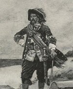
Although you do not state ā€œWhoā€ was the Master Mind and Benefactor behind the construction of the Oak Island Money Pitā€¦a large portion of your research points to ā€œCaptain William Kiddā€.

Captain William Kidd.jpg

Although many have presented the early romantic ideas that ā€œPiratesā€ were responsible for its construction, the lack of logic presented sways me that this was not so!

Your research may help correct some of these ā€œRoad Blocksā€.

It was believed that William Kidd was not an educated man and some say he ran away from home at an early age to work as a cabin boy on a navy ship.

Reports say that Captain Kidd was not a Navy appointed Captain, but rather one who had this title elected upon him.

Stories portray him to be not well respected as a Captain and unable to command the loyalty of his crew.

Although he lived in a New York Mansion and contributed to the construction of Trinity Church, his money was the product of his marriage to Sarah Bradley Cox Oort one of the richest women in New York.

To fund his Privateer expedition and purchase a small share, he was required to sell his present ship (Antigua) to purchase the Adventure Galley.

It was shown that Captain Kidd was not well politically connected to the English Court or Royal Navy and his main supporters were corrupt New York Governors, those who only desired the riches of his plunder and who were not willing to exert any powers of protection towards him.

His original handpicked crew were pressed into service by the Royal Navy forcing him to round up a crew of hardened criminals, some undoubtedly former pirates.

As a Privateer the booty plundered from Pirates would be his and his investors, but as a Pirate only 2 shares of the profits would be his and the rest dispersed among his crew.

Without returning to New York with a large plunder for his investors he knew he would realize his fate and their betrayal.

Building the extensive workings of Oak Island with his limited skills, knowledge and loyalty from his crew would have been very difficult.

Oak Island would be inaccessible during the winter months for any withdrawals; it is located in an enclosed bay, ruled by the French, the same Countries ships that Captain Kidd was pirating.

The Miā€™ kmaq Indians were loyal to the French and would have reported any unattended activity.

It was written that prior to his execution Captain William Kidd eluded to hidden treasure to be located in the Indies.
 

OP
OP
G

gjb

Full Member
Apr 21, 2016
240
307
UK
Detector(s) used
Garrett Ace 300i
Garrett EuroAce
Primary Interest:
All Treasure Hunting
I for one am privileged that such an author and researcher as you has started this Thread on Treasure Net.

Aw, shucks!

I tend to steer away from the ā€˜whoā€™ of Oak Island, both generically (e.g. pirates) and specifically (e.g. Captain Kidd) as I really donā€™t think weā€™ve got a lot to go on. Carbon dating and the dating of other archaeology is just so all over the place that it provides no leads. Everything else is pure guesswork. Fascinating but unhelpful.

However, I would challenge the suggestion that no pirate would have been prompted to undertake such a project, or would have had the skills or the resources to accomplish it, of which more later.

In terms of the ā€˜whenā€™ of Oak Island, Iā€™m tied to the implications of my reconstruction, in that this is predicated on the supposition that the originator used a magnetic compass in his underground workings to maintain a constant bearing. This would mean that the angle of magnetic variation might be identified and, potentially, then tied to specific periods of history.

The mechanism is imprecise, as it depends on the reporting of the variation on charts of the area over time (sparse). However, at a best guess, the variation I calculate would seem to point to either the mid 1600s or about 1740 (The War of Austrian Succession, or King Georgeā€™s War).

As to the 17th century, I looked into the possibility of a buccaneer deposit maybe along the lines of the communal bank (the ā€˜whyā€™). The individual I focused on is Colonel Jean LeVasseur who established Tortuga as the base of piracy against Spanish possessions from 1639 to 1653. He was a French military engineer with a highly competent following of like minded veterans, and reputedly amassed a fortune in booty (the ā€˜whatā€™).

The occupancy of Nova Scotia is obviously a major consideration, and there is only a short window of opportunity during the ā€˜civil warā€™ in Acadia at the time. However, in my book, I suggested c. 1652 long before the coin was discovered in the swamp, though I have difficulty believing the origins were this early.

My research also pointed to an interest in the maps (and therefore the island) in the 1740s (maybe a cache for commerce raiding) and the 1760s (which might suggest the Siege of Havana).

As to the ā€˜whereā€™, as you know, I do not subscribe to belief in the Money Pit as a prime deposit. I believe it may be worthwhile looking for signs of an original survey as outlined in my book, and might expect the trail to lead northeast of the Money Pit.

Captain Kidd only appears in my work because the instructions on the maps I use have long been associated with his name. Papers I came across in my research mention a Captain Kidd as being involved, but he could not have been the pirate of this name. I believe it was this confusion that caused the maps to become Captain Kidd Maps.

I've some sympathy with the suggestion that Freemasonry may have featured in the project, but because the originator(s) may have been Masons, not because the undertaking was essentially Masonic in nature or purpose. I just happen to see geometry written all over it. Freemasonry was present in military Lodges in Nova Scotia pre-1740.

If you need me to elaborate on any of these points, I shall do my best. And thanks for your interest.
 

Top Member Reactions

Users who are viewing this thread

Top