-Ki-
Hero Member
- Feb 12, 2009
- 642
- 574
- Detector(s) used
- MD & Handwand "CaveHunter"Hiker" SonyDigital SLR
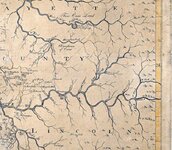
Pioneer map of Ky 1770's
This map shows Lick cr on the red river a creek supposedly named by John Swift, and also shows the warriors path that ran up through station camp creek and the wilderness road that ran up through blue licks on the map...
This map shows Lick cr on the red river a creek supposedly named by John Swift, and also shows the warriors path that ran up through station camp creek and the wilderness road that ran up through blue licks on the map...