Ancient Indian Sites

Old Rerntern

Jr. Member
May 19, 2008
68
31
Hegins, PA
Hi Guys,
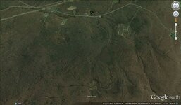
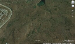
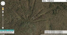
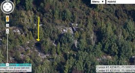
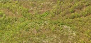
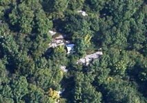
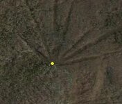
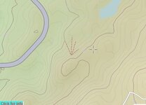
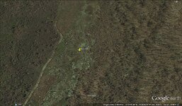
Been doing some GOOGLE EARTH flying and found these interesting land formations from a medium altitude. High altitude they are hard to spot and low you would pass right over them. They are on very high mount tops and appear to be some sort of ancient azimuth markings locating celestial and solar positions. Kind of like a calendar or Stonehenge. These are located in Pennsylvania. If anyone knows what these are or has information on them please post. :icon_scratch:

Thanks

site1-4.jpg sites 7-10.jpg
 

Todd from PA

Full Member
Dec 6, 2011
235
83
Southeast Pa
Primary Interest:
Other
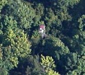
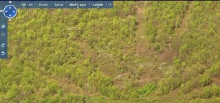
Found them. Slightly to the North of these is Edgerton Reservoir. Just to the East and North of the reservoir are more of these. If you use Bing "Bird's eye" view you can see what appears to be a lookout tower or hunting blind at the center of at least two of these formations.
 

OP
OP
Old Rerntern

Old Rerntern

Jr. Member
May 19, 2008
68
31
Hegins, PA
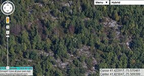
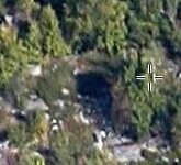
I seen the the small rectangular shapes and thought so too. But they do not appear to be towers. I'd say hunting blinds would be out. Who would cut these lines out for such long distances just for hunting? Way too much work. It appears that the lines are dug below the natural land surface about 20 feet across and travel for quite a distance. Some over a 1/4 mile and all in a straight line. I started to map them out and see if there are any references to celestial bodies or solstices. The one that intrigues me the most is at the southern mountain. If you zoom in right at the center point it appears the rocks are cut or cracked into squares with deep crevasses. From one angle it looks like there's a circular pool of water about 2 meters wide. I'm still researching these and would like to plan a hike later in the fall of this year after the leaves are mostly gone.
 

Todd from PA

Full Member
Dec 6, 2011
235
83
Southeast Pa
Primary Interest:
Other
... The one that intrigues me the most is at the southern mountain. If you zoom in right at the center point it appears the rocks are cut or cracked into squares with deep crevasses. From one angle it looks like there's a circular pool of water about 2 meters wide. I'm still researching these and would like to plan a hike later in the fall of this year after the leaves are mostly gone.

This one does not appear in aerial photos from 1969., see historicaerials.com. At least one is present up near the Edgerton Reservoir in 1969, but not nearly as many as current views show.
 

jeff of pa

Super Moderator
Staff member
Dec 19, 2003
85,775
59,572
🥇 Banner finds
1
🏆 Honorable Mentions:
1
Primary Interest:
All Treasure Hunting
these appear to be Roads, However they appear to be Ancient Roads.

Or Stretch Marks from Peaks
tongue3.gif


These are of Your second Picture

Untitled1.jpg

Closer

Untitled2.jpg

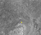
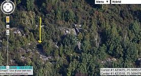
& WOW Is This a Cave ?

Untitled3.jpg

aaaaaaaa.jpg

Untitled4.jpg

Cordinates of possible Cave

6.jpg
 

Last edited:

jeff of pa

Super Moderator
Staff member
Dec 19, 2003
85,775
59,572
🥇 Banner finds
1
🏆 Honorable Mentions:
1
Primary Interest:
All Treasure Hunting
sites from the Center of 2 east of Edgerton Reservoir

11111.jpg

222222222.jpg
 

jeff of pa

Super Moderator
Staff member
Dec 19, 2003
85,775
59,572
🥇 Banner finds
1
🏆 Honorable Mentions:
1
Primary Interest:
All Treasure Hunting
By the way I checked 1939, 1959, 1960 & 1969 Aerials they do not appear on any in black & White.

My guess the Type & Quality of film these days has allot to do with it
 

Last edited:

jeff of pa

Super Moderator
Staff member
Dec 19, 2003
85,775
59,572
🥇 Banner finds
1
🏆 Honorable Mentions:
1
Primary Interest:
All Treasure Hunting
OK may 1939 & September 2012

Can't see in 39


View attachment 1058677 View attachment 1058678

222.jpg 111.jpg

Could these be related to the Crop Circle Phenomena ? :tongue3:

seriously though I can't rule out that these are Peaks & the lines are due to the full color Camera Lense Looking almost straight down on them
 

Last edited:
OP
OP
Old Rerntern

Old Rerntern

Jr. Member
May 19, 2008
68
31
Hegins, PA
This is getting more and more interesting. I noticed the "cave" in the beginning but thought at first it was a pool of water. But if you rotate 90 degrees it disappears. So most likely an opening. Also on the north face there appears to be more openings in the rock slices. When I zoom out to view the entire crown it looks almost like a fort or at least a good vantage point going 360 degrees. If you rotate the compass from 3800 feet eye altitude you can see what I'm talking about. The plateau measures a little less the a half mile north to south and a bit longer then a quarter mile east to west at it's widest point.

I still plan on hiking up there this fall. Probably late November, no leaves and snakes. If anyone else is interested in joining me please let me know. We can start getting a plan together. I would like to make this an all day expedition, doing some exploring, measuring and taking pictures. I will be doing more research prior to the trip and preparing maps and arial photos for reference.
 

OP
OP
Old Rerntern

Old Rerntern

Jr. Member
May 19, 2008
68
31
Hegins, PA
I noticed this unusual stone circle located halfway between the northern radius lines and southern radius lines. It appears in older arial photos too. Not sure what it is but is easily accessible.:icon_scratch:

Ancient Circle PA.jpg
 

jeff of pa

Super Moderator
Staff member
Dec 19, 2003
85,775
59,572
🥇 Banner finds
1
🏆 Honorable Mentions:
1
Primary Interest:
All Treasure Hunting
I noticed this unusual stone circle located halfway between the northern radius lines and southern radius lines. It appears in older arial photos too. Not sure what it is but is easily accessible.:icon_scratch:

View attachment 1060072

I don't know where that is located so I can't see if i can get closer then that.
But it looks interesting. I don't have the Health to join ya but Keep me Updated

Also my Eyes are seeing this as a Mountain side that may be pretty arduous at points making it a strange place for a pool of water

Untitled3.jpg

what appear to be Shadows below
& Stone Leading into it also suggests to me Cave
 

Last edited:

EYEROCK

Jr. Member
Aug 19, 2015
22
23
HARRISBURG PA
Detector(s) used
WHITES
Primary Interest:
All Treasure Hunting
Did you ever make your trip? If not I am interested, and willing to go with you?????
 

Top Member Reactions

Users who are viewing this thread

Top