PA Property owner info listed by county

kayden

Bronze Member
Apr 24, 2011
1,331
229
Pennsylvania
Detector(s) used
Ace250,AT Pro & Garrett Propointer!
Primary Interest:
All Treasure Hunting
OK now im gonna beg...Please put up Clearfield county (if its availible)....thanks in advance!
 

jeff of pa

Super Moderator
Staff member
Dec 19, 2003
85,821
59,616
🥇 Banner finds
1
🏆 Honorable Mentions:
1
Primary Interest:
All Treasure Hunting
kayden said:
OK now im gonna beg...Please put up Clearfield county (if its availible)....thanks in advance!


unfortunately it looks like Clearfield wants $$

DIGITAL GIS DATA...

At the present time we do have various digital GIS data available for purchase in ESRI Shapefile format. These shapefiles include, but are not limited to:
Street Centerlines
Private Roads (Driveways, gas well roads)
Addressable Structures (No resident information)
Outbuildings (Barns, garages, sheds, etc.)
Hydrography (Water features)
Railroads
Cemetery Locations
Municipal Boundaries
Parcel Data

Parcel Data maintained by the Clearfield County Assessment Office is also available for purchase in ESRI Shapefile format. Prices for parcel data are as follows:

Parcel Polygon and Parcel Id Number - $.02 per parcel
Parcel Polygon and all associated tax data - $.05 per parcel
A minimum charge of $20.00 applies to all orders.

At the present time there are nearly 70,000 parcels in Clearfield County. We do offer a reduced rate for bulk purchases of parcel data.

Entire County, Parcel Polygon and PIN Number - $1,200.00
Entire County, Parcel Polygon and all tax data - $3,000.00

http://www.gis.clearfieldco.org/digitaldata.htm
 

kayden

Bronze Member
Apr 24, 2011
1,331
229
Pennsylvania
Detector(s) used
Ace250,AT Pro & Garrett Propointer!
Primary Interest:
All Treasure Hunting
jeff of pa said:
kayden said:
OK now im gonna beg...Please put up Clearfield county (if its availible)....thanks in advance!


unfortunately it looks like Clearfield wants $$

DIGITAL GIS DATA...

At the present time we do have various digital GIS data available for purchase in ESRI Shapefile format. These shapefiles include, but are not limited to:
Street Centerlines
Private Roads (Driveways, gas well roads)
Addressable Structures (No resident information)
Outbuildings (Barns, garages, sheds, etc.)
Hydrography (Water features)
Railroads
Cemetery Locations
Municipal Boundaries
Parcel Data

Parcel Data maintained by the Clearfield County Assessment Office is also available for purchase in ESRI Shapefile format. Prices for parcel data are as follows:

Parcel Polygon and Parcel Id Number - $.02 per parcel
Parcel Polygon and all associated tax data - $.05 per parcel
A minimum charge of $20.00 applies to all orders.

At the present time there are nearly 70,000 parcels in Clearfield County. We do offer a reduced rate for bulk purchases of parcel data.

Entire County, Parcel Polygon and PIN Number - $1,200.00
Entire County, Parcel Polygon and all tax data - $3,000.00

http://www.gis.clearfieldco.org/digitaldata.htm
Thanks Jeff for the info, However thats outta my budget to find indian heads & wheaties!
 

jeff of pa

Super Moderator
Staff member
Dec 19, 2003
85,821
59,616
🥇 Banner finds
1
🏆 Honorable Mentions:
1
Primary Interest:
All Treasure Hunting
yea they appear to be soaking the real estate agencies
 

DigDugNY

Bronze Member
Aug 19, 2006
1,227
251
New York
Detector(s) used
Minelab Excalibur 2, Fisher F75, XP Deus
Primary Interest:
All Treasure Hunting
can you find susquehanna county?
 

Greatday05

Full Member
Mar 20, 2014
104
131
Pittsfield, PA
Detector(s) used
Minelab Etrac, Coiltech 15", Garrett Pro Pinpointer
Primary Interest:
All Treasure Hunting
Does anyone know of the gis services for Warren County? All I know is they have at the county courthouse. Oh, and are county courthouses off limits to search? Thanks in advance...
 

jeff of pa

Super Moderator
Staff member
Dec 19, 2003
85,821
59,616
🥇 Banner finds
1
🏆 Honorable Mentions:
1
Primary Interest:
All Treasure Hunting
Does anyone know of the gis services for Warren County? All I know is they have at the county courthouse. Oh, and are county courthouses off limits to search? Thanks in advance...

The Court houses Have info & must supply it if you go & request it.
(Freedom of information act) however some do charge. Especially if
you expect them to do more then point towards the files.
 

Last edited:

Headofmetal

Greenie
May 10, 2013
13
2
Detector(s) used
Fisher F5, Garrett Master Hunter ADS II
Primary Interest:
Metal Detecting
The page for Centre County wasn't working.
 

jeff of pa

Super Moderator
Staff member
Dec 19, 2003
85,821
59,616
🥇 Banner finds
1
🏆 Honorable Mentions:
1
Primary Interest:
All Treasure Hunting
Schuylkill County debuts new Map Viewer website


There is a new and improved way to look up properties in Schuylkill County.
The county Geographic Information Systems department officially launched its new Map Viewer on Wednesday. It will replace the Schuylkill Parcel Locator and is free to use at any time.
“The parcel locator was on the ground since 2003 and was built with what became legacy software and it became very necessary to upgrade the parcel locator and bring it up to speed with new technology,” Susan A. Smith, director of county planning and the Graphic Information Systems coordinator, said.
The new Map Viewer available at Loading ... provides continuous access to parcel, assessment and county zoning data with new or improved functions, additional information and a redesigned layout. It was designed by GeographIT, a GIS and information technology firm in Lacaster. The company has provided services for the county since 2010, Smith said.
“This was an offshoot of a product that they had made for another county, which we really liked, and we then molded it to fit the needs of the county,” Smith said.

County debuts new Map Viewer website - News - Republican Herald
 

jjalbers

Tenderfoot
May 18, 2015
7
4
Clearfield County, PA
Detector(s) used
Looking for my first MD
Primary Interest:
All Treasure Hunting
Anyone have any luck finding land owners in Jefferson County. I have tried this site: PASDA - Related Links but the link on that site sends me to Jefferson County, TN.(which is weird since it is a PA website) I thought I would try this thread first, but think I will have to try the court house. I've been searching online and found some cool mapping for mines, but not property owners.
 

jeff of pa

Super Moderator
Staff member
Dec 19, 2003
85,821
59,616
🥇 Banner finds
1
🏆 Honorable Mentions:
1
Primary Interest:
All Treasure Hunting
The Chester one is not that easy to use.

Try this

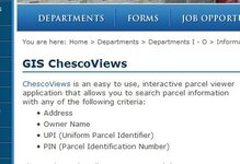
Chester County, PA - Official Website - GIS ChescoViews

then Click ChescoViews

Untitled.jpg

then

scroll down to I ACCEPT

it should give you the interactive map.

I adjusted it on the Main page too


Attachments

  • Untitled.jpg
    Untitled.jpg
    25.7 KB · Views: 182
Last edited:

jeff of pa

Super Moderator
Staff member
Dec 19, 2003
85,821
59,616
🥇 Banner finds
1
🏆 Honorable Mentions:
1
Primary Interest:
All Treasure Hunting
interactive Map for Chester County working for me.

3 Examples

Untitled.jpg

Untitled2.jpg


[h=1]Current Parcel Details[/h]

UPI:61-2-50.2MPLAN NUMBER:
PIN:6102 005002M0LUC:R-10 SINGLE FAMILY/CABIN
Street Number:952Street Direction:
Street Name:UNIONVILLE WAWASETStreet Type:RD
Situs Address:952 UNIONVILLE WAWASET RDMAILING ADDRESS:952 UNIONVILLE WAWASET RD
OWNER(S):BULKLEY ROBERT AKENNETT SQUARE PA
DEBORAH J
LOT LOCATION:SS OF UNIONVILLE WAWASET RZIP:19348
PROPERTY DESCRIPTION:1.1 AC & DWG LOT 39BOOK:6120
ACRES:PAGE:1743
SQUARE FEET:47916DATE OF RECORDATION:04-14-2004
LAST SALE PRICE:292000TOTAL ASSESSMENT:199500
ASSESSMENT DATE:12-19-2014Lot Assessment:55670
Municipality Number:61Property Assessment:143830

[SIZE=+2]Parcel History[/SIZE]


Owner NameDeed VolumeBookPageSale DateSale PriceLot LocationProp DescriptionTotal Assessment
BULKLEY ROBERT A &6120174304-14-2004292000SS OF RT 8421.1 AC & DWG LOT 39199500
SOLON ERIC G &4617167608-12-1999229900SS OF RT 8421.1 AC & DWG LOT 39199500
SIDELL MARK W &428790601-13-1998188500SS OF RT 8421.1 AC & DWG LOT 39199500
SPAID ARTHUR H &K5433301-01-197916500SS OF RT 8421.1 AC & DWG LOT 39199500
Records 1 to 4 of 4
 

Last edited:

rubicon2013

Jr. Member
Jun 20, 2013
24
5
OnXHunt. It's a app for hunters to help them find property information. You have to pay a yearly subscription but it's works well.
 

Retiredusne8

Greenie
Feb 1, 2017
16
11
Indiana County,PA.
Detector(s) used
Garrett AT Pro--
-Bounty Hunter Red Barron RB7
Primary Interest:
All Treasure Hunting
I have the xmaps of PA.for hunting and it list the land owners, the only question is on some land it say ACM III who is this or is the land in a land bank or a clean and green program?
 

Top Member Reactions

Users who are viewing this thread

Top