Gypsy Heart
Gold Member
In 2000 this town had approx. 540 households......I would be checking this area out ....expecially the old Mill and Tavern site onthe river bank if I lived near .........
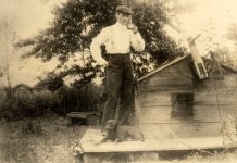
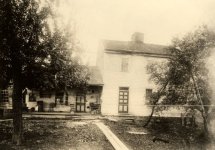
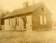
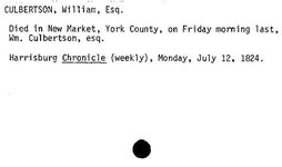
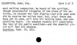
Andrew Culbertson was one of the first settlers to have success in the Duboistown area. He purchased several tracts of land beginning in 1773, including the parcel owned by Samuel Boone (cousin to Daniel), near the mouth of Mosquito Run. Culbertson is thought to have moved into the by crossing an Indian Trail over White Deer Mountain that is now know as Culbertson's Path. He built a sawmill on the mouth of the creek so after moving to the area and there he lived for several years. Culbertson was forced to flee the area during the American Revolutionary War when settlements throughout the Susquehanna valley were attacked by Loyalists and Native Americans allied with the British. After the Wyoming Valley battle and massacre in the summer of 1778 (near what is now Wilkes-Barre) and smaller local attacks, the "Big Runaway" occurred throughout the West Branch Susquehanna valley. Settlers fled feared and actual attacks by the British and their allies. Settlers abandoned their homes and fields, drove their livestock south, and towed their possessions on rafts on the river to Sunbury. Their abandoned property was burnt by the attackers. Some settlers soon returned, only to flee again in the summer of 1779 in the "Little RunawayCulbertson returned to the area and rebuilt his sawmill. He also built a gristmill, distillery, and a press that extracted nut and linseed oils. His gristmill was especially important to the development of the West Branch Susquehanna River Valley. It was easily accessible from canoe. Farmers could float their grain in their canoes or other watercraft right up to the mill. Other farmers from the surrounding valleys reached his mill via Culbertonson's Path. Culbertson saw another business opportunity with the farmers who were coming to his mill. He quickly built a tavern in which the weary farmers could enjoy a drink and get some food while they waited for their grain to be ground into flour. This tavern became a popular destination for the young people of the West Branch Valley. Today Culbertson's Mill and tavern are long gone and the area is a largely overgrown riverbank with an abandoned softball field, that is surrounded by a railroad, bridge, and woods.
Duboistown is located at 41°13′31″N, 77°2′6″W (41.225278, -77.034953).GR1 It is bordered by South Williamsport to the east, Armstrong Township to the south and west, and the West Branch Susquehanna River to the north (with Williamsport north of the river).


")