Hi all,
for all of you interested in shipwrecks I would like to point you towards a site promoted by the European Union, the MACHU (Managing Cultural Heritage Underwater)
http://www.machuproject.eu/
I also have online a video of a (very) low-cost operation in underwater archaeology (we had 500 euros to spend and managed to save 75) done on a wreck of the Arade 23, with a bunch of college students:
[video=vimeo;7404764]http://www.vimeo.com/7404764[/video]
The so called Arade 23 site was located in 2005 by the National Center for Underwater and Maritime Archaeology during a magnetometer and side-scan sonar survey of the Arade river estuary, one of the two Portuguese MACHU project elected areas. In 2006, survey dives on the site identified it as being a tumulus of ballast stones, from under which poked some fragments of wood with copper nails. This gives us a preliminary dating starting from the late 18th century onwards.
The overburden of sand and silt was removed with the aid of a water dredge and a test trench was dug. Unfortunately, not only the extreme ends of the vessel could not be located, but the keel was also absent as was any sign for the turn of the bilge. The trench that crossed the wreck section transversally was done by the manual removing of ballast rocks as well as by clearing any sand overburden intermingled with them.
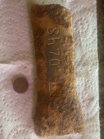
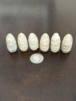
Few and scant artefacts were recovered: mainly some fragments of ceramic, some shards of glass and the bottom of a dark tinted glass bottle. A large folded sheet of copper hull sheathing studded with copper tacks was also discovered. The scantlings revealed by this test excavation were not uniform, with the timber assemblage beneath the ballast mound showing a wide collection of widths and timber orientation. Also, the wood used for some of the timbers was clearly different from the one used on other structural elements.
Considerable effort was spent trying to understand this exposed section. It was concluded that the construction that has been investigated is part of a board side, somewhere above the turn of the bilge. At the end of the project, 30 bags of sand were used to weight down two large pieces of Geotextile on top of the wreck. These physical measures should protect the site against looting, anchoring or other damaging activities. The canvas, the trench and both test pits were back-filled with sand from around the site. For that purpose, the end of the water dredge was used.
At this moment, due to the nature of the samples and the artefacts but also the limited intrusive work executed, the site can only be
dated roughly in the 18th century. The site has not been identified.
for all of you interested in shipwrecks I would like to point you towards a site promoted by the European Union, the MACHU (Managing Cultural Heritage Underwater)
http://www.machuproject.eu/
I also have online a video of a (very) low-cost operation in underwater archaeology (we had 500 euros to spend and managed to save 75) done on a wreck of the Arade 23, with a bunch of college students:
[video=vimeo;7404764]http://www.vimeo.com/7404764[/video]
The so called Arade 23 site was located in 2005 by the National Center for Underwater and Maritime Archaeology during a magnetometer and side-scan sonar survey of the Arade river estuary, one of the two Portuguese MACHU project elected areas. In 2006, survey dives on the site identified it as being a tumulus of ballast stones, from under which poked some fragments of wood with copper nails. This gives us a preliminary dating starting from the late 18th century onwards.
The overburden of sand and silt was removed with the aid of a water dredge and a test trench was dug. Unfortunately, not only the extreme ends of the vessel could not be located, but the keel was also absent as was any sign for the turn of the bilge. The trench that crossed the wreck section transversally was done by the manual removing of ballast rocks as well as by clearing any sand overburden intermingled with them.
Few and scant artefacts were recovered: mainly some fragments of ceramic, some shards of glass and the bottom of a dark tinted glass bottle. A large folded sheet of copper hull sheathing studded with copper tacks was also discovered. The scantlings revealed by this test excavation were not uniform, with the timber assemblage beneath the ballast mound showing a wide collection of widths and timber orientation. Also, the wood used for some of the timbers was clearly different from the one used on other structural elements.
Considerable effort was spent trying to understand this exposed section. It was concluded that the construction that has been investigated is part of a board side, somewhere above the turn of the bilge. At the end of the project, 30 bags of sand were used to weight down two large pieces of Geotextile on top of the wreck. These physical measures should protect the site against looting, anchoring or other damaging activities. The canvas, the trench and both test pits were back-filled with sand from around the site. For that purpose, the end of the water dredge was used.
At this moment, due to the nature of the samples and the artefacts but also the limited intrusive work executed, the site can only be
dated roughly in the 18th century. The site has not been identified.


 enjoyed the video