GOHO
Sr. Member
- Apr 13, 2008
- 299
- 35
Re: accounting for the 1715 fleet vessels by their own " offical records"
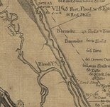
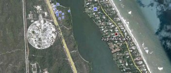
Bill, ths chart was made in 1776... If you look close at Ays Inlet it shows Leech Shoal in front on the Ays Inlet so it has to be in the same place as the old St Lucie Inlet.....
Bill, ths chart was made in 1776... If you look close at Ays Inlet it shows Leech Shoal in front on the Ays Inlet so it has to be in the same place as the old St Lucie Inlet.....


 ?
?
 Maybe I can go dig my files out and give the references for what I found back then. This has been a great thread!