You can see shipwrecks using Google Earth, but you won't see them in 100' of water...using standard GE sat imagery. You can import other files into GE to see shipwrecks though, such as LIDAR or multibeam sonar mosaics available on the internet. Shipwrecks pop out easily in those data sets... ;>)
You are using an out of date browser. It may not display this or other websites correctly.
You should upgrade or use an alternative browser.
You should upgrade or use an alternative browser.
Finding shallow water ( less than 100ft) shipwrecks with google earth, BS or not?
- Thread starter SADS 669
- Start date


OP
OP
SADS 669
Bronze Member
- Jan 20, 2013
- 2,453
- 3,734
- Detector(s) used
- Tesoro Sand Shark....Aqua pulse 1B....Equinox ll
- Primary Interest:
- Shipwrecks
- Thread starter
- #22
Barney, speak English....ha ha, sorry but you lost me at 100ft,
I will gladly send you the 4 mile by 4 mile location if you fancy some fun, it's in 70 to 80 ft......warm clear tropical water?
I will gladly send you the 4 mile by 4 mile location if you fancy some fun, it's in 70 to 80 ft......warm clear tropical water?
Barney, speak English....ha ha, sorry but you lost me at 100ft,
I will gladly send you the 4 mile by 4 mile location if you fancy some fun, it's in 70 to 80 ft......warm clear tropical water?
Satellite or any aerial imagery will be limited primarily due to issues with water clarity, but also time of day (angle of sun) and other factors. In any case, you would be lucky to see a significantly large wreck in clear water deeper than 30-40'. If it's a small ballast pile, less (like 20'), particularly if you have coral habitat nearby. You can sometimes spot wrecks due to the sand halo around it, such as when a wreck is in seagrass. But again, this is shallow water. You might get a few more feet if it was a large wreck with relief on a white sand bottom. Spotting wrecks in anything close to 100' of water using satellite imagery is unlikely.
Also consider most of the available imagery does not extend out that far, as it's of little interest to most users.
Salvor6
Silver Member
- Feb 5, 2005
- 3,755
- 2,169
- Detector(s) used
- Aquapulse, J.W. Fisher Proton 3, Pulse Star II, Detector Pro Headhunter, AK-47
- Primary Interest:
- Shipwrecks
Back in the '60s and '70s during the peak of the cold war the U.S. claimed we have spy satellites that can read the license plate of a car on the streets of Moscow. That was 40-50 years ago. What do you think we have now? LIDAR is a type of Laser/Radar that can penetrate water and see below the sand. It can pick out individual coins but can't read the dates! Synthetic aperature radar, Sir-C can do the same thing but these are not available to the public. It is top secret and available only to the CIA and Homeland Security. The National Geographic Society was granted use to search for the lost city of Ur in Saudi Arabia. They found it buried under sand.
goldnugget
Sr. Member
- Nov 3, 2005
- 435
- 241
- 🥇 Banner finds
- 1
- Detector(s) used
- Minelab XP-Pro- MinelabExcaliber -Fisher1260 Minelab E-Trac - Minelab Equinox 800
Ivan, I new you would Ring in on the Topic with some Good Information. Doug,Judy and I will be arriving at Ft Clich next week, I'm due in on Friday-goldnugget--Charlotte
Red_desert
Gold Member
- Feb 21, 2008
- 6,850
- 3,500
- Detector(s) used
- Garrett Ace 250/GTA 1,000; Fisher Gold Bug-2; Gemini-3; Unique Design L-Rods
- Primary Interest:
- All Treasure Hunting
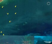
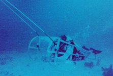
It can work if you get the right historical image for good water clarity, do a good job of enlarging/cropping the images, use a large enough flat screen on the computer. Then only certain wrecks will show up, even if searching an area full of shipwrecks.
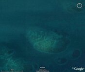
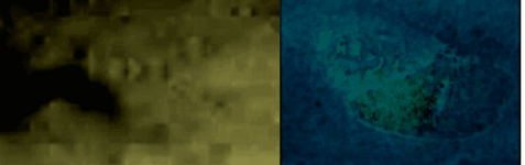
First photo has GE satellite image on right compared with on the left side, a wreck found by someone else in the shipwreck board here using underwater scan equipment.
First photo has GE satellite image on right compared with on the left side, a wreck found by someone else in the shipwreck board here using underwater scan equipment.
Attachments

Last edited:

- Jun 3, 2007
- 1,190
- 1,998
- Detector(s) used
- A sharp eye, an AquaPulse and a finely tuned shrimp fork.
- Primary Interest:
- Shipwrecks
My thoughts- worth just what they cost ya:
There are many well documented wrecks in the Keys in pretty clear, pretty shallow water. Look at your satellite images of known sites to learn what to look for.
It strikes me that an iron wreck in shallow water would absorb more solar heat than the surrounding bottom structure and might be seen using thermal imaging equipment for some period after sunset, until the stored heat is dissipated into the surrounding water.
I do not believe or disbelieve the stories of this or that that technology that can see into the ground or under the water or into the ground under the water, but the only guy that has come to me with that kind of claim couldn't come up with the money to pay me to drive my little boat 30 miles and blow a hole on his "exact coordinates" and recover a "Guaranteed 10 lbs of gold". Hard to imagine how he might have been able to afford such information, but not be able to put together a few hundred bucks to go out there and retrieve a couple hundred grand.
I am now putting my few remaining brain cells back into an idle condition for the night.
ropesfish -over and out
Bill Black
Blue Ocean Enterprises
Sebastian, FL
ARC
Gold Member
- Aug 19, 2014
- 37,265
- 131,665
- Detector(s) used
- JW 8X-ML X2-VP 585
- Primary Interest:
- All Treasure Hunting
I have been using GE since its release to look for potential dive points.
I would "pinpoint" anomalies and such...
Then after awhile I booted GE ... and parts of the Florida coastline were almost solid yellow... heh
I had so many points marked I could hardly see some areas anymore...
There are so many "things" in the water...
you can drive yourself nuts looking in some areas.
BUT...
I will say this...
At least ten + spots look REALLY good...
and make sense...
and no... I have not dove them... YET")
I would "pinpoint" anomalies and such...
Then after awhile I booted GE ... and parts of the Florida coastline were almost solid yellow... heh
I had so many points marked I could hardly see some areas anymore...
There are so many "things" in the water...
you can drive yourself nuts looking in some areas.
BUT...
I will say this...
At least ten + spots look REALLY good...
and make sense...
and no... I have not dove them... YET
treasurediver
Full Member
- Mar 13, 2005
- 176
- 263
Red_desert
Gold Member
- Feb 21, 2008
- 6,850
- 3,500
- Detector(s) used
- Garrett Ace 250/GTA 1,000; Fisher Gold Bug-2; Gemini-3; Unique Design L-Rods
- Primary Interest:
- All Treasure Hunting
How are you doing SADS 669 on the search? if you want to let me play around with the Google Earth some, I've got software to bring the map details in real close. A PM with a gps starting point of the general area, would be all I'd need....do my own looking around.Barney, speak English....ha ha, sorry but you lost me at 100ft,
I will gladly send you the 4 mile by 4 mile location if you fancy some fun, it's in 70 to 80 ft......warm clear tropical water?
Last edited:
OP
OP
SADS 669
Bronze Member
- Jan 20, 2013
- 2,453
- 3,734
- Detector(s) used
- Tesoro Sand Shark....Aqua pulse 1B....Equinox ll
- Primary Interest:
- Shipwrecks
- Thread starter
- #33
Red, send me a normal email address I'll send you a screen shot of the area, thanks you are a champion, I don't care what anyone says ha ha,......
You can bring the image into photoshop. There are several effects with the colors that can be used to enhance the image and perhaps notice something with different colors and/or thresholds.
In addition, there are several commercial satellite operations that have imaging available. Digital Globe Bahamas
In addition, there are several commercial satellite operations that have imaging available. Digital Globe Bahamas
Red_desert
Gold Member
- Feb 21, 2008
- 6,850
- 3,500
- Detector(s) used
- Garrett Ace 250/GTA 1,000; Fisher Gold Bug-2; Gemini-3; Unique Design L-Rods
- Primary Interest:
- All Treasure Hunting
Check your PMs.Red, send me a normal email address I'll send you a screen shot of the area, thanks you are a champion, I don't care what anyone says ha ha,......

ivan salis
Gold Member
- Feb 5, 2007
- 16,794
- 3,809
- 🏆 Honorable Mentions:
- 1
- Detector(s) used
- delta 4000 / ace 250 - used BH and many others too
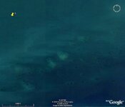
google earth if one scans areas with clear water and white sand bottoms ...can be used to find shallow water "near shore" wrecks .. the sunlight filtering thru the water will reflect on the white sand bottom revealing any wrecks by backlighting them ...I know this for a fact ...did it several times myself now the 100 foot bit might be a bit too deep but shallow "near shore" waters for sure --and since google EARTH seldom records just "empty ocean" but rather does land --you must scan the shoreline and check out the near by shallow water recorded by "accident" basically
Red_desert
Gold Member
- Feb 21, 2008
- 6,850
- 3,500
- Detector(s) used
- Garrett Ace 250/GTA 1,000; Fisher Gold Bug-2; Gemini-3; Unique Design L-Rods
- Primary Interest:
- All Treasure Hunting

old man
Bronze Member
Sads669, How's that hunt for the sub on the reef near you coming along?
Top Member Reactions
-
 2392
2392 -
 1139
1139 -
 1098
1098 -
 896
896 -
 826
826 -
 803
803 -
 766
766 -
 738
738 -
 617
617 -
 505
505 -
 493
493 -
 474
474 -
 468
468 -
 426
426 -
 400
400 -
 393
393 -
O
369
-
 365
365 -
 363
363 -
 362
362
Users who are viewing this thread
Total: 2 (members: 0, guests: 2)
