keegah
Jr. Member
- Mar 26, 2007
- 96
- 2
- Detector(s) used
- Minelab Sovereign GT/Fisher Impulse/eyes + hands
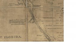
anybody know where to get a copy of the east coast map of DeBrahm/Romans? thanks all
")
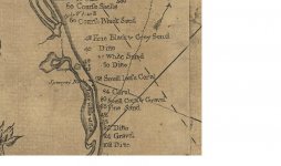
Peg Leg said:I can count about 14 X's on the map south of Sabastian Inlet.
If these were/are shipwrecks there are a good number of them under the beach sand and no longer in the ocean.
Very interesting.
Peg Leg