Find prospects w/o spending a cent with instructions

ncclaymaker

Sr. Member
Aug 26, 2011
370
315
Champlain, NY on the Canadian border.
Detector(s) used
Minelab 1000, A Motorized Power Glider Trike, 17 foot travel trailer behind my Jeep. 4" suction dredge/high banker.
Primary Interest:
Prospecting
Everywhere on the web, a lot of fine merchants are all selling the same old, same old. For those of us that prefer FREE... here's an add-on for Google Earth. Go to www.minecache.com and download their FREE app. Better than most of the books, maps, and "ghost" mine guides. This free app may not be a perfect substitute for hard copy, but it will aid you finding what most cannot.

For detailed data searches anywhere in the world, try the Mineral Resources Data System... our tax dollars at work (an oxymoron) at the link below.

http://tin.er.usgs.gov/mrds/

http://tin.er.usgs.gov/mrds/select.php
 

Hoser John

Gold Member
Mar 22, 2003
5,854
6,721
Redding,Calif.
Primary Interest:
All Treasure Hunting
Re: Find prospects w/o spending a cent

:icon_thumleft: Craigslist rocks the mining world for FREE and every state,every city and everywhere-John :icon_thumright:
 

CoastalSChunter

Jr. Member
Oct 5, 2011
41
0
Re: Find prospects w/o spending a cent

John,

please tell me about the Craigslist/mining please, where do i look or post for this?
 

B H Prospector

Hero Member
Feb 2, 2010
856
838
Black Hills, South Dakota
Primary Interest:
All Treasure Hunting
Re: Find prospects w/o spending a cent

Mine Cache is useless! I downloaded it and gave it a spin. The only thing it lists is old hardrock mines. If someone wanted to find some ground to make a claim they could get into trouble. Most people don't realize they need to contact the BLM to find out if an area is open to claim. Not one placer claim is shown. Most mines today are placer and without that info Mine Cache is useless. Good thing it is free.

B H Prospector
 

OP
OP
ncclaymaker

ncclaymaker

Sr. Member
Aug 26, 2011
370
315
Champlain, NY on the Canadian border.
Detector(s) used
Minelab 1000, A Motorized Power Glider Trike, 17 foot travel trailer behind my Jeep. 4" suction dredge/high banker.
Primary Interest:
Prospecting
Re: Find prospects w/o spending a cent

B H Prospector said:
Mine Cache is useless! I downloaded it and gave it a spin. The only thing it lists is old hardrock mines. If someone wanted to find some ground to make a claim they could get into trouble. Most people don't realize they need to contact the BLM to find out if an area is open to claim. Not one placer claim is shown. Most mines today are placer and without that info Mine Cache is useless. Good thing it is free.

B H Prospector

Reply to BH Prospector -
Apparently you haven't taken the time to really use this application, or at least understand it. Useless, not at all. Placer deposits are usually designated as S or Surface. Your assumption that most mines today are placer is great for those of us that know different.
 

homefires

Hero Member
May 20, 2008
526
15
deming n.m.
Detector(s) used
Any thing Available within 50ft
Re: Find prospects w/o spending a cent

It will tell you the claim owners name and contact.

What more do you want? A kitchen pass?

Yes the info is a bit old and you need a trip to the blm on new grounds anyways.

But it sure helps.

I've used it to contact owners asking for permission to hit the claims and have only been denied once out of 7 times.
 

Lanny in AB

Gold Member
Apr 2, 2003
5,654
6,344
Alberta
Detector(s) used
Various Minelabs(5000, 2100, X-Terra 705, Equinox 800, Gold Monster), Falcon MD20, Tesoro Sand Shark, Gold Bug Pro, Makro Gold Racer.
Primary Interest:
Prospecting
Re: Find prospects w/o spending a cent

Knowing where old hardrock is great if you want to detect throw-out piles. Permission is, of course, essential.

All the best,

Lanny
 

OP
OP
ncclaymaker

ncclaymaker

Sr. Member
Aug 26, 2011
370
315
Champlain, NY on the Canadian border.
Detector(s) used
Minelab 1000, A Motorized Power Glider Trike, 17 foot travel trailer behind my Jeep. 4" suction dredge/high banker.
Primary Interest:
Prospecting
Re: Find prospects w/o spending a cent

The MRDS site is not too user intuitive, so here are some instruction for use.

1. Go to this link. http://tin.er.usgs.gov/mrds/find-mrds.php
2. Leave site name blank.
3. Select a state, leave country at the default value of anywhere.
4. With commodity - select Gold from the pulldown list.
5. Leave Operation type and ID as is.
6. Click on the Search button.... wait for the database on the server to create a file with the relative data.

A new page will appear with Choose Format:. Change the Shapefile type to Google Earth.
1. Click on the Get Data button.
==== Wait ==== Like when did the government ever do something in an instant. If this was private enterprise, you wouldn't have had time to blink... except dialup users.
Usually I would select the filename.KML. Runs faster than the compressed file(kmz).
2. Click on mrds-selected state-Gold.kml
3. File download window appears.
4. Select the Save Button.
5. Select a folder where you know the file can be found later
6. Open Google Earth and from the File menu, select Open. Go to the folder and click on the KML file that you saved.

You will now have the whereabouts of almost every known gold mining activity in the state that you searched. It isn't free, we've all paid for the right of its' use. Happy hunting.

Best regards
 

B H Prospector

Hero Member
Feb 2, 2010
856
838
Black Hills, South Dakota
Primary Interest:
All Treasure Hunting
Hi ncclaymaker,
I have talked to the designer of minecache and he told me that I was right and there is a problem with the program. The information is not complete as it does not show current claims. I gave him mmc numbers for claims that have been active for the last four to 30 years and he couldn't find them using minecache. Someday it may be useful but right now it is inaccurate and incomlpete. In my area there are more placer claims than any other. 99% of all hardrock claims are closed here and the ones that are still operated are owned by large mining companies and it's not hard to find them. It's the small claims you need to know about so you're not claim jumping. The designer said he will be getting it updated. I hope he does cause I can see it being useful some day.

B H Prospector
 

nickmarch

Hero Member
May 30, 2009
561
50
Primary Interest:
All Treasure Hunting
Re: Find prospects w/o spending a cent

ncclaymaker said:
You will now have the whereabouts of almost every known gold mining activity in the state that you searched. It isn't free, we've all paid for the right of its' use. Happy hunting.

Best regards

ncclaymaker,

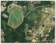
Many of the mines shown are not accurate. The files do not show the correct location of the mine. Look up Cotton Patch Mine in NC from the MRDS data. The location of the mine is off by about a mile. Look at the attached photo. Top left is Cotton Patch mines actual location ( the red balloon marked A). Bottom right corner is where the MRDS data shows Cotton Patch Mine. (The black X)
 

Attachments

  • cotton-patch.png
    cotton-patch.png
    259 KB · Views: 598
OP
OP
ncclaymaker

ncclaymaker

Sr. Member
Aug 26, 2011
370
315
Champlain, NY on the Canadian border.
Detector(s) used
Minelab 1000, A Motorized Power Glider Trike, 17 foot travel trailer behind my Jeep. 4" suction dredge/high banker.
Primary Interest:
Prospecting
First of all, you are 100% correct. The MRDS stated lat/long is 35.4276, -80.17479, instead of on Gurley Rd. But, everything considered, what do you expect from the US Government... if it is absolute accuracy, we all should know better. But, it is a tool that should get you some form of direction as to where to prospect or where the chances are slim to none. The data that some people sell is usually from the very same data sources, replete with the same errors. When checking any location, I usually verify with the latitude and longitude on Google Maps and Google Earth. I have seen minor differences in locations up to 1/4 mile or so.

Best regards
 

OP
OP
ncclaymaker

ncclaymaker

Sr. Member
Aug 26, 2011
370
315
Champlain, NY on the Canadian border.
Detector(s) used
Minelab 1000, A Motorized Power Glider Trike, 17 foot travel trailer behind my Jeep. 4" suction dredge/high banker.
Primary Interest:
Prospecting
B H Prospector,
I used to recommend minecache to everyone, when it was free. but his data is probably from the very source that we get access to for nothing. I would always check with the feds or local mining authorities what claims are active or not. Claims are always in flux, good today,gone tommorow. So is the data that we have... its valid now, not so, when we check back later.

I'm not saying that it's not a good tool, but it will only be as good as the accuracy and timeliness of the data.

Best regards
 

B H Prospector

Hero Member
Feb 2, 2010
856
838
Black Hills, South Dakota
Primary Interest:
All Treasure Hunting
ncclaymaker,
You are very correct about the data. Even when the BLM geolocator was easy to use they admitted it wasn't all that accurate. I too alway contact the feds when looking into a new area. That is always the best, however not error free either. I once filed on a 20 acre track they said was open to claim only to find out it was under claim and the blm had it registered in the wrong state. Turned out for the better as because I didn't try to cause trouble with the owner I got in on a clain that has an assesed value of $22 + million.

Good luck!

B H Prospector
 

greydigger

Bronze Member
Mar 28, 2008
1,360
33
Aloha, Orygun
Detector(s) used
wishing stick
Primary Interest:
Other
Went to LR2000 site for BLM and they no longer have mine data compatible with Google.
Someone didn't pay the baksheesh.
Or someone at BLM has a retirement plan.
Grey
 

calisdad

Bronze Member
Sep 8, 2010
1,237
442
Groveland, CA
Primary Interest:
All Treasure Hunting
The MRDS site is not too user intuitive, so here are some instruction for use.

1. Go to this link. Search the Mineral Resources Data System
2. Leave site name blank.
3. Select a state, leave country at the default value of anywhere.
4. With commodity - select Gold from the pulldown list.
5. Leave Operation type and ID as is.
6. Click on the Search button.... wait for the database on the server to create a file with the relative data.

A new page will appear with Choose Format:. Change the Shapefile type to Google Earth.
1. Click on the Get Data button.
==== Wait ==== Like when did the government ever do something in an instant. If this was private enterprise, you wouldn't have had time to blink... except dialup users.
Usually I would select the filename.KML. Runs faster than the compressed file(kmz).
2. Click on mrds-selected state-Gold.kml
3. File download window appears.
4. Select the Save Button.
5. Select a folder where you know the file can be found later
6. Open Google Earth and from the File menu, select Open. Go to the folder and click on the KML file that you saved.

You will now have the whereabouts of almost every known gold mining activity in the state that you searched. It isn't free, we've all paid for the right of its' use. Happy hunting.

Best regards

thanks for the turorial.
 

Top Member Reactions

Users who are viewing this thread

Top