signumops
Hero Member
- Feb 28, 2007
- 756
- 226
- Detector(s) used
- Garrett, Minelab, Aqua-Pulse
- Primary Interest:
- All Treasure Hunting
Hey cuzcosquirell and Anthony:
I moved the GIS thread here because this is the forum where folks are looking for methods and have actually got a GPS thread running along with some serious map researchers. This would be the place I think. For you folks who stumbled into this topic without warning, it started at the cob forum... wrong place to discuss mapping technology and the like. This forum is more like it.
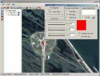
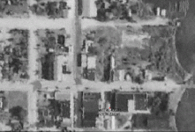
UTM is OK, and, in fact if you need to use the Dept. Environmental Protection dune setback monuments, you have to set your map datum with UTM. I don't know why the DEP used UTM, but, it is in the same zone across the state while state plane has three different systems in Florida. I got some magnetometer charts that were done back in the 60's in UTM and the only way I could translate them accurately was to find the coordinates of the setback monuments on the chart and lay the linework onto a photo that was registered in state plane.
As for Google Earth, you're right, you can convert using their options online, but, if you get data from property appraisers, it will be in state plane most of the time. You can go to www.labins.org and find it already converted for some stuff, but not everything. And if you get it directly from the property appraiser websites, it will not be in UTM, or geographic.
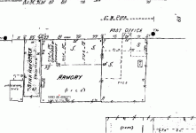
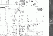
I have had luck getting un-colared maps and aerials from the St. Johns Water Management District in the past that were offered both in UTM and state plane. www.sjrwmd.org
I moved the GIS thread here because this is the forum where folks are looking for methods and have actually got a GPS thread running along with some serious map researchers. This would be the place I think. For you folks who stumbled into this topic without warning, it started at the cob forum... wrong place to discuss mapping technology and the like. This forum is more like it.
UTM is OK, and, in fact if you need to use the Dept. Environmental Protection dune setback monuments, you have to set your map datum with UTM. I don't know why the DEP used UTM, but, it is in the same zone across the state while state plane has three different systems in Florida. I got some magnetometer charts that were done back in the 60's in UTM and the only way I could translate them accurately was to find the coordinates of the setback monuments on the chart and lay the linework onto a photo that was registered in state plane.
As for Google Earth, you're right, you can convert using their options online, but, if you get data from property appraisers, it will be in state plane most of the time. You can go to www.labins.org and find it already converted for some stuff, but not everything. And if you get it directly from the property appraiser websites, it will not be in UTM, or geographic.
I have had luck getting un-colared maps and aerials from the St. Johns Water Management District in the past that were offered both in UTM and state plane. www.sjrwmd.org