Has anybody done any reading on this ? It looks like it maybe on private land
You are using an out of date browser. It may not display this or other websites correctly.
You should upgrade or use an alternative browser.
You should upgrade or use an alternative browser.
Bird Creek Battle
- Thread starter Sallysue
- Start date


dustbuster
Full Member
Haven't heard anything on this. What part of Texas
texan connection
Silver Member
lots of stuff online about it. downtown belton now apparently, I live in milam county
austin
Gold Member
Texas State Historical Association-The Handbook of Texas Online. 1839 battle, 34 Texas rangers/ 200 caddo, kickapoo, comanche. Capt. Bird led the rangers and was killed. Comanche chief also killed. Two markers in Temple. Battle at Adams St(Rd) and IH35 in Temple.
I would luv to do more homework on it
My ggg-grandfather, HMC Hall, was killed in that battle. He was the first ranger injured in the skirmish but he was the last to perish. He died early the next morning at the fort. He is buried, along with the other 4 victims, in the cemetery at the original site of Fort Griffin outside of Belton. Find A Grave: Fort Griffin Cemetery
On April 26, 2009 a joint dedication ceremony was held at the recently discovered grave at the Fort Griffin Cemetery in Bell County, Texas, to honor the five victims of the Battle of Bird's Creek. All five victims are buried in a common grave there. Members of the Daughters of the Republic of Texas unveiled a stone with a medallion honoring H. M. C. Hall for his service as a "Defender of the Republic of Texas". The Former Texas Rangers Association unveiled a bronze Texas Ranger Memorial Cross to mark their honored Rangers' grave. This was the first time that the DRT and the FTRA had held a joint ceremony. I was fortunate to be able to attend the event.
The following is taken from the book
Recollections of Early Texas,
The Memoirs of John Holland Jenkins
By John Holmes Jenkins III
(This was written in reference to the Battle of Bird’s Creek)
"One of our men proved himself a hero indeed, through this memorable day of daring and danger and suffering. I wish I could remember his name and record it, but I cannot. We can cherish his memory, however, as one of those sleeping in unmarked graves, who, in life, erected to themselves monuments more enduring than brass or marble, by a fortitude and bravery unsurpassed by the most hardy of Spartan warriors. Early in the morning he received a deadly wound--a poisonous arrow sinking a message of death throughout his strong frame, but, pausing not for pain, faltering not from fear, he stood with his comrades, loading and firing upon the savages. All through the heat and fervor of the day he fought, and, at last, as the battle was ending, the soldier's life struggle ended, too. The Night of Death brought its strange peace to the life thus given for Texas. How many in the world's broad field of battle thus fell--the results of their mightiest efforts unknown to them.
Calmly rest in peaceful triumph,
Soldier brave, "the day was won",
And we know your single valor,
Aided in the work these have done;
Thus it is in all our life work,
We must strike with might and main,
And full oft we leave the issue,
Knowing not its loss or gain.
But, 'tis written, He will crown us,
And up there we will know not pain.
Conflicts over; blessed triumph;
Of that rest that doth remain."
austin
Gold Member
Find the areas around it and have at it. Indians probably had a fairly big camp and fighting may have been over a large area. Worth a shot...
Tejaas
Hero Member
- Sep 8, 2012
- 826
- 1,019
- Detector(s) used
- Garrett AT PRO ~ Propointer ~ Modified Lesche ~ Predator Little Eagle ~ Royal Picks ~ Marshalltown Trowels ~ Sift Tables/Screens
- Primary Interest:
- Relic Hunting
I've been all over this since 2005!
I'm actually in the process of getting my "in" with three different property owners and hope to start hunting after New Year.
This is a prime example of the whole "never take stuff at face value" ideal...
I'll give you a few tips. Read between the lines and interpret how you please!
TIP 1.)
Typical of a lot of the Texas 1936 Centennial markers, they were often placed in locations that were sympathetic to the development of the local area. SOME markers have statements such as "half a mile south of here" or "nearby" - some markers do not have inscriptions like this, but in depth research may show otherwise. So don't always assume that a site is not able to be hunted because the marker is not always on the actual location. This is a benefit to hunters, however, because if the markers WERE always on the actual site, you couldn't hunt it BECAUSE of the markers presence!
TIP 2.)
I'll tell you straight up, I made a half dozen trips to Austin to go thru the State Archives, and numerous more hours spent in the university libraries at TSU and A&M just to acquire some more pertinent research materials in regards to this site.
Some folks laugh when they see my home library... It's full of nothing but out-of-print books, laminated historic map copies, microfilm prints, scanned journal excerpts / eyewitness accounts, etc... All broken down by subject, and all of them pertaining to "Texas 1700-1970".
My research of the Bird's Creek engagement easily added another couple of thick binders and three more maps.
TIP 3.)
When you do your research, don't forget the search terms "Little River Fort" / "Fort Milam" / "Fort Smith" and "Fort Griffin".
Military engagements throughout history always have references in regards to where the troops were coming from, and heading to. This may not seem helpful to you, but remember: this was a "Running Engagement" - meaning they covered some ground from the time of first contact until they hunkered down in that ravine. That fact alone opens up a wide area of places worth hunting! Get yourself the correct maps, ( freebie tip - it takes more than one) find the exact fort locations, plot out the detachments travel route, and compare it to today's geography!
Remember, map overlays are a great tool to compare 1839 to 2013!
TIP 4.)
I-35 completely changed the lay of a whole lot of land.
Grade had to be met, so a great amount of cut and fill work was needed. Take that misplaced dirt into account when you think you pinpointed a good spot.
TIP 5.)
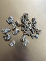
Because it was a very short engagement, I'd put money on the fact that you won't be finding too many relics other than musket shot and maybe some buttons... We can assume at the Bird's Creek site that "drops" are to be found at the Rangers position and fired shot will be found at the Indians positions.
This directly relates to one of the 2 major events that happened at The Battle of Bird's Creek... Captain Bird was "felled by an arrow at a distance of 200 yards". So after you find the Ranger position, remember this and fan out your search area! There are always two sides to detecting any military engagement!
Lastly, I'd like to share a fun fact.
Buffalo Hump, the Penateka Comanche Chief that was present at the Bird's Creek engagement - is portrayed in the 'Lonesome Dove' saga and appears in both "Dead Man's Walk" and "Comanche Moon".
Blue Duck, who appears in the original "Lonesome Dove" installment, is his fictitious son.
If you don't like "Lonesome Dove", that's a character flaw on your part.
Just saying.
I'm actually in the process of getting my "in" with three different property owners and hope to start hunting after New Year.
This is a prime example of the whole "never take stuff at face value" ideal...
I'll give you a few tips. Read between the lines and interpret how you please!
TIP 1.)
Typical of a lot of the Texas 1936 Centennial markers, they were often placed in locations that were sympathetic to the development of the local area. SOME markers have statements such as "half a mile south of here" or "nearby" - some markers do not have inscriptions like this, but in depth research may show otherwise. So don't always assume that a site is not able to be hunted because the marker is not always on the actual location. This is a benefit to hunters, however, because if the markers WERE always on the actual site, you couldn't hunt it BECAUSE of the markers presence!
TIP 2.)
I'll tell you straight up, I made a half dozen trips to Austin to go thru the State Archives, and numerous more hours spent in the university libraries at TSU and A&M just to acquire some more pertinent research materials in regards to this site.
Some folks laugh when they see my home library... It's full of nothing but out-of-print books, laminated historic map copies, microfilm prints, scanned journal excerpts / eyewitness accounts, etc... All broken down by subject, and all of them pertaining to "Texas 1700-1970".
My research of the Bird's Creek engagement easily added another couple of thick binders and three more maps.
TIP 3.)
When you do your research, don't forget the search terms "Little River Fort" / "Fort Milam" / "Fort Smith" and "Fort Griffin".
Military engagements throughout history always have references in regards to where the troops were coming from, and heading to. This may not seem helpful to you, but remember: this was a "Running Engagement" - meaning they covered some ground from the time of first contact until they hunkered down in that ravine. That fact alone opens up a wide area of places worth hunting! Get yourself the correct maps, ( freebie tip - it takes more than one) find the exact fort locations, plot out the detachments travel route, and compare it to today's geography!
Remember, map overlays are a great tool to compare 1839 to 2013!
TIP 4.)
I-35 completely changed the lay of a whole lot of land.
Grade had to be met, so a great amount of cut and fill work was needed. Take that misplaced dirt into account when you think you pinpointed a good spot.
TIP 5.)
Because it was a very short engagement, I'd put money on the fact that you won't be finding too many relics other than musket shot and maybe some buttons... We can assume at the Bird's Creek site that "drops" are to be found at the Rangers position and fired shot will be found at the Indians positions.
This directly relates to one of the 2 major events that happened at The Battle of Bird's Creek... Captain Bird was "felled by an arrow at a distance of 200 yards". So after you find the Ranger position, remember this and fan out your search area! There are always two sides to detecting any military engagement!
Lastly, I'd like to share a fun fact.
Buffalo Hump, the Penateka Comanche Chief that was present at the Bird's Creek engagement - is portrayed in the 'Lonesome Dove' saga and appears in both "Dead Man's Walk" and "Comanche Moon".
Blue Duck, who appears in the original "Lonesome Dove" installment, is his fictitious son.
If you don't like "Lonesome Dove", that's a character flaw on your part.
Just saying.
Tejaas
Hero Member
- Sep 8, 2012
- 826
- 1,019
- Detector(s) used
- Garrett AT PRO ~ Propointer ~ Modified Lesche ~ Predator Little Eagle ~ Royal Picks ~ Marshalltown Trowels ~ Sift Tables/Screens
- Primary Interest:
- Relic Hunting
Find the areas around it and have at it. Indians probably had a fairly big camp and fighting may have been over a large area. Worth a shot...
Please remember that the Plains Indians founded the guerrilla style tactics that the American military uses today.
Warring factions ALWAYS took the fight TO the enemy, to intentionally draw them away from their encampments.
The whole "war party" and "raiding party" concept was factual, and these guys could be riding for weeks to fulfill their mission. Simply put, they drew or headed off fights as far as possible from the camps.
The early to mid-1800s were relatively heavy laden with Indian attacks due to territorial dispute, while the mid to late-1800s, the decline of the Plains Indians, featured more Indian raids for the purpose of stealing livestock to eat, sell, and trade.
The 1870s - 1890s US Cavalry massacres of some encampments in the Dakotas, Wyoming, Montana, etc. were actually due to the able-bodied men being away from their camps on hunting expeditions... As the surviving Indians, considered as renegades, who didn't move to the federal reservations were literally starving.
Texas, Arizona and New Mexico had the most "holdouts" due to the abundance of territory and minimal ability for military enforcement. Northern Mexico offered safe haven and was heavily utilized.
sharpshooter#1
Greenie
I've been all over this since 2005!
I'm actually in the process of getting my "in" with three different property owners and hope to start hunting after New Year.
This is a prime example of the whole "never take stuff at face value" ideal...
I'll give you a few tips. Read between the lines and interpret how you please!
TIP 1.)
Typical of a lot of the Texas 1936 Centennial markers, they were often placed in locations that were sympathetic to the development of the local area. SOME markers have statements such as "half a mile south of here" or "nearby" - some markers do not have inscriptions like this, but in depth research may show otherwise. So don't always assume that a site is not able to be hunted because the marker is not always on the actual location. This is a benefit to hunters, however, because if the markers WERE always on the actual site, you couldn't hunt it BECAUSE of the markers presence!
TIP 2.)
I'll tell you straight up, I made a half dozen trips to Austin to go thru the State Archives, and numerous more hours spent in the university libraries at TSU and A&M just to acquire some more pertinent research materials in regards to this site.
Some folks laugh when they see my home library... It's full of nothing but out-of-print books, laminated historic map copies, microfilm prints, scanned journal excerpts / eyewitness accounts, etc... All broken down by subject, and all of them pertaining to "Texas 1700-1970".
My research of the Bird's Creek engagement easily added another couple of thick binders and three more maps.
TIP 3.)
When you do your research, don't forget the search terms "Little River Fort" / "Fort Milam" / "Fort Smith" and "Fort Griffin".
Military engagements throughout history always have references in regards to where the troops were coming from, and heading to. This may not seem helpful to you, but remember: this was a "Running Engagement" - meaning they covered some ground from the time of first contact until they hunkered down in that ravine. That fact alone opens up a wide area of places worth hunting! Get yourself the correct maps, ( freebie tip - it takes more than one) find the exact fort locations, plot out the detachments travel route, and compare it to today's geography!
Remember, map overlays are a great tool to compare 1839 to 2013!
TIP 4.)
I-35 completely changed the lay of a whole lot of land.
Grade had to be met, so a great amount of cut and fill work was needed. Take that misplaced dirt into account when you think you pinpointed a good spot.
TIP 5.)
Because it was a very short engagement, I'd put money on the fact that you won't be finding too many relics other than musket shot and maybe some buttons... We can assume at the Bird's Creek site that "drops" are to be found at the Rangers position and fired shot will be found at the Indians positions.
This directly relates to one of the 2 major events that happened at The Battle of Bird's Creek... Captain Bird was "felled by an arrow at a distance of 200 yards". So after you find the Ranger position, remember this and fan out your search area! There are always two sides to detecting any military engagement!
Lastly, I'd like to share a fun fact.
Buffalo Hump, the Penateka Comanche Chief that was present at the Bird's Creek engagement - is portrayed in the 'Lonesome Dove' saga and appears in both "Dead Man's Walk" and "Comanche Moon".
Blue Duck, who appears in the original "Lonesome Dove" installment, is his fictitious son.
If you don't like "Lonesome Dove", that's a character flaw on your part.
Just saying.
I'm in hurst tx not to far from this location Mabry we can get together sometime I'm kindly a greehorn been at it about for month but I'm hooked would love to find old relics instead of clad ....if your interested let me nkow...
Top Member Reactions
-
 2318
2318 -
 1122
1122 -
 1041
1041 -
 895
895 -
 834
834 -
 778
778 -
 753
753 -
 742
742 -
 607
607 -
 504
504 -
 493
493 -
 475
475 -
 453
453 -
 421
421 -
 396
396 -
 394
394 -
O
393
-
 386
386 -
 383
383 -
 374
374
Users who are viewing this thread
Total: 2 (members: 0, guests: 2)