The story of Hermit John’s Gold. I think I found the spot, but no Gold.

gollum

Gold Member
Jan 2, 2006
6,729
7,596
Arizona Vagrant
Detector(s) used
Minelab SD2200D (Modded)/ Whites GMT 24k / Fisher FX-3 / Fisher Gold Bug II / Fisher Gemini / Schiebel MIMID / Falcon MD-20
Primary Interest:
All Treasure Hunting
Dang Roy,

I can't believe you never saw this before!

What Ant thought was an arrastra was a circular cement water catch basin. Probably from the 40s or 50s. There are two of 'em there, but one is badly degraded.

The Hermit John is not in this area. I've been most of the way around the Sheepholes and have found nothing that matches the story. Nothing even close. Most of the Northeastern and Eastern Side of the range is a Wilderness Area and therefore can't be driven into. There is a smaller chunk of the Eastern side I haven't gotten to yet.

Also, the Hermit John and the Shotgun are completely different. The Lost Shotgun is hundreds of miles North of this area. The Lost Mines closest to this area are the Lost Arch (Turtles), Dutch Oven (Coxcombs), Railroad Worker's Lost Ledge (Coxcombs).

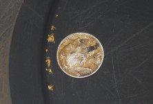
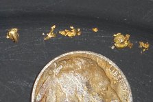
The story says the mine lies between Dale Dry Lake and the Northern End of the Sheepholes. I doubt Old Hermit John told Mitchell the whole truth. What did he have to gain? He might have been telling a partial truth. The Sheepholes were heavily mined over the years, and no gold deposits similar in nature to what was seen in Amboy (white quartz held together by strings and leaves of gold) in 1909 were worked. He MIGHT have been describing Cadiz Dry Lake and not Dale Dry Lake. Cadiz is at the Northern end of the Calumet Mountains. Since there are absolutely no roads along the North End of either the Sheepholes or the Calumets, the Lost Hermit John is probably somewhere between Cadiz Dry Lake and Amboy.

Best-Mike
 

Oroblanco

Gold Member
Jan 21, 2005
7,838
9,830
DAKOTA TERRITORY
Detector(s) used
Tesoro Lobo Supertraq, (95%) Garrett Scorpion (5%)
Howdy Mike - never ventured into the CA treasure legends board much before, but yes I am familiar with this story. I suspect it is the same as the Shotgun mine but that is just my opinion. I have never done any prospecting in the Sheep Hole range at all, the geology looks wrong to me but then all it takes is one good spot.

Don't you just love all the fake "wilderness" areas that blot up so much land now? Great for those who want to go hiking I suppose, but as far as I know there is only one spring in that entire range and that is right in the pass; I just hope that some of those jackasses who pushed for this "wilderness" to be created will one day find themselves in that wilderness and needing water.

I am a bit surprised that anyone has even looked for this one, thought the story was not that well known.
Roy
 

gollum

Gold Member
Jan 2, 2006
6,729
7,596
Arizona Vagrant
Detector(s) used
Minelab SD2200D (Modded)/ Whites GMT 24k / Fisher FX-3 / Fisher Gold Bug II / Fisher Gemini / Schiebel MIMID / Falcon MD-20
Primary Interest:
All Treasure Hunting
Any story close to home that has this many witnesses I will look for.

Also, the Hermit John and the Shotgun are completely different. The Lost Shotgun is hundreds of miles North of this area. The Lost Mines closest to this area are the Lost Arch (Turtles), Dutch Oven (Coxcombs), Railroad Worker's Lost Ledge (Coxcombs).

Oh yeah. The Shotgun is a ledge and the Hermit John is an actual mine with graves and either a well or pit mine.

Mike
 

Oroblanco

Gold Member
Jan 21, 2005
7,838
9,830
DAKOTA TERRITORY
Detector(s) used
Tesoro Lobo Supertraq, (95%) Garrett Scorpion (5%)
Could there be more than one lost Shotgun mine? I don't know of one that is NOT supposed to be located in the Sheep Hole mountains, and check out "Lost Gold & Silver Mines of the Southwest" Eugene L. Conrotto, pp 110.
Roy
 

gollum

Gold Member
Jan 2, 2006
6,729
7,596
Arizona Vagrant
Detector(s) used
Minelab SD2200D (Modded)/ Whites GMT 24k / Fisher FX-3 / Fisher Gold Bug II / Fisher Gemini / Schiebel MIMID / Falcon MD-20
Primary Interest:
All Treasure Hunting
Hey GT,

Nice shots. Nothing Hermit John about it though. Your arrastra is cemented together (its not caliche). I actually panned out that big catch at the lower end of the canyon. Just black sand and not one speck of color. Sad, I thought I was going to get SOMETHING! :censored:

sheepholecatch3.jpg

Up that canyon (the one on your website by the cement water catch and the single stamp platform) are several Spanish Signs. Here are a couple:

EYE1 EYE2 Cross
eye3.jpg eye2a.jpg cross1.jpg

EYE1 points to the beginning of a foot trail up the mountain to the mines.

EYE2 is looking at a split in the trail. You have to go the way the eye is looking.

Cross is self explanatory.

You have to do a lot of climbing to get to the second two. There are several others, but they point to places that don't have any open mines. There may still be a couple of sealed shafts in the area. If you climb up that mountain via the OLD ROUTE (not the trail that starts on the left/north side of the canyon), there are gunsights that seem to point to nothing in particular. If you take the miners trail along the left side of the canyon, then cross over every gunsight points to open mines. Somebody figured that out a long time ago. Those mines were originally Spanish, but were opened and reworked in the late 1800s and again during the depression.

That canyon is also where I had the scare of a lifetime. I decided to metal detect up the bed to see if there was anything of value there. Just past where the patch of mines are, I saw one HUGE paw print. She stayed behind the rocks, and I only saw her twice, but I slung my detector and walked backwards all the way back to the water catch. She followed me most of the way. Never seen her before or since.

Mike
 

Last edited:

gollum

Gold Member
Jan 2, 2006
6,729
7,596
Arizona Vagrant
Detector(s) used
Minelab SD2200D (Modded)/ Whites GMT 24k / Fisher FX-3 / Fisher Gold Bug II / Fisher Gemini / Schiebel MIMID / Falcon MD-20
Primary Interest:
All Treasure Hunting
I will give you a quick idea of how the gunsights work:

You start at the beginning of the trail. There are markers all along the way. As soon as you lose sight of one marker, the next one appears on the same side of the trail. This just shows you that you are still on the trail. At the beginning of the trail, there is what is called an "ALPHA" Monument. It lets you know that THERE is the beginning of a trail. When you get to the end of the trail, there is always an "OMEGA" Monument to show that you are at the end of the trail. Since the Spanish couldn't work these mines year round, they had to seal them up and go back to Mexico usually in the late Spring (when water sources started drying up). Each set of mines had one manager. One of this manager's duties was to figure out a system to recognize where the sealed up mines were, so the next fall they could get right back to work. In this area, the manager used a system of gunsights to locate each mine.

These are not in order, but there are a total of about six in this area pointing to already opened mines.

This first gunsight points at the open pit mine at the edge of the ravine:

View attachment 914625 This One: View attachment 914630
...and this one: View attachment 914632 using the pointer: View attachment 914633 to see this: View attachment 914634


...and this one: View attachment 914635 (backwards view), and so on.

As you move to the location of each mine, there is another gunsight pointing to another mine shaft. Next time you go to that spot, look for what I am telling you. They are all there. The old camp sight for that area is on the South side of the canyon in a big flat surrounded by rocks (lots of cholla now be careful).

Mike
 

Last edited:

gollum

Gold Member
Jan 2, 2006
6,729
7,596
Arizona Vagrant
Detector(s) used
Minelab SD2200D (Modded)/ Whites GMT 24k / Fisher FX-3 / Fisher Gold Bug II / Fisher Gemini / Schiebel MIMID / Falcon MD-20
Primary Interest:
All Treasure Hunting
Thanks GT,

If the markings/monuments were individual (on their own), I might think they COULD be natural. EVERY marking is part of a well monumented trail of markers/monuments. Every trail of monuments leads to mines. Deductively pretty simple.

When the Spanish were finding gold/silver in those mountains while using the Sheephole/Calumet Valleys as shortcuts to the Old Spanish Trail, they did things very differently than later Americans. They spread their tailings for miles (or duped them down deep crevasses) so nobody could tell where their mines were. The entrances to their mines were very small (to make them easy to conceal and not easily seen).

Remember one thing ..... since the Spanish/Mexicans left in the 1840s, a TON of American Miners tromped over those mountains. Probably not a ten square foot patch that hasn't been walked on. Most of the entire Sheephole Range was under claim at one point in time or another. Metal detectorists have beaten up those mountains pretty hard as well since the 40s-50s.

In that general area (won't say exactly where), an old timer from Yucca Valley found three big ollas with about 2500 gold coins about five years ago. I haven't heard from him since he moved.

A known fact that in the Bullion Mts, there is a cave with gold bars. When Patton's Troops were training in the area, two guys told their friends that while on Range Duty, they were wandering around and found the cave. They both went to war immediately after. One was killed in Italy, and the other survived the war. I think he was from Detroit (but can't be certain). Well, some Marines on Range Duty spotted a lone person walking across the Impact Area near the Bullions. When they ordered him to stop, he pulled out a pistol and fired at them. They returned fire killing the man. When they searched his body, they found two gold bars in his pack. Nobody that I know of has ever found the cave.
 

Last edited:

gollum

Gold Member
Jan 2, 2006
6,729
7,596
Arizona Vagrant
Detector(s) used
Minelab SD2200D (Modded)/ Whites GMT 24k / Fisher FX-3 / Fisher Gold Bug II / Fisher Gemini / Schiebel MIMID / Falcon MD-20
Primary Interest:
All Treasure Hunting
Yes I did. I was hoping some nice ore samples fell off some burro's back and laid there waiting for me. I also detected the tailings going up the mountain. No free gold. I even detected the bottom of the ravine and nothing. Everything in those mines was gold in sulphides, and I did find some nice silver/galena in a couple of places, but couldn't trace it back to a mine.

There are more stories in that area than you could shake a stick at. Keep'em all in mind, so you don't overlook something that has to do with one story while looking for clues to a different one.

Best - Mike
 

gollum

Gold Member
Jan 2, 2006
6,729
7,596
Arizona Vagrant
Detector(s) used
Minelab SD2200D (Modded)/ Whites GMT 24k / Fisher FX-3 / Fisher Gold Bug II / Fisher Gemini / Schiebel MIMID / Falcon MD-20
Primary Interest:
All Treasure Hunting
One more thing.................

L.O. Long said that his mine was about 15 miles East of Dale Dry Lake. That's nowhere near the Sheepholes. That is the Southern Calumets or Eastern Pintos.

Best - Mike
 

gollum

Gold Member
Jan 2, 2006
6,729
7,596
Arizona Vagrant
Detector(s) used
Minelab SD2200D (Modded)/ Whites GMT 24k / Fisher FX-3 / Fisher Gold Bug II / Fisher Gemini / Schiebel MIMID / Falcon MD-20
Primary Interest:
All Treasure Hunting
Mornin Mike.
today im nursing a cold, sucks because its a nice day out and been inside with the wind for a few days now.

I always figured that Long was talking about coming from the south side of the Dale lake as the big mining camp was there, and it would of been on the trail from his resupply trip, he most likely had friends in that camp and would pick up water at this site ? He may not of been able to get enough water from the spring at that time? we have yet to find any signs of Indians as they would of used this as a water source so his spring may have just been a seep ? and not reliable water source?

Anyways his camp would be about 15 miles from the Sheep mnt pass, if he was talking about coming from Dale camp on the southern side of the lake.
His camp from a miners point of view was right below a spring as the crow flys.
There are two old roads that traverse the lake and lead into the old camp not the camp with the old arrastras, but the cross roads camp, where the trails split and went into the Dale district and to the early mill sites, by the way I think I heard the Dale was called Monte Negro district and one time ?

We did a couple hikes into the Calumett area not much mineralization and a god awfull place to traverse for man or beast I don't think that there is even a seep out in that part of the desert ?

The backside or east facing slope of the sheep mnts, from the pass I have been back a couple miles on foot, from the southern end and hwy 62, back before they closed that area I drove most of the way across the faint road that goes across the back side of these mnts, had to stop for lack of 4x4. did a lot of prospecting out that way the most I ever found was milatary training areas.
we plan a hiking trip into this area sometime 2014 before it gets to hot.

Good talking to you about this Hermit John/ Long tale.
Herb................

Hope your cold doesn't hit you too hard.

You are adding things to the story that aren't in Long's letters. First, Sheephole Pass is almost directly North of Old Dale. I think that anybody familiar with the area (especially an experienced prospector) would know North from East. Also, the letters do not say "DALE", they say "DALE DRY LAKE" (very specifically). If you don't believe them, that is one thing, but the letters specifically say that his mine is about "15 miles east of Dale Dry Lake." I can see some variance from slightly Northeast to slightly Southeast, but not DUE NORTH.

Also, as UNmineralized as most of the Calumets may look, there are several gold mines and gold prospects at the Northern End of the range. They were all gold in host granite mines. You used to be able to find them on Google Earth and Google Maps. Now, the road that goes up the East Side of the Calumets stops well short of the mine (in their database).

northcalumets.jpg

Best - Mike
 

Last edited:

gollum

Gold Member
Jan 2, 2006
6,729
7,596
Arizona Vagrant
Detector(s) used
Minelab SD2200D (Modded)/ Whites GMT 24k / Fisher FX-3 / Fisher Gold Bug II / Fisher Gemini / Schiebel MIMID / Falcon MD-20
Primary Interest:
All Treasure Hunting
Next time I get out that way, I might like to do that.

I have been out to them as well. If you look up the mines in BLM Database, they are listed as Gold Mines (gold in granite host), with "Other Commodities" listed as Copper, Zinc, and Silver. Using a metal detector (other than a gold machine) is worthless out there due to all the spent ammunition, bomb and artillery shrapnel left over from Gen Patton's 3rd Army. Supposed to be a tank and several vehicles buried out that way as well.

You can still drive out there. You just have to know they are there (since the BLM has taken to hiding all those places by leaving them off maps now, but that is a rant for another thread). You must mean the old road between the Calumets and the Sheepholes. That one is blocked at the South End. You can still drive around the North End of the Sheepholes from Amboy Road and get over to the East Side that way. I have a couple of spots I dry wash on the NE Side. The ONLY kind of prospecting I hate is dam* Dry Washing. To me, its like sanding drywall (the one construction job I refuse to do). Cement boogers for two weeks after. LOL

Best - Mike
 

gollum

Gold Member
Jan 2, 2006
6,729
7,596
Arizona Vagrant
Detector(s) used
Minelab SD2200D (Modded)/ Whites GMT 24k / Fisher FX-3 / Fisher Gold Bug II / Fisher Gemini / Schiebel MIMID / Falcon MD-20
Primary Interest:
All Treasure Hunting
One last word, any one visiting camping or climbing, the Sheep mnts .
Please help us clean the area as folks that use amboy rd going to gamble or what ever, use it as a dump site, we pick up what we can when we are there but its getting bad and we cant do it alone.
Also those hiking the top of the mnt please don't leave plastic trash on the mnt if it blows out of your hand please pick it up.

Thanks for the help.
Cpt Herb n Crew....................

I doubt this will ACTUALLY be the last word on the subject of Hermit John's Mine, but I agree 100% with Capn Herb. Every time I go out there, I find those damm marlex balloons, and all kinds of trash. I pack out everything I find that isn't natural to the mountains.

Leave only footprints!

REAL Treasure Hunters have a love for the land that provides them with the opportunity to become wealthy and/or famous. Please.................... keep the wilderness areas clean and free of garbage. We are not destroyers of the land. We love every part of the craggy, sweltering, void that are the desert/mountains.

Best - Mike
 

Last edited:

gollum

Gold Member
Jan 2, 2006
6,729
7,596
Arizona Vagrant
Detector(s) used
Minelab SD2200D (Modded)/ Whites GMT 24k / Fisher FX-3 / Fisher Gold Bug II / Fisher Gemini / Schiebel MIMID / Falcon MD-20
Primary Interest:
All Treasure Hunting
Well,

The Southernmost Route of the Old Spanish Trail went along where I40 is today. They would occasionally cut down between mts to about where the 62 is now, and head West from there.

In the Sheeps, probably a dozen or so (based on the number of shafts and prospects in the area). All Burros no wagons in the mts. Trails are only footpaths so just burros or mules. Wagons and such probably stayed on the edge of the mts in the dry riverbed (maybe in the cooler months it was wet back then).

Mike
 

OP
OP
Ant

Ant

Silver Member
Aug 6, 2006
3,389
554
Cali
Detector(s) used
Glold Bug 2 MineLab SE
Okay, the directions that I gave you were a little off; you have to go up higher before turning off the road, I sent you up the wrong wash. The atrratra not old like I thought it was when I first passed by it. It has a metal pipe that was used to drain off the amalgamated gold slurry. The coyote hole that is next the arrastra was all filled up the last time I went to look. There is a guy that works at Ace Hardware that told me they use to mine by it back in the 60’s. I’ll send you a PM to the exact location.
As far as trash, that is not the spot.
 

OP
OP
Ant

Ant

Silver Member
Aug 6, 2006
3,389
554
Cali
Detector(s) used
Glold Bug 2 MineLab SE
The video starts with the approach to the atrrastra. For some reason my audio capture was mumbled so I'll give you the narrative here.
As I start I say over on that hill side is an old stamp mill foundation and a many prospect sites. Then I wake up to a cpuple hard rock drifts. Then I head towards the atrrastra and say look it is to right side of that rock out cropping. As I approach I mention that I'm waking fast so that the video wont is long, and that the road that I'm following leads to the arristra.
When I get there I mention that it doesn't look old, not much clolore glass and that only round head nails are on the nearby foundation. The metal rail attached to the atrrastra has a tag on it. But I need reading glasses to see that and didn't have any. I couldn't locate the coyote hole but I really didn't look.


OP
OP
Ant

Ant

Silver Member
Aug 6, 2006
3,389
554
Cali
Detector(s) used
Glold Bug 2 MineLab SE

I'm still trying to find it, gold that is.


OP
OP
Ant

Ant

Silver Member
Aug 6, 2006
3,389
554
Cali
Detector(s) used
Glold Bug 2 MineLab SE
Here is what I got from around that rock, it was from about 3/4 of a 5 gallon bucket which about a 5th was drywashed before panning. Even flour gold is in that mix.
 

Attachments

  • Gold From Prospecting 1.jpg
    Gold From Prospecting 1.jpg
    72.8 KB · Views: 164
  • Gold From Prospecting 2.jpg
    Gold From Prospecting 2.jpg
    81.3 KB · Views: 176
  • Gold From Prospecting 3.jpg
    Gold From Prospecting 3.jpg
    68.2 KB · Views: 198

gollum

Gold Member
Jan 2, 2006
6,729
7,596
Arizona Vagrant
Detector(s) used
Minelab SD2200D (Modded)/ Whites GMT 24k / Fisher FX-3 / Fisher Gold Bug II / Fisher Gemini / Schiebel MIMID / Falcon MD-20
Primary Interest:
All Treasure Hunting
Buddy,

Almost anywhere you go in the Sheepholes, you crack apart a few big rocks and you can find some pickers and fines. Those mountains are shot through with old mines. That arrastra is like all the other mine stuff there. It was last worked mostly through the early 1950s. Notice they used cement to hold the rocks together.

The Hermit John will have a rocked well next to a mine. I have been all up and down the West and North sides of those mountains. I have snuck around to the East Side (Wilderness), but didn't spend a lot of time there. I have a few ideas about the Hermit John, but if it WAS in the Sheepholes, then it was found and mined out a loooooooooooong time ago. Almost every inch of those mountains was under claim at one time or another.

Mike
 

OP
OP
Ant

Ant

Silver Member
Aug 6, 2006
3,389
554
Cali
Detector(s) used
Glold Bug 2 MineLab SE
That gold didn't come from the sheepholes, and I never would post glory hole gold, I only post spects of it. When I first came across this site there was a deep coyote hole nearby, I guess it was covered up by nature or someone, or I need to look better. I live in this area, it's my backyard.
 

Top Member Reactions

Users who are viewing this thread

Top