RGINN
Gold Member
- Oct 16, 2007
- 8,603
- 10,721
- 🏆 Honorable Mentions:
- 1
- Detector(s) used
- White's DFX, White's Classic 1 Coinmaster, Nokta Pointer
- Primary Interest:
- All Treasure Hunting
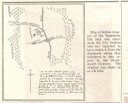
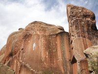
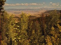
This is supposed to be a map published in 1937 in the Salida Record with directions to buried Spanish treasure. Probably everybody has already seen it, but I was doing some research on Thomas A. Summers, a guy who spent a lot of time looking around the Chalk Cliffs at Mt. Princeton for a treasure, and first time I came across it. One researcher thought maybe the cross was formed by Browns Creek and another canyon on the Arkansas River, and 'Agua Blanca' was Chalk Creek, but who knows? Only useful thing I did find out, I always thought the face of the Spanish Princess was probably a sun sign, only revealed at a particular time of year and time of day. Summers said the signs on the Chalk Cliffs (more than one) were moon signs, and you had to be there when the moon shone just right on the cliffs to see them.