John Singer Lost Treasure/South Padre Island, Texas

OP
OP
TheHarleyMan2

TheHarleyMan2

Bronze Member
Feb 27, 2008
1,594
464
Never Know I May Live Next To You!
Detector(s) used
GTI 2500/Bounty Hunter
Minelab Equinox 800
Primary Interest:
All Treasure Hunting
I was wondering because on several things, I read information about the treasure and some maps that were made 1857-1880 that is on historical maps site and I looked and different ones. I saw other maps listing his ranch near the inlet that seperates South Padre Island and the State Park across the channel. According to some maps his ranch was supposed to be about 4 miles from the channel. Others sources have his ranch at the tip end of South Padre Island by Port Isabelle which is now an RV park.

Now according to the grid coordinates of the historical maps made by several people during the mid 1800's it shows his ranch as being in the grid vicinity of East Sunset Blvd, Gulf Blvd, East Morningside Dr, and to about P100. Well according to the historical map there was not much of land on the island where his ranch was, (closer to the East beach side if you look at the historical maps) compared to todays map. With hurricanes and storms filling in sand and changing the terrain. Then people building on the terrain long after the hurricane took everything, then if the historical grids are correct, then the treasure got buried during the storm before he could retrieve it. Well over time the island got bigger storms and hurricanes came and went, people built and filled in to build on and no one still has not found his treasure.

My guess is that if the grid cooridinates are right, then it is still there deep under some road, foundation, or who knows what because that area is heavily populated with houses, roads, and buildings. I find this interesting!!!
 

ecastro111

Full Member
Oct 23, 2006
104
2
Rio Grande Valley
Detector(s) used
Garret Infinium/Fisher CZ7a
TheHarleyMan2 said:
Now according to the grid coordinates of the historical maps made by several people during the mid 1800's it shows his ranch as being in the grid vicinity of East Sunset Blvd, Gulf Blvd, East Morningside Dr, and to about P100. Well according to the historical map there was not much of land on the island where his ranch was, (closer to the East beach side if you look at the historical maps) compared to todays map.

That is interesting ??? Do you have a pic to put on the forum or a link to check it out? According to local lore two Mexican Nationals found the treasure in the late 70's, but who really knows.
Ernie
 

OP
OP
TheHarleyMan2

TheHarleyMan2

Bronze Member
Feb 27, 2008
1,594
464
Never Know I May Live Next To You!
Detector(s) used
GTI 2500/Bounty Hunter
Minelab Equinox 800
Primary Interest:
All Treasure Hunting
ecastro111 said:
TheHarleyMan2 said:
Now according to the grid coordinates of the historical maps made by several people during the mid 1800's it shows his ranch as being in the grid vicinity of East Sunset Blvd, Gulf Blvd, East Morningside Dr, and to about P100. Well according to the historical map there was not much of land on the island where his ranch was, (closer to the East beach side if you look at the historical maps) compared to todays map.

That is interesting ??? Do you have a pic to put on the forum or a link to check it out? According to local lore two Mexican Nationals found the treasure in the late 70's, but who really knows.
Ernie

I have the grid cootdinates on my home computer with several maps on it. I won't be back home for another month and a half so I can't post anything on this computer, (government). I wonder if they did find it how come there is no mention of it?
 

Seajay

Full Member
Jul 6, 2003
149
2
Eastern North Carolina
Detector(s) used
White's XLT, Garrett's CX w/Bloodhound, GTA 500, Whites PI
THM2,

This question was posed about a year ago I believe by another TH'er in South Texas. I replied to him that I came across some information indicating that the Singer treasure had been recovered. This was while I was in Allen, TX in the late 1970s. I do not recall the source, but several tens of thousands in silver coinage was recovered and attributed to Singer.

Seajay
 

OP
OP
TheHarleyMan2

TheHarleyMan2

Bronze Member
Feb 27, 2008
1,594
464
Never Know I May Live Next To You!
Detector(s) used
GTI 2500/Bounty Hunter
Minelab Equinox 800
Primary Interest:
All Treasure Hunting
If someone found it wonder how come there is no info on it. Figured that if it WAS found that info would be all over the net and newspapers and such. JMP?
 

Seajay

Full Member
Jul 6, 2003
149
2
Eastern North Carolina
Detector(s) used
White's XLT, Garrett's CX w/Bloodhound, GTA 500, Whites PI
THM2,

Perhaps the finder elected not to publicize his find for whaterver reasons: taxes, potential robber victim, etc. Who knows?

Seajay
 

cielosauce

Tenderfoot
Apr 13, 2008
6
0
From what I remember, the part of the "treasure" that was recovered was done so by a salvage operation as a result of digging the Mansfield Cut at Port Mansfield for the "shrimpers" there.

A salvage operation was commissioned and they recovered several cannons, lot of coins, sextants etc. This was done out by the second or third sandbar well away from the beach. Texas "commandeered" almost all of the treasure from the salvage company.

There were four ships Spanish ships that ran aground there, each spaced about a mile apart from one another spaced up the beach from the "Cut".

The Singer cabin was located by the Karankawa mound located just south of the Cut back a bit from the coastline. It's (the mound) is still there and indian artifacts can still be found there as well.

Some of the treasure was recovered from the other ships as well, including a small jewelry box by a lady who went crazy afterwards, she was found walking on the beach with all of the jewelry on. This was about 1910 if memory serves.

Lots of maps exist which purport to show the location of Money Hill, but the fact that the island has been changed forever by Hurricanes, no one knows what they're talking about when they speak of exact location. But it is curious that the Money Hill was located about a mile north of the Singer cabin, that would've put it at about center point as to where the ships ran ashore. I know if I had found lots of gold and silver, I wouldn't have wanted to carry it very far to secure it.
 

octoberchild

Jr. Member
Dec 7, 2007
53
3
the singer ranch was located just south of deer island and a little east over on the island. singer had building in several different places on the island, one was just about where the present day coast guard station is located. also money hill, which is key to the mystery, is yet in another location. i gave the exact location of the ranch in an earlier post, a little further down this page.
according to my information, in the 1930's two mexicans looking for shells to sell stumbled on a small box of coins at money hill. one killed the other over the find.
 

jlv956

Jr. Member
Jan 24, 2007
20
0
Brownsville Texas
Detector(s) used
DetectorPro head hunter pulse
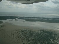
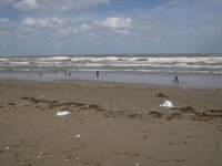
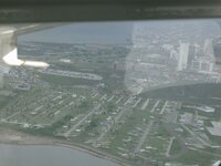
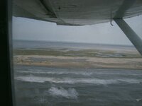
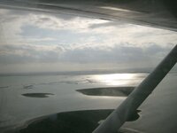
I know this story and I have often dreamed of finding the treasure. Recently Hurricane Ike created a huge storm surge that washed over the Island. I figured this would be the best time to go looking for the Singer ranch. I was luck enough to have a cousin with an air plane so we took off from Brownsville and surveyed the Island to make sure we could drive up the beach. I attached some pictures I took from the air. We flew over the jetties at SPI and marked our position with the GPS. We then began our route straight north. I did see several old boats in the dunes and the beaches were surprisingly clean. I marked a spot at exactly 26 miles from the jetties at SPI. We than flew back to Brownsville and jumped in the 4 X 4. On our way up the Island I stopped at several places of interest but at the time the only detector I had was a Ace 250 (Which sucks on the wet beach). We ended up at the Mansfield pass without really finding much other than some neat shells and a few sand dollars. On the way back the tide was going out and at exactly 24.6 miles from the SPI Jetties we found what I believe is the remains of the singer ranch. I discovered several wooden poles pounded into the clay. One of the poles had a large hand forged Spike or nail imbedded in it. I removed it and could tell it was old. The configuration of the poles did not look like a ship or a boat it seemed more like a pier and beam configuration. The interesting this is that according to the Garmin GPS the spot we were standing at did not show to be in the surf. In fact the GPS indicated I was 250 yards from the surf. I marked it with the GPS, but the Island lost allot of beach and I believe this spot is probably well under water by now.
 

Attachments

  • August 17, 2008 007.jpg
    August 17, 2008 007.jpg
    185.8 KB · Views: 2,143
  • August 17, 2008 005.jpg
    August 17, 2008 005.jpg
    203.1 KB · Views: 2,593
  • August 17, 2008 006.jpg
    August 17, 2008 006.jpg
    182 KB · Views: 2,239
  • August 17, 2008 015.jpg
    August 17, 2008 015.jpg
    160.5 KB · Views: 2,292
  • August 17, 2008 017.jpg
    August 17, 2008 017.jpg
    192 KB · Views: 3,035
  • August 17, 2008 018.jpg
    August 17, 2008 018.jpg
    202.1 KB · Views: 4,883

ecastro111

Full Member
Oct 23, 2006
104
2
Rio Grande Valley
Detector(s) used
Garret Infinium/Fisher CZ7a
Awesome little adventure, jlv956! Talk about being thorough. I'm also from Brownsville and I drove out to the "Lost City" late one night and camped out with my wife. The next morning I attempted to move the 4Runner closer to shore and ended up getting stuck. Needless say I spent the rest of the morning digging myself out several times (even adjusting tire pressure to 14 psi). We almost got swamped when the tide was coming in. I didn't even get to metal detect :'( It was a real nightmare! :'(

Later I was told by one of the SPI locals that there are pockets along the beach that even 4X4s get stuck. In those cases its good to have a wench to pull yourself out since even a buddy pulling you out will get stuck. I guess the sand was pretty packed right after the storm surge.

Do you have any pics of the old boats you saw from the air. Don't forget to post your finds :thumbsup:

Laters,
Ernie
 

Shaw

Hero Member
Mar 16, 2008
858
0
Houston Area
Detector(s) used
ACE 250, Vibraprobe 570, My Melon
I have a great feeling about that area, good luck and keep it on the "low down" :thumbsup: There has to be some things left around there after reading all you guys stories.

Its amazing what you can get accomplished by airplane.

Keep hunting the area, good things may come your way. Thanks for posting up the pictures, very cool.

Jason
 

txkickergirl

Silver Member
Jan 4, 2007
2,782
25
George West, TX
Detector(s) used
SOV, EXCAL, CZ20, & more
Primary Interest:
All Treasure Hunting
I love the pics, I was down there weekend before last. I was amazed to see the dunes wiped out for miles in some places. Lots of new trash though piling up. I found a couple old old pieces of glass one by the jetties and the other near where the big tank with the pipe sticking out is. I saw the posts as well and figured that is where the old bait stand was. I did see a couple old boats 50's-70's out there. I believe the singer treasure to be found years ago and unlike others they knew to keep it quiet and soldl it through a broker elsewhere. Just my opinion.

Here is an interesting link though, and even if the singer treasure was found there is still other treasure to found out there.

http://texaslesstraveled.com/frenchtreasure.htm
 

21stTNCav

Hero Member
Apr 11, 2006
928
11
Tennessee/Texas
Detector(s) used
Minelab Sov / Fisher CZ-70 Pro/Fisher CZ 20
:D Now thats some funny info. I gotta decipher the long and lat to figure out where on the beach to look. Very cool
 

redwolf74

Jr. Member
Jan 6, 2009
26
0
Bloomngton, MN
Detector(s) used
Coinmaster 6000D

octoberchild

Jr. Member
Dec 7, 2007
53
3
Neat old map you've found, I havn't seen this one. I just happen to be in the possession of the entire collection of old maps ranging from the mouth of the river to just north of present day Port Mansfield cut. They're great big old things, about 3'x4'. The oldest being the futherest south, 1854 up to the PM cut 1879-1881, two in between--1867. I bought them fro NOAA, Rockville, Md. They don't sell them anymore, but should be able to view them online. Just talked to a guy there, couldn't figure out why we couldn't pull them up. He said he will try to straighten it out soon.
http://oceanservice.noaa.gov/topics/navops/hydrosurvey/welcome.html

By the way, lots of good Singer info on these maps, including ranch headquarters location and southern house location(about where present day coast guard station is) and some stuff in between. (its padre Balli)
 

Top Member Reactions

Users who are viewing this thread

Top