The Lost Carson Mine

rschneider3

Greenie
Apr 16, 2014
19
10
Fort Collins, CO
Detector(s) used
Fisher F2
Primary Interest:
All Treasure Hunting
You make a very good point! I believe that you are correct in your leaning towards that the outcropping of Sugar Quartz with Gold in it, must in fact be below a point where any eroded out Gold would end up in the pond. That in itself should clear a lot of area that a person might have searched but now knows that the Gold deposit(s) should be below any areas where the Gold would end up in the pond. From when I earlier searched out this area on Google Maps, that is a lot of land that a person could have wasted time on searching.


Frank

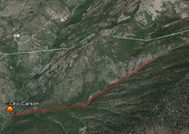
I'm with ya on this, looking at the map starting at the waterfall up to the first lake is where I'd start. Be nice like Mark said to hitch a ride up to that point.

It appears to be ~2,000' elevation gain from Lime creek up to the waterfall area and only ~ 1.00 miles.
If any of you are familiar with Hanging lake in Glenwood Springs, it about a mile long trail with an elevation gain of a little over 1,000'. It took me an hour to get up, 45 mins down. So I expect a couple hour trip one way with gear.
Carson.JPG
 

lastleg

Silver Member
Feb 3, 2008
2,876
658
I am not so sure the West Needles are in the Colorado Mineral Belt. It was the miners around
the Silverton area would have exploited it. They left no stone unturned in the nearby mountains.
Those guys were a tough breed and surely panned Twilight Creek along with all the other water
courses and any paying float would have sent them to its source.

Starting to believe Levi veered off westerly. Remember the Baker brothers experience.
 

sdcfia

Silver Member
Sep 28, 2014
3,648
8,861
Primary Interest:
Other
I am not so sure the West Needles are in the Colorado Mineral Belt. It was the miners around
the Silverton area would have exploited it. They left no stone unturned in the nearby mountains.
Those guys were a tough breed and surely panned Twilight Creek along with all the other water
courses and any paying float would have sent them to its source.

Starting to believe Levi veered off westerly. Remember the Baker brothers experience.

I think that trying to follow float in that Twilight drainage is a total fool's errand. If the Carson outcropping does in fact exist, it seems that a guy may as well grid off the West Needles upper slope and perform a visual search for possible anomalies. This, of course would take years in itself - possibly a lifetime depending on the thoroughness of the search - and is probably the reason there hasn't been much of an effort up there. As you said, there were much better chances available elsewhere. But - those other chances were exploited decades ago, and the Carson outcropping is apparently still up there somewhere. It's a job for strong legs, leather lungs and an obsessive personality. And for someone with plenty of free time and money.
 

rschneider3

Greenie
Apr 16, 2014
19
10
Fort Collins, CO
Detector(s) used
Fisher F2
Primary Interest:
All Treasure Hunting
I am not so sure the West Needles are in the Colorado Mineral Belt. It was the miners around
the Silverton area would have exploited it. They left no stone unturned in the nearby mountains.
Those guys were a tough breed and surely panned Twilight Creek along with all the other water
courses and any paying float would have sent them to its source.

Starting to believe Levi veered off westerly. Remember the Baker brothers experience.

Plenty of gold and silver mines in the Silverton area, mainly north. You are correct that, that area has been looked over fairly well. Chances are that many people have panned Twilight and Lime Creeks and went after the source if any.

That said, gold is where you find it. Its not impossible for areas to be undiscovered by prospectors or overlooked when searching.

Who knows Carson could have prospected there, maybe he didn't find enough and moved on, maybe westward.
 

OP
OP
UncleMatt

UncleMatt

Bronze Member
Jul 14, 2012
2,389
2,530
Albuqerque, NM / Durango, CO
Detector(s) used
Garrett Infinium & Gold Bug II, Bazooka Super Prospector Sluice
Primary Interest:
All Treasure Hunting
As soon Gollum is re-instated from his recent banning, I will be happy to post photos and my story of exploring the Baker Brother's Seam to the west....
 

sdcfia

Silver Member
Sep 28, 2014
3,648
8,861
Primary Interest:
Other
As soon Gollum is re-instated from his recent banning, I will be happy to post photos and my story of exploring the Baker Brother's Seam to the west....


Gollum? What does Gollum have to do with it?
 

OP
OP
UncleMatt

UncleMatt

Bronze Member
Jul 14, 2012
2,389
2,530
Albuqerque, NM / Durango, CO
Detector(s) used
Garrett Infinium & Gold Bug II, Bazooka Super Prospector Sluice
Primary Interest:
All Treasure Hunting
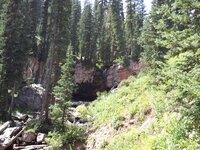
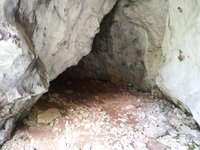
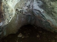
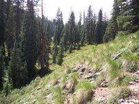
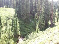
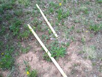
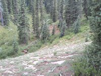
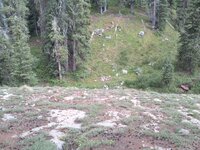
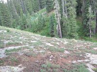
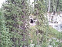
Okay, with regard to the Baker Brother's Seam, I went up and explored the area around the upper area of Coal Creek in 2012 and 2013. I found 3 caves on the way up, but was only able to explore 1. The target area was exactly as Temple described in his book, a triangular piece of land defined by two branches of Coal Creek above a waterfall. You could not climb the rock around the fall, but had to follow the northern branch of Coal Creek up a bit until you could cross over to the area above the fall. In the target area described by Temple in the tale, I found a trench that had been dug within the past ten years or so. This trench was just at the top of a steeply angled bank that ran down to the southern branch of Coal Creek on the south side of the triangular land formation. This bank was about 100 feet from top to bottom, and was comprised of granite strata outcroppings all the way from top to bottom, lightly covered with soil and vegetation. I also found several 1"x3" stakes about 3 feet long with the ends cut to a sharpened end near the trench. The stakes were just laying together on the ground, and looked like they had only been there a few weeks. I could see signs of an old blue tarp across the creek, that was in pieces.

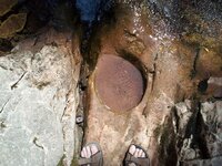
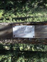
The country rock in the area was riddled with quartz seams, and the granite was quite degraded. Any granite that was exposed looked like it had been exposed for a very long time and the surface was heavily weathered. I spent several hours metal detecting the stream at the bottom of the bank, hoping to locate some float that was similar to that which had been described in the tale. However, the only thing I found were many pieces of an old, rusted bucket that had rusted to bits over the years. Which ironically enough matched the name of a couple of old mining claims up there called the Rusty Bucket claims. I found a couple of what looked to be claim markers up there as well consisting of stakes driven into the ground with metal plates on them.
 

Last edited:
OP
OP
UncleMatt

UncleMatt

Bronze Member
Jul 14, 2012
2,389
2,530
Albuqerque, NM / Durango, CO
Detector(s) used
Garrett Infinium & Gold Bug II, Bazooka Super Prospector Sluice
Primary Interest:
All Treasure Hunting
GPS

Water Fall at point of triangular land formation 37°42'34.65"N, 107°46'58.35"W

Trench Location (not exact) 37°42'34.95"N, 107°47'3.37"W

Steep Bank 37°42'34.21"N, 107°47'3.76"W
 

OP
OP
UncleMatt

UncleMatt

Bronze Member
Jul 14, 2012
2,389
2,530
Albuqerque, NM / Durango, CO
Detector(s) used
Garrett Infinium & Gold Bug II, Bazooka Super Prospector Sluice
Primary Interest:
All Treasure Hunting
2012-08-19 13.46.15.jpg

2012-08-19 13.45.49.jpg

2012-08-19 14.26.18.jpg

^^^Steep Bank, trench on top to right

2012-08-19 14.26.27.jpg
 

Last edited:
OP
OP
UncleMatt

UncleMatt

Bronze Member
Jul 14, 2012
2,389
2,530
Albuqerque, NM / Durango, CO
Detector(s) used
Garrett Infinium & Gold Bug II, Bazooka Super Prospector Sluice
Primary Interest:
All Treasure Hunting
From my on site research for the Baker Brothers Seam, I could see many signs of prospecting, but did not find a single trace of gold with my metal detector or in 20 panning attempts. Its an interesting area that warrants more research, but did not find anything conclusive thus far.
 

OP
OP
UncleMatt

UncleMatt

Bronze Member
Jul 14, 2012
2,389
2,530
Albuqerque, NM / Durango, CO
Detector(s) used
Garrett Infinium & Gold Bug II, Bazooka Super Prospector Sluice
Primary Interest:
All Treasure Hunting
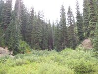
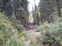
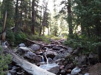
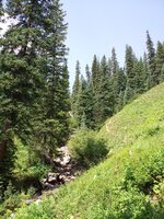
Here are photos from right to left from top of steep bank looking down

2013-07-09 16.35.58.jpg

2013-07-09 16.36.11.jpg

2013-07-09 16.36.26.jpg

Another cave

2013-07-09 16.51.45.jpg
 

OP
OP
UncleMatt

UncleMatt

Bronze Member
Jul 14, 2012
2,389
2,530
Albuqerque, NM / Durango, CO
Detector(s) used
Garrett Infinium & Gold Bug II, Bazooka Super Prospector Sluice
Primary Interest:
All Treasure Hunting
Actually, that last photo is of the cave entrance I posted interior photos of earlier
 

ikesdad

Jr. Member
Jun 23, 2010
78
80
Colorado
You can bet your butt that every inch of that area has been staked and claimed.
Better not to be poking around on some other guy's claim.
 

OP
OP
UncleMatt

UncleMatt

Bronze Member
Jul 14, 2012
2,389
2,530
Albuqerque, NM / Durango, CO
Detector(s) used
Garrett Infinium & Gold Bug II, Bazooka Super Prospector Sluice
Primary Interest:
All Treasure Hunting
Well, since I have every single active claim in a kzm file on my google earth on my phone, I can tell you for a fact there are no current claims up there. Now in the past there have been, but they were all abandoned years ago. I go out of my way to respect mining claims.
 

OP
OP
UncleMatt

UncleMatt

Bronze Member
Jul 14, 2012
2,389
2,530
Albuqerque, NM / Durango, CO
Detector(s) used
Garrett Infinium & Gold Bug II, Bazooka Super Prospector Sluice
Primary Interest:
All Treasure Hunting
It would be interesting to find out the meaning of the metal plate markings I posted earlier though: LOGISTICAL GRACE 5 NE 2 CORNER. Sounds like a mining claim marker to me, but I can find no record of a claim in the area by that name. Of course I welcome input from others about that.

The trench I found at the top of the steep bank was very near where I imagine the Baker Brothers were sitting on their log. It may have been an exploratory trench, or it could have been that someone found the Baker Brother's seam and excavated it.
 

sdcfia

Silver Member
Sep 28, 2014
3,648
8,861
Primary Interest:
Other
It would be interesting to find out the meaning of the metal plate markings I posted earlier though: LOGISTICAL GRACE 5 NE 2 CORNER. Sounds like a mining claim marker to me, but I can find no record of a claim in the area by that name. Of course I welcome input from others about that.

The trench I found at the top of the steep bank was very near where I imagine the Baker Brothers were sitting on their log. It may have been an exploratory trench, or it could have been that someone found the Baker Brother's seam and excavated it.

Those grade stakes looked fresh in 2013. And the stamped altag is a typical corner marker - it looks unweathered too. Being "LG 5", chances are it was one of a larger group of claims. Maybe the claims have lapsed, leaving the ground open. Or, possibly they staked the group with good intentions but changed their minds and decided against paying to file them. You found no mineral indications - maybe they didn't either.
 

Top Member Reactions

Users who are viewing this thread

Top